Academic Profile
Statistics
Similar Authors
Papers on arXiv
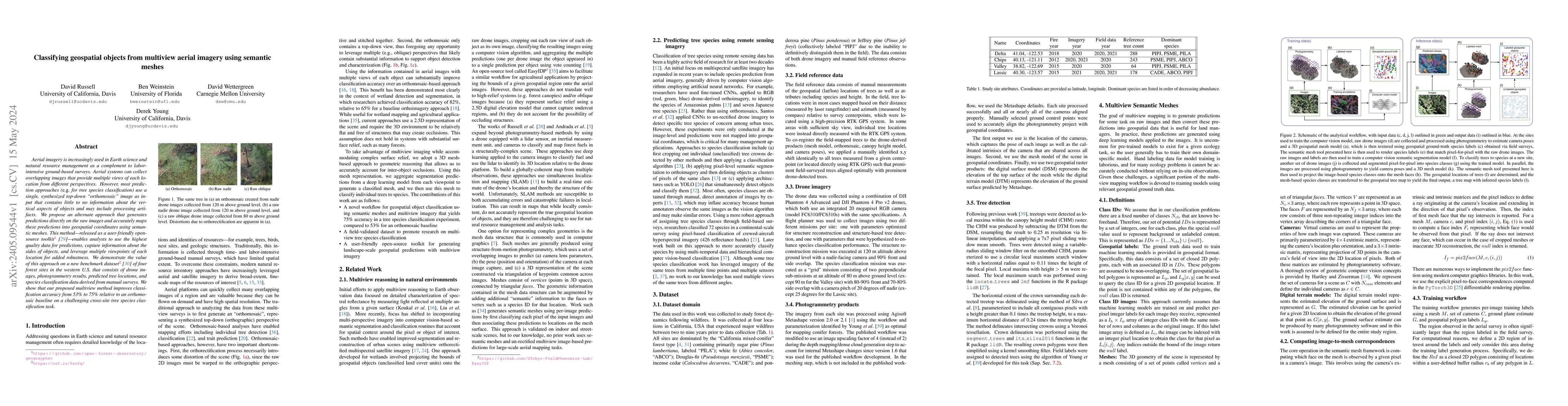
Aerial imagery is increasingly used in Earth science and natural resource management as a complement to labor-intensive ground-based surveys. Aerial systems can collect overlapping images that provi...
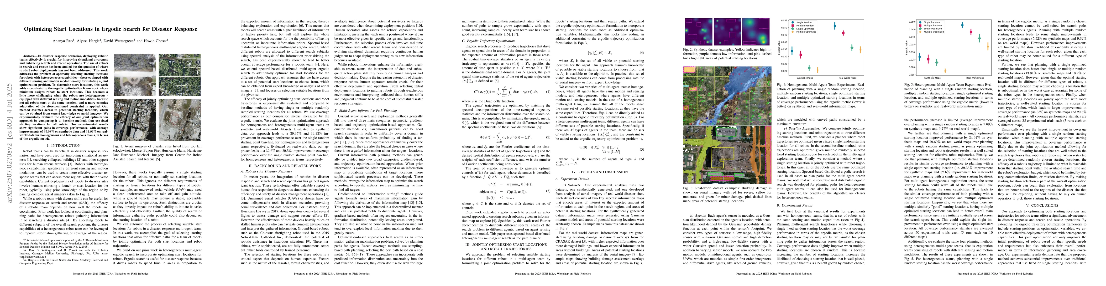
In disaster response scenarios, deploying robotic teams effectively is crucial for improving situational awareness and enhancing search and rescue operations. The use of robots in search and rescue ha...
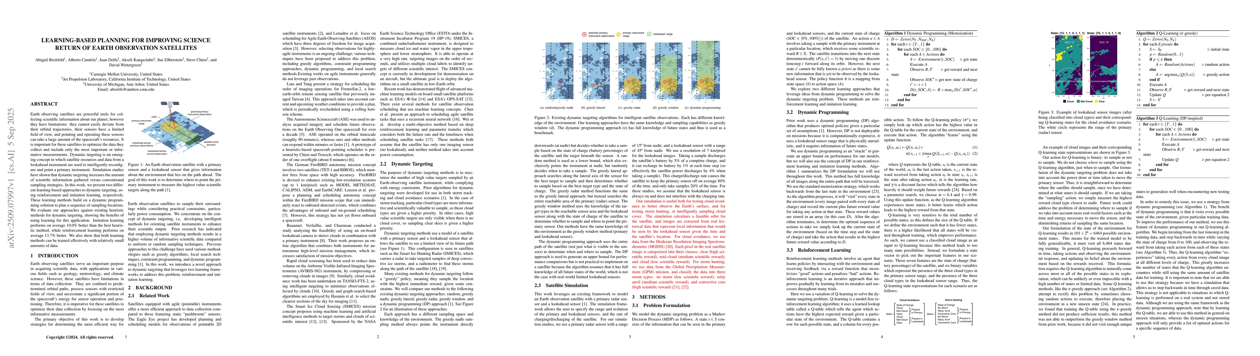
Earth observing satellites are powerful tools for collecting scientific information about our planet, however they have limitations: they cannot easily deviate from their orbital trajectories, their s...
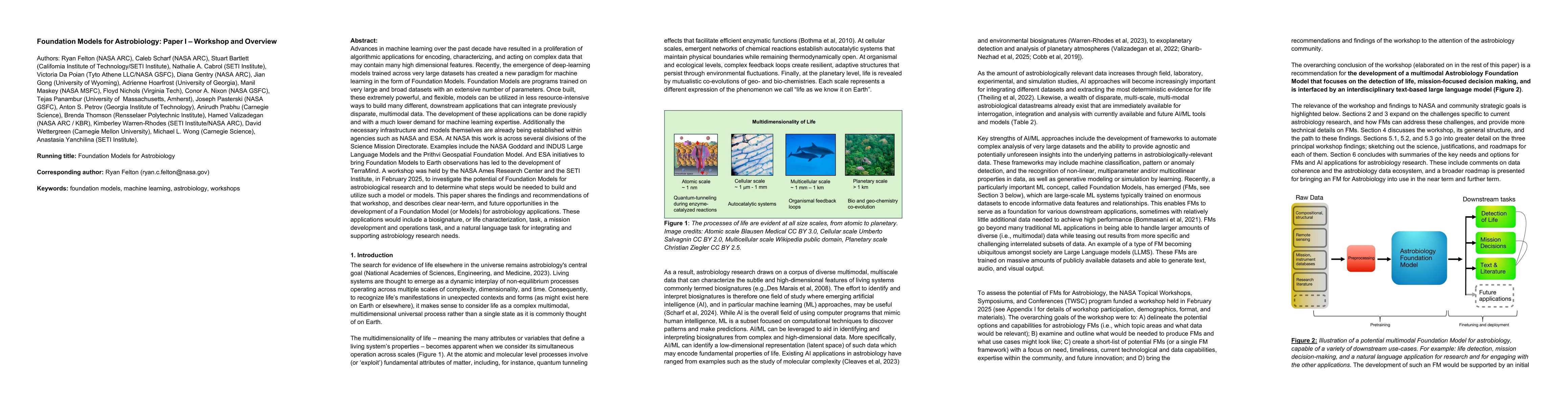
Advances in machine learning over the past decade have resulted in a proliferation of algorithmic applications for encoding, characterizing, and acting on complex data that may contain many high dimen...