Academic Profile
Statistics
Similar Authors
Papers on arXiv
In this paper, we present a deforestation estimation method based on attention guided UNet architecture using Electro-Optical (EO) and Synthetic Aperture Radar (SAR) satellite imagery. For optical i...
The generic risk estimator addresses the problem of denoising images corrupted by additive white noise without placing any restriction on the statistical distribution of the noise. In this paper, we...
In the past few years supervised and adversarial learning have been widely adopted in various complex computer vision tasks. It seems natural to wonder whether another branch of artificial intellige...
Intersection of adversarial learning and satellite image processing is an emerging field in remote sensing. In this study, we intend to address synthesis of high resolution multi-spectral satellite ...
Hyperspectral imaging is a powerful tool for Earth exploration, allowing for detailed analysis of spectral features. India has launched a dedicated hyperspectral Earth observation satellite capable of...
Resourcesat-3S/3SA, an upcoming Indian satellite, is designed with Aft and Fore payloads capturing stereo images at look angles of -5deg and 26deg, respectively. Operating at 632.6 km altitude, it fea...
The Geo High Resolution Camera (GHRC) aboard ISRO GSAT-29 satellite is a state-of-the-art 6-band Visible and Near Infrared (VNIR) imager in geostationary orbit at 55degE longitude. It provides a groun...
Hyperspectral images enable precise identification of ground objects by capturing their spectral signatures with fine spectral resolution.While high spatial resolution further enhances this capability...
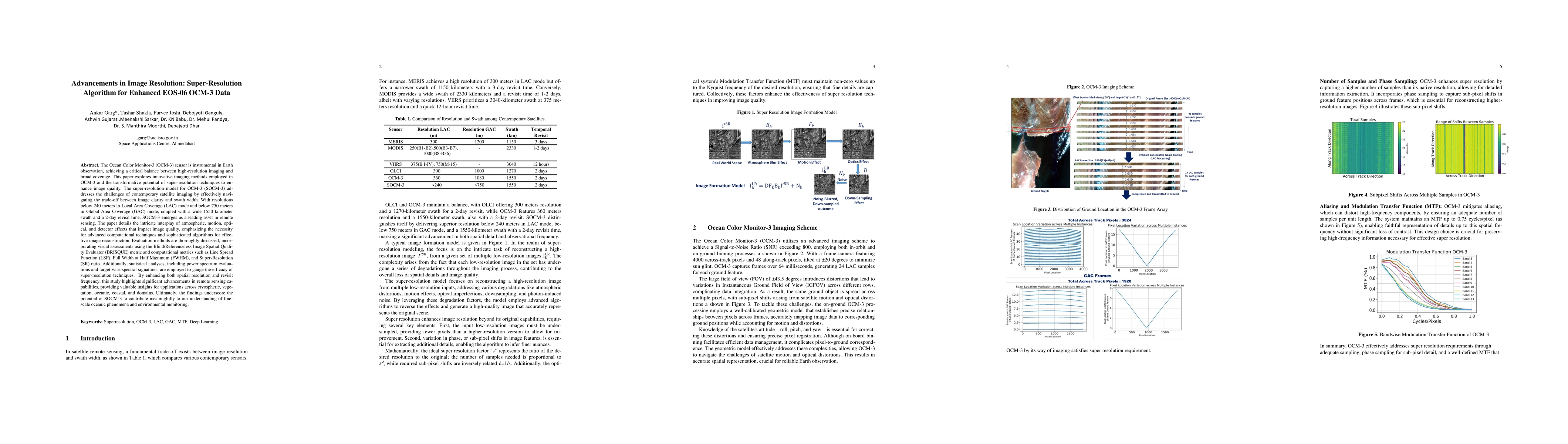
The Ocean Color Monitor-3 (OCM-3) sensor is instrumental in Earth observation, achieving a critical balance between high-resolution imaging and broad coverage. This paper explores innovative imaging m...
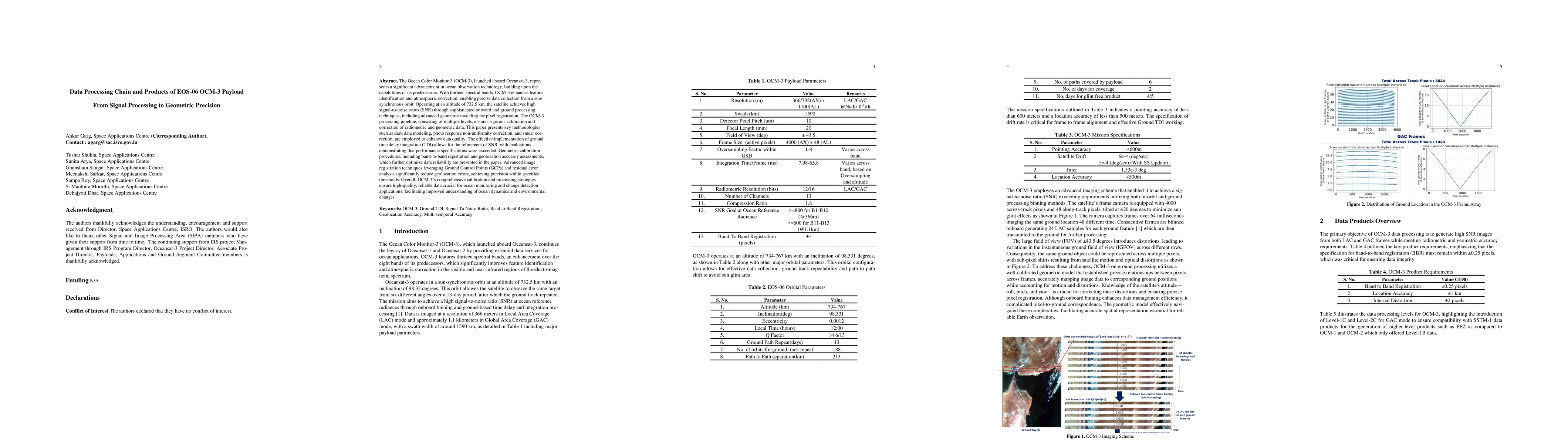
The Ocean Color Monitor-3, launched aboard Oceansat-3, represents a significant advancement in ocean observation technology, building upon the capabilities of its predecessors. With thirteen spectral ...