Academic Profile
Statistics
Similar Authors
Papers on arXiv
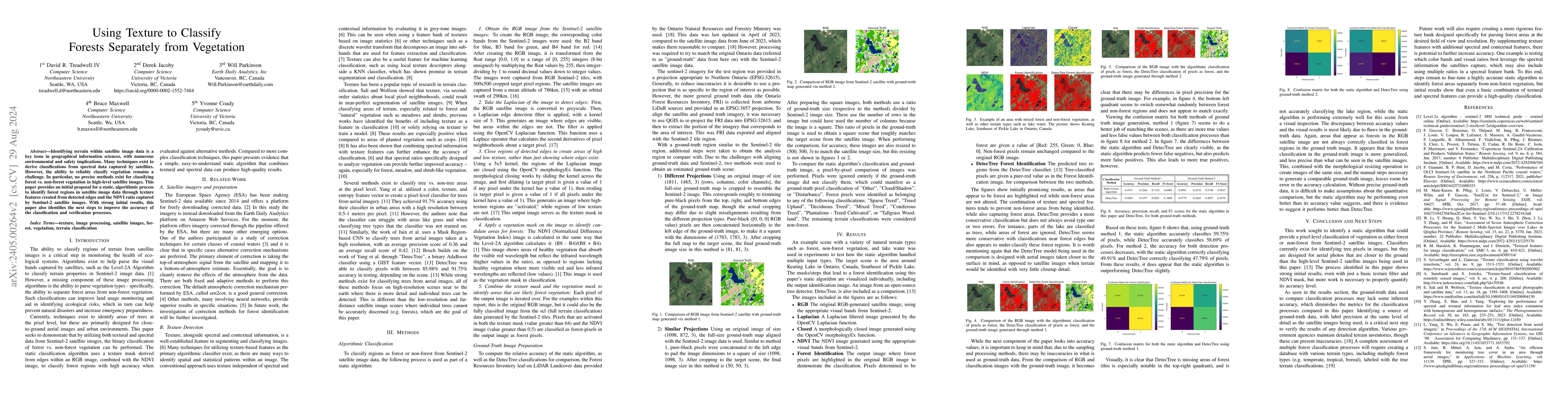
Identifying terrain within satellite image data is a key issue in geographical information sciences, with numerous environmental and safety implications. Many techniques exist to derive classificati...
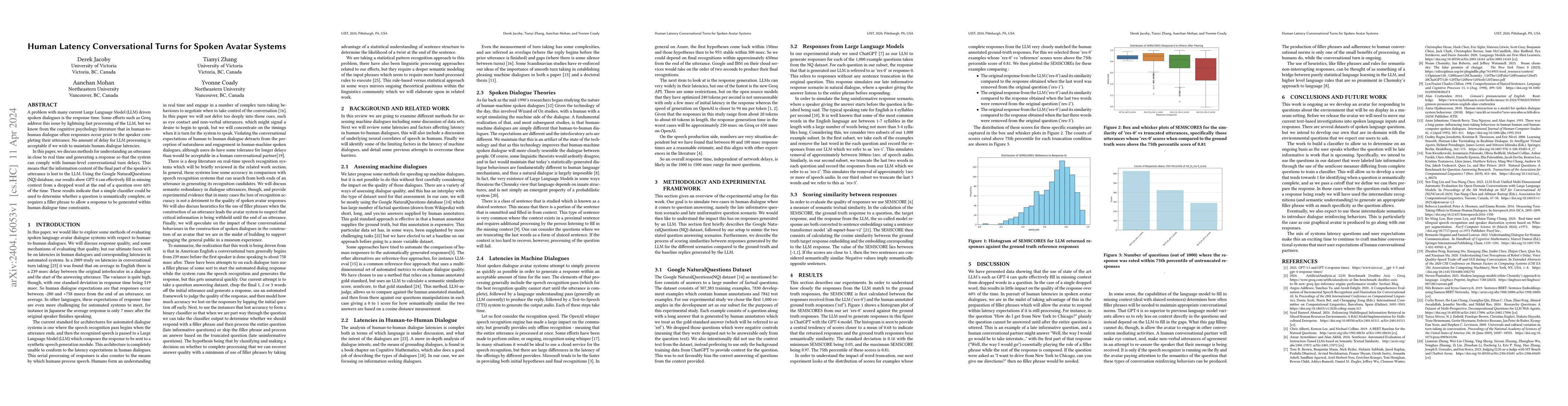
A problem with many current Large Language Model (LLM) driven spoken dialogues is the response time. Some efforts such as Groq address this issue by lightning fast processing of the LLM, but we know...
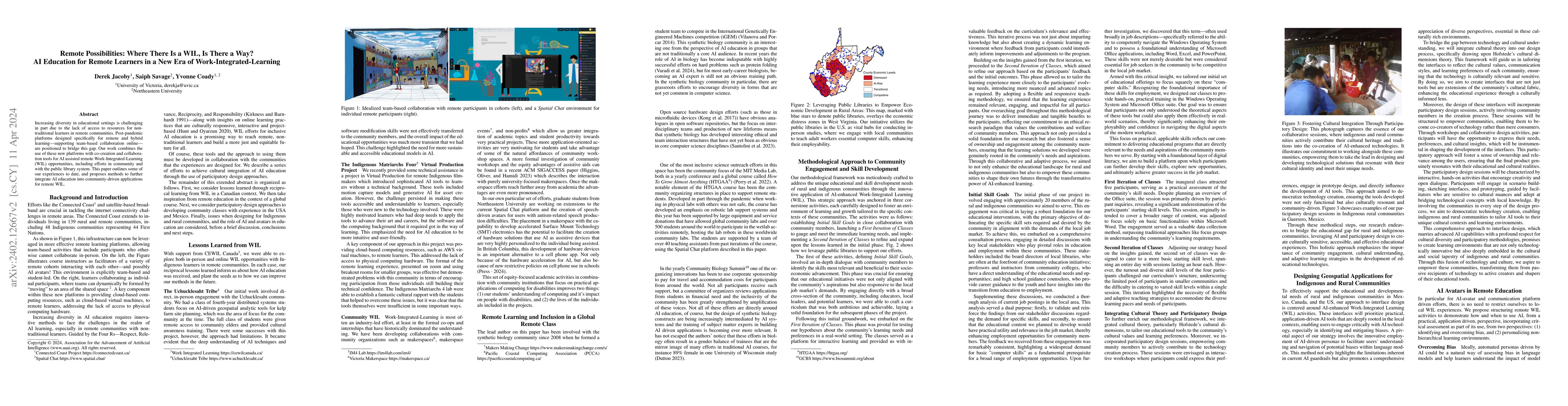
Increasing diversity in educational settings is challenging in part due to the lack of access to resources for non-traditional learners in remote communities. Post-pandemic platforms designed specif...
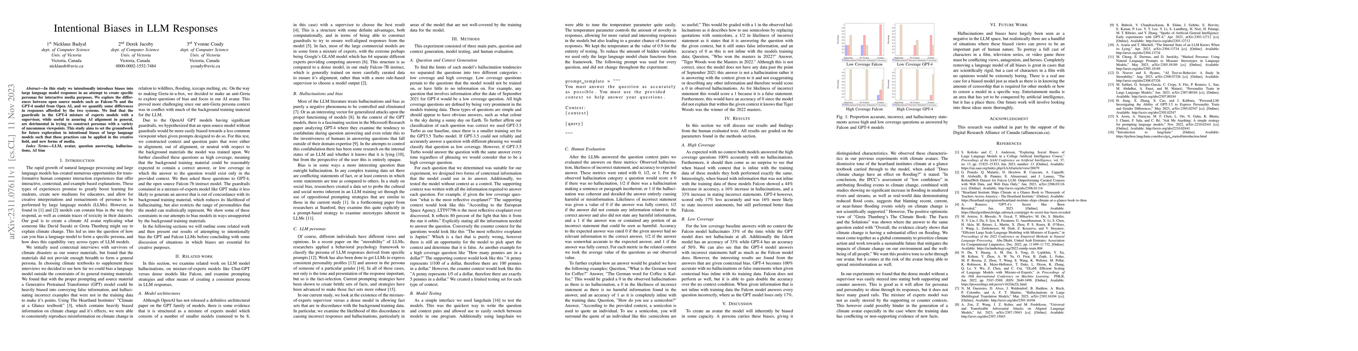
In this study we intentionally introduce biases into large language model responses in an attempt to create specific personas for interactive media purposes. We explore the differences between open ...
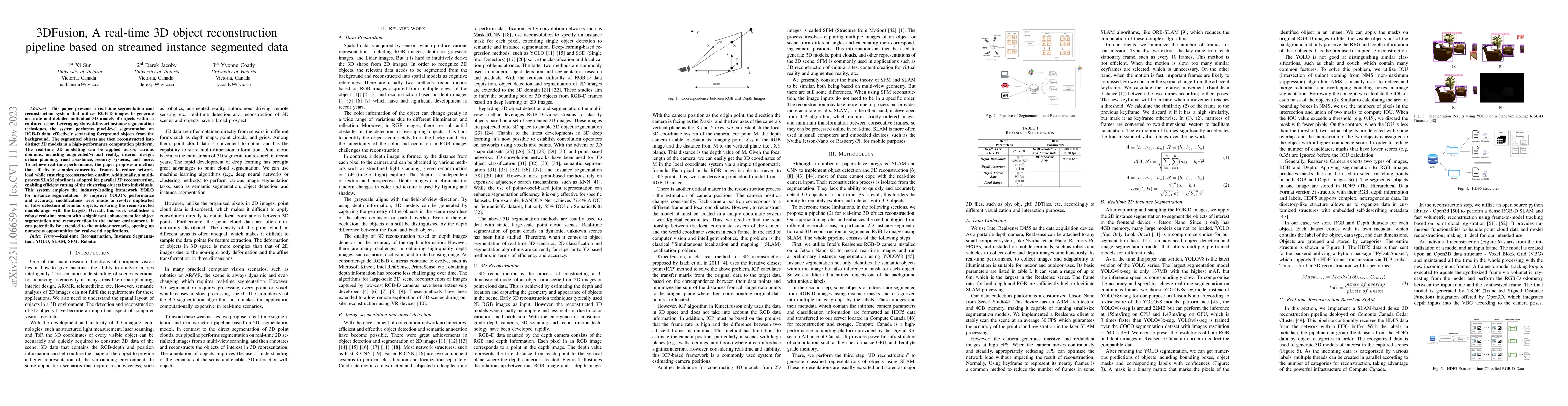
This paper presents a real-time segmentation and reconstruction system that utilizes RGB-D images to generate accurate and detailed individual 3D models of objects within a captured scene. Leveragin...
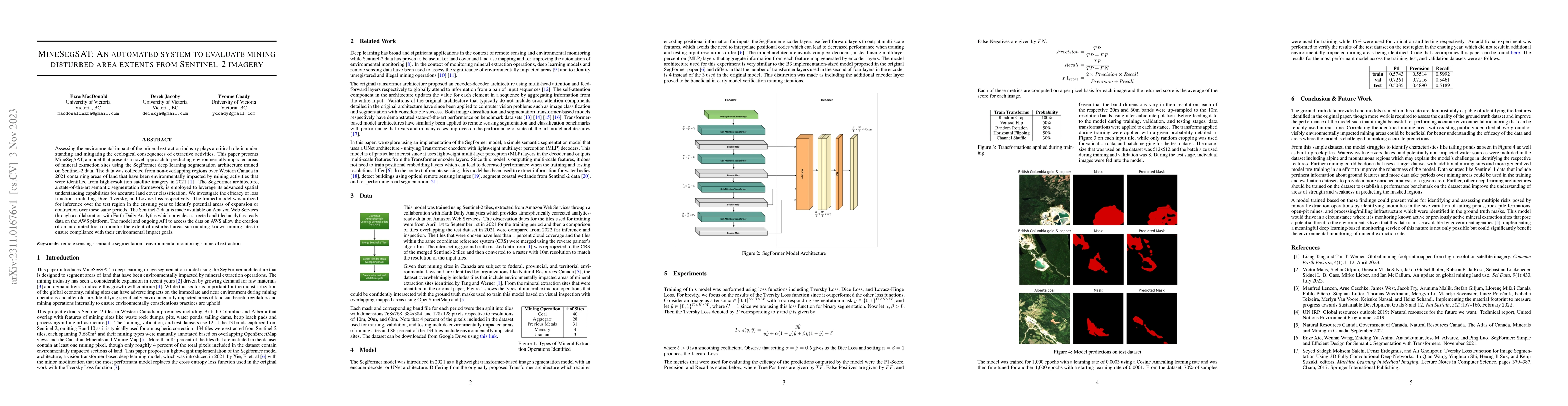
Assessing the environmental impact of the mineral extraction industry plays a critical role in understanding and mitigating the ecological consequences of extractive activities. This paper presents ...
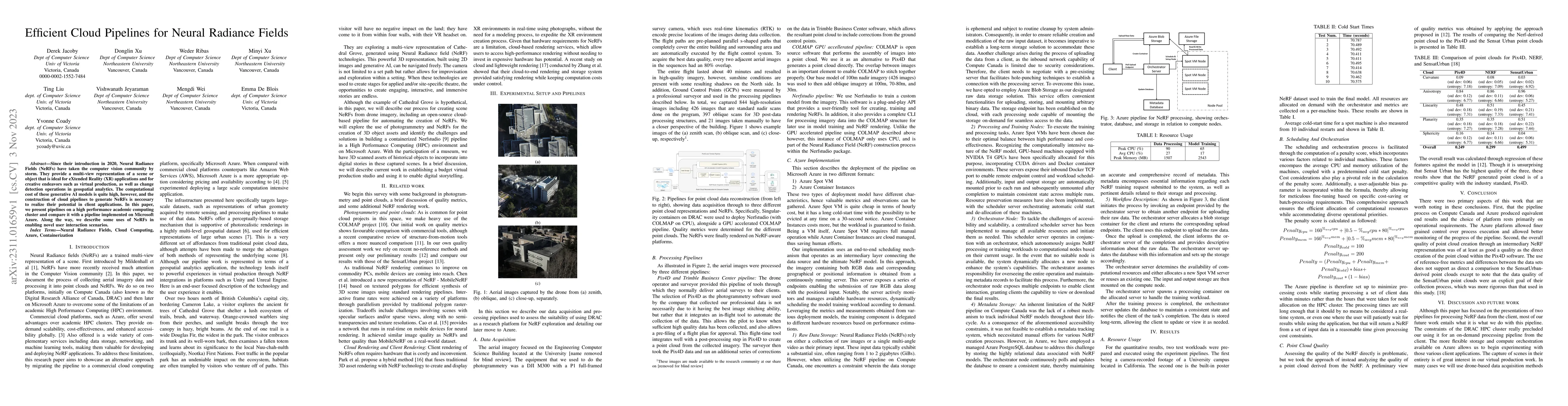
Since their introduction in 2020, Neural Radiance Fields (NeRFs) have taken the computer vision community by storm. They provide a multi-view representation of a scene or object that is ideal for eX...
Methodical aerial population surveys monitoring critically endangered species in Canadian North Atlantic waters are instrumental in influencing government policies both in economic and conservationa...
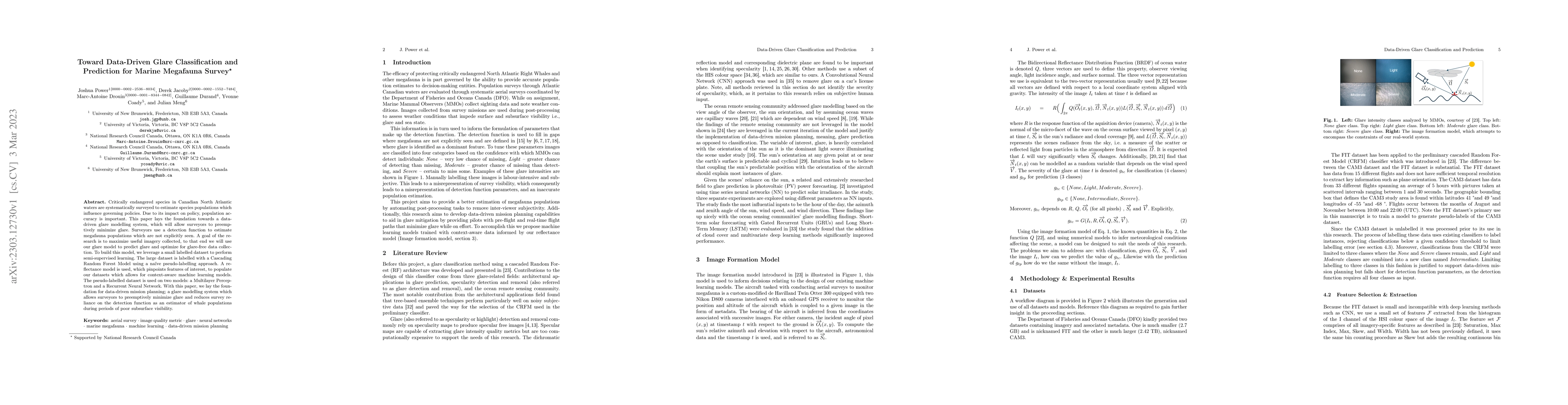
Critically endangered species in Canadian North Atlantic waters are systematically surveyed to estimate species populations which influence governing policies. Due to its impact on policy, populatio...
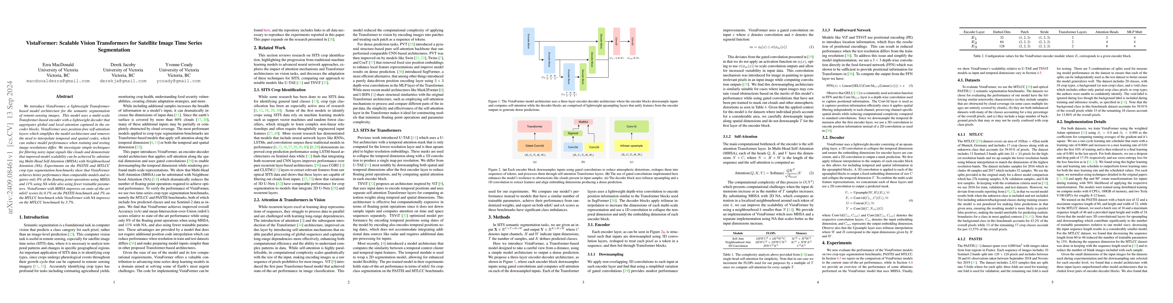
We introduce VistaFormer, a lightweight Transformer-based model architecture for the semantic segmentation of remote-sensing images. This model uses a multi-scale Transformer-based encoder with a ligh...