Academic Profile
Statistics
Similar Authors
Papers on arXiv
Image-level regression is an important task in Earth observation, where visual domain and label shifts are a core challenge hampering generalization. However, cross-domain regression with remote sen...
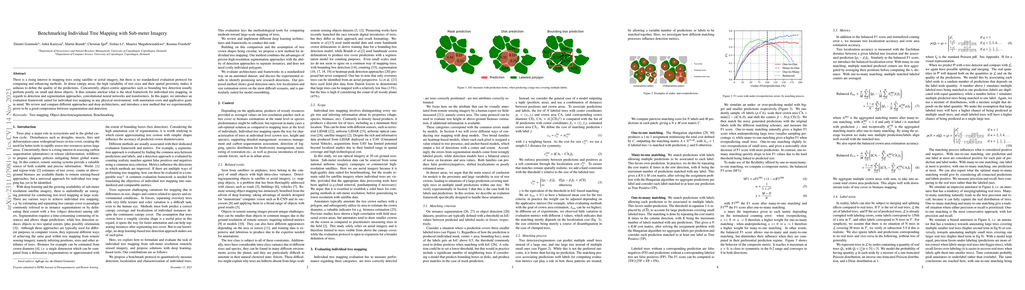
There is a rising interest in mapping trees using satellite or aerial imagery, but there is no standardized evaluation protocol for comparing and enhancing methods. In dense canopy areas, the high v...
With impressive results in applications relying on feature learning, deep learning has also blurred the line between algorithm and data. Pick a training dataset, pick a backbone network for feature ...
Advances in high resolution remote sensing image analysis are currently hampered by the difficulty of gathering enough annotated data for training deep learning methods, giving rise to a variety of ...
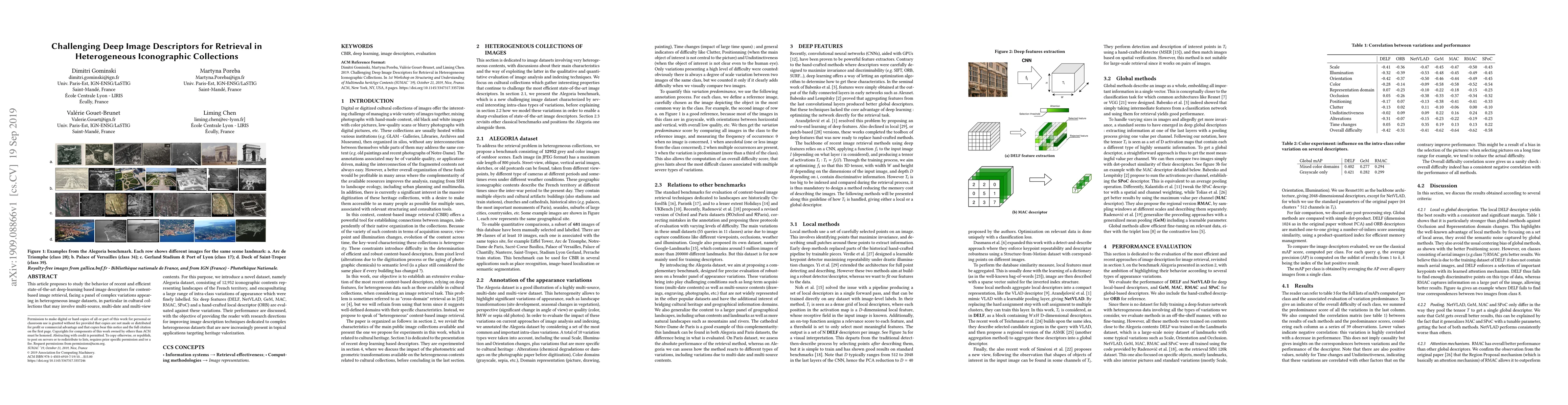
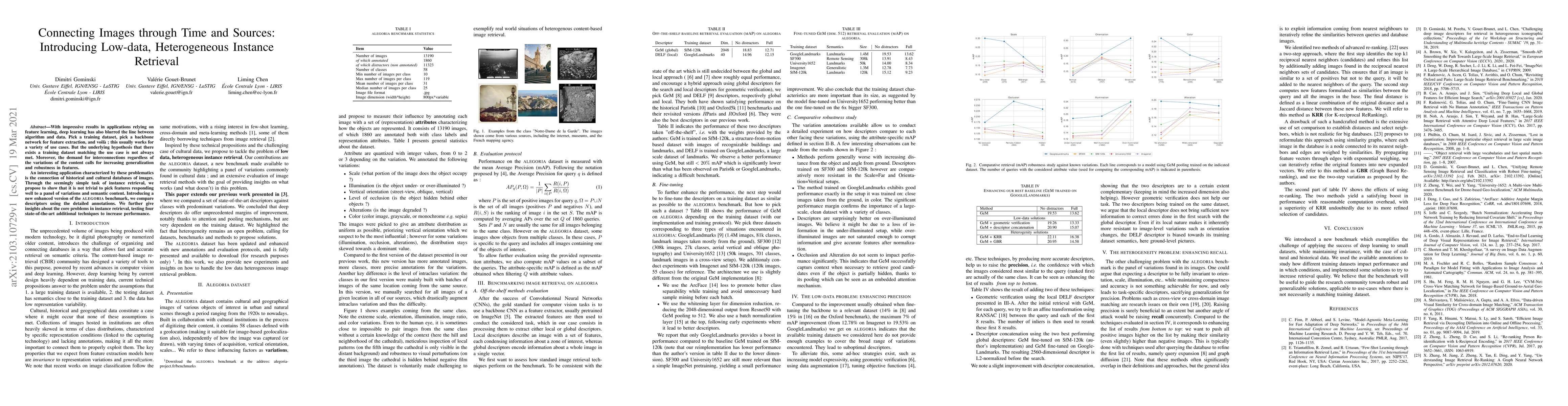
This article proposes to study the behavior of recent and efficient state-of-the-art deep-learning based image descriptors for content-based image retrieval, facing a panel of complex variations app...
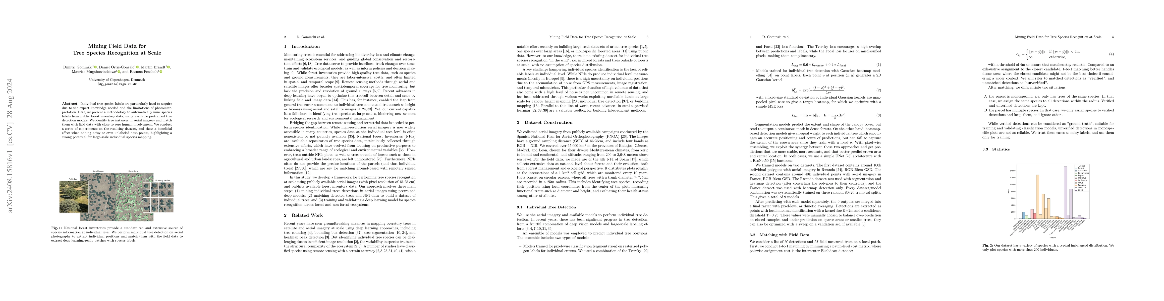
Individual tree species labels are particularly hard to acquire due to the expert knowledge needed and the limitations of photointerpretation. Here, we present a methodology to automatically mine spec...
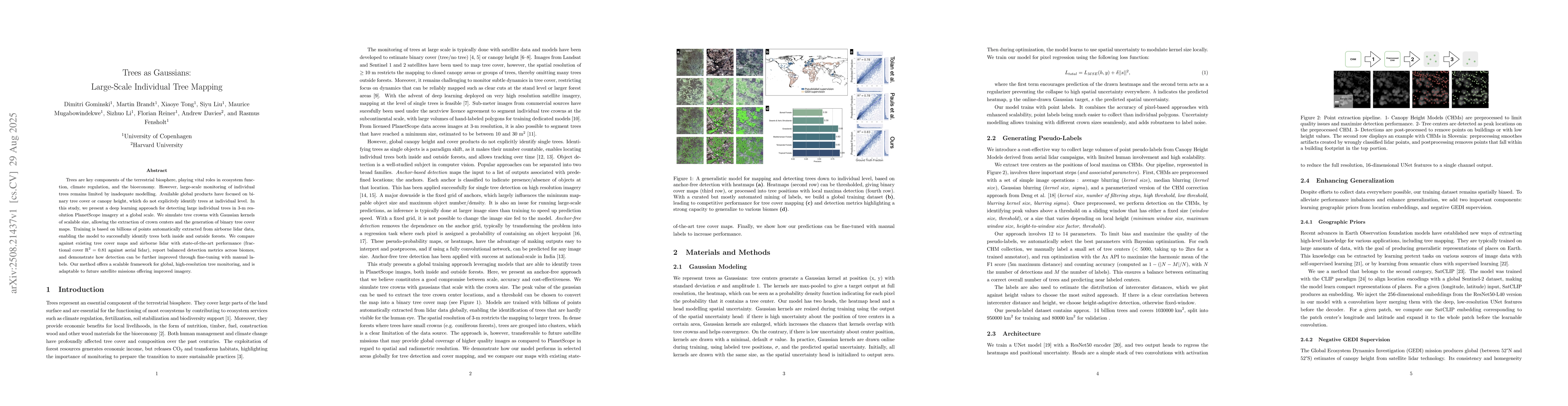
Trees are key components of the terrestrial biosphere, playing vital roles in ecosystem function, climate regulation, and the bioeconomy. However, large-scale monitoring of individual trees remains li...

Counting individual trees is a fundamental task for environmental monitoring, yet remains largely unexplored with satellite imagery. At these resolutions, isolated trees may still be identifiable, but...
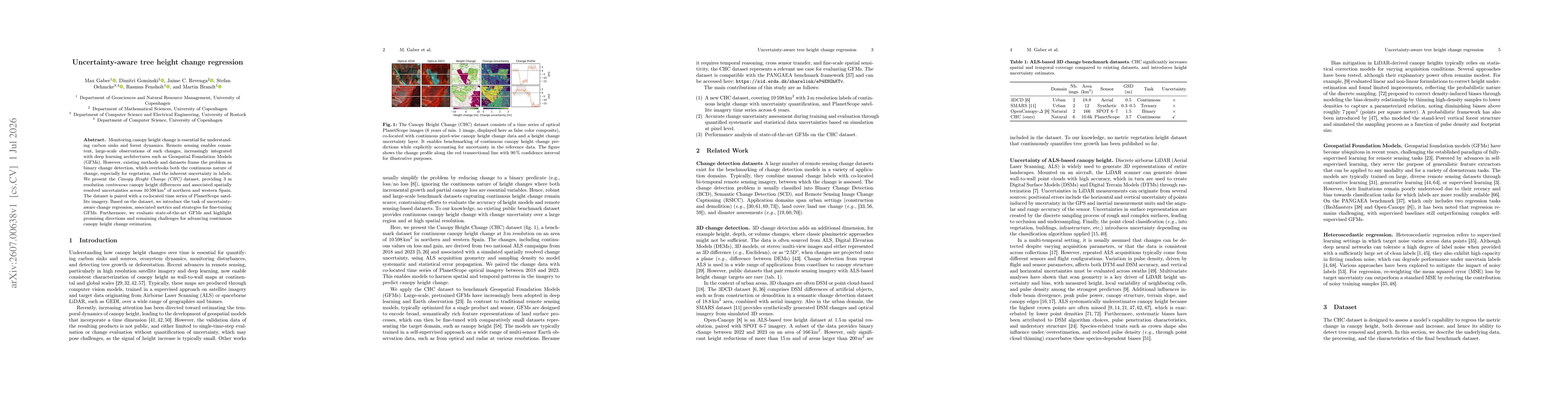
Monitoring canopy height change is essential for understanding carbon sinks and forest dynamics. Remote sensing enables consistent, large-scale observations of such changes, increasingly integrated wi...
Supervised learning for image segmentation typically requires spatially aligned image and label sets. When images and labels originate from different sources, the pairing may be misaligned, which can ...