Academic Profile
Statistics
Similar Authors
Papers on arXiv
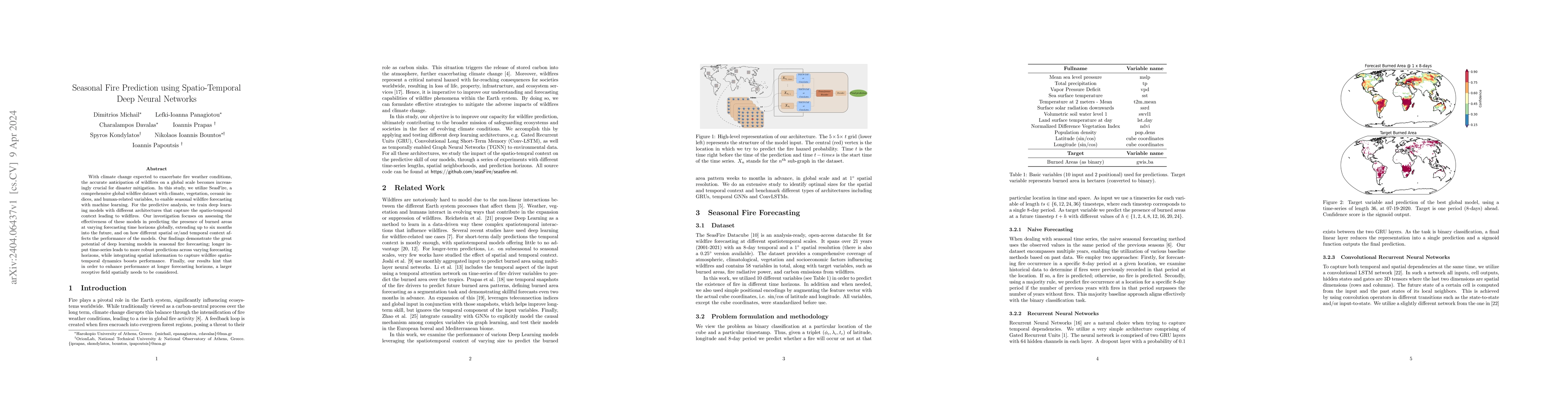
With climate change expected to exacerbate fire weather conditions, the accurate anticipation of wildfires on a global scale becomes increasingly crucial for disaster mitigation. In this study, we u...
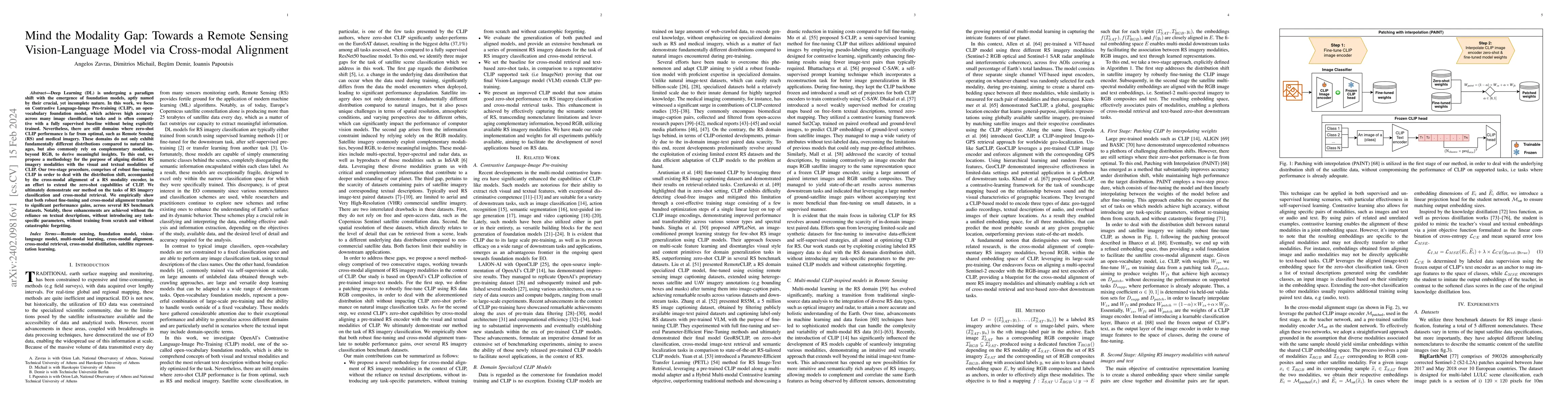
Deep Learning (DL) is undergoing a paradigm shift with the emergence of foundation models, aptly named by their crucial, yet incomplete nature. In this work, we focus on Contrastive Language-Image P...
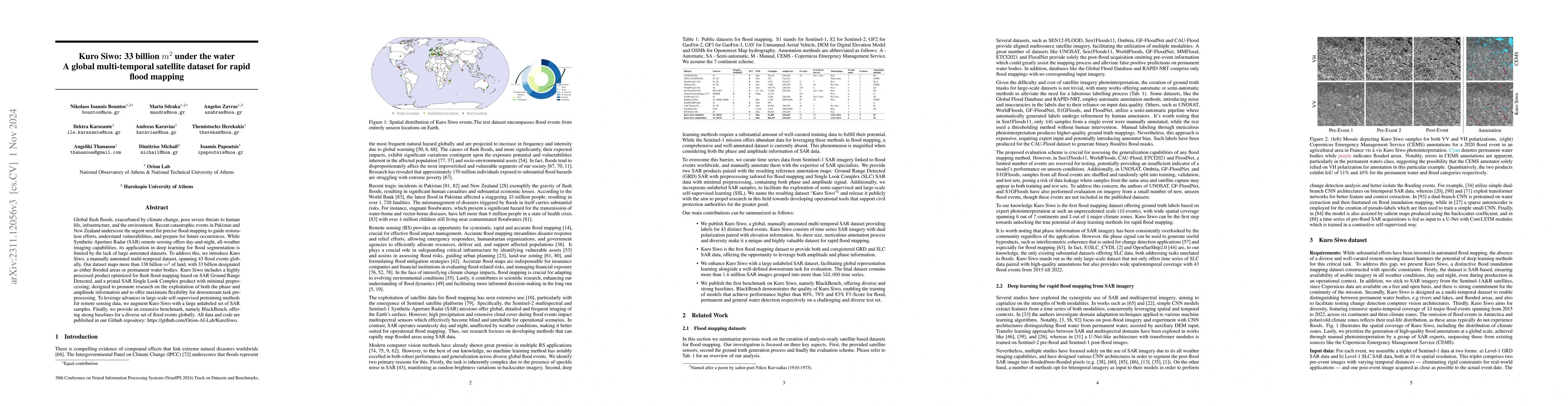
Global floods, exacerbated by climate change, pose severe threats to human life, infrastructure, and the environment. Recent catastrophic events in Pakistan and New Zealand underscore the urgent nee...
Over the last decade there has been an increasing frequency and intensity of wildfires across the globe, posing significant threats to human and animal lives, ecosystems, and socio-economic stabilit...
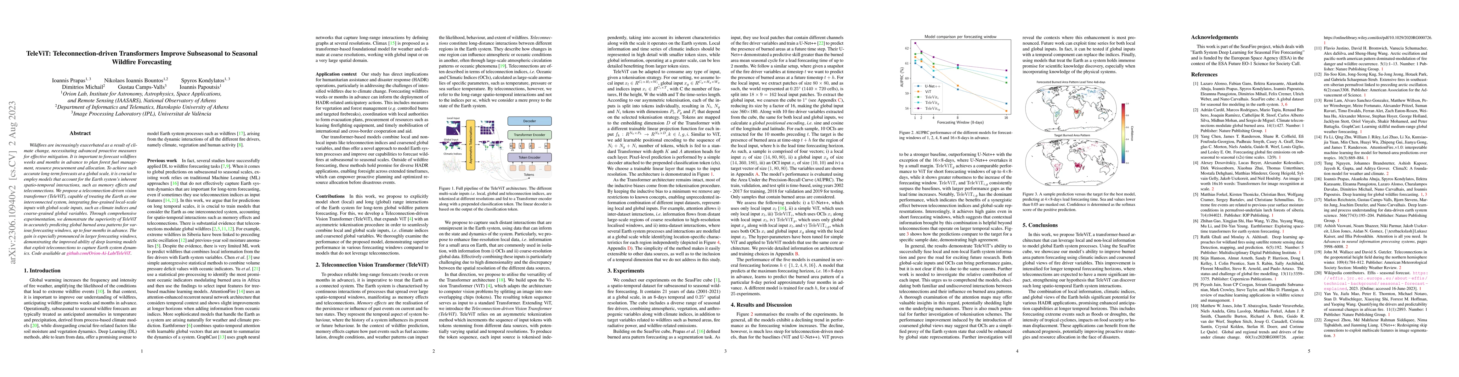
Wildfires are increasingly exacerbated as a result of climate change, necessitating advanced proactive measures for effective mitigation. It is important to forecast wildfires weeks and months in ad...
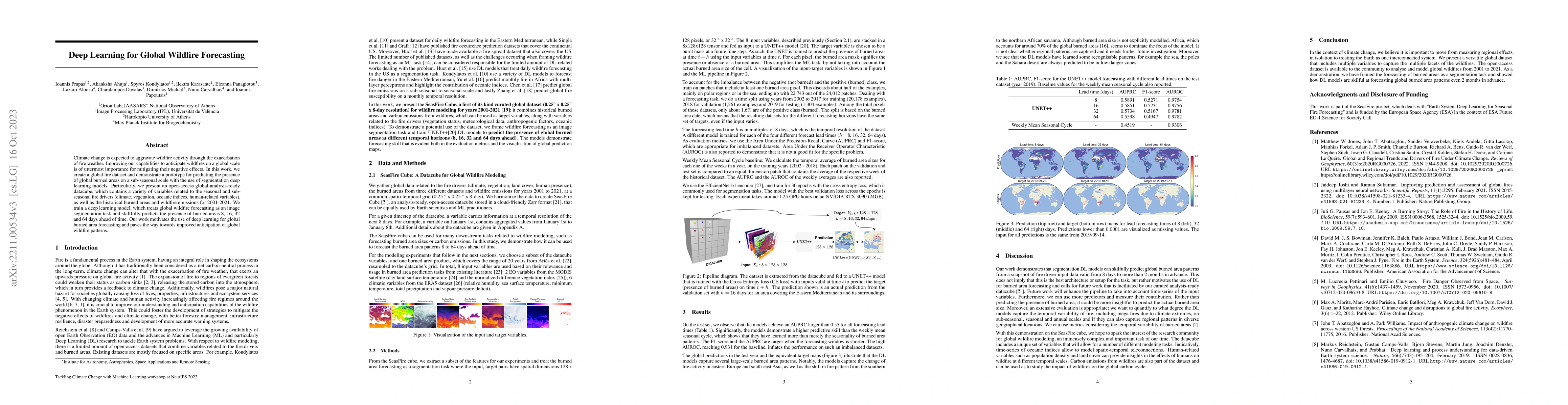
Climate change is expected to aggravate wildfire activity through the exacerbation of fire weather. Improving our capabilities to anticipate wildfires on a global scale is of uttermost importance fo...
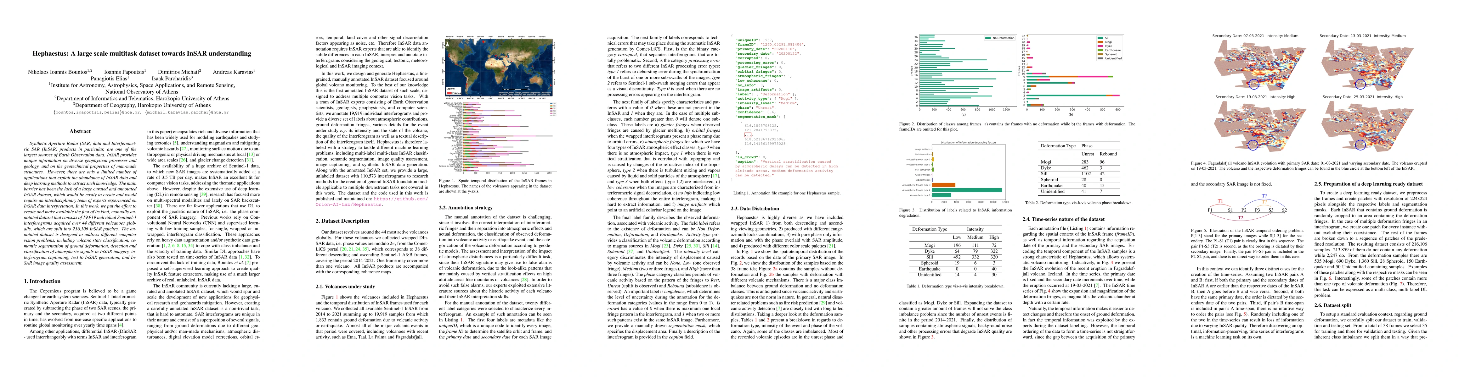
Synthetic Aperture Radar (SAR) data and Interferometric SAR (InSAR) products in particular, are one of the largest sources of Earth Observation data. InSAR provides unique information on diverse geo...
Ground deformation measured from Interferometric Synthetic Aperture Radar (InSAR) data is considered a sign of volcanic unrest, statistically linked to a volcanic eruption. Recent studies have shown...
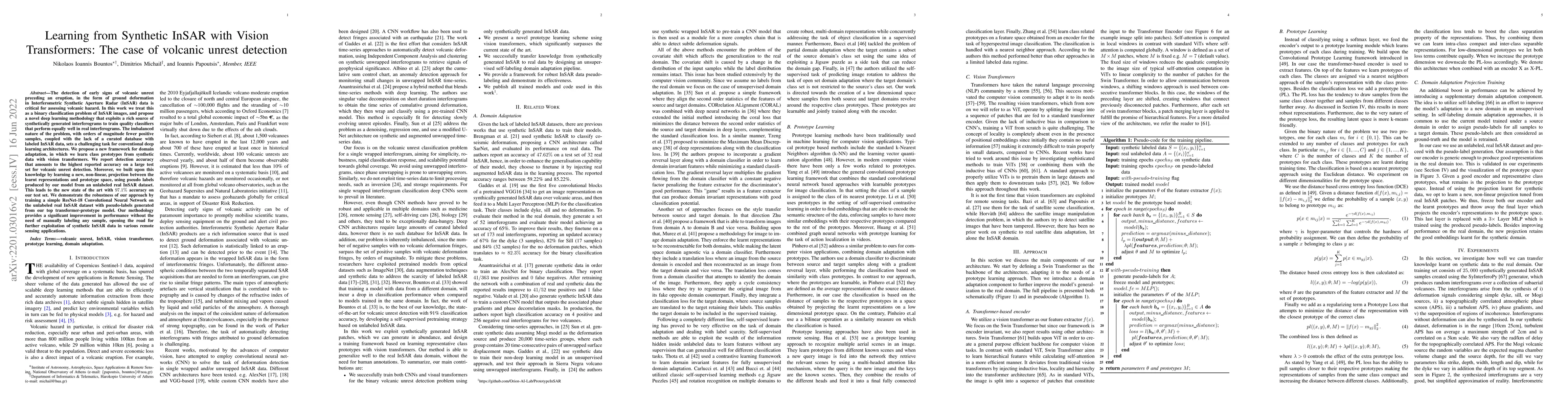
The detection of early signs of volcanic unrest preceding an eruption, in the form of ground deformation in Interferometric Synthetic Aperture Radar (InSAR) data is critical for assessing volcanic h...
The availability of the sheer volume of Copernicus Sentinel-2 imagery has created new opportunities for exploiting deep learning (DL) methods for land use land cover (LULC) image classification. How...
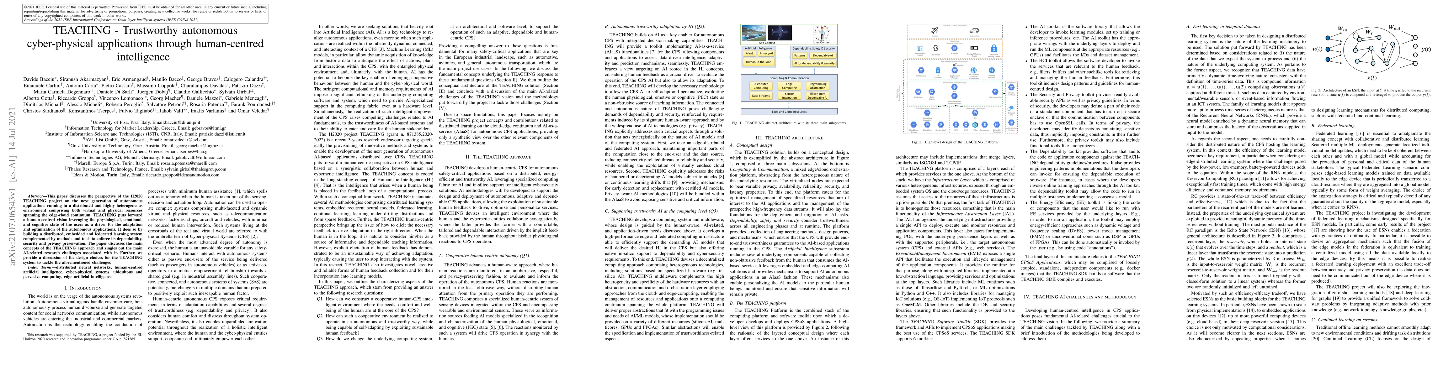
This paper discusses the perspective of the H2020 TEACHING project on the next generation of autonomous applications running in a distributed and highly heterogeneous environment comprising both vir...
Mathematical software and graph-theoretical algorithmic packages to efficiently model, analyze and query graphs are crucial in an era where large-scale spatial, societal and economic network data ar...
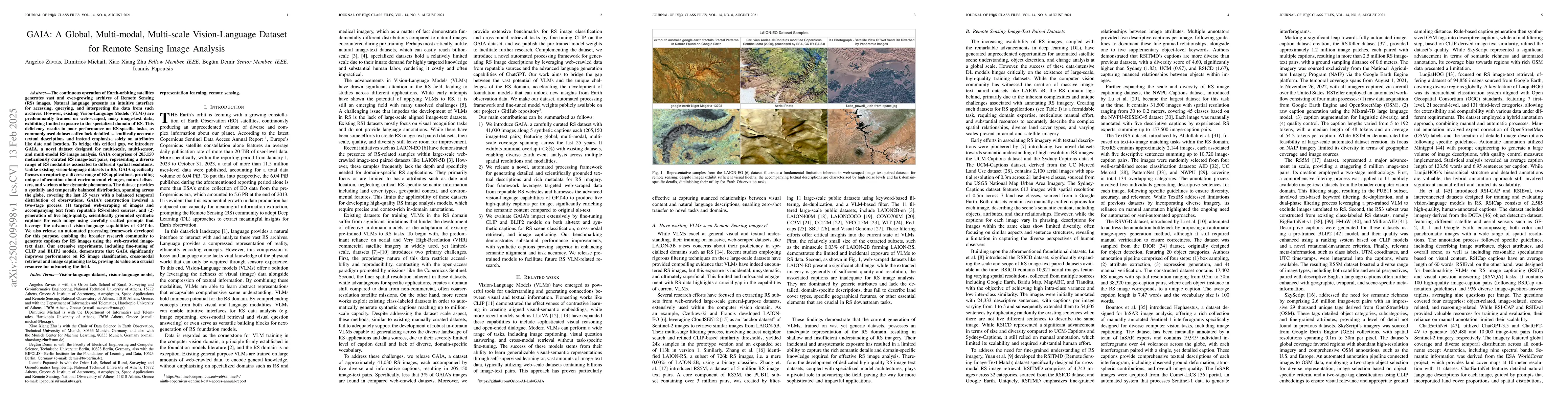
The continuous operation of Earth-orbiting satellites generates vast and ever-growing archives of Remote Sensing (RS) images. Natural language presents an intuitive interface for accessing, querying, ...
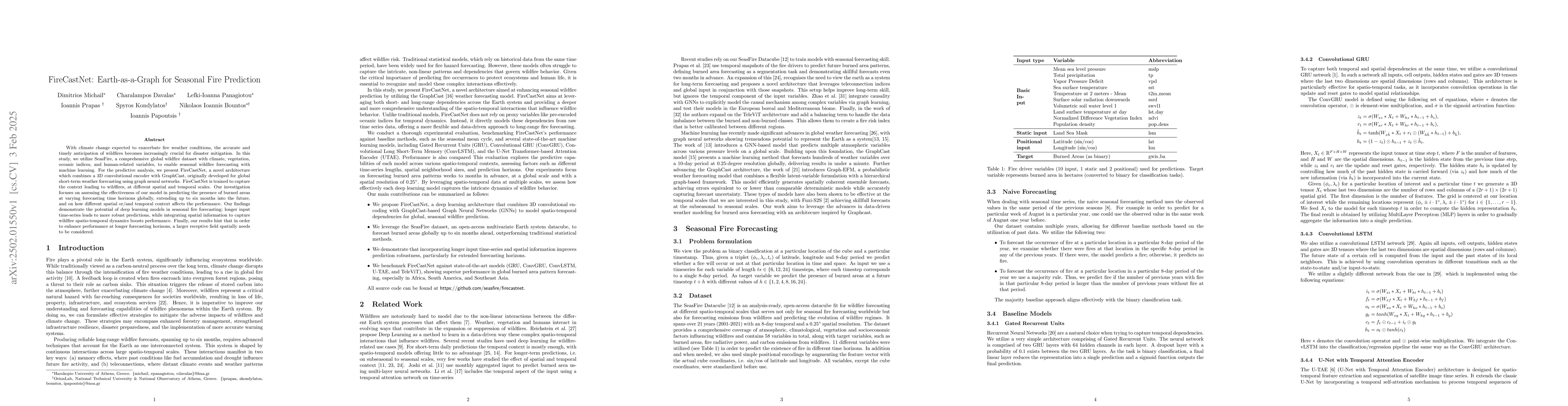
With climate change expected to exacerbate fire weather conditions, the accurate and timely anticipation of wildfires becomes increasingly crucial for disaster mitigation. In this study, we utilize Se...
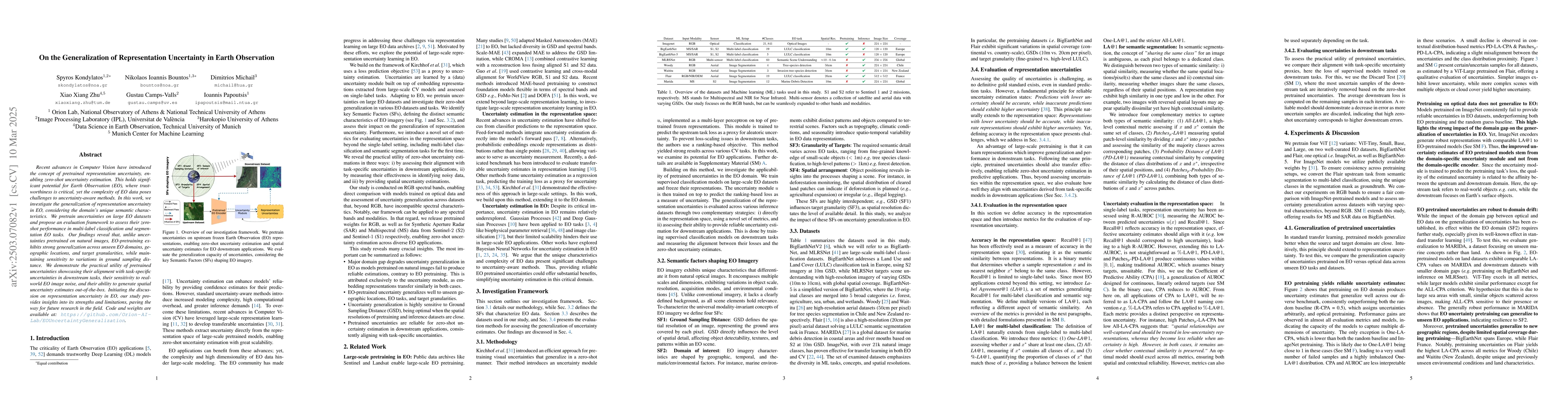
Recent advances in Computer Vision have introduced the concept of pretrained representation uncertainty, enabling zero-shot uncertainty estimation. This holds significant potential for Earth Observati...
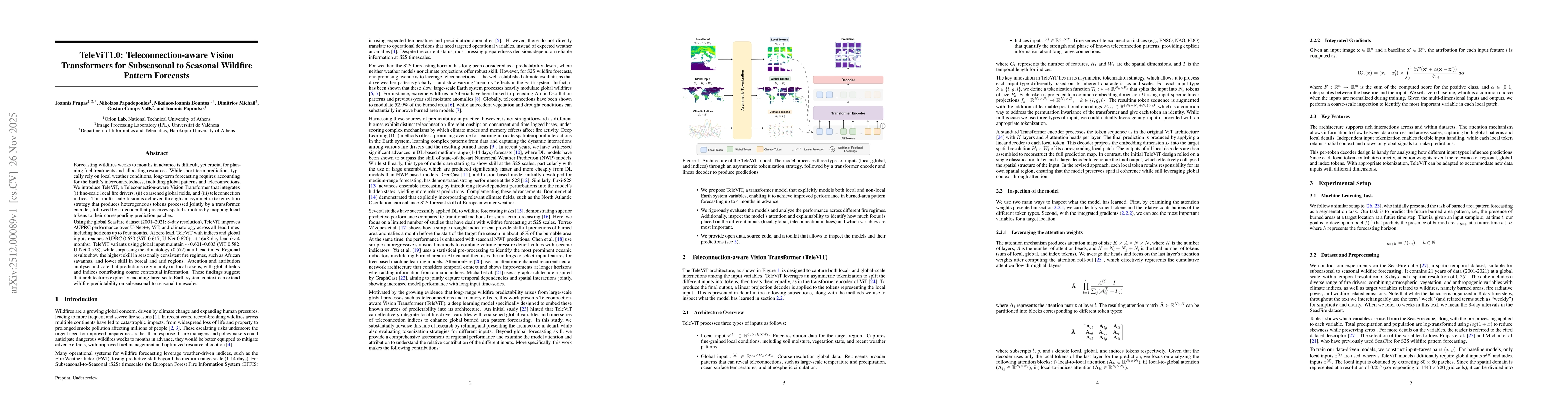
Forecasting wildfires weeks to months in advance is difficult, yet crucial for planning fuel treatments and allocating resources. While short-term predictions typically rely on local weather condition...
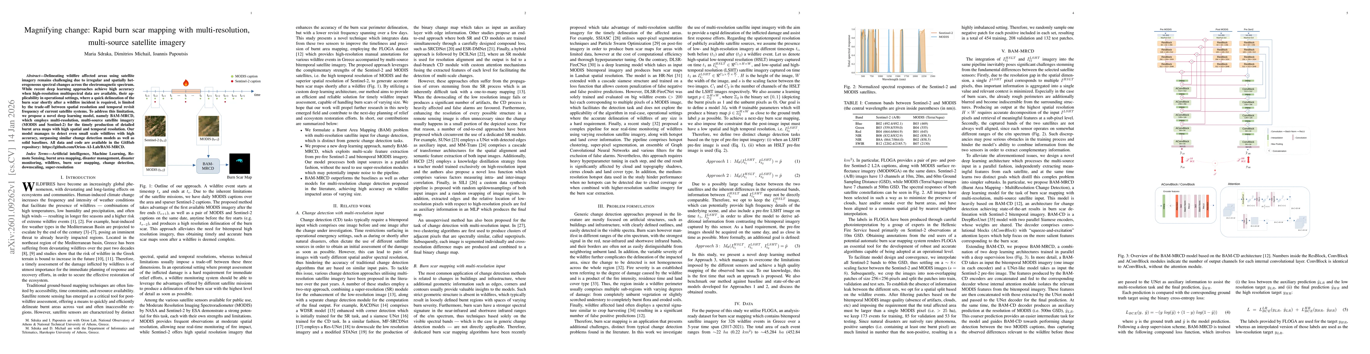
Delineating wildfire affected areas using satellite imagery remains challenging due to irregular and spatially heterogeneous spectral changes across the electromagnetic spectrum. While recent deep lea...
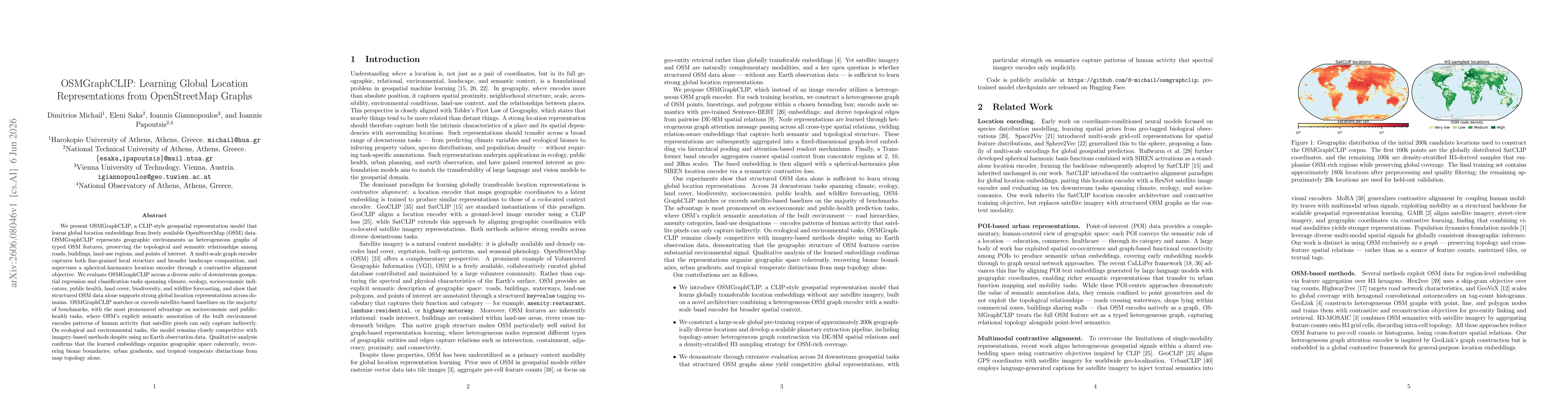
We present OSMGraphCLIP, a CLIP-style geospatial representation model that learns global location embeddings from freely available OpenStreetMap (OSM) data. OSMGraphCLIP represents geographic environm...