Domingo Alcaraz-Segura
1 papers on arXiv
Academic Profile
Statistics
arXiv Papers
1
Total Publications
96
Similar Authors
Papers on arXiv
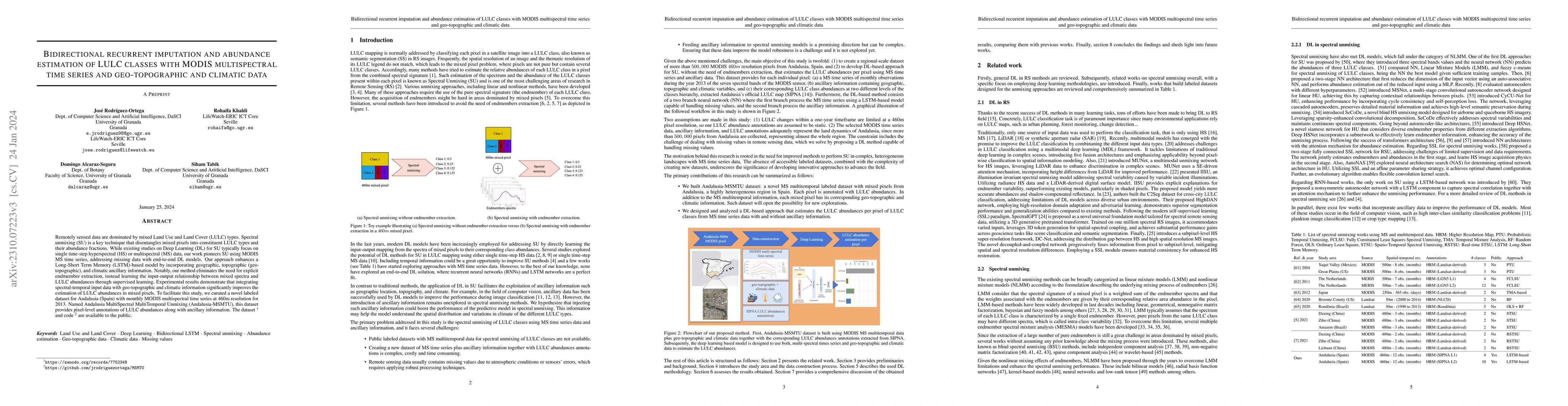
Bidirectional recurrent imputation and abundance estimation of LULC classes with MODIS multispectral time series and geo-topographic and climatic data
Remotely sensed data are dominated by mixed Land Use and Land Cover (LULC) types. Spectral unmixing (SU) is a key technique that disentangles mixed pixels into constituent LULC types and their abund...