Academic Profile
Statistics
Similar Authors
Papers on arXiv
Moving beyond traditional surveys, combining heterogeneous data sources with AI-driven inference models brings new opportunities to measure socio-economic conditions, such as poverty and population,...
While measuring socioeconomic indicators is critical for local governments to make informed policy decisions, such measurements are often unavailable at fine-grained levels like municipality. This s...
High-resolution daytime satellite imagery has become a promising source to study economic activities. These images display detailed terrain over large areas and allow zooming into smaller neighborho...
Satellite imagery has long been an attractive data source that provides a wealth of information on human-inhabited areas. While super resolution satellite images are rapidly becoming available, litt...
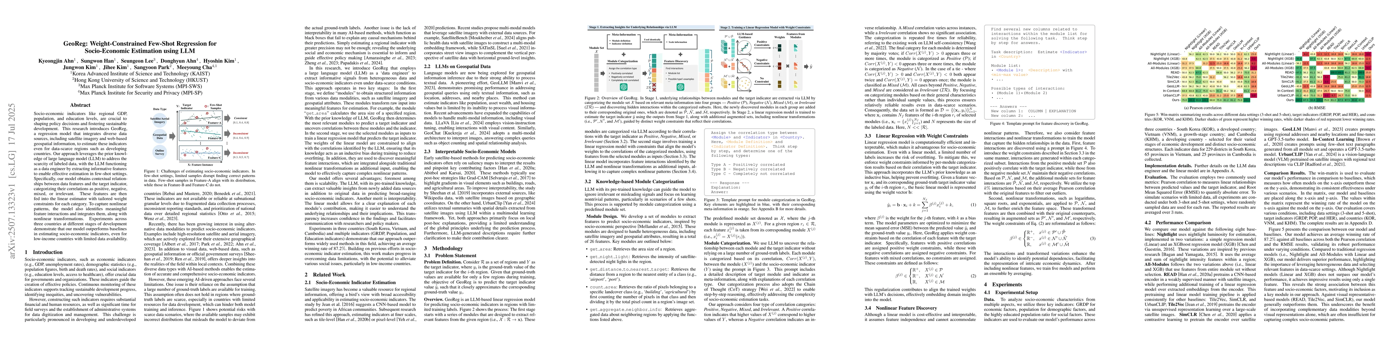
Socio-economic indicators like regional GDP, population, and education levels, are crucial to shaping policy decisions and fostering sustainable development. This research introduces GeoReg a regressi...
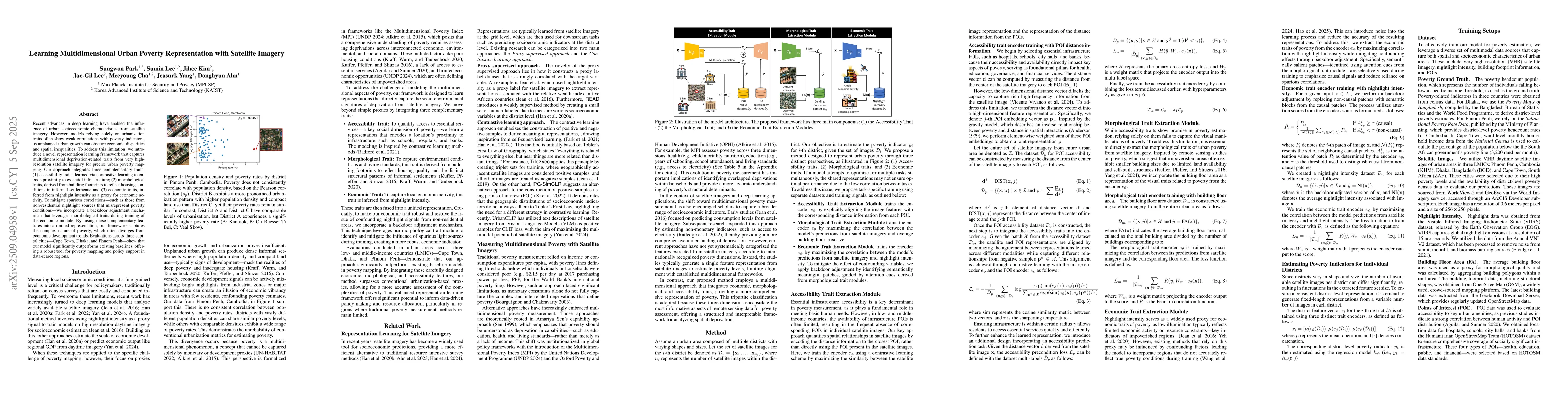
Recent advances in deep learning have enabled the inference of urban socioeconomic characteristics from satellite imagery. However, models relying solely on urbanization traits often show weak correla...