Academic Profile
Statistics
Similar Authors
Papers on arXiv
Image generation and image completion are rapidly evolving fields, thanks to machine learning algorithms that are able to realistically replace missing pixels. However, generating large high resolut...
This work aims to produce landslide density estimates using Synthetic Aperture Radar (SAR) satellite imageries to prioritise emergency resources for rapid response. We use the United States Geologic...
Rapid assessment after a natural disaster is key for prioritizing emergency resources. In the case of landslides, rapid assessment involves determining the extent of the area affected and measuring ...
With climate change predicted to increase the likelihood of landslide events, there is a growing need for rapid landslide detection technologies that help inform emergency responses. Synthetic Apert...
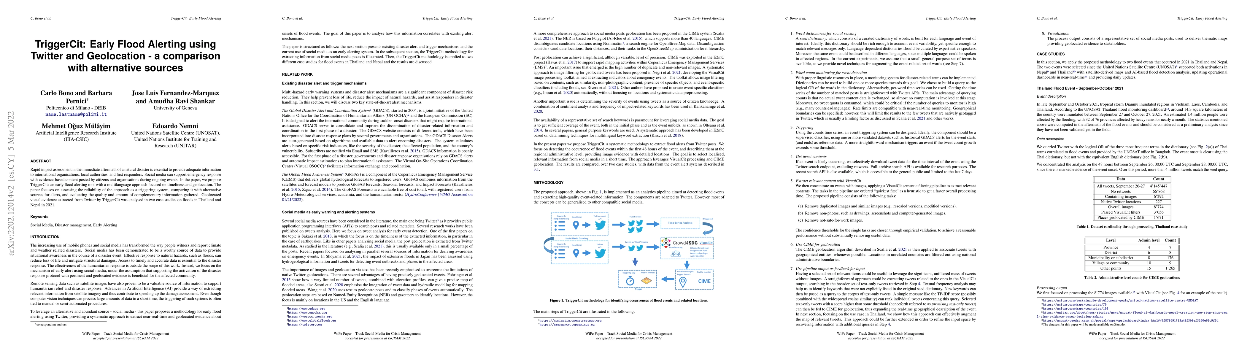
Rapid impact assessment in the immediate aftermath of a natural disaster is essential to provide adequate information to international organisations, local authorities, and first responders. Social ...
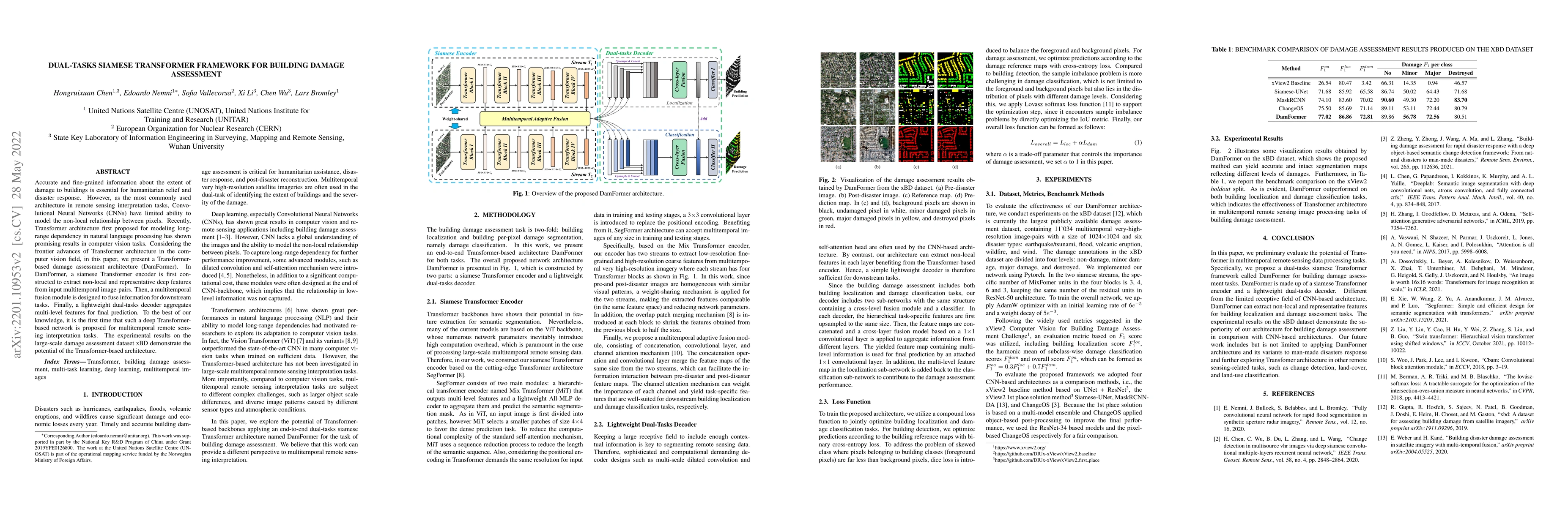
Accurate and fine-grained information about the extent of damage to buildings is essential for humanitarian relief and disaster response. However, as the most commonly used architecture in remote se...
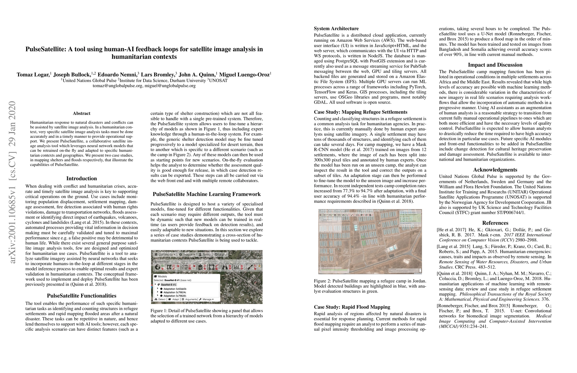
Humanitarian response to natural disasters and conflicts can be assisted by satellite image analysis. In a humanitarian context, very specific satellite image analysis tasks must be done accurately ...