Eija Honkavaara

6 papers on arXiv

Academic Profile

Name: E. Honkavaara
Total Papers: 14

Statistics

arXiv Papers 6
Total Publications 14

Papers on arXiv

Thumbnail for Detecting Wildfires on UAVs with Real-time Segmentation Trained by
  Larger Teacher Models

Detecting Wildfires on UAVs with Real-time Segmentation Trained by Larger Teacher Models

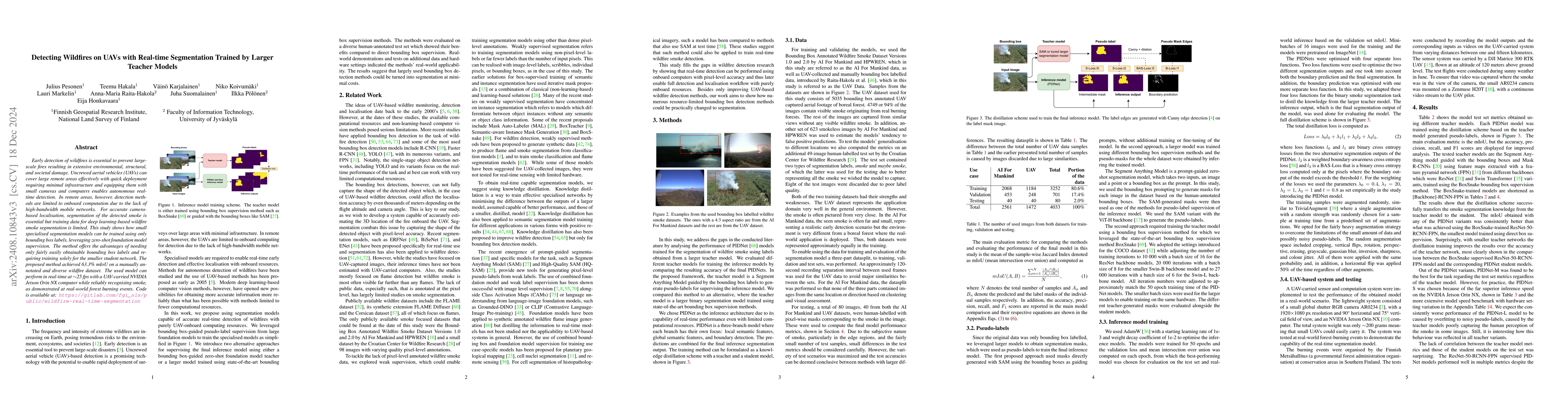
Early detection of wildfires is essential to prevent large-scale fires resulting in extensive environmental, structural, and societal damage. Uncrewed aerial vehicles (UAVs) can cover large remote are...

Thumbnail for Towards autonomous photogrammetric forest inventory using a lightweight
  under-canopy robotic drone

Towards autonomous photogrammetric forest inventory using a lightweight under-canopy robotic drone

Drones are increasingly used in forestry to capture high-resolution remote sensing data. While operations above the forest canopy are already highly automated, flying inside forests remains challengin...

Thumbnail for Finding 3D Positions of Distant Objects from Noisy Camera Movement and
  Semantic Segmentation Sequences

Finding 3D Positions of Distant Objects from Noisy Camera Movement and Semantic Segmentation Sequences

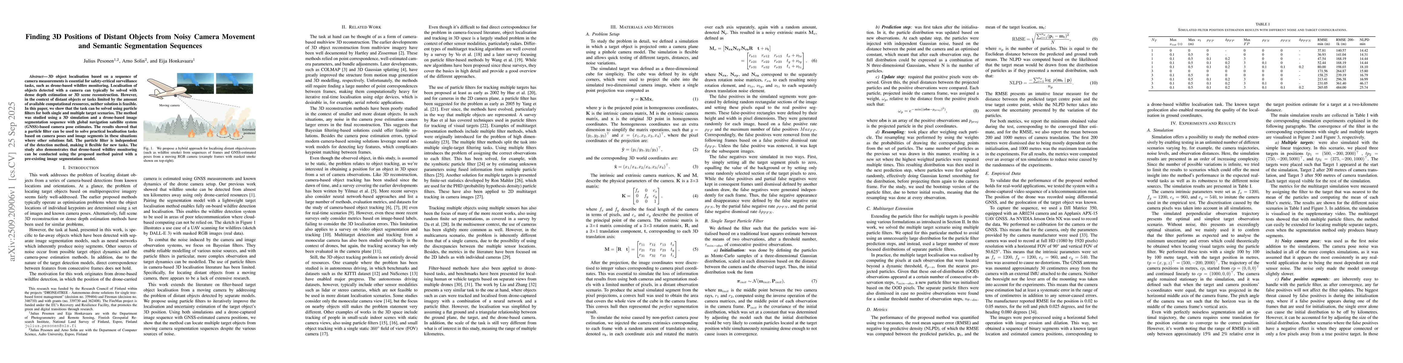
3D object localisation based on a sequence of camera measurements is essential for safety-critical surveillance tasks, such as drone-based wildfire monitoring. Localisation of objects detected with a ...

Thumbnail for Field evaluation and optimization of a lightweight lidar-based UAV navigation system for dense boreal forest environments

Field evaluation and optimization of a lightweight lidar-based UAV navigation system for dense boreal forest environments

The interest in the usage of uncrewed aerial vehicles (UAVs) for forest applications has increased in recent years. While above-canopy flight has reached a high level of autonomy, navigating under-can...

Thumbnail for Deep Learning-based Robust Autonomous Navigation of Aerial Robots in Dense Forests

Deep Learning-based Robust Autonomous Navigation of Aerial Robots in Dense Forests

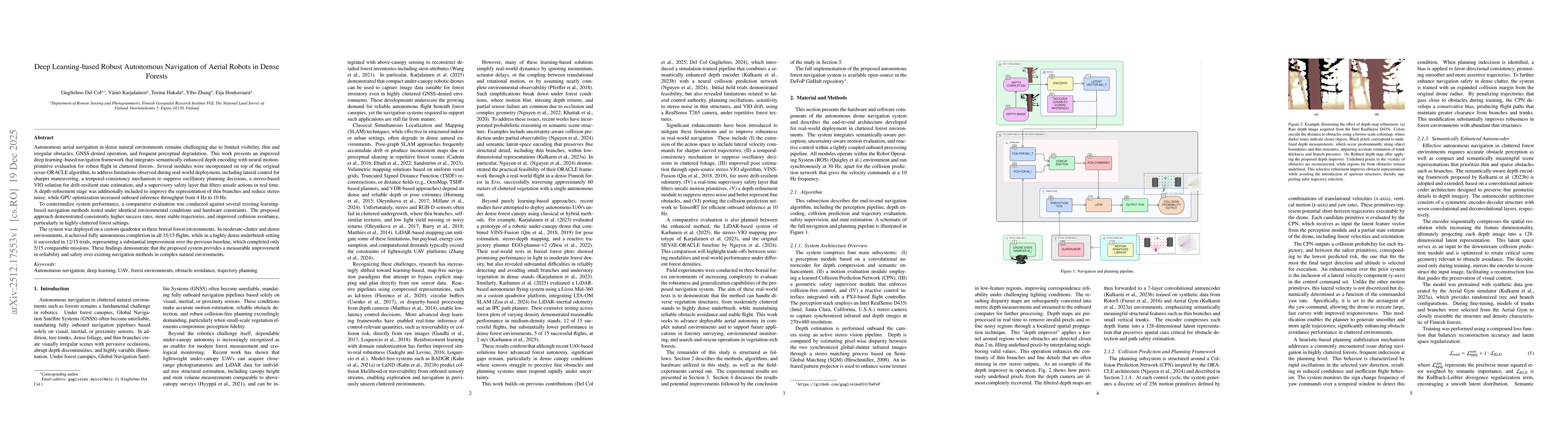
Autonomous aerial navigation in dense natural environments remains challenging due to limited visibility, thin and irregular obstacles, GNSS-denied operation, and frequent perceptual degradation. This...

Thumbnail for Learning Image-based Tree Crown Segmentation from Enhanced Lidar-based Pseudo-labels

Learning Image-based Tree Crown Segmentation from Enhanced Lidar-based Pseudo-labels

Mapping individual tree crowns is essential for tasks such as maintaining urban tree inventories and monitoring forest health, which help us understand and care for our environment. However, automatic...

This website uses cookies to ensure you get the best experience. Learn more