Academic Profile
Statistics
Similar Authors
Papers on arXiv
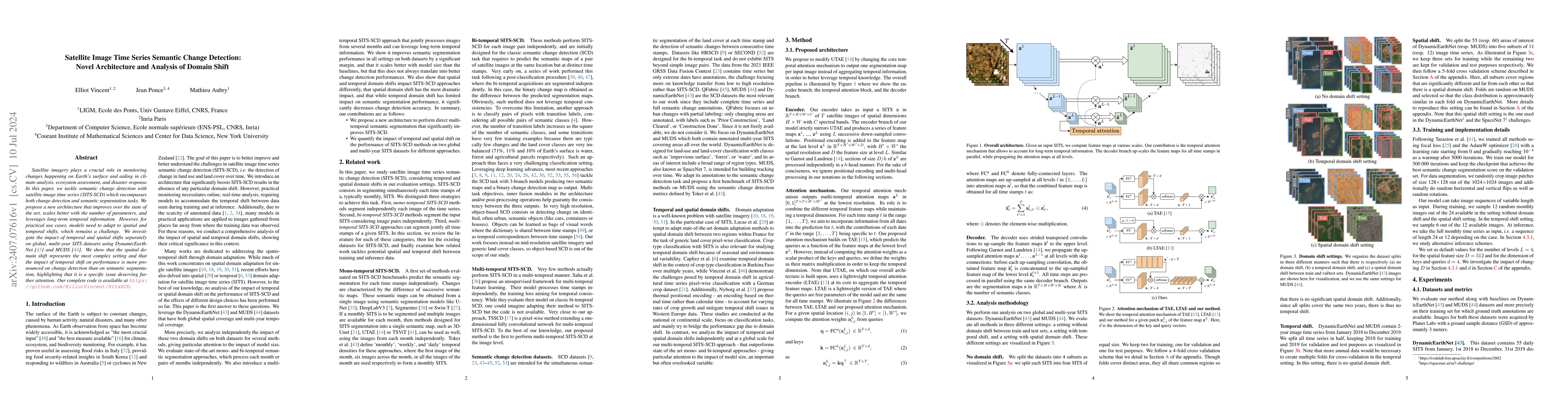
Satellite imagery plays a crucial role in monitoring changes happening on Earth's surface and aiding in climate analysis, ecosystem assessment, and disaster response. In this paper, we tackle semantic...
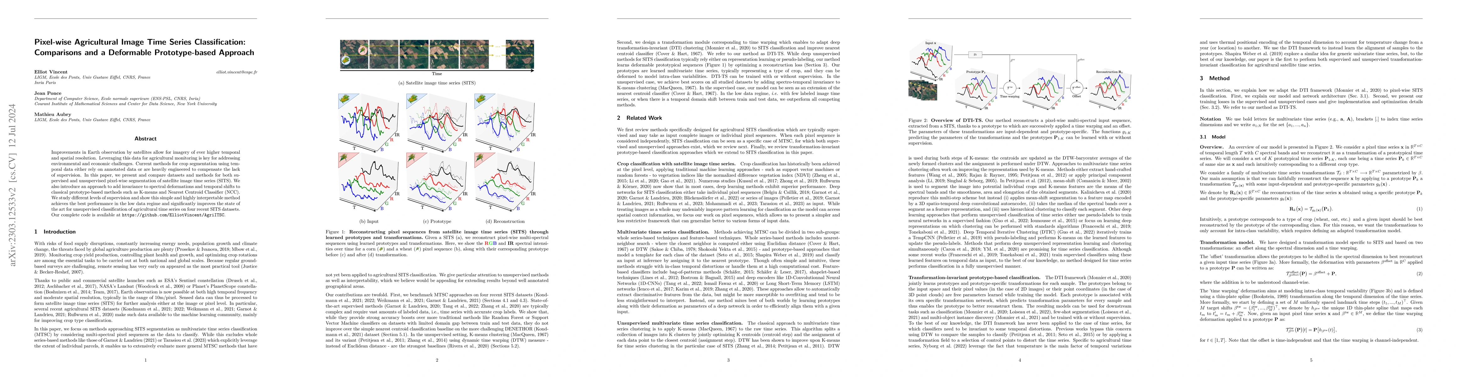
Improvements in Earth observation by satellites allow for imagery of ever higher temporal and spatial resolution. Leveraging this data for agricultural monitoring is key for addressing environmental a...
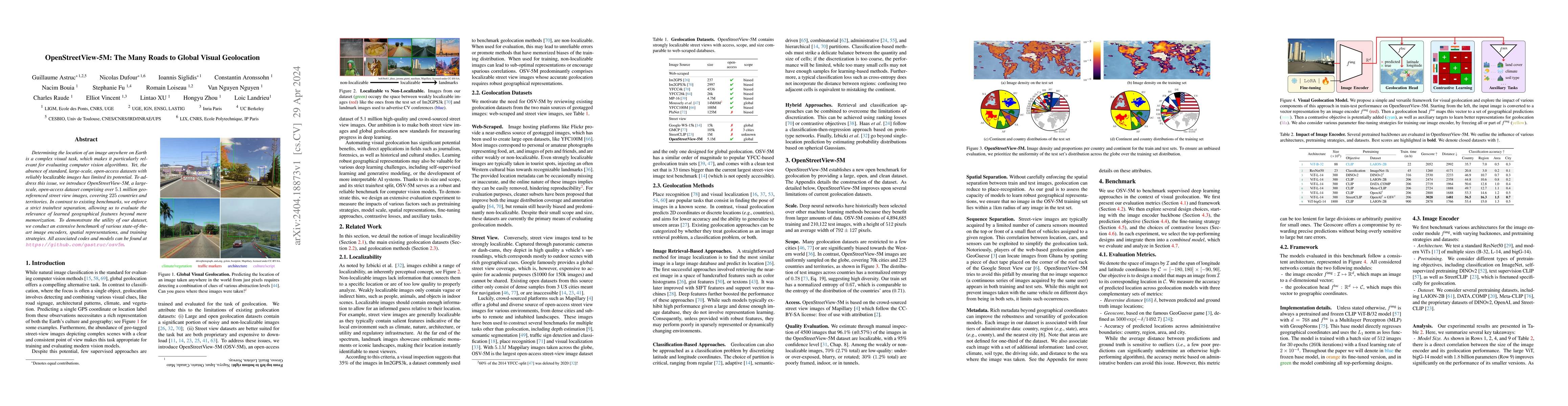
Determining the location of an image anywhere on Earth is a complex visual task, which makes it particularly relevant for evaluating computer vision algorithms. Yet, the absence of standard, large-s...
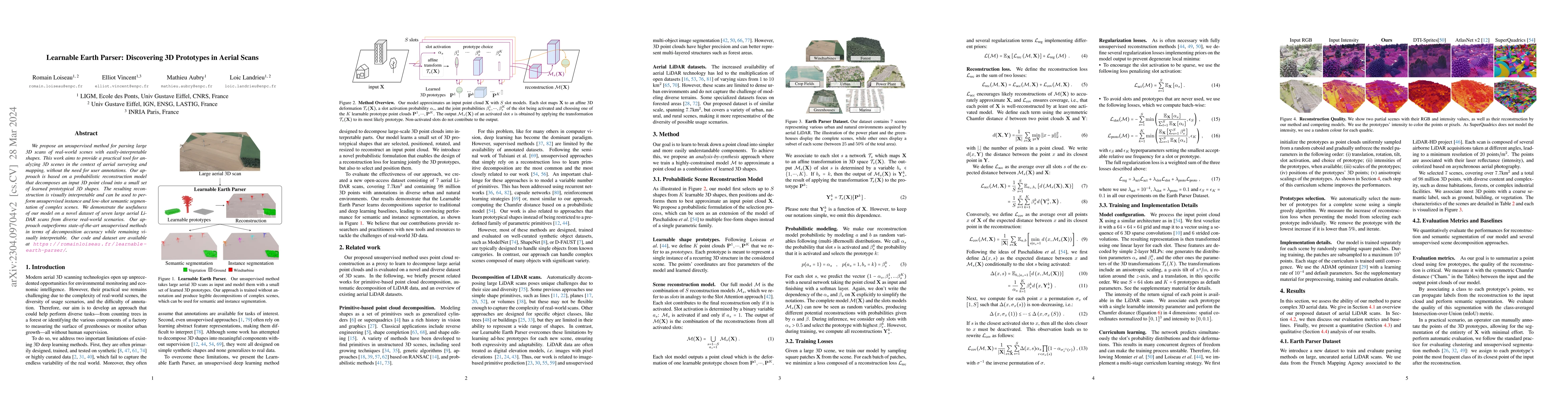
We propose an unsupervised method for parsing large 3D scans of real-world scenes with easily-interpretable shapes. This work aims to provide a practical tool for analyzing 3D scenes in the context ...
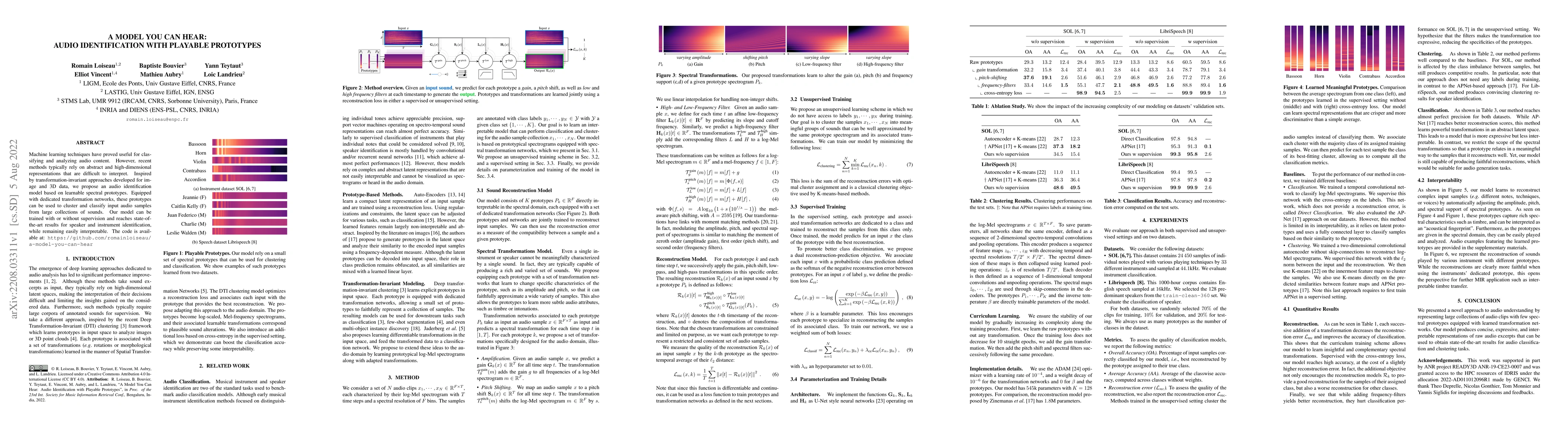
Machine learning techniques have proved useful for classifying and analyzing audio content. However, recent methods typically rely on abstract and high-dimensional representations that are difficult...
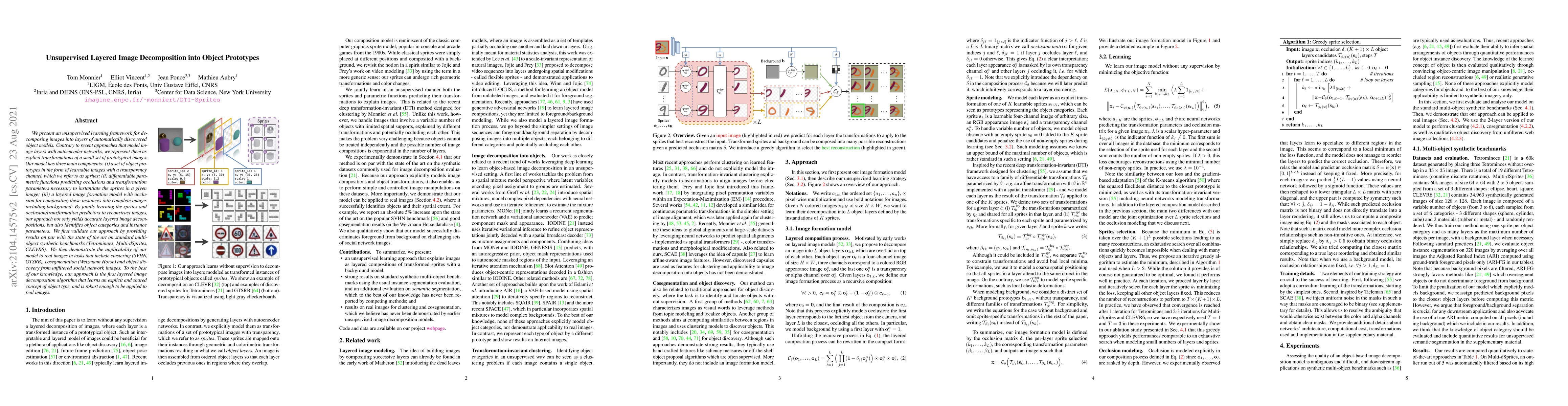
We present an unsupervised learning framework for decomposing images into layers of automatically discovered object models. Contrary to recent approaches that model image layers with autoencoder net...
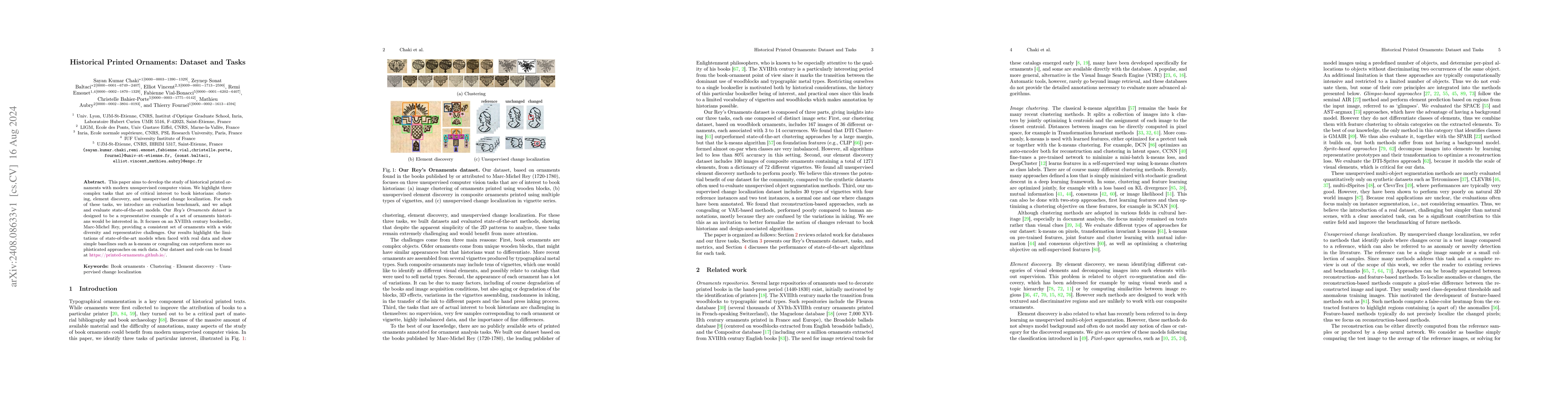
This paper aims to develop the study of historical printed ornaments with modern unsupervised computer vision. We highlight three complex tasks that are of critical interest to book historians: cluste...
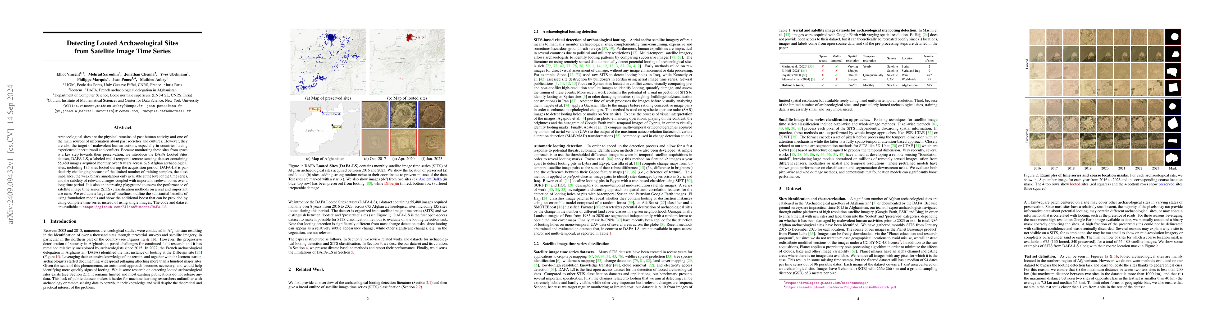
Archaeological sites are the physical remains of past human activity and one of the main sources of information about past societies and cultures. However, they are also the target of malevolent human...

Global variations in terrain appearance raise a major challenge for satellite image analysis, leading to poor model performance when training on locations that differ from those encountered at test ti...
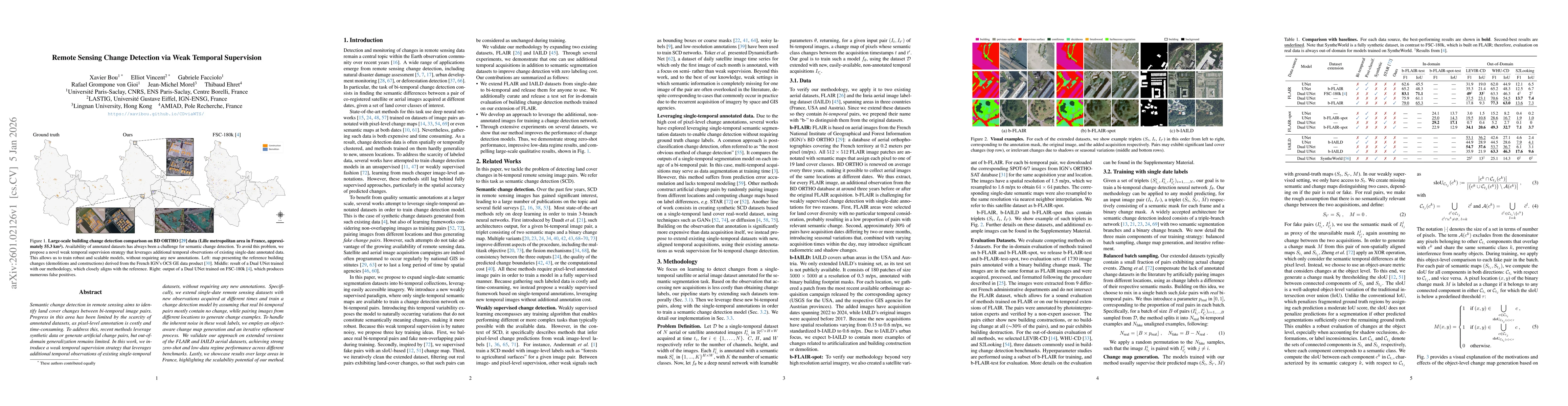
Semantic change detection in remote sensing aims to identify land cover changes between bi-temporal image pairs. Progress in this area has been limited by the scarcity of annotated datasets, as pixel-...
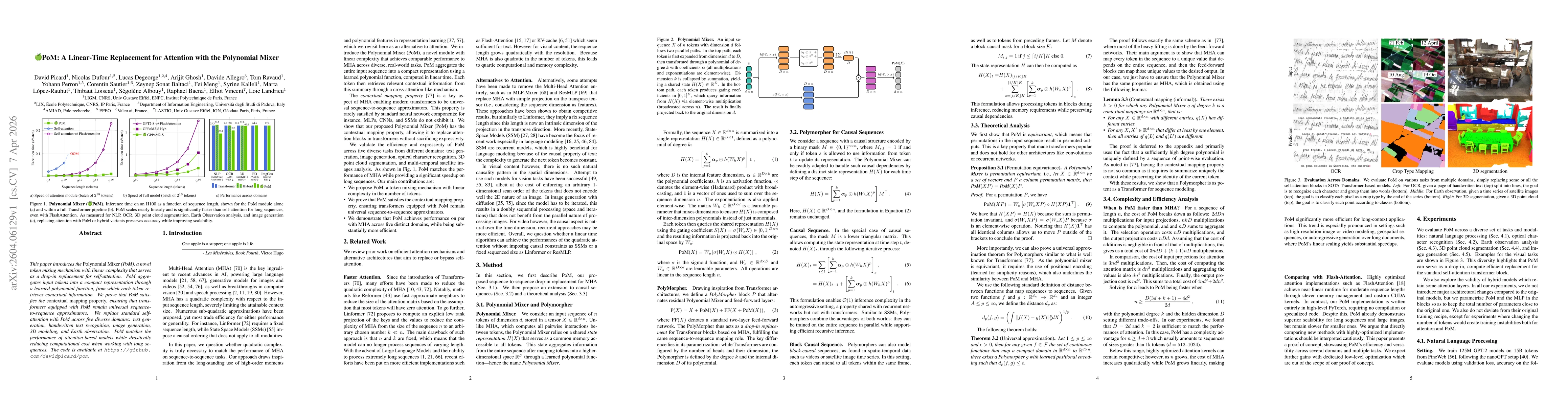
This paper introduces the Polynomial Mixer (PoM), a novel token mixing mechanism with linear complexity that serves as a drop-in replacement for self-attention. PoM aggregates input tokens into a comp...