Academic Profile
Statistics
Similar Authors
Papers on arXiv
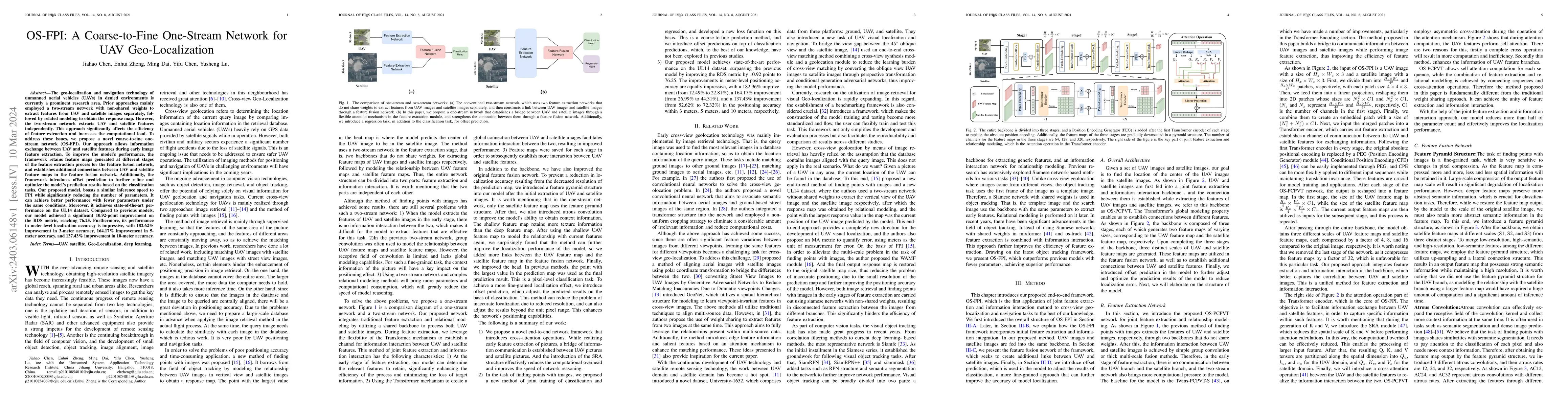
The geo-localization and navigation technology of unmanned aerial vehicles (UAVs) in denied environments is currently a prominent research area. Prior approaches mainly employed a two-stream network...
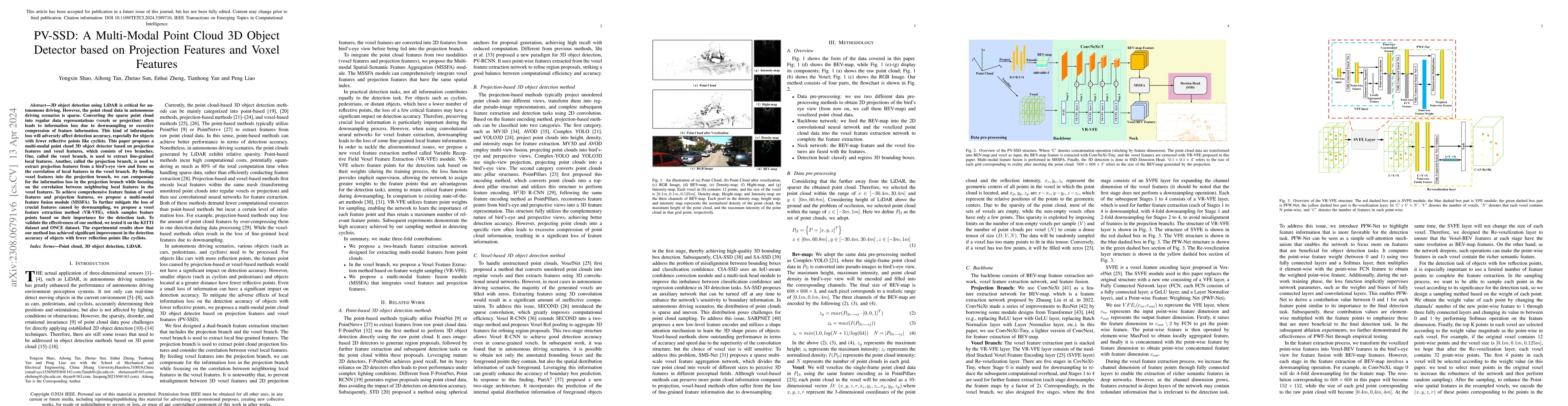
LiDAR-based 3D object detection and classification is crucial for autonomous driving. However, real-time inference from extremely sparse 3D data is a formidable challenge. To address this problem, a...
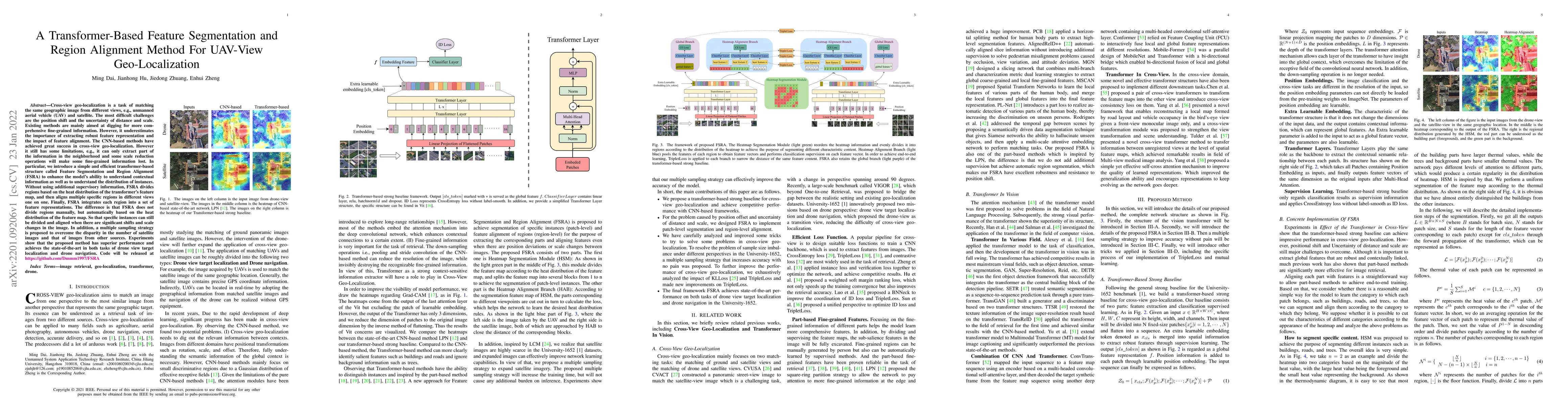
Cross-view geo-localization is a task of matching the same geographic image from different views, e.g., unmanned aerial vehicle (UAV) and satellite. The most difficult challenges are the position sh...
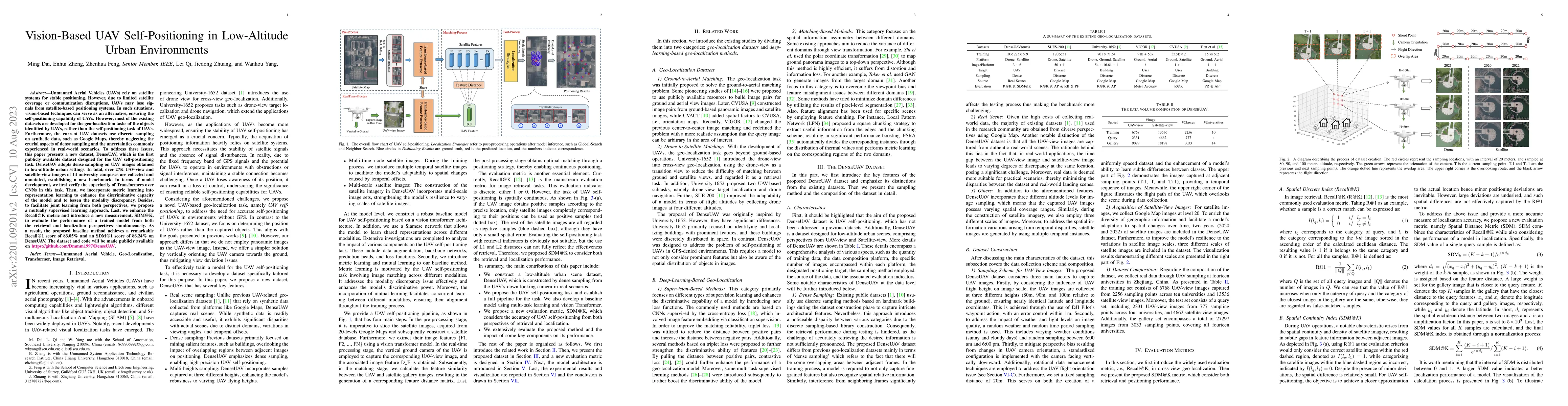
Unmanned Aerial Vehicles (UAVs) rely on satellite systems for stable positioning. However, due to limited satellite coverage or communication disruptions, UAVs may lose signals from satellite-based ...
Vision-based Unmanned Aerial Vehicle (UAV) localization systems have been extensively investigated for Global Navigation Satellite System (GNSS)-denied environments. However, existing retrieval-based ...