Academic Profile
Statistics
Similar Authors
Papers on arXiv
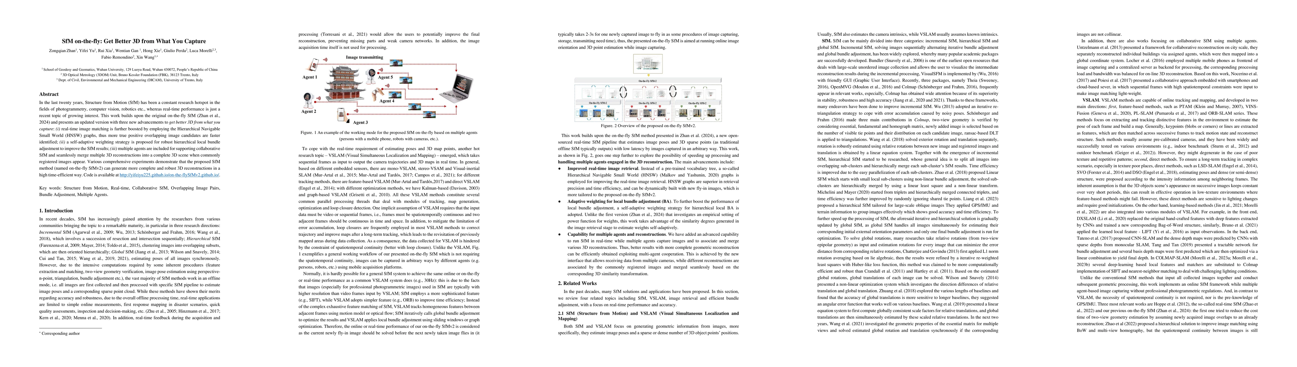
In the last twenty years, Structure from Motion (SfM) has been a constant research hotspot in the fields of photogrammetry, computer vision, robotics etc., whereas real-time performance is just a rece...
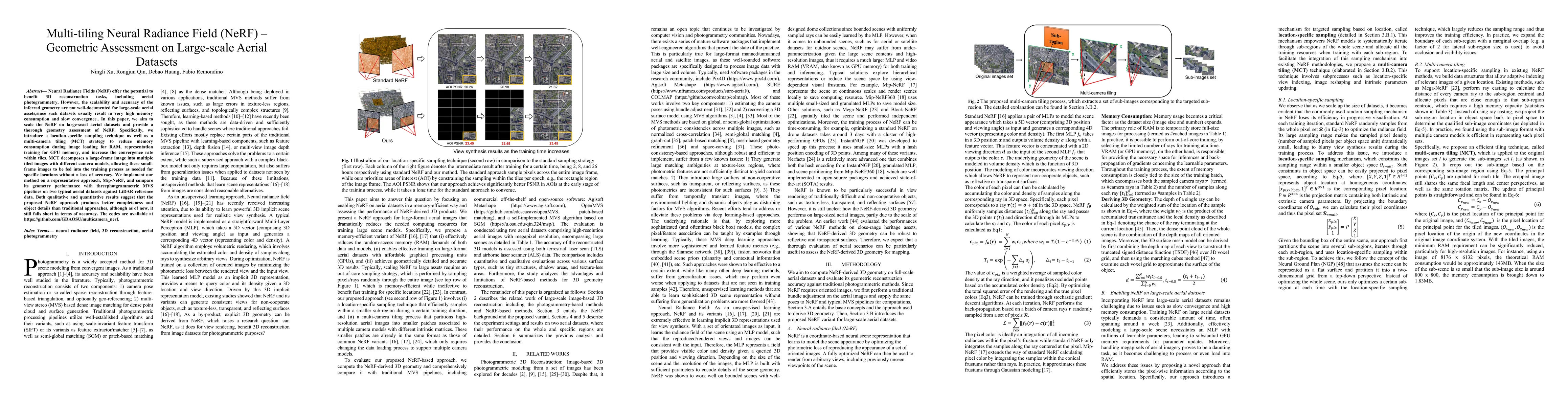
Neural Radiance Fields (NeRF) offer the potential to benefit 3D reconstruction tasks, including aerial photogrammetry. However, the scalability and accuracy of the inferred geometry are not well-doc...
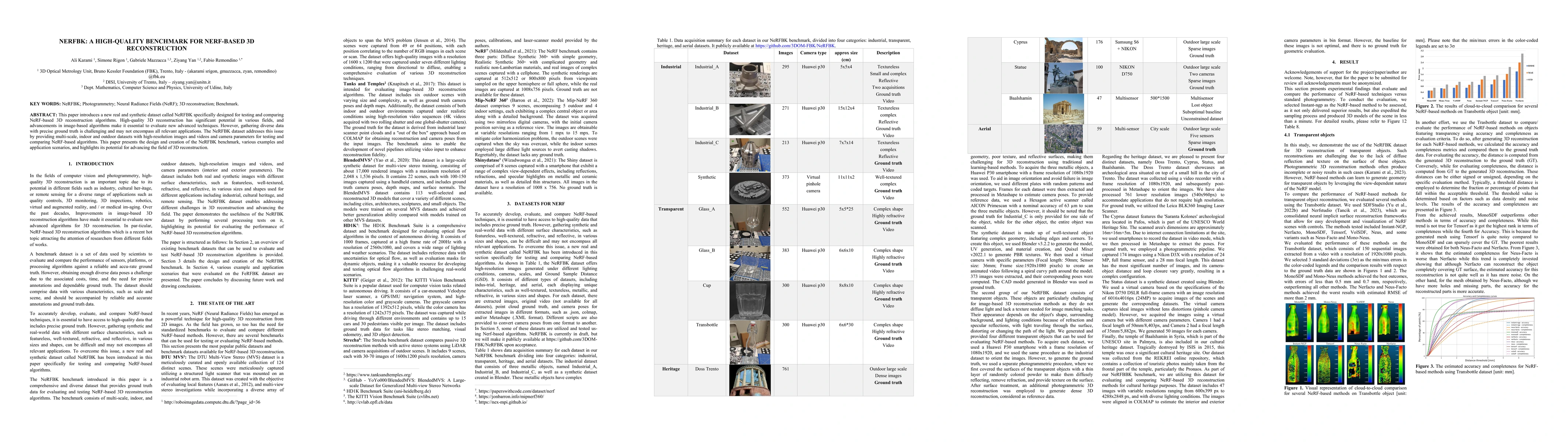
This paper introduces a new real and synthetic dataset called NeRFBK specifically designed for testing and comparing NeRF-based 3D reconstruction algorithms. High-quality 3D reconstruction has signi...
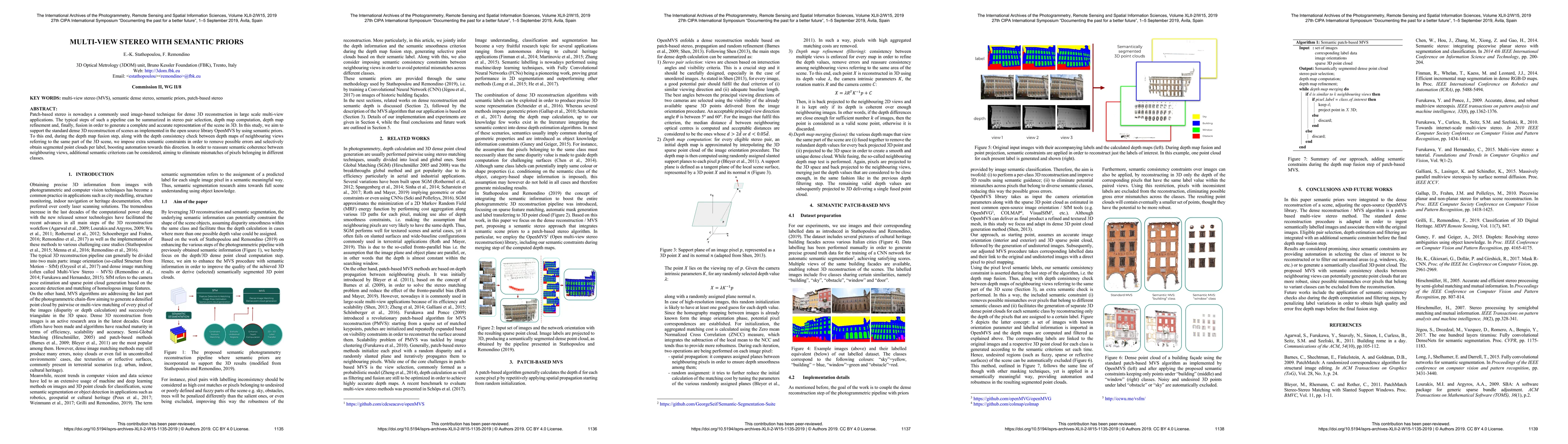
Patch-based stereo is nowadays a commonly used image-based technique for dense 3D reconstruction in large scale multi-view applications. The typical steps of such a pipeline can be summarized in ste...
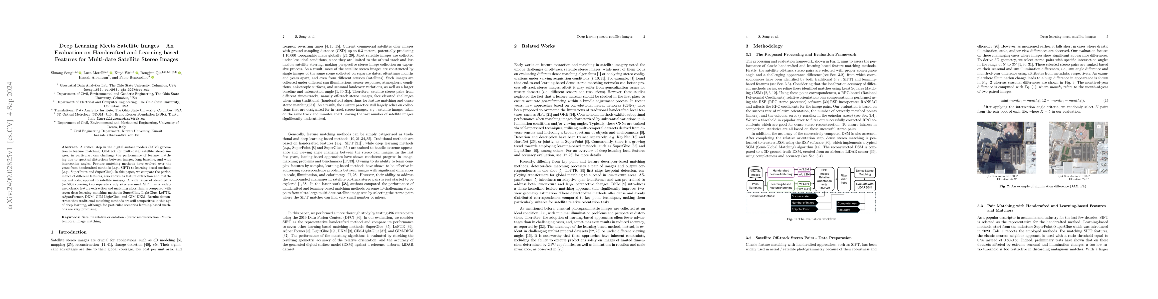
A critical step in the digital surface models(DSM) generation is feature matching. Off-track (or multi-date) satellite stereo images, in particular, can challenge the performance of feature matching d...
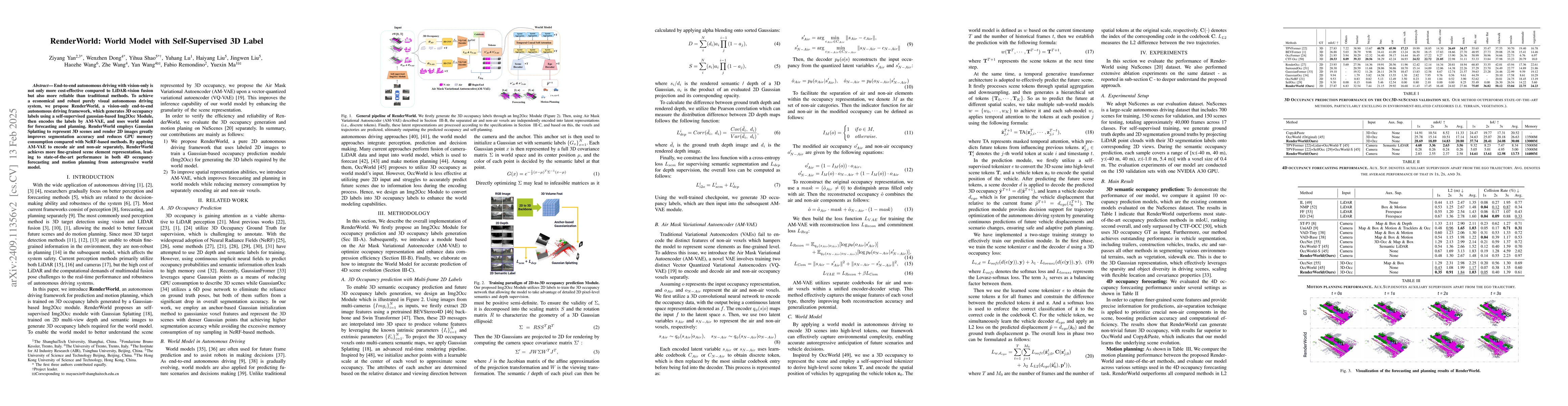
End-to-end autonomous driving with vision-only is not only more cost-effective compared to LiDAR-vision fusion but also more reliable than traditional methods. To achieve a economical and robust purel...
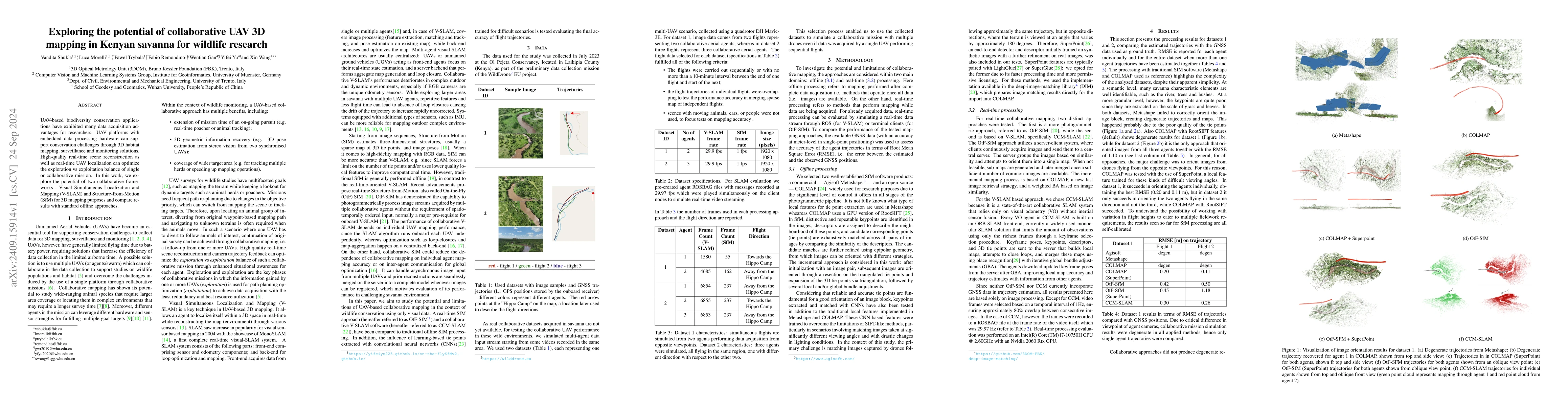
UAV-based biodiversity conservation applications have exhibited many data acquisition advantages for researchers. UAV platforms with embedded data processing hardware can support conservation challeng...
This paper introduces a modular, non-deep learning method for filtering and refining sparse correspondences in image matching. Assuming that motion flow within the scene can be approximated by local h...
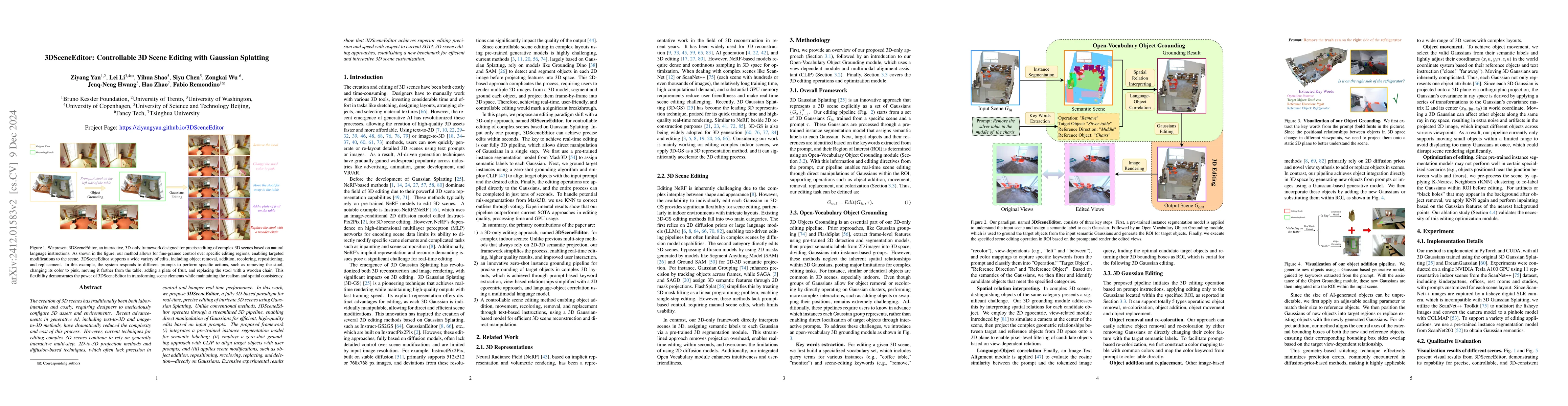
The creation of 3D scenes has traditionally been both labor-intensive and costly, requiring designers to meticulously configure 3D assets and environments. Recent advancements in generative AI, includ...
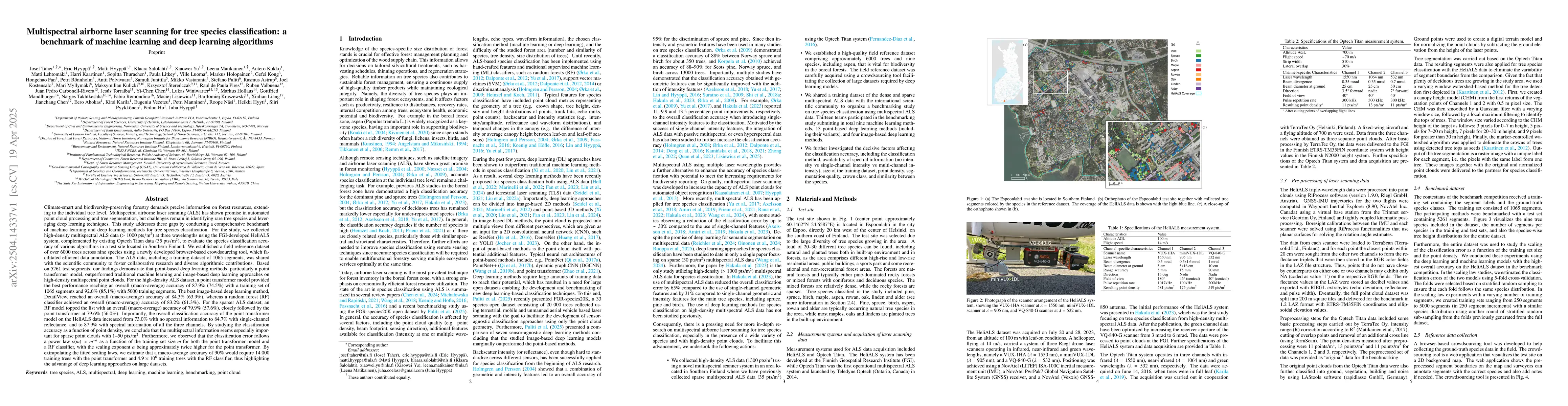
Climate-smart and biodiversity-preserving forestry demands precise information on forest resources, extending to the individual tree level. Multispectral airborne laser scanning (ALS) has shown promis...
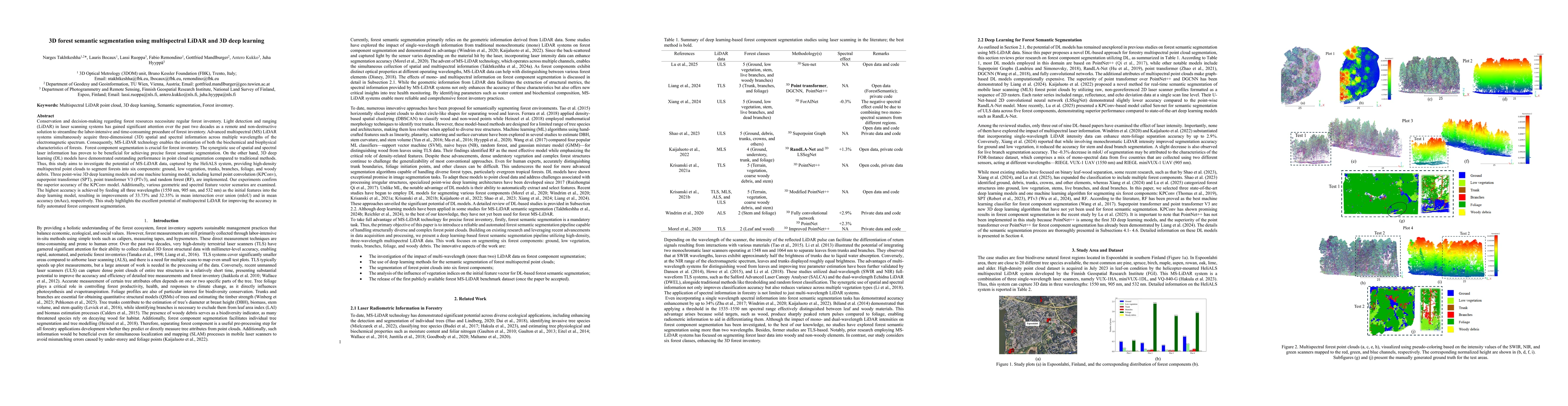
Conservation and decision-making regarding forest resources necessitate regular forest inventory. Light detection and ranging (LiDAR) in laser scanning systems has gained significant attention over th...
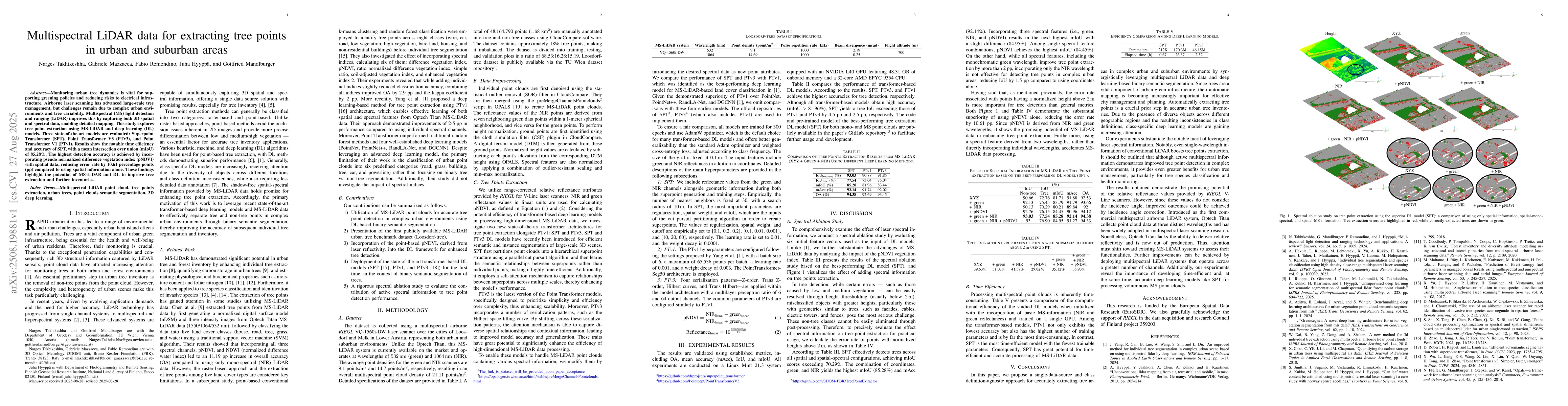
Monitoring urban tree dynamics is vital for supporting greening policies and reducing risks to electrical infrastructure. Airborne laser scanning has advanced large-scale tree management, but challeng...
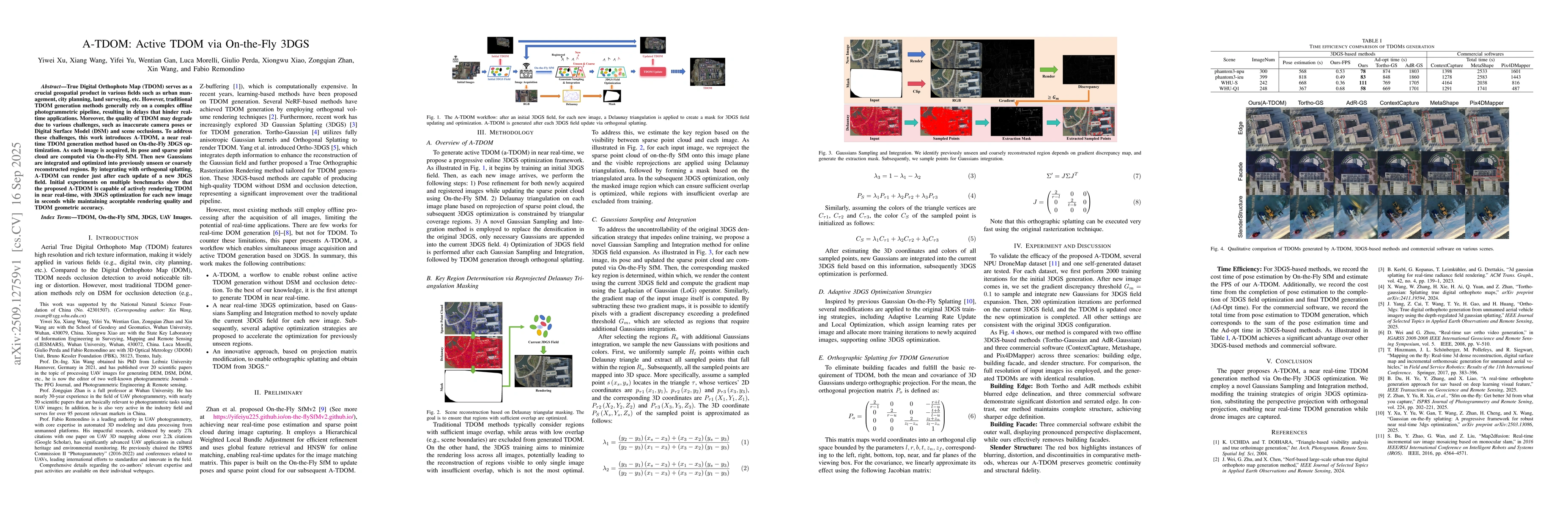
True Digital Orthophoto Map (TDOM) serves as a crucial geospatial product in various fields such as urban management, city planning, land surveying, etc. However, traditional TDOM generation methods g...
Monocular imaging of animals inherently reduces 3D structures to 2D projections. Detection algorithms lead to 2D bounding boxes that lack information about animal's orientation relative to the camera....
Monocular RGB cameras mounted on drones are widely used for wildlife monitoring, yet most analytical pipelines remain confined to two-dimensional image space, leaving geometric information in video un...
Land Use Land Cover (LULC) classification is essential for national 3D mapping, geospatial analysis, and sustainable planning. Multispectral (MS) LiDAR provides synchronized spatial-spectral informati...
Animal ecology data collection using drones represents a substantial investment of time, expertise, and financial resources. Yet most existing datasets serve only a single research community, limiting...
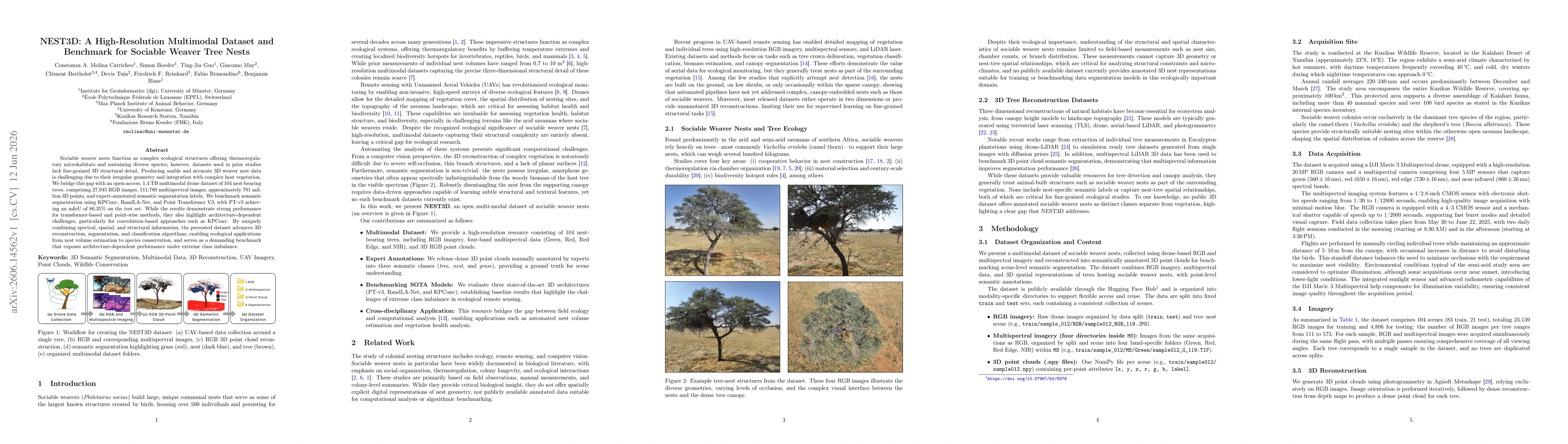
Sociable weaver nests function as complex ecological structures offering thermoregulatory microhabitats and sustaining diverse species; however, datasets used in prior studies lack fine-grained 3D str...
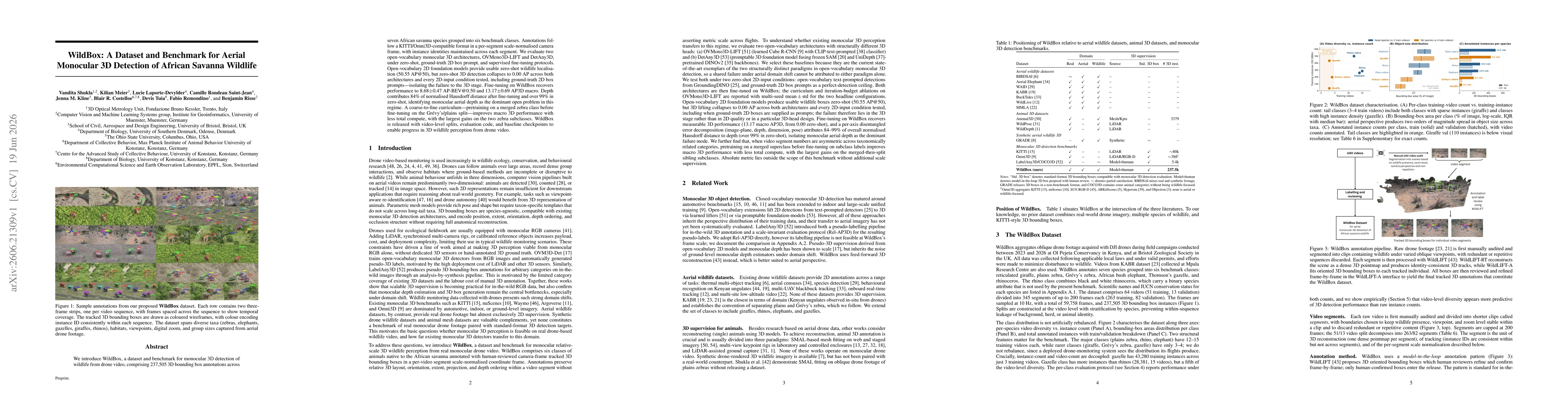
We introduce WildBox, a dataset and benchmark for monocular 3D detection of wildlife from drone video, comprising 237,505 3D bounding box annotations across seven African savanna species grouped into ...