Academic Profile
Statistics
Similar Authors
Papers on arXiv
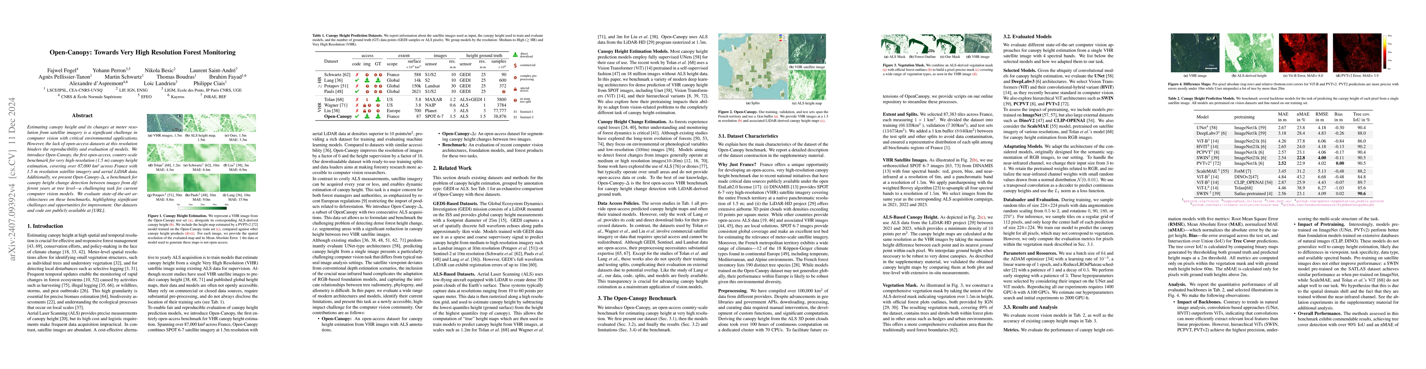
Estimating canopy height and canopy height change at meter resolution from satellite imagery has numerous applications, such as monitoring forest health, logging activities, wood resources, and carbon...
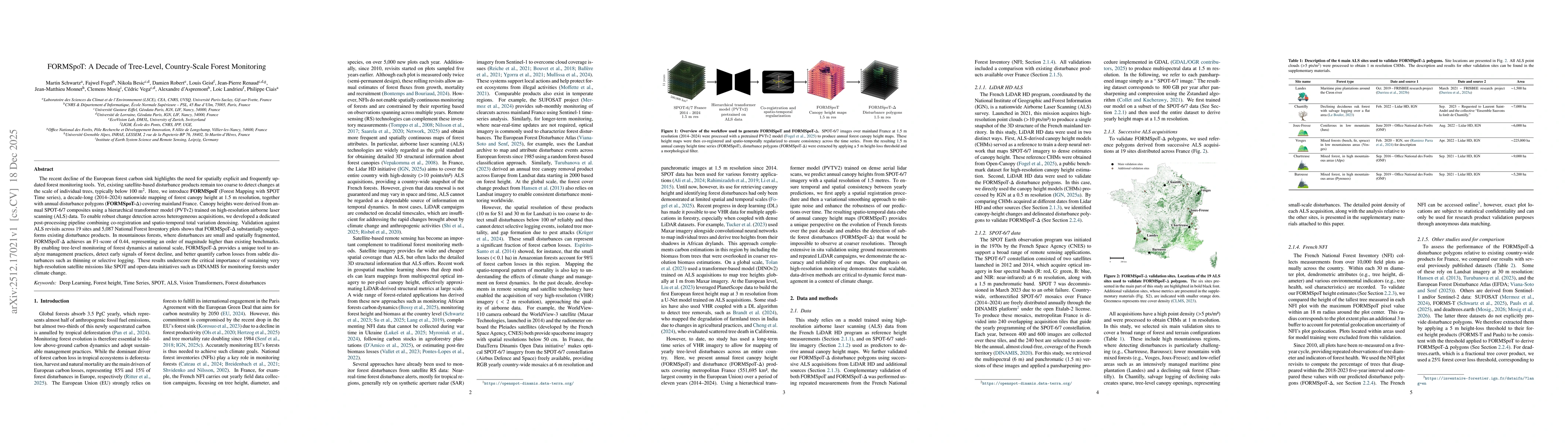
The recent decline of the European forest carbon sink highlights the need for spatially explicit and frequently updated forest monitoring tools. Yet, existing satellite-based disturbance products rema...
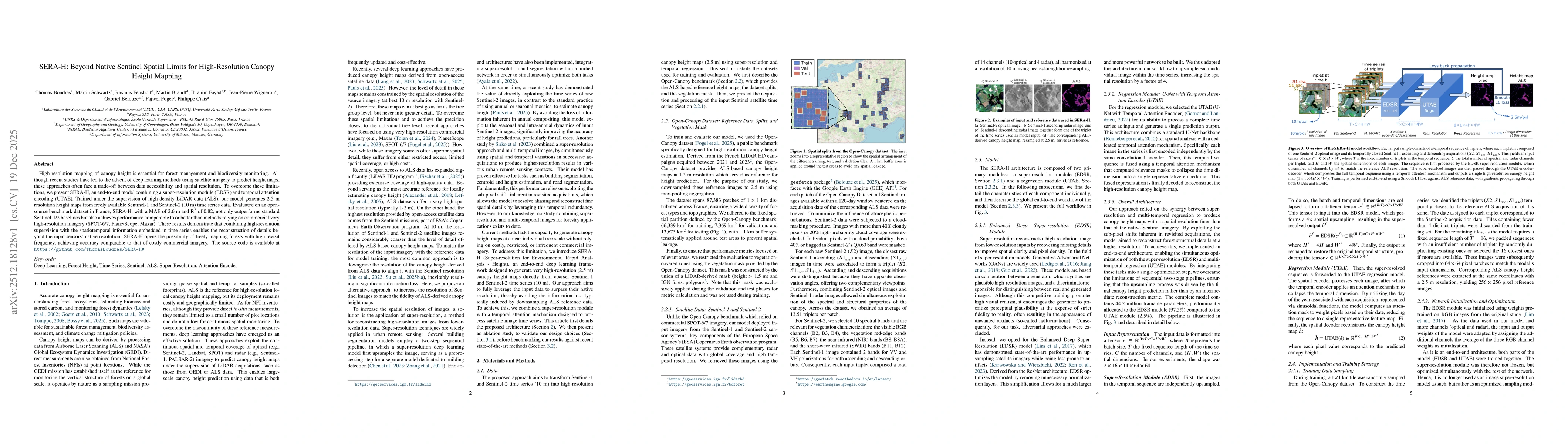
High-resolution mapping of canopy height is essential for forest management and biodiversity monitoring. Although recent studies have led to the advent of deep learning methods using satellite imagery...
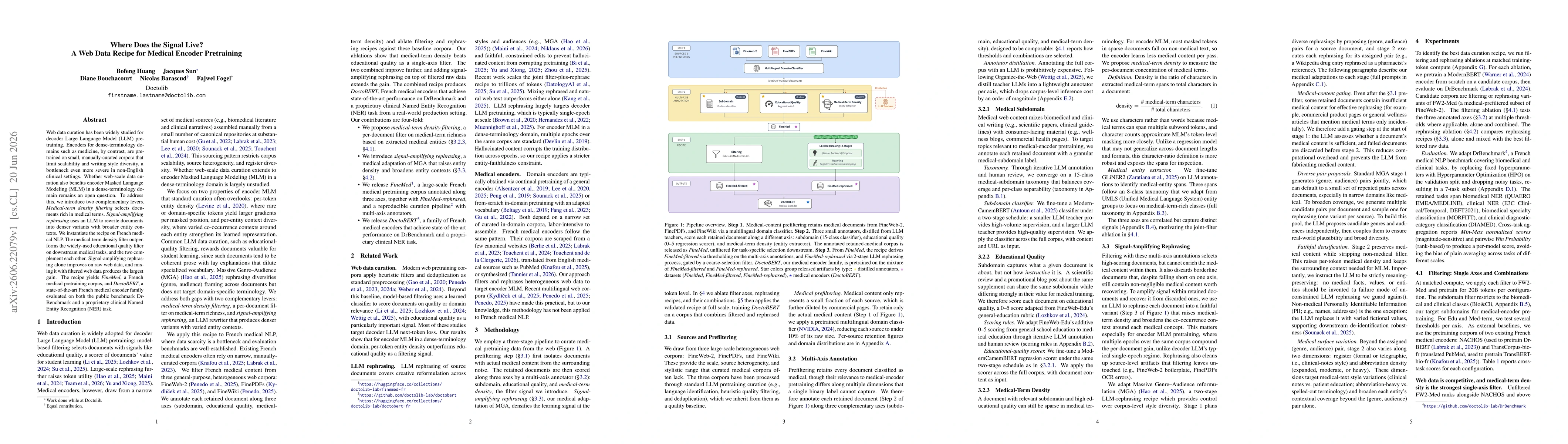
Web data curation has been widely studied for decoder Large Language Model (LLM) pretraining. Encoders for dense-terminology domains such as medicine, by contrast, are pretrained on small, manually-cu...