Academic Profile
Statistics
Similar Authors
Papers on arXiv
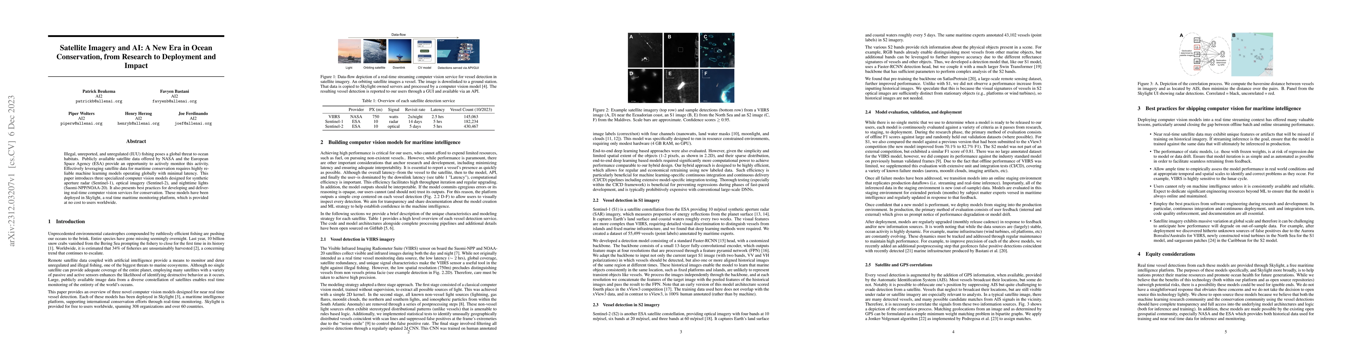
Illegal, unreported, and unregulated (IUU) fishing poses a global threat to ocean habitats. Publicly available satellite data offered by NASA and the European Space Agency (ESA) provide an opportuni...
Super-Resolution for remote sensing has the potential for huge impact on planet monitoring by producing accurate and realistic high resolution imagery on a frequent basis and a global scale. Despite...
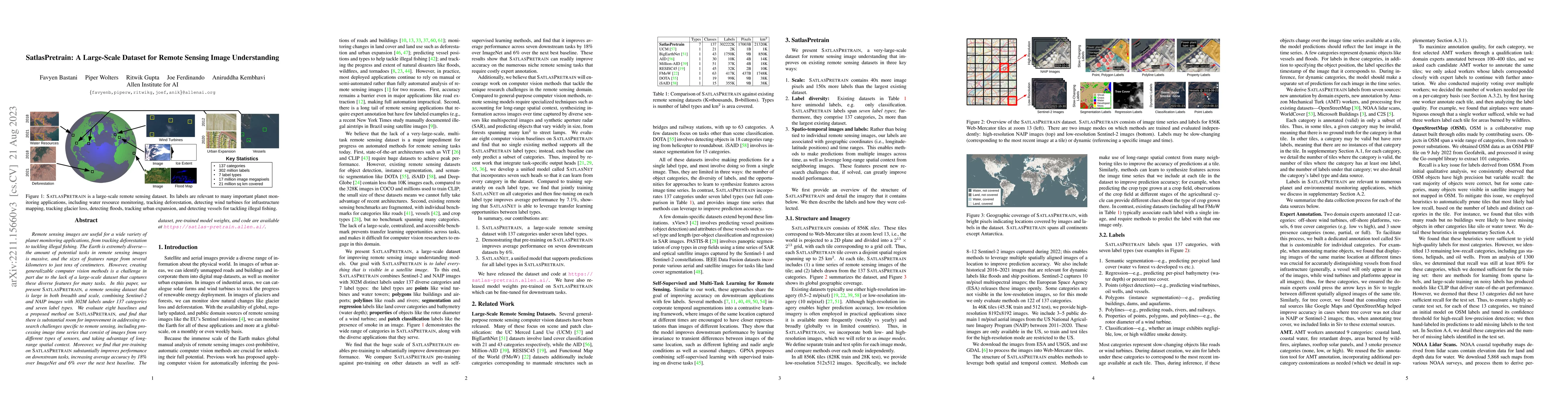
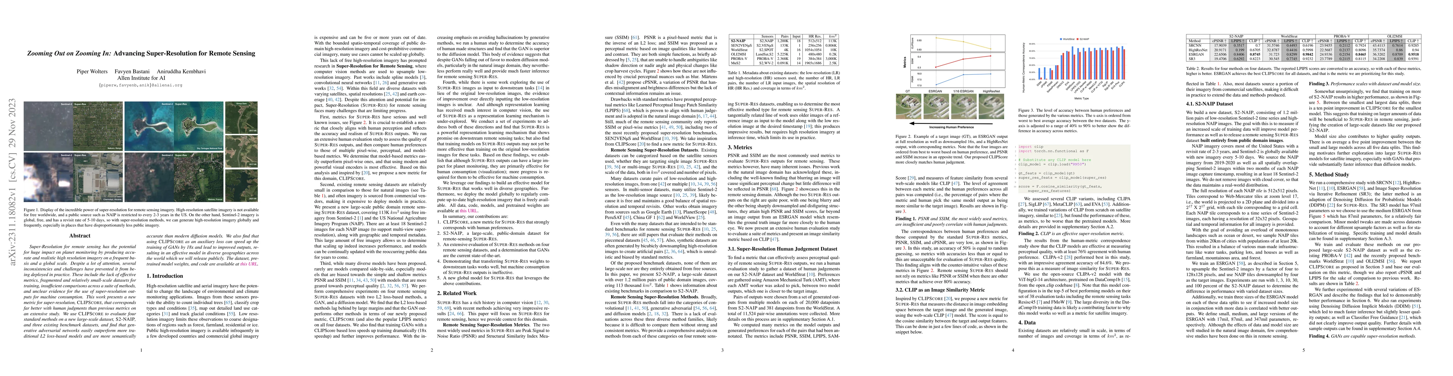
Remote sensing images are useful for a wide variety of planet monitoring applications, from tracking deforestation to tackling illegal fishing. The Earth is extremely diverse -- the amount of potent...
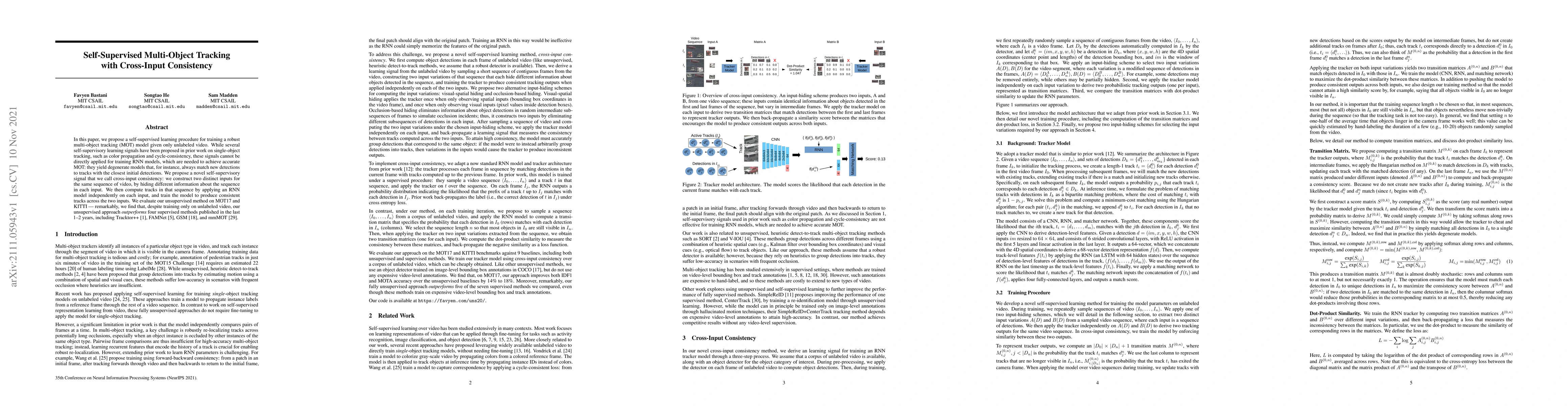
In this paper, we propose a self-supervised learning procedure for training a robust multi-object tracking (MOT) model given only unlabeled video. While several self-supervisory learning signals hav...
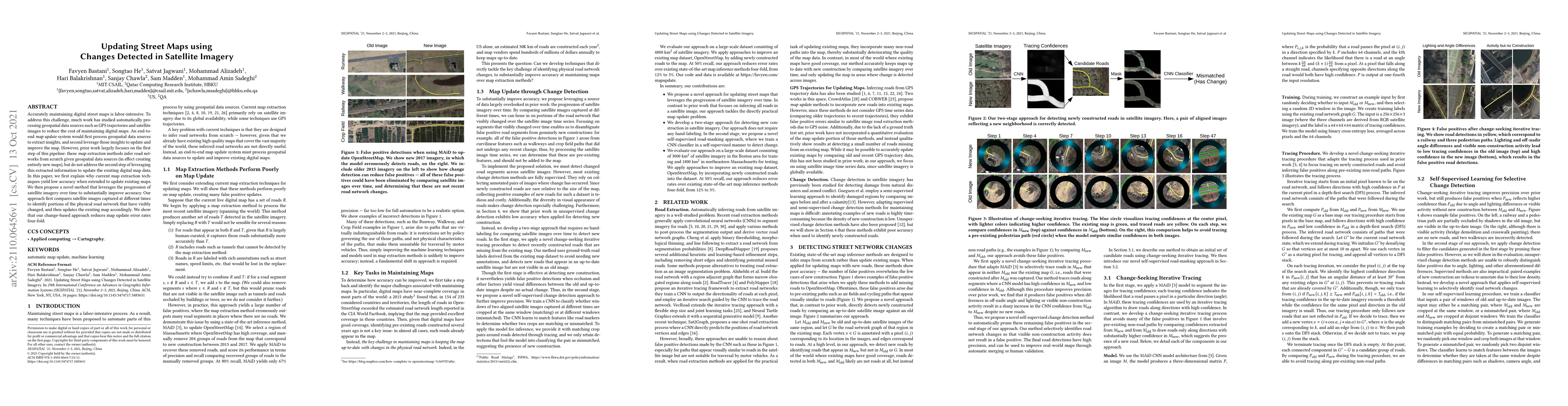
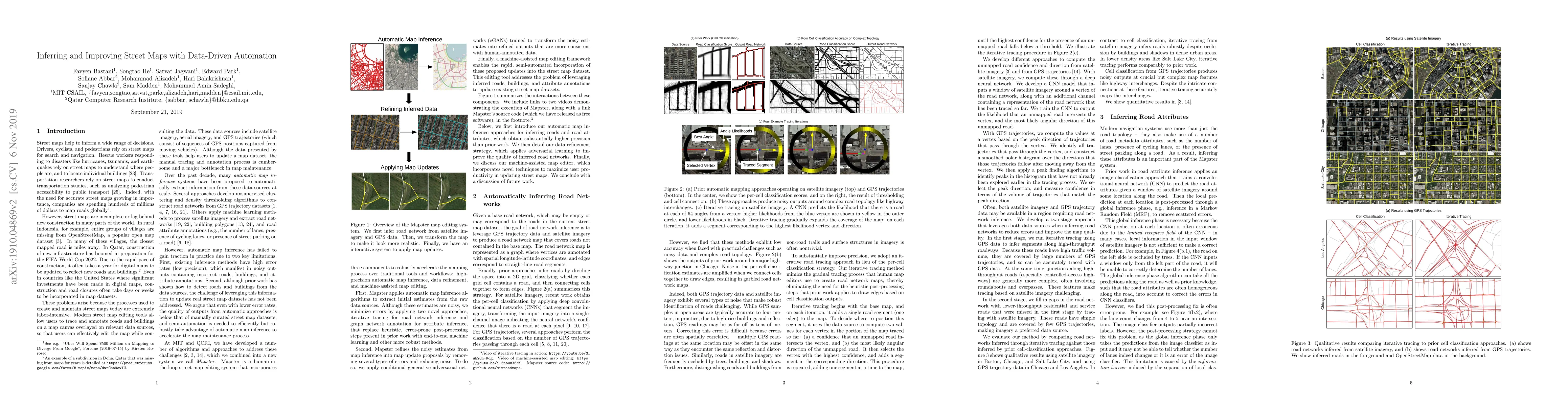
Accurately maintaining digital street maps is labor-intensive. To address this challenge, much work has studied automatically processing geospatial data sources such as GPS trajectories and satellit...
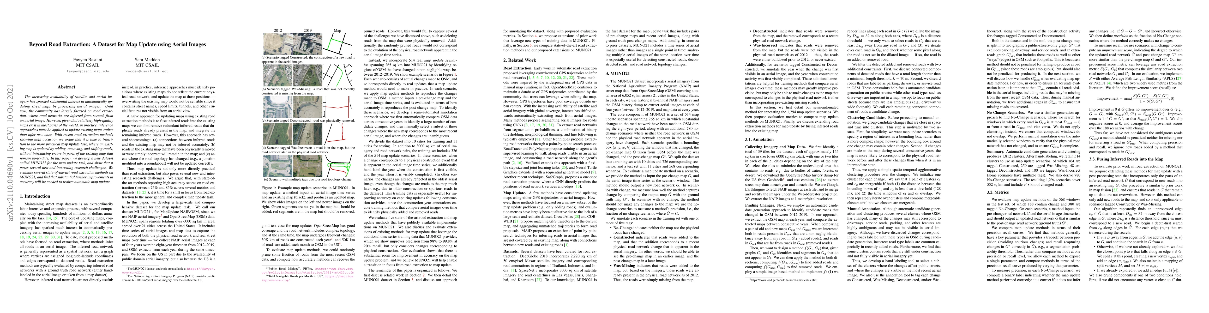
The increasing availability of satellite and aerial imagery has sparked substantial interest in automatically updating street maps by processing aerial images. Until now, the community has largely f...
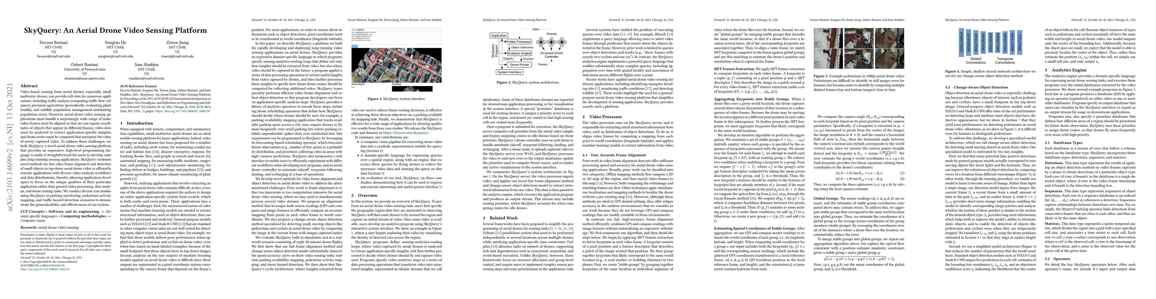
Video-based sensing from aerial drones, especially small multirotor drones, can provide rich data for numerous applications, including traffic analysis (computing traffic flow volumes), precision ag...
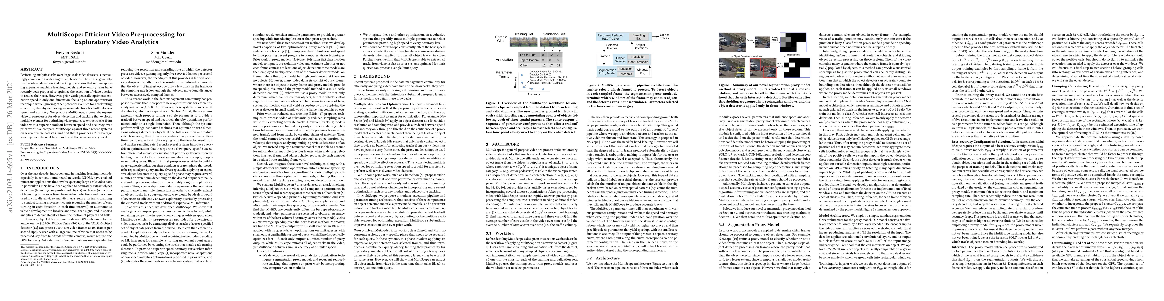
Performing analytics tasks over large-scale video datasets is increasingly common in a wide range of applications. These tasks generally involve object detection and tracking operations that require...
Training high-accuracy object detection models requires large and diverse annotated datasets. However, creating these data-sets is time-consuming and expensive since it relies on human annotators. W...
Inferring road graphs from satellite imagery is a challenging computer vision task. Prior solutions fall into two categories: (1) pixel-wise segmentation-based approaches, which predict whether each...
Capturing and processing video is increasingly common as cameras become cheaper to deploy. At the same time, rich video understanding methods have progressed greatly in the last decade. As a result,...
Inferring road attributes such as lane count and road type from satellite imagery is challenging. Often, due to the occlusion in satellite imagery and the spatial correlation of road attributes, a r...
Street maps are a crucial data source that help to inform a wide range of decisions, from navigating a city to disaster relief and urban planning. However, in many parts of the world, street maps ar...
Foundation models pre-trained using self-supervised and weakly-supervised learning have shown powerful transfer learning capabilities on various downstream tasks, including language understanding, tex...
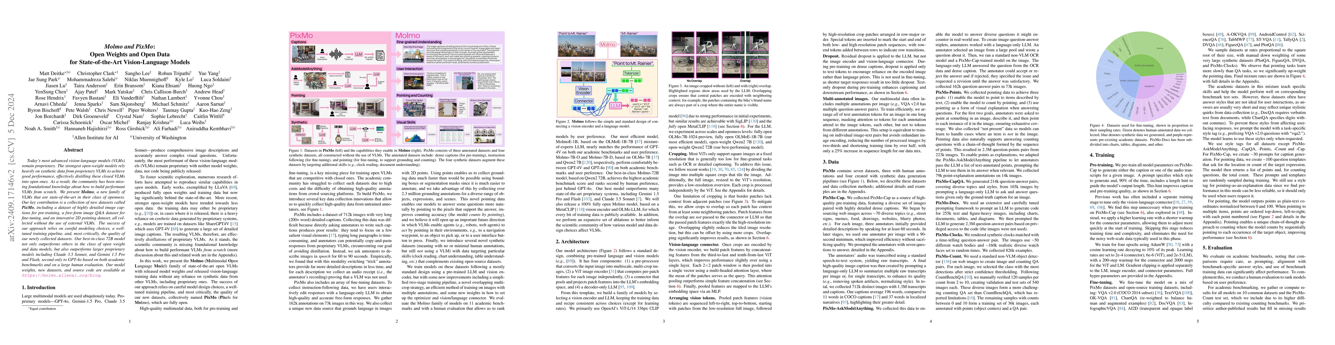
Today's most advanced multimodal models remain proprietary. The strongest open-weight models rely heavily on synthetic data from proprietary VLMs to achieve good performance, effectively distilling th...

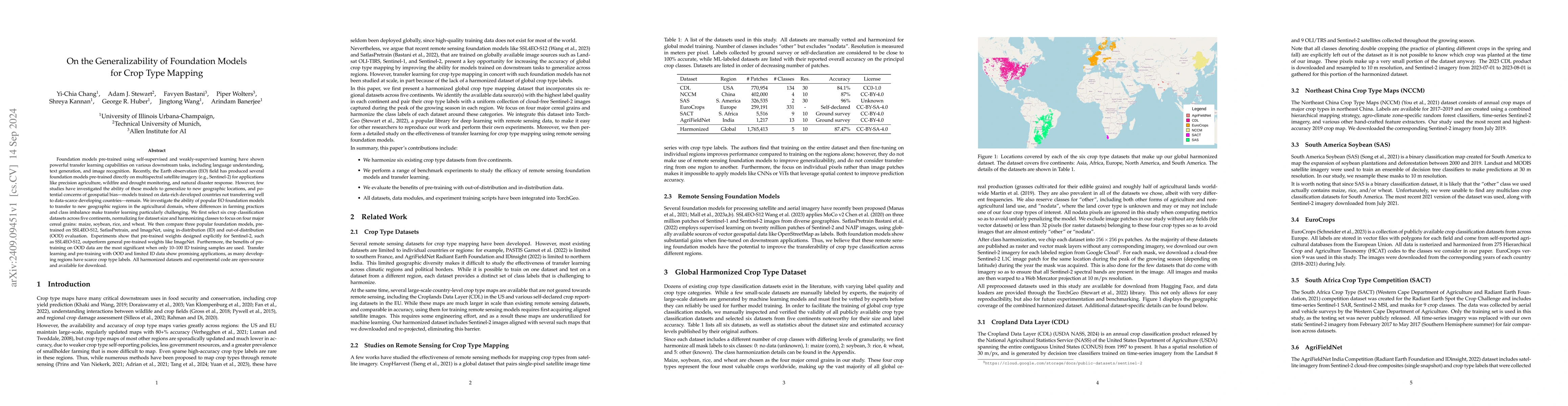
From crop mapping to flood detection, machine learning in remote sensing has a wide range of societally beneficial applications. The commonalities between remote sensing data in these applications pre...
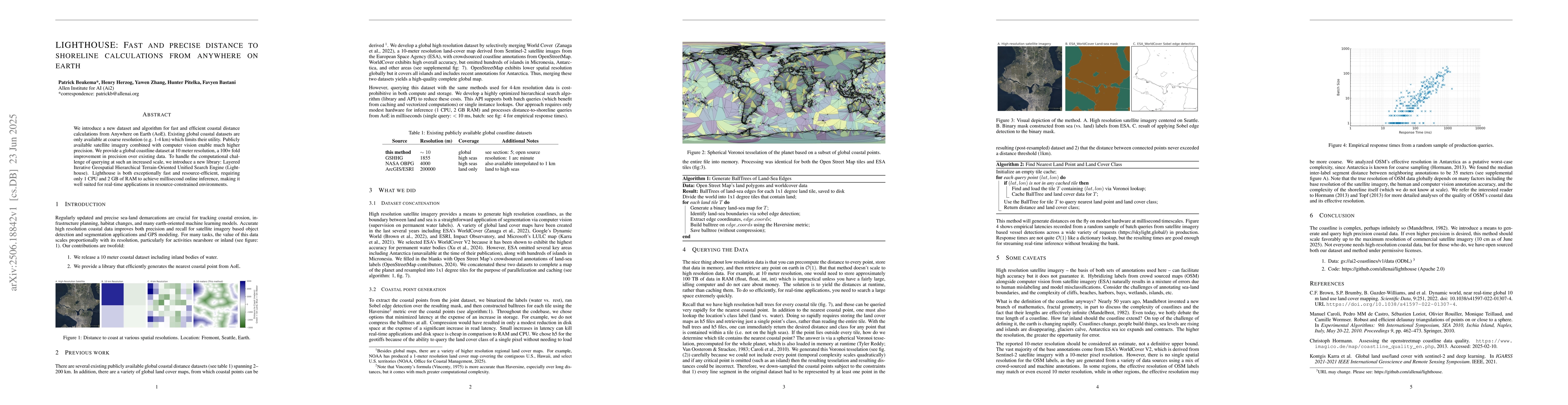
We introduce a new dataset and algorithm for fast and efficient coastal distance calculations from Anywhere on Earth (AoE). Existing global coastal datasets are only available at coarse resolution (e....
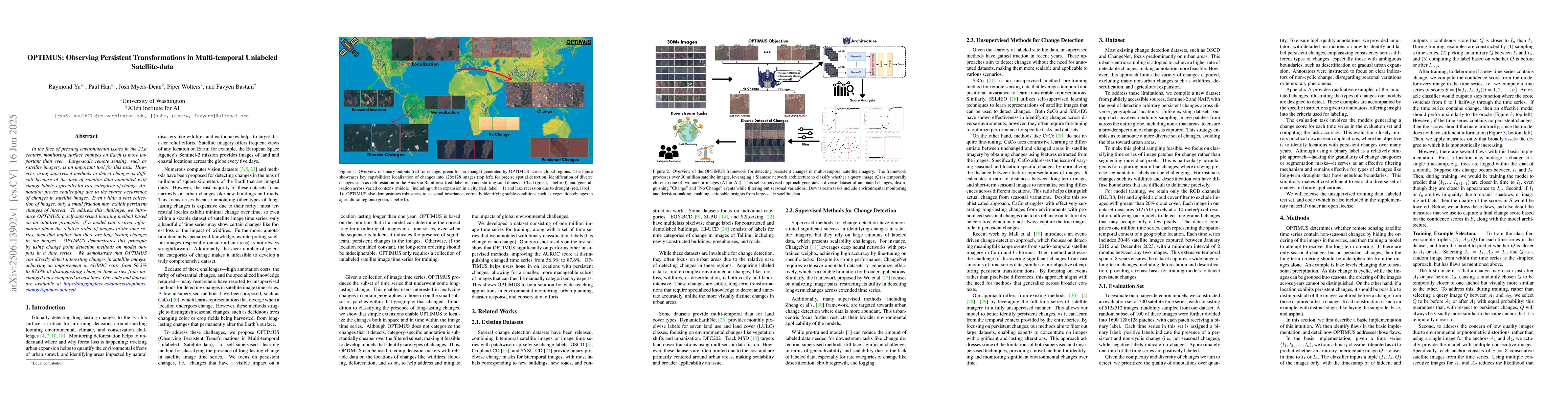
In the face of pressing environmental issues in the 21st century, monitoring surface changes on Earth is more important than ever. Large-scale remote sensing, such as satellite imagery, is an importan...
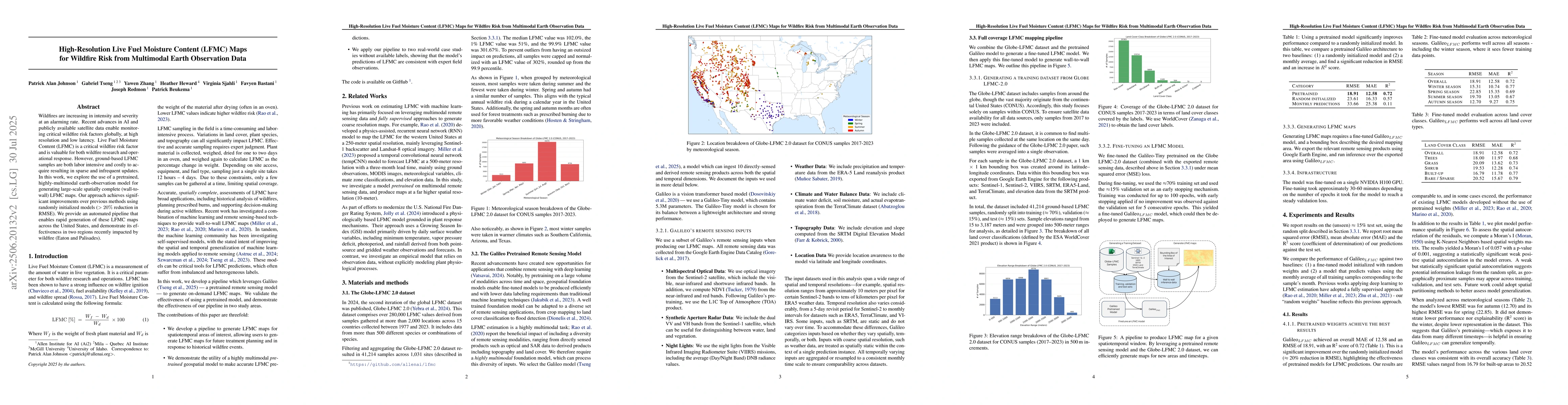
Wildfires are increasing in intensity and severity at an alarming rate. Recent advances in AI and publicly available satellite data enable monitoring critical wildfire risk factors globally, at high r...
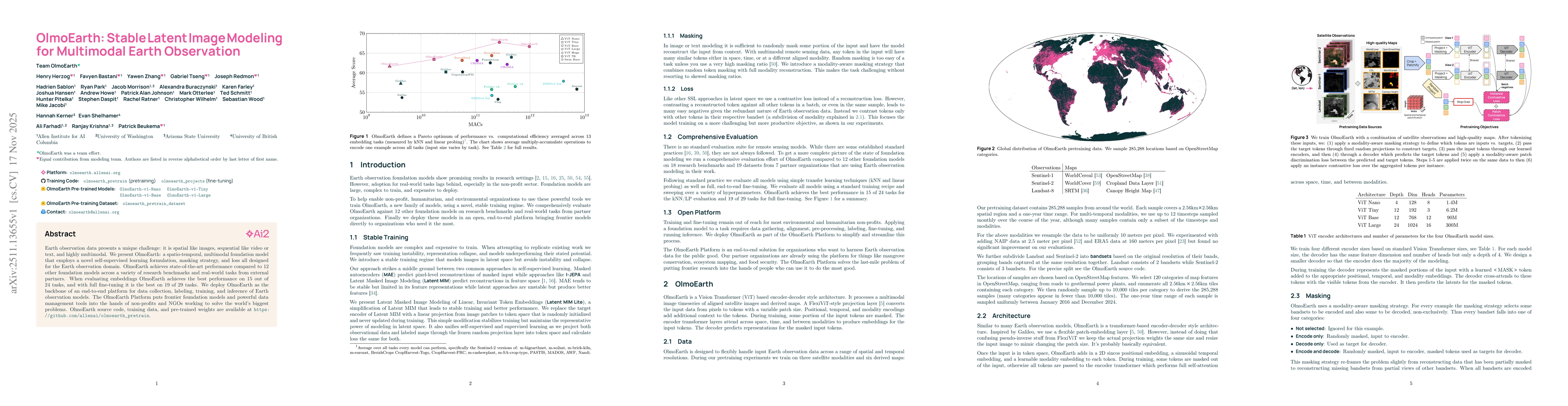
Earth observation data presents a unique challenge: it is spatial like images, sequential like video or text, and highly multimodal. We present OlmoEarth: a multimodal, spatio-temporal foundation mode...
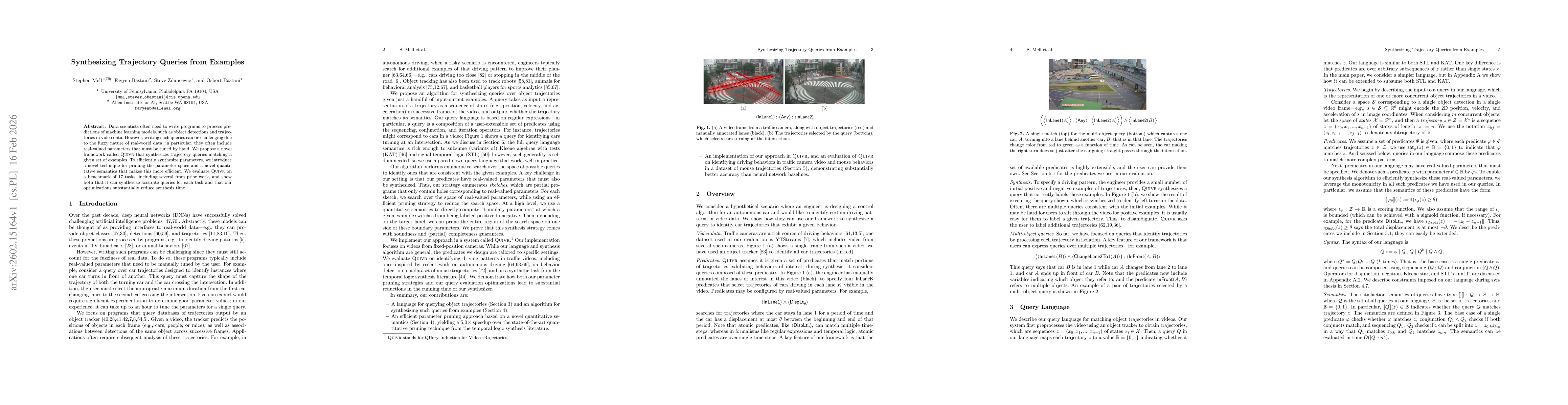
Data scientists often need to write programs to process predictions of machine learning models, such as object detections and trajectories in video data. However, writing such queries can be challengi...
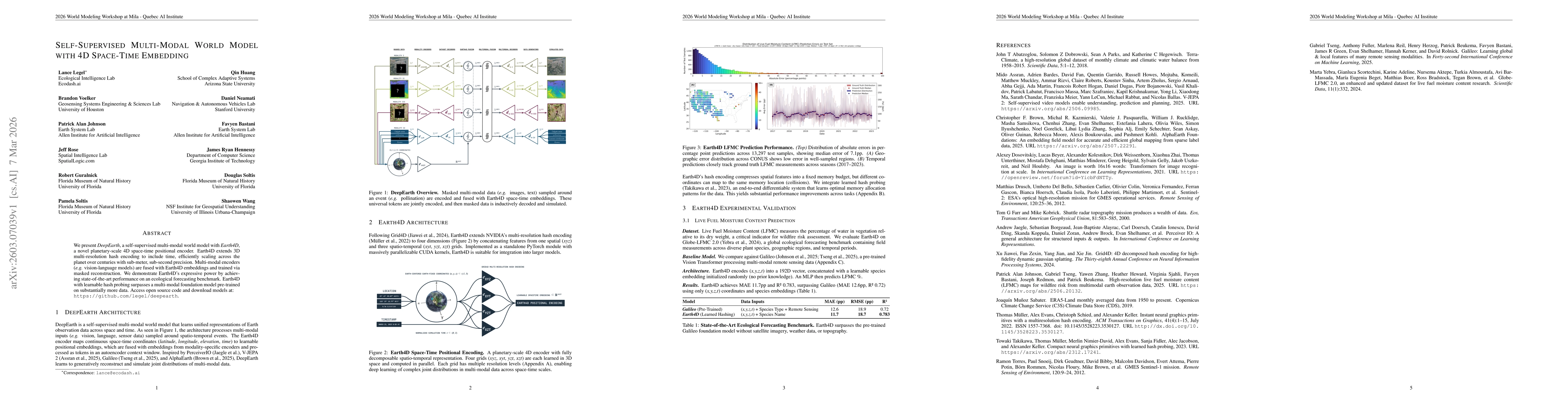
We present DeepEarth, a self-supervised multi-modal world model with Earth4D, a novel planetary-scale 4D space-time positional encoder. Earth4D extends 3D multi-resolution hash encoding to include tim...
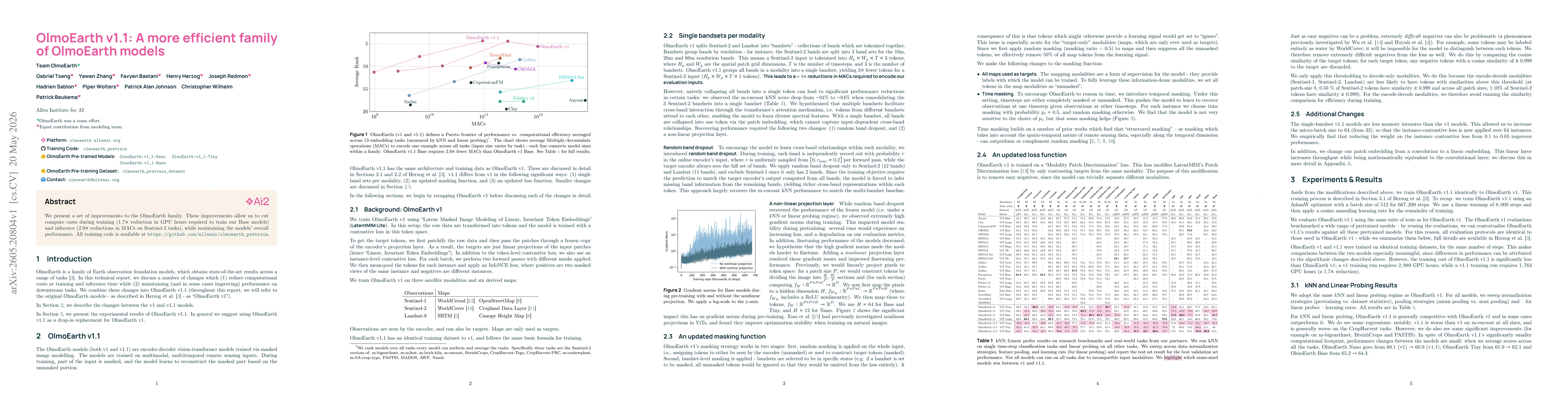
We present a set of improvements to the OlmoEarth family. These improvements allow us to cut compute costs during training ($1.7 \times$ reduction in GPU hours required to train our Base models) and i...