Academic Profile
Statistics
Similar Authors
Papers on arXiv
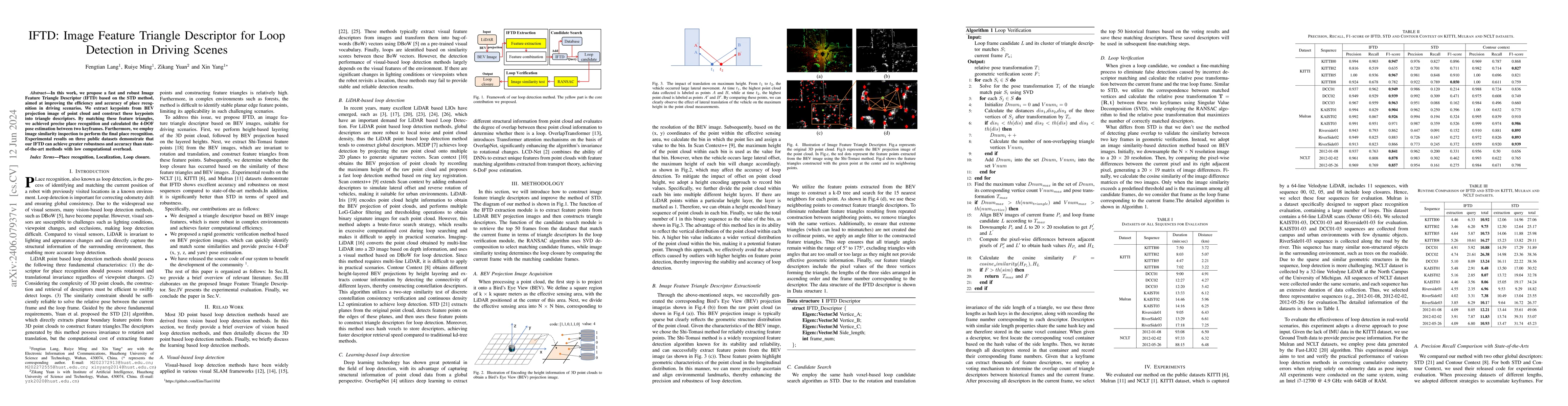
In this work, we propose a fast and robust Image Feature Triangle Descriptor (IFTD) based on the STD method, aimed at improving the efficiency and accuracy of place recognition in driving scenarios....
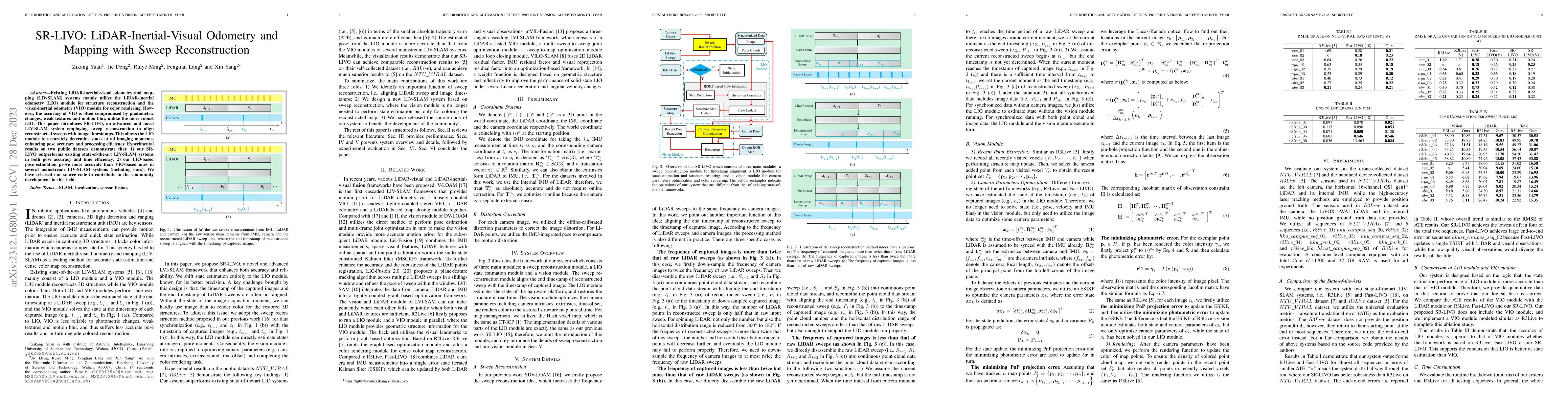
Existing LiDAR-inertial-visual odometry and mapping (LIV-SLAM) systems mainly utilize the LiDAR-inertial odometry (LIO) module for structure reconstruction and the visual-inertial odometry (VIO) mod...
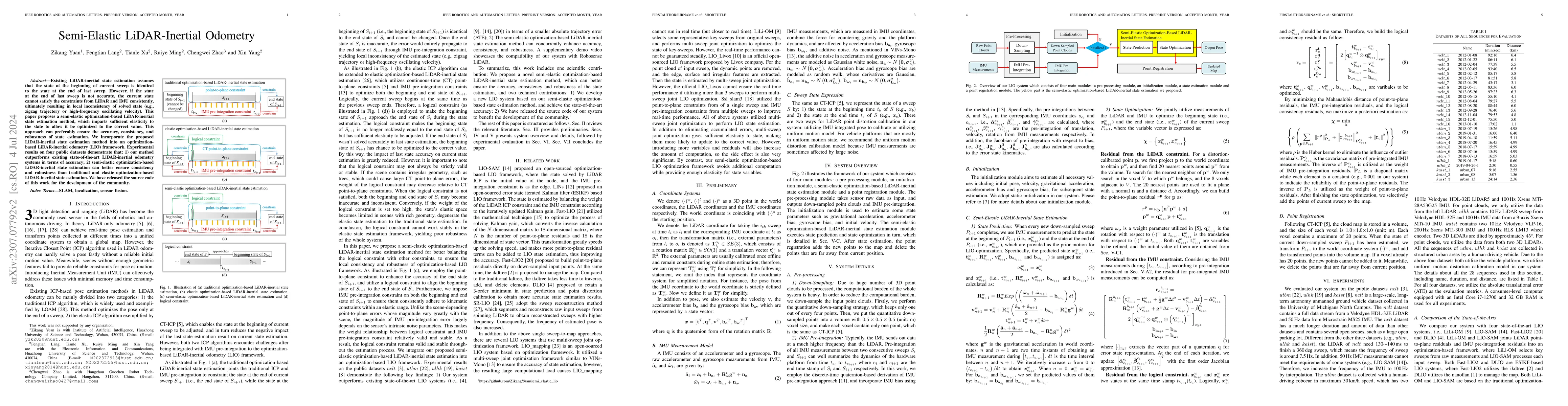
Existing LiDAR-inertial state estimation methods treats the state at the beginning of current sweep as equal to the state at the end of previous sweep. However, if the previous state is inaccurate, ...
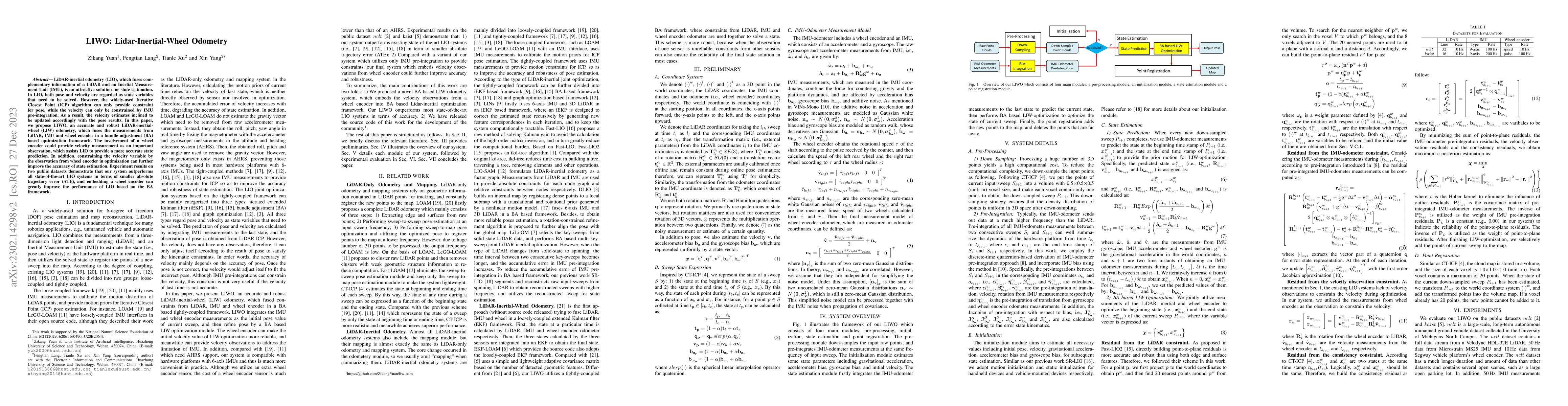
LiDAR-inertial odometry (LIO), which fuses complementary information of a LiDAR and an Inertial Measurement Unit (IMU), is an attractive solution for state estimation. In LIO, both pose and velocity...
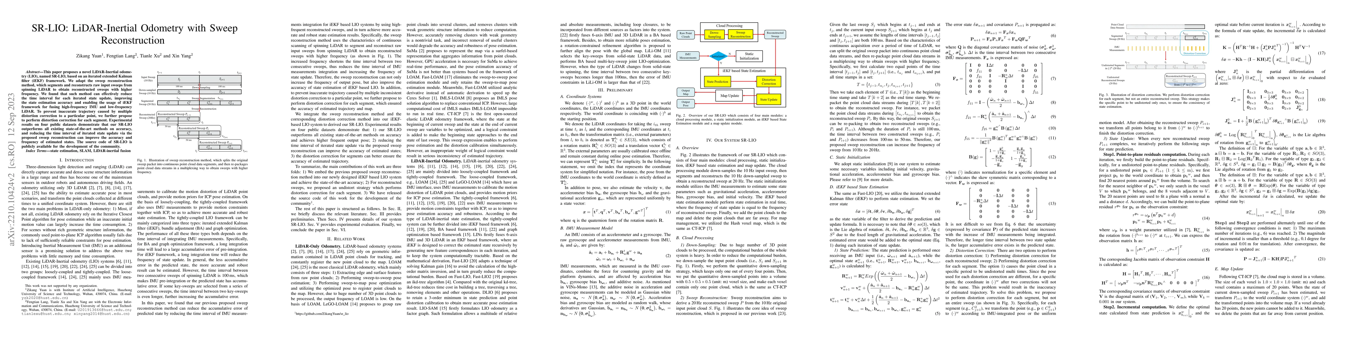
This paper proposes a novel LiDAR-Inertial odometry (LIO), named SR-LIO, based on an iterated extended Kalman filter (iEKF) framework. We adapt the sweep reconstruction method, which segments and re...
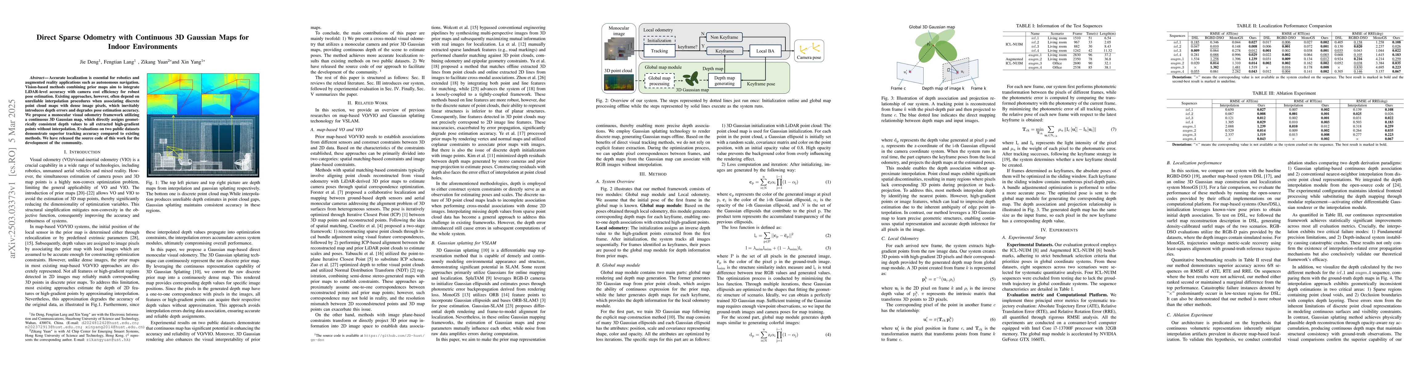
Accurate localization is essential for robotics and augmented reality applications such as autonomous navigation. Vision-based methods combining prior maps aim to integrate LiDAR-level accuracy with c...
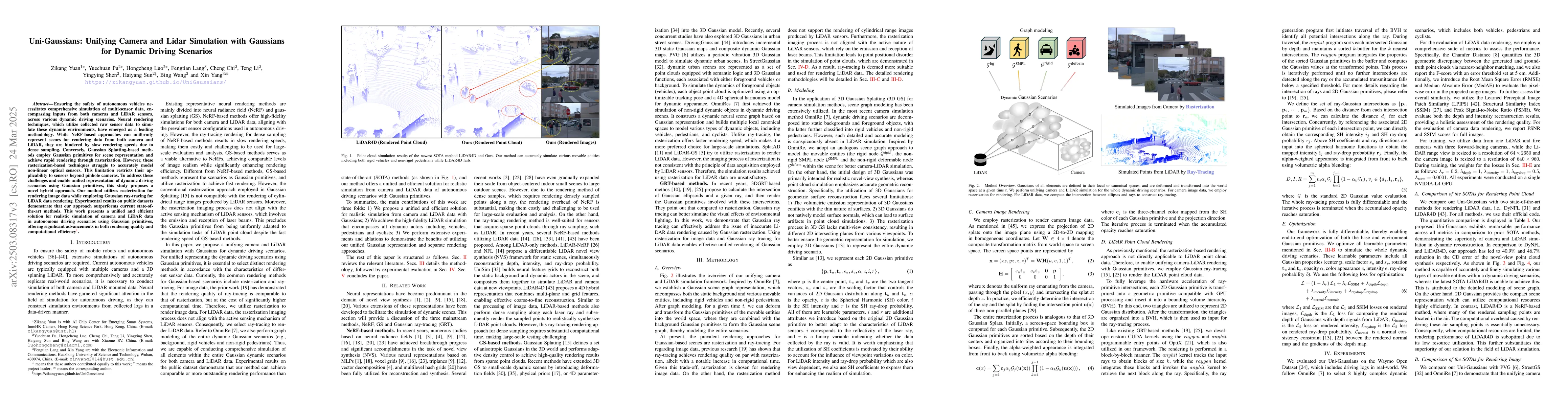
Ensuring the safety of autonomous vehicles necessitates comprehensive simulation of multi-sensor data, encompassing inputs from both cameras and LiDAR sensors, across various dynamic driving scenarios...