Academic Profile
Statistics
Similar Authors
Papers on arXiv
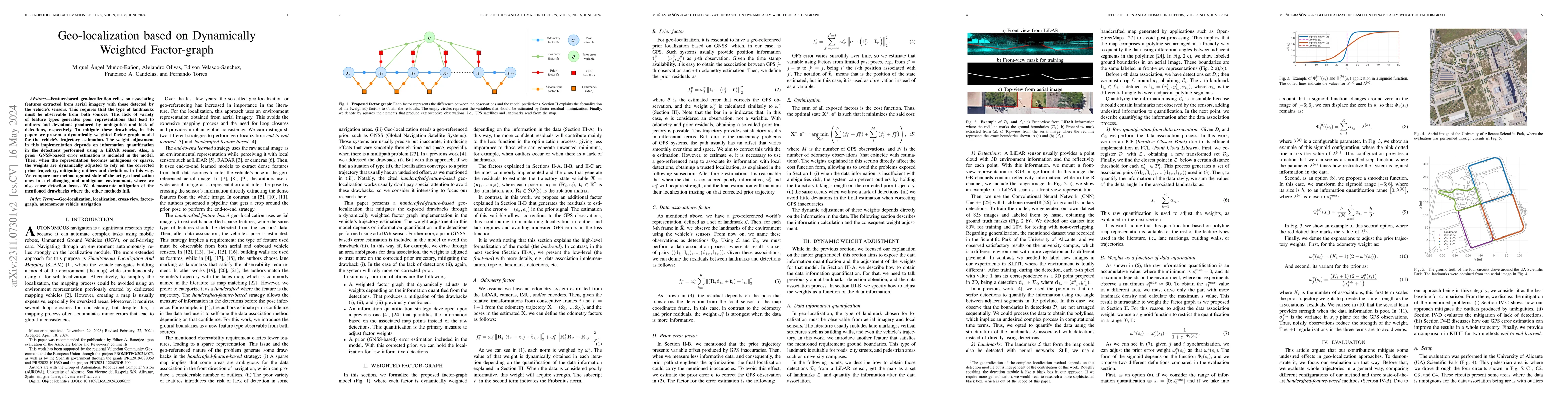
Feature-based geo-localization relies on associating features extracted from aerial imagery with those detected by the vehicle's sensors. This requires that the type of landmarks must be observable ...
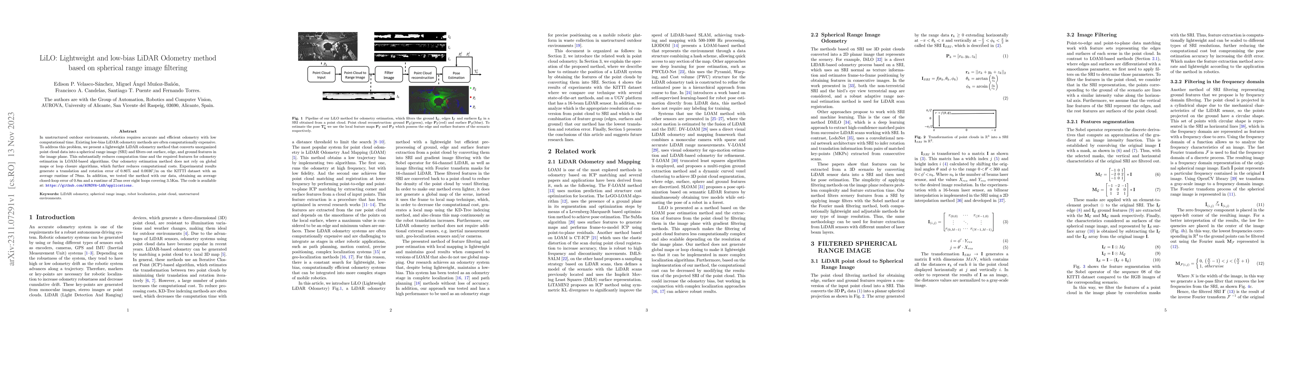
In unstructured outdoor environments, robotics requires accurate and efficient odometry with low computational time. Existing low-bias LiDAR odometry methods are often computationally expensive. To ...
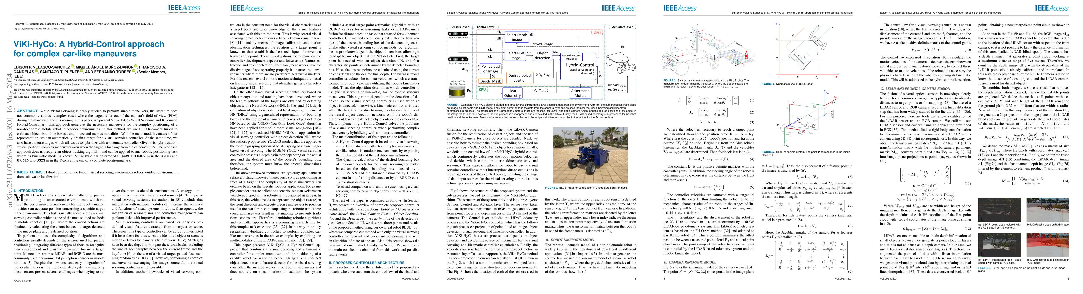
While Visual Servoing is deeply studied to perform simple maneuvers, the literature does not commonly address complex cases where the target is far out of the camera's field of view (FOV) during the...
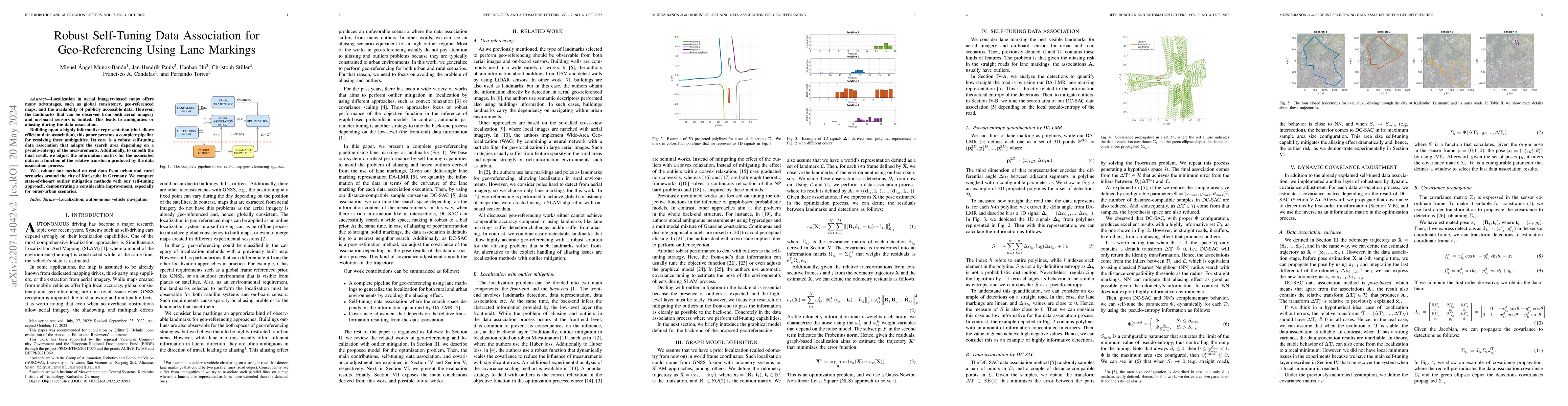
Localization in aerial imagery-based maps offers many advantages, such as global consistency, geo-referenced maps, and the availability of publicly accessible data. However, the landmarks that can b...
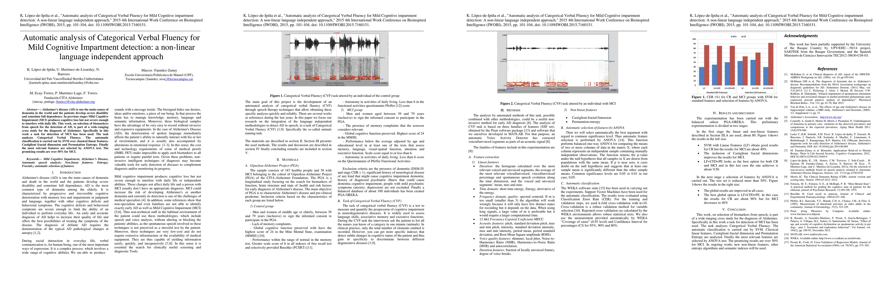
Alzheimer's disease (AD) is one the main causes of dementia in the world and the patients develop severe disability and sometime full dependence. In previous stages Mild Cognitive Impairment (MCI) p...
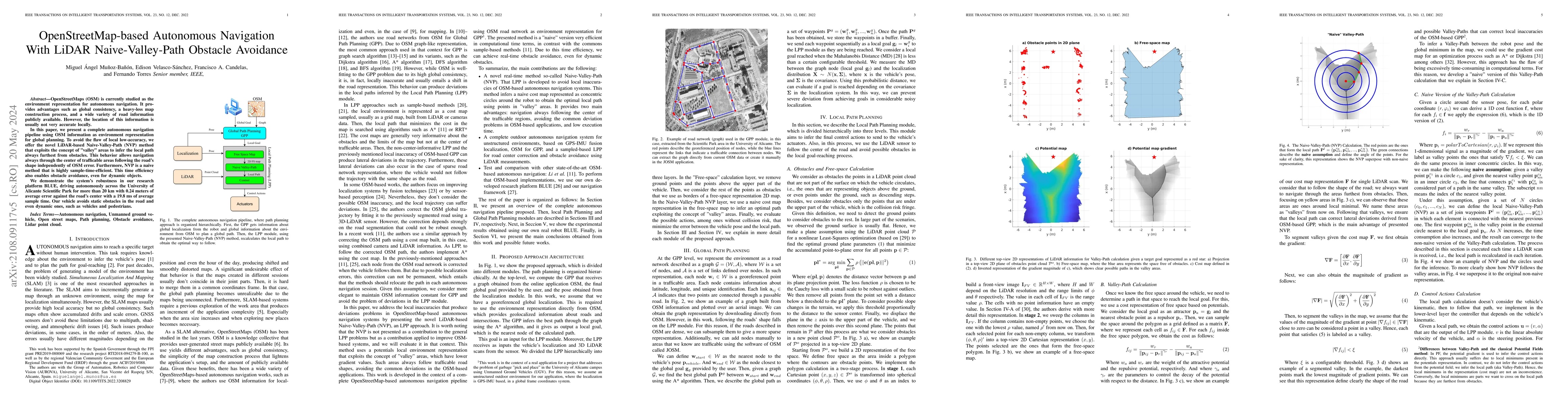
OpenStreetMaps (OSM) is currently studied as the environment representation for autonomous navigation. It provides advantages such as global consistency, a heavy-less map construction process, and a...
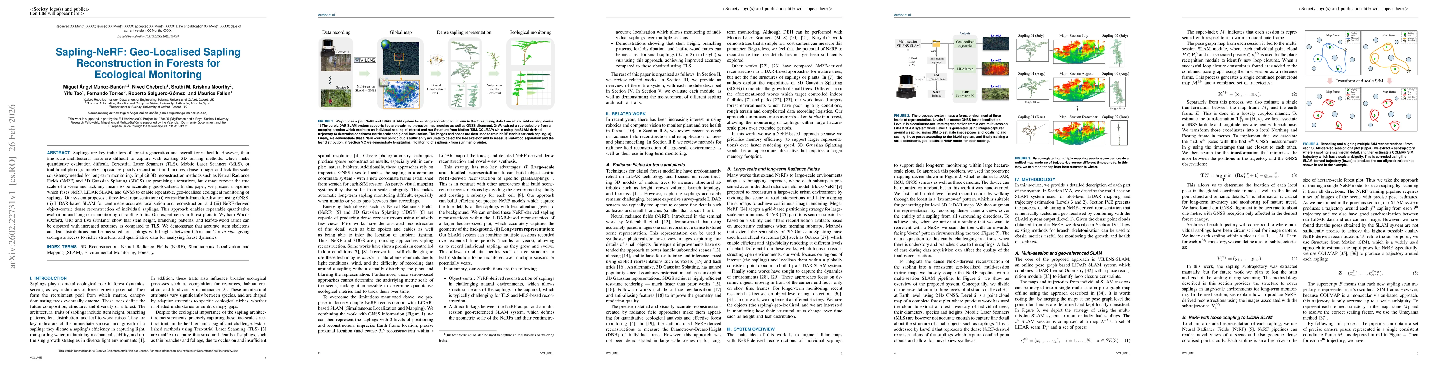
Saplings are key indicators of forest regeneration and overall forest health. However, their fine-scale architectural traits are difficult to capture with existing 3D sensing methods, which make quant...