ArxivLens
F
Researcher

Florian Mouret

5 papers on arXiv

5 arXiv Papers
3 Total Publications
Profile

Academic Profile

Name Florian Mouret
Total Papers 3
Scholar Profile View on Semantic Scholar
Metrics

Statistics

5 arXiv Papers
3 Total Publications
Publications

Papers on arXiv

Thumbnail for Estimation of forest height and biomass from open-access multi-sensor
  satellite imagery and GEDI Lidar data: high-resolution maps of metropolitan
  France
arXiv
Estimation of forest height and biomass from open-access multi-sensor satellite imagery and GEDI Lidar data: high-resolution maps of metropolitan France

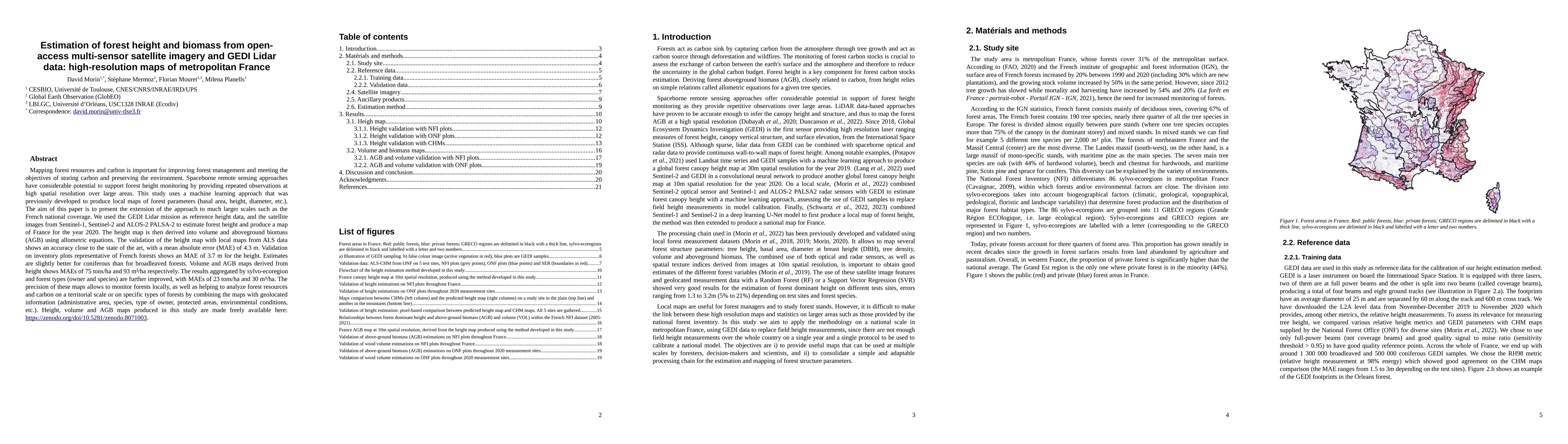
Mapping forest resources and carbon is important for improving forest management and meeting the objectives of storing carbon and preserving the environment. Spaceborne remote sensing approaches hav...

Thumbnail for A Robust and Flexible EM Algorithm for Mixtures of Elliptical
  Distributions with Missing Data
arXiv
A Robust and Flexible EM Algorithm for Mixtures of Elliptical Distributions with Missing Data

This paper tackles the problem of missing data imputation for noisy and non-Gaussian data. A classical imputation method, the Expectation Maximization (EM) algorithm for Gaussian mixture models, has...

Thumbnail for Reconstruction of Sentinel-2 Time Series Using Robust Gaussian Mixture
  Models -- Application to the Detection of Anomalous Crop Development in wheat
  and rapeseed crops
arXiv
Reconstruction of Sentinel-2 Time Series Using Robust Gaussian Mixture Models -- Application to the Detection of Anomalous Crop Development in wheat and rapeseed crops

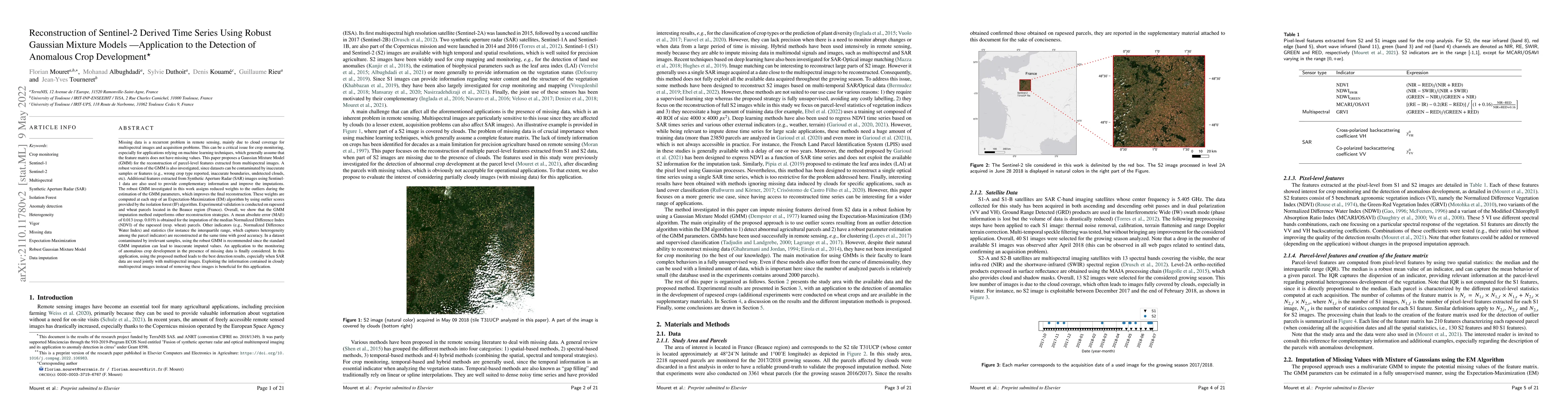
Missing data is a recurrent problem in remote sensing, mainly due to cloud coverage for multispectral images and acquisition problems. This can be a critical issue for crop monitoring, especially fo...

Thumbnail for Tree species classification at the pixel-level using deep learning and
  multispectral time series in an imbalanced context
arXiv
Tree species classification at the pixel-level using deep learning and multispectral time series in an imbalanced context

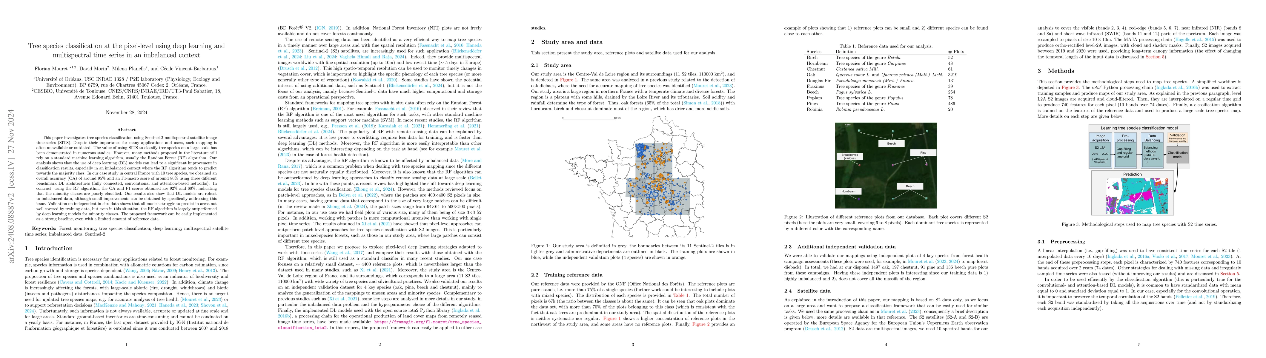
This paper investigates tree species classification using Sentinel-2 multispectral satellite image time-series. Despite their critical importance for many applications, such maps are often unavailable...

Thumbnail for Super-Resolved Canopy Height Mapping from Sentinel-2 Time Series Using LiDAR HD Reference Data across Metropolitan France
arXiv
Super-Resolved Canopy Height Mapping from Sentinel-2 Time Series Using LiDAR HD Reference Data across Metropolitan France

Fine-scale forest monitoring is essential for understanding canopy structure and its dynamics, which are key indicators of carbon stocks, biodiversity, and forest health. Deep learning is particularly...

This website uses cookies to ensure you get the best experience. Learn more