Academic Profile
Statistics
Similar Authors
Papers on arXiv
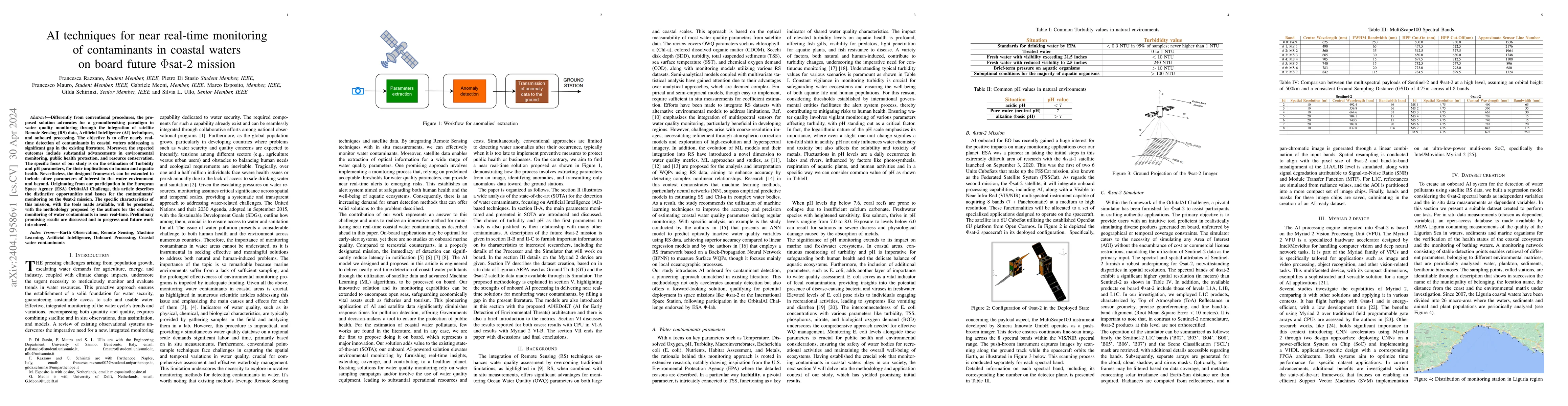
Differently from conventional procedures, the proposed solution advocates for a groundbreaking paradigm in water quality monitoring through the integration of satellite Remote Sensing (RS) data, Art...
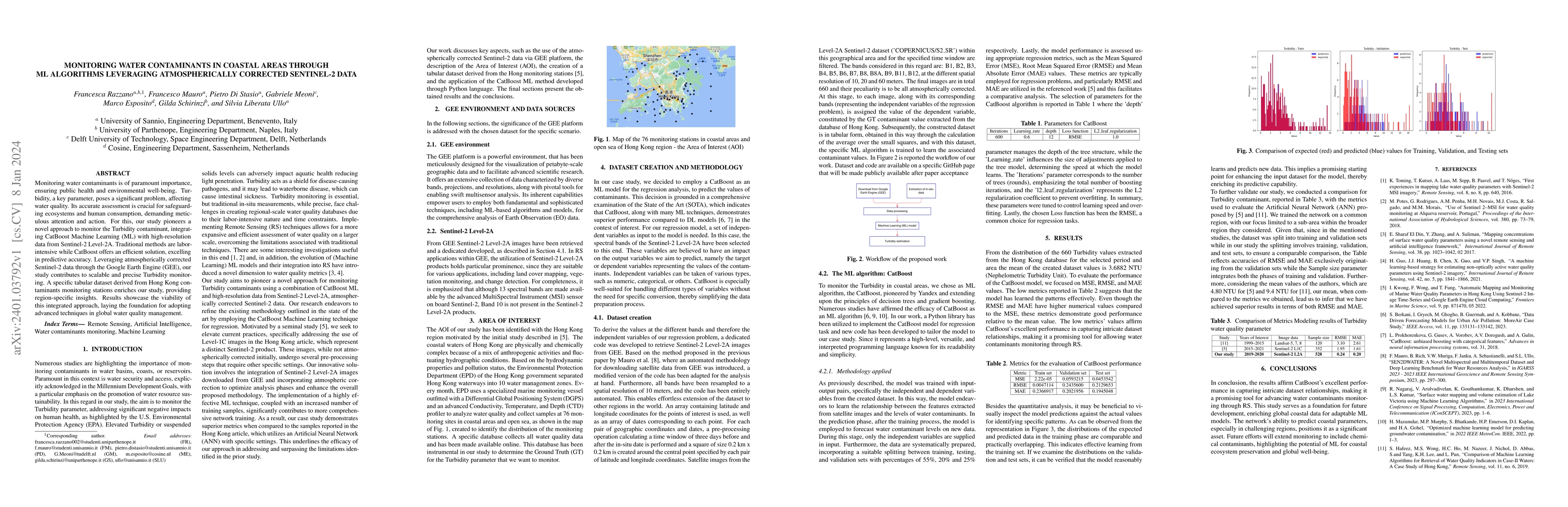
Monitoring water contaminants is of paramount importance, ensuring public health and environmental well-being. Turbidity, a key parameter, poses a significant problem, affecting water quality. Its a...
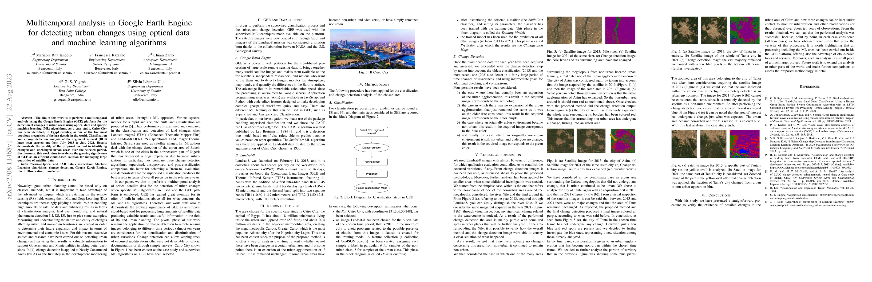
The aim of this work is to perform a multitemporal analysis using the Google Earth Engine (GEE) platform for the detection of changes in urban areas using optical data and specific machine learning ...
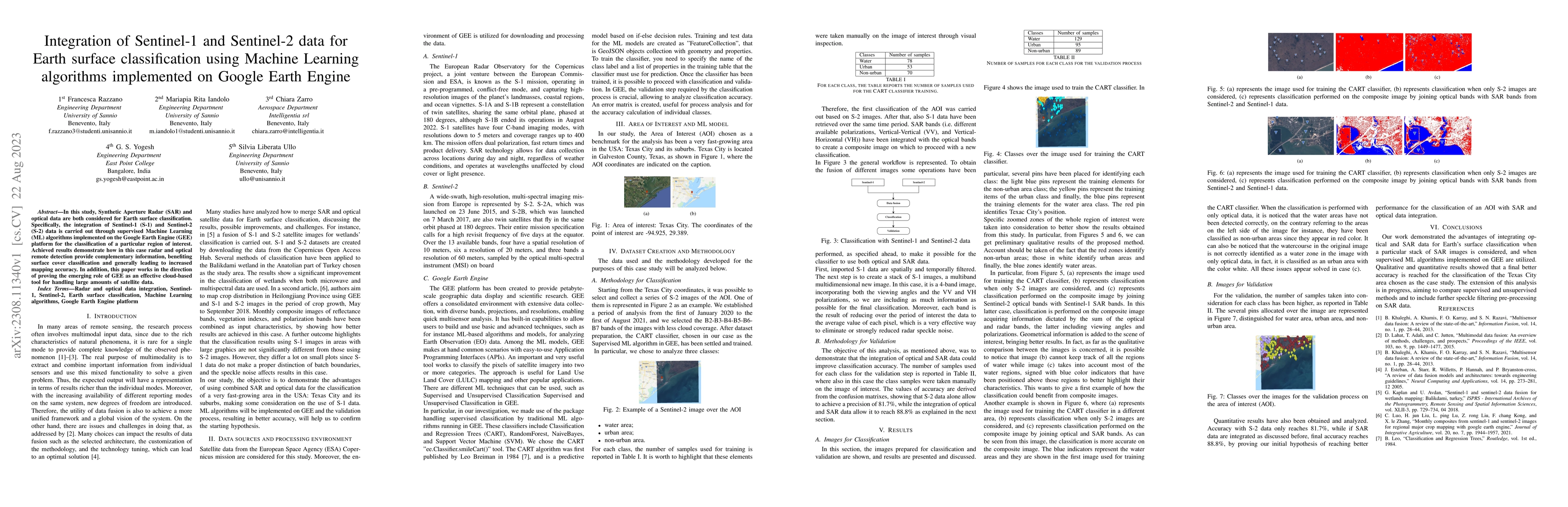
In this study, Synthetic Aperture Radar (SAR) and optical data are both considered for Earth surface classification. Specifically, the integration of Sentinel-1 (S-1) and Sentinel-2 (S-2) data is ca...
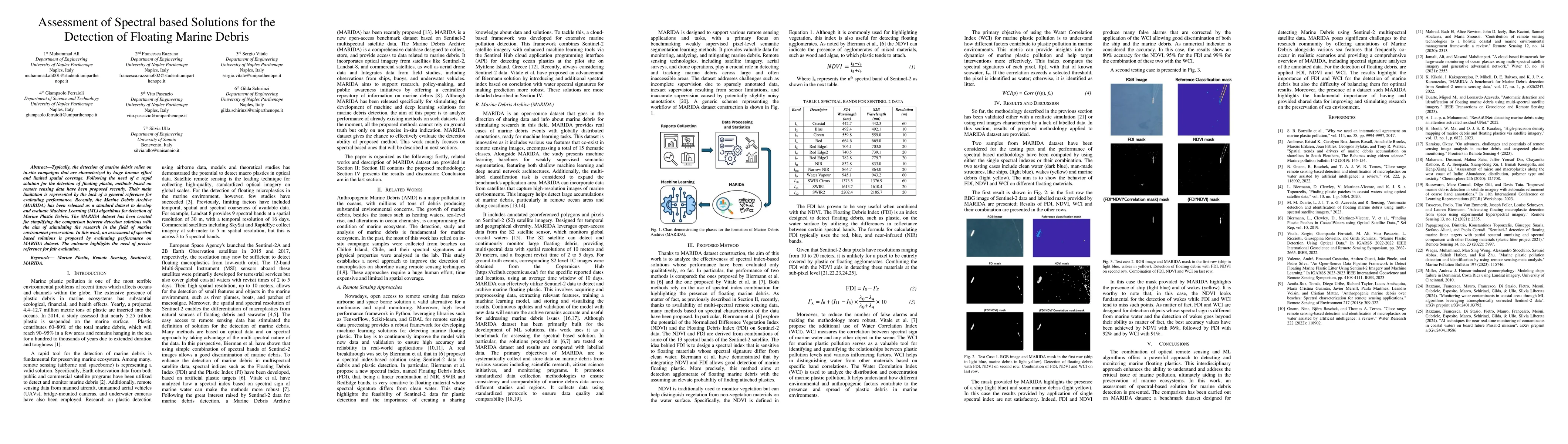
Typically, the detection of marine debris relies on in-situ campaigns that are characterized by huge human effort and limited spatial coverage. Following the need of a rapid solution for the detection...
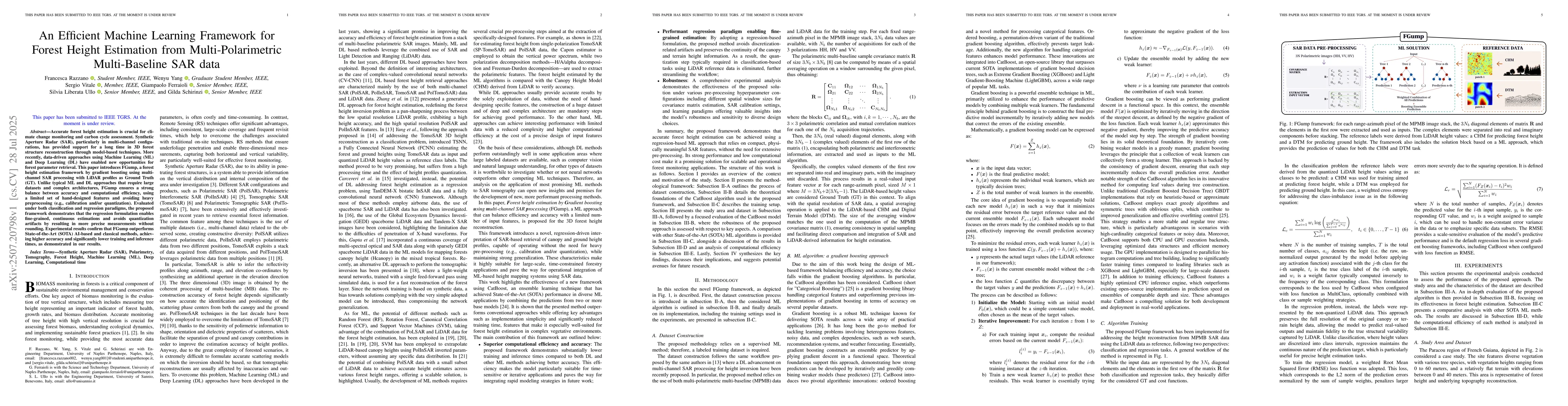
Accurate forest height estimation is crucial for climate change monitoring and carbon cycle assessment. Synthetic Aperture Radar (SAR), particularly in multi-channel configurations, has provided suppo...