Academic Profile
Statistics
Similar Authors
Papers on arXiv
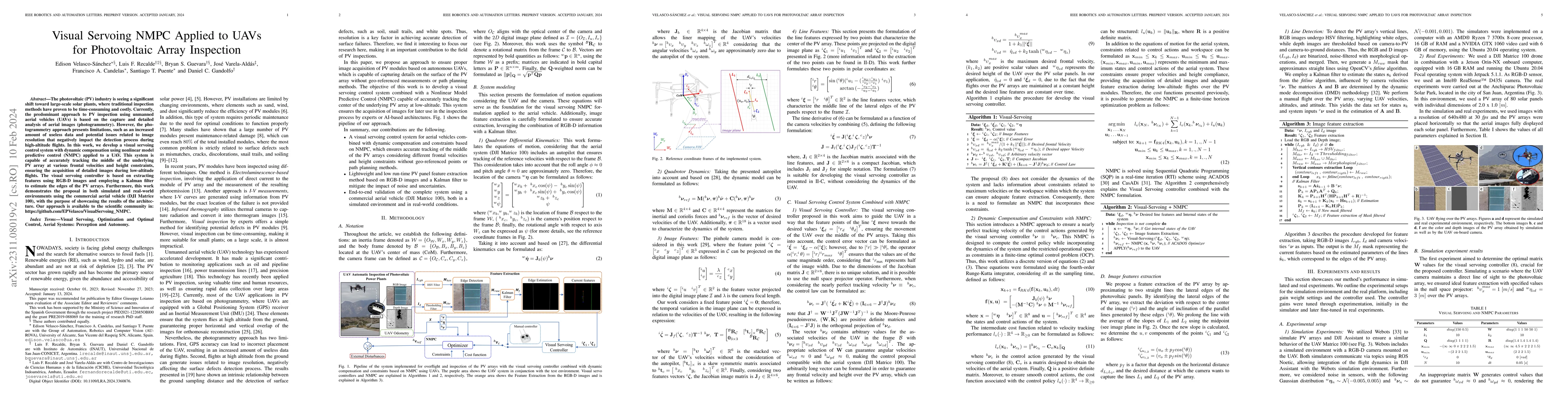
The photovoltaic (PV) industry is seeing a significant shift toward large-scale solar plants, where traditional inspection methods have proven to be time-consuming and costly. Currently, the predomi...
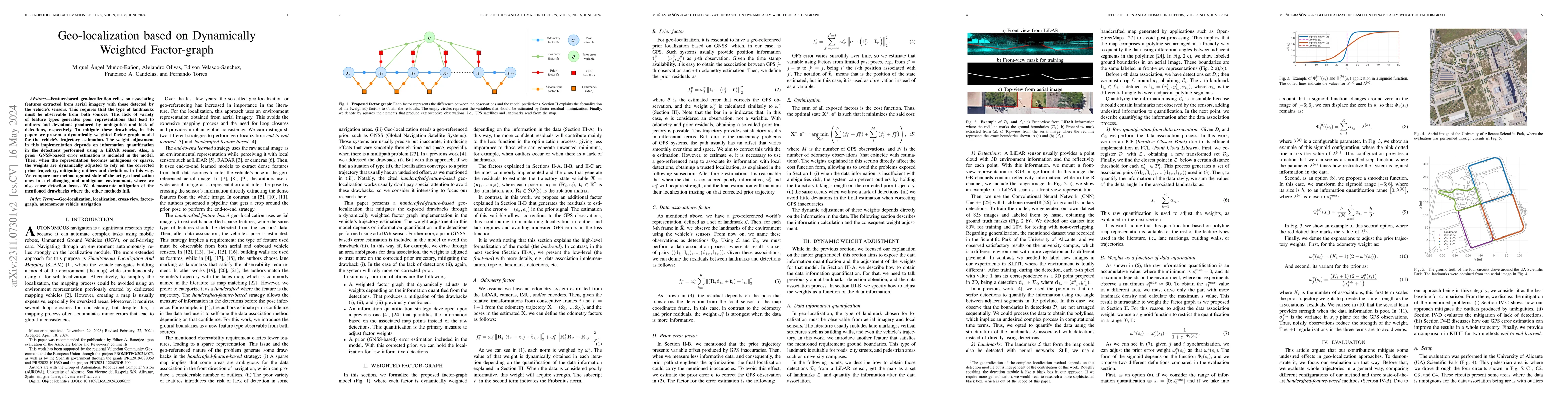
Feature-based geo-localization relies on associating features extracted from aerial imagery with those detected by the vehicle's sensors. This requires that the type of landmarks must be observable ...
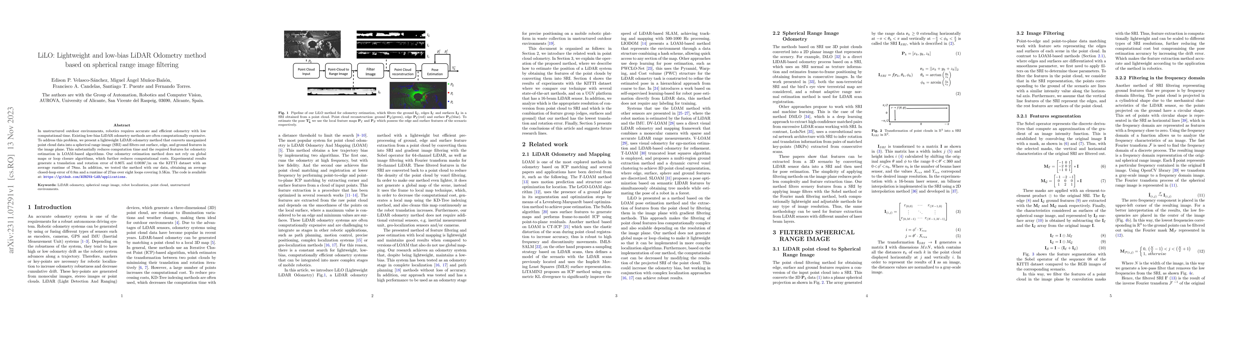
In unstructured outdoor environments, robotics requires accurate and efficient odometry with low computational time. Existing low-bias LiDAR odometry methods are often computationally expensive. To ...
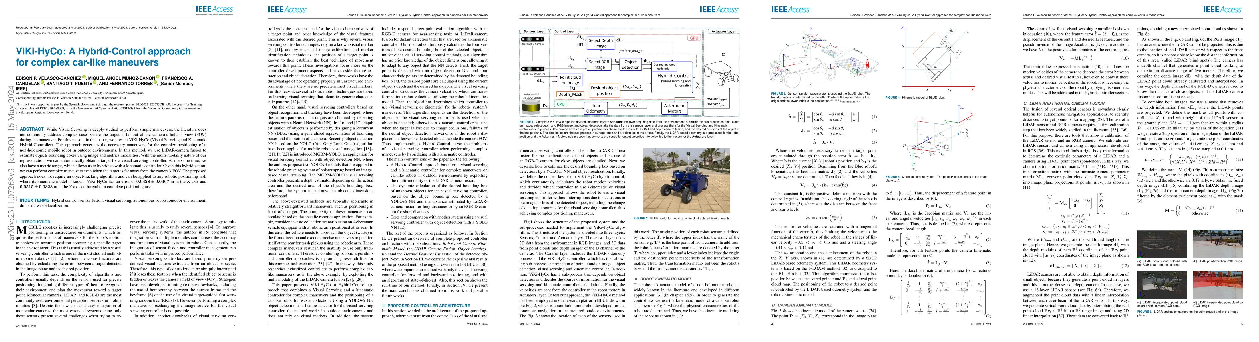
While Visual Servoing is deeply studied to perform simple maneuvers, the literature does not commonly address complex cases where the target is far out of the camera's field of view (FOV) during the...
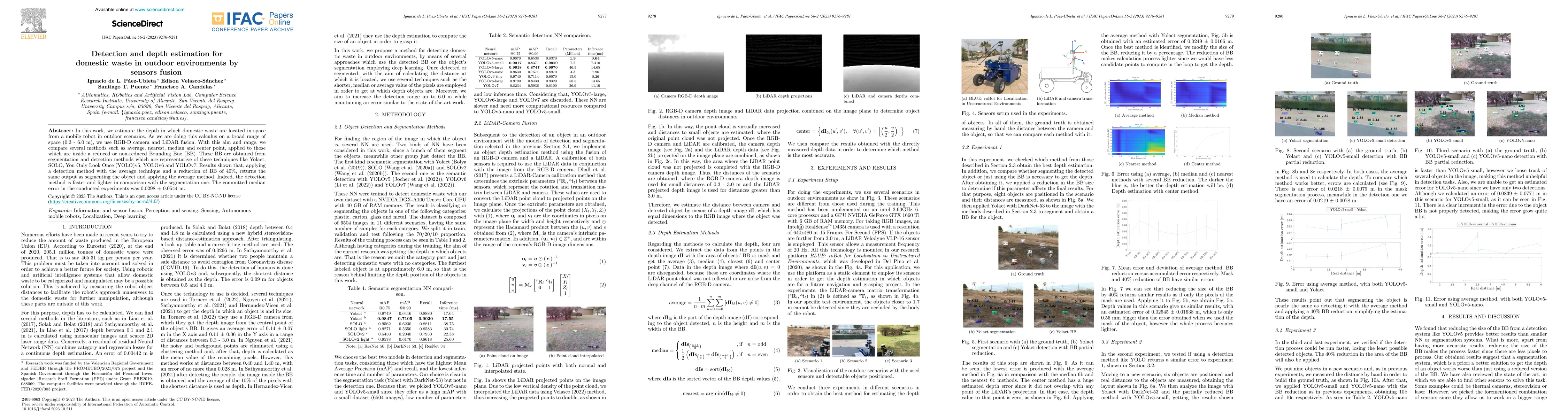
In this work, we estimate the depth in which domestic waste are located in space from a mobile robot in outdoor scenarios. As we are doing this calculus on a broad range of space (0.3 - 6.0 m), we u...
Localization in aerial imagery-based maps offers many advantages, such as global consistency, geo-referenced maps, and the availability of publicly accessible data. However, the landmarks that can b...
OpenStreetMaps (OSM) is currently studied as the environment representation for autonomous navigation. It provides advantages such as global consistency, a heavy-less map construction process, and a...