ArxivLens
F
Researcher

Frank Mascarich

5 papers on arXiv

5 arXiv Papers
34 Total Publications
Profile

Academic Profile

Name Frank Mascarich
Total Papers 34
Scholar Profile View on Semantic Scholar
Metrics

Statistics

5 arXiv Papers
34 Total Publications
Publications

Papers on arXiv

Thumbnail for Team CERBERUS Wins the DARPA Subterranean Challenge: Technical Overview
  and Lessons Learned
arXiv
Team CERBERUS Wins the DARPA Subterranean Challenge: Technical Overview and Lessons Learned

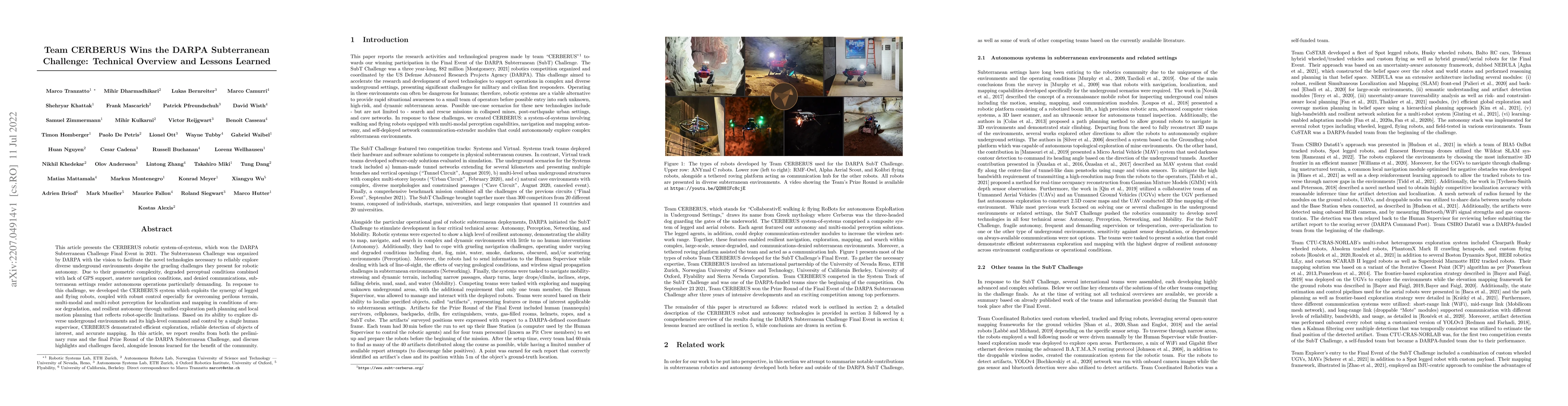
This article presents the CERBERUS robotic system-of-systems, which won the DARPA Subterranean Challenge Final Event in 2021. The Subterranean Challenge was organized by DARPA with the vision to fac...

Thumbnail for RMF-Owl: A Collision-Tolerant Flying Robot for Autonomous Subterranean
  Exploration
arXiv
RMF-Owl: A Collision-Tolerant Flying Robot for Autonomous Subterranean Exploration

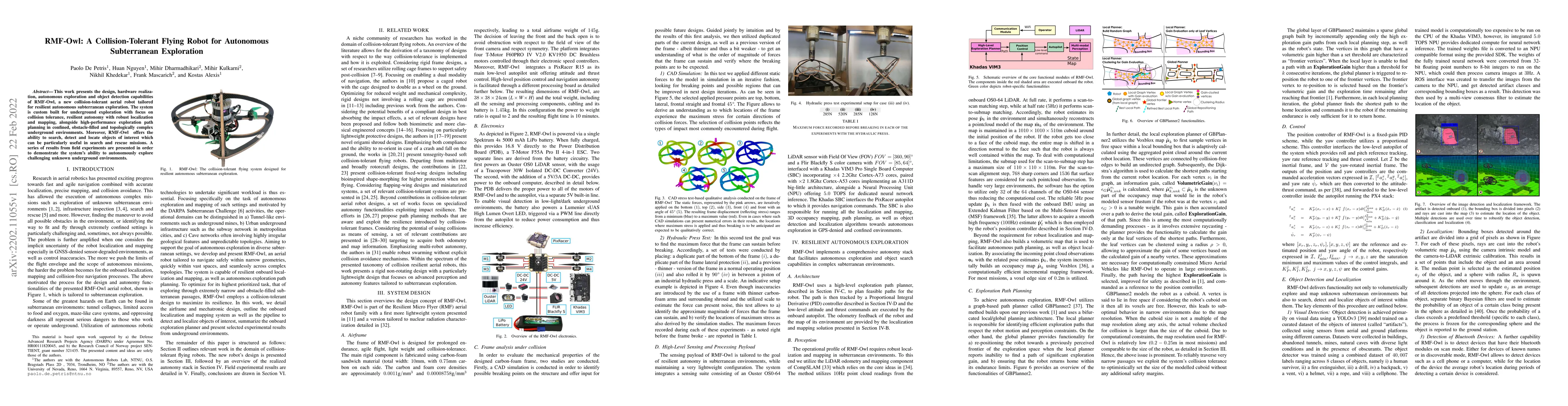
This work presents the design, hardware realization, autonomous exploration and object detection capabilities of RMF-Owl, a new collision-tolerant aerial robot tailored for resilient autonomous subt...

Thumbnail for CERBERUS: Autonomous Legged and Aerial Robotic Exploration in the Tunnel
  and Urban Circuits of the DARPA Subterranean Challenge
arXiv
CERBERUS: Autonomous Legged and Aerial Robotic Exploration in the Tunnel and Urban Circuits of the DARPA Subterranean Challenge

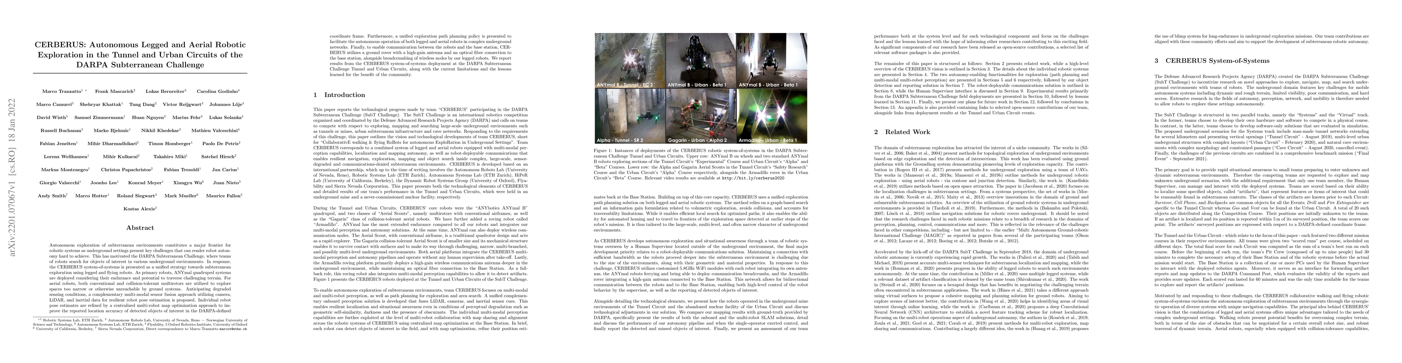
Autonomous exploration of subterranean environments constitutes a major frontier for robotic systems as underground settings present key challenges that can render robot autonomy hard to achieve. Th...

Thumbnail for Visual-Thermal Camera Dataset Release and Multi-Modal Alignment without
  Calibration Information
arXiv
Visual-Thermal Camera Dataset Release and Multi-Modal Alignment without Calibration Information

This report accompanies a dataset release on visual and thermal camera data and details a procedure followed to align such multi-modal camera frames in order to provide pixel-level correspondence be...

Thumbnail for Autonomous Aerial Robotic Surveying and Mapping with Application to
  Construction Operations
arXiv
Autonomous Aerial Robotic Surveying and Mapping with Application to Construction Operations

In this paper we present an overview of the methods and systems that give rise to a flying robotic system capable of autonomous inspection, surveying, comprehensive multi-modal mapping and inventory...

This website uses cookies to ensure you get the best experience. Learn more