Academic Profile
Statistics
Similar Authors
Papers on arXiv
Satellite Earth observations (EO) can provide affordable and timely information for assessing crop conditions and food production. Such monitoring systems are essential in Africa, where there is hig...
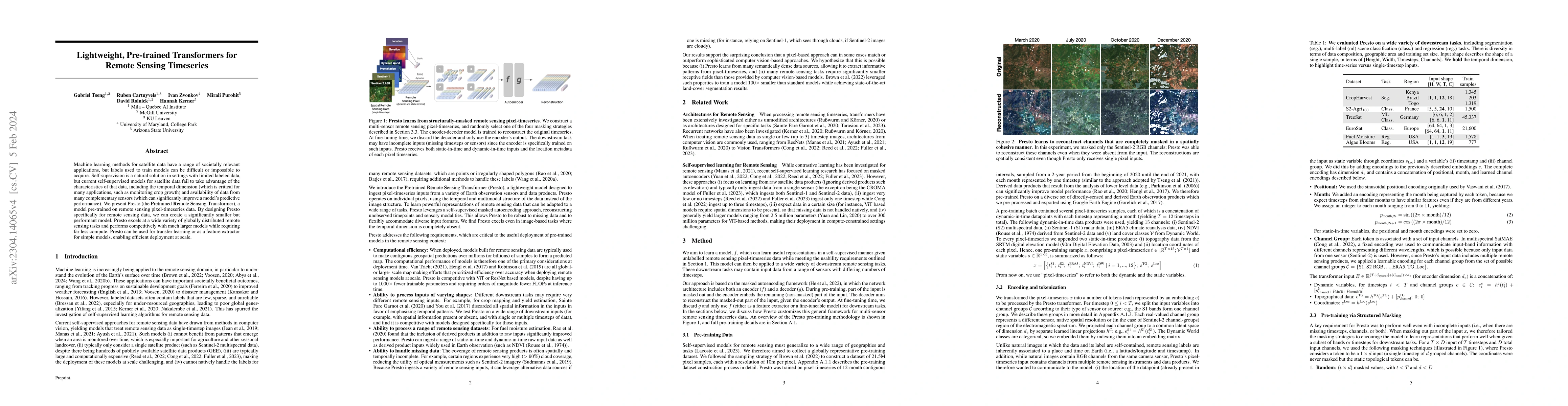
Machine learning methods for satellite data have a range of societally relevant applications, but labels used to train models can be difficult or impossible to acquire. Self-supervision is a natural...

Labeled datasets for agriculture are extremely spatially imbalanced. When developing algorithms for data-sparse regions, a natural approach is to use transfer learning from data-rich regions. While ...
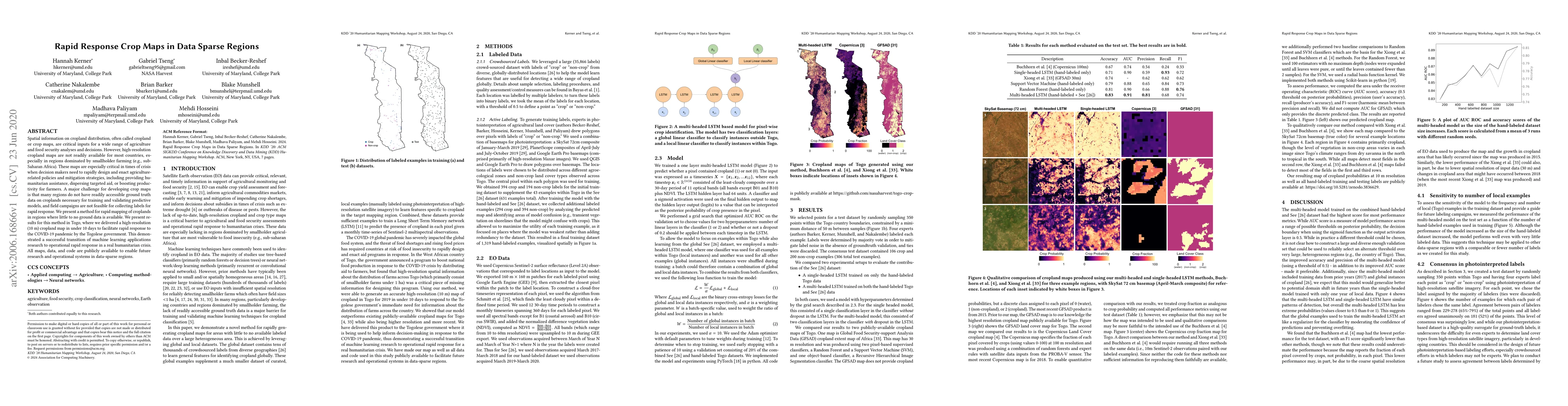
Spatial information on cropland distribution, often called cropland or crop maps, are critical inputs for a wide range of agriculture and food security analyses and decisions. However, high-resoluti...
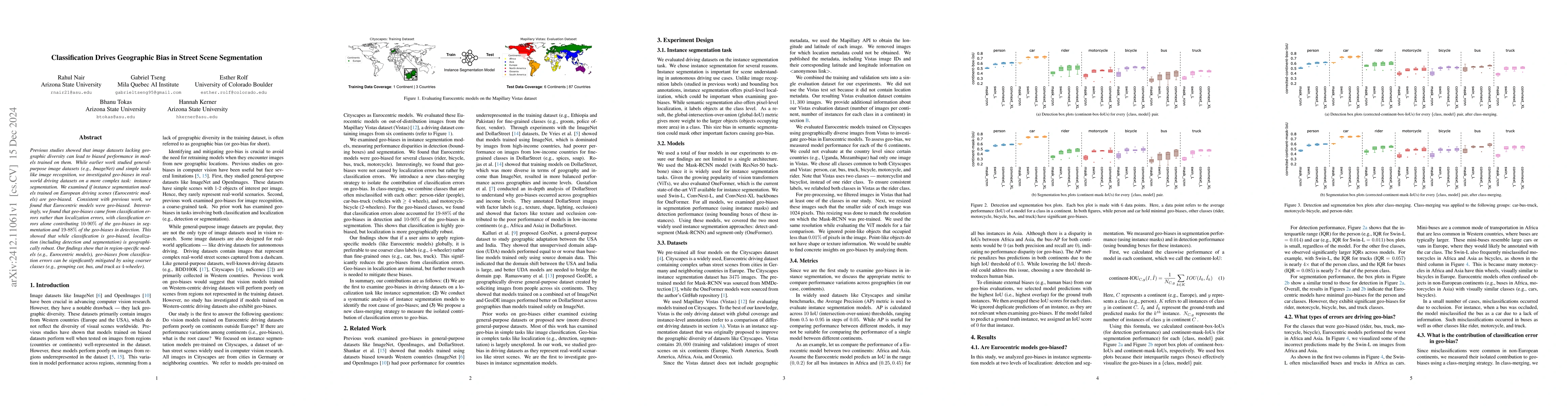
Previous studies showed that image datasets lacking geographic diversity can lead to biased performance in models trained on them. While earlier work studied general-purpose image datasets (e.g., Imag...

From crop mapping to flood detection, machine learning in remote sensing has a wide range of societally beneficial applications. The commonalities between remote sensing data in these applications pre...
In many real-world machine learning (ML) applications (e.g. detecting broken bones in x-ray images, detecting species in camera traps), in practice models need to perform well on specific deployments ...
Wildfires are increasing in intensity and severity at an alarming rate. Recent advances in AI and publicly available satellite data enable monitoring critical wildfire risk factors globally, at high r...
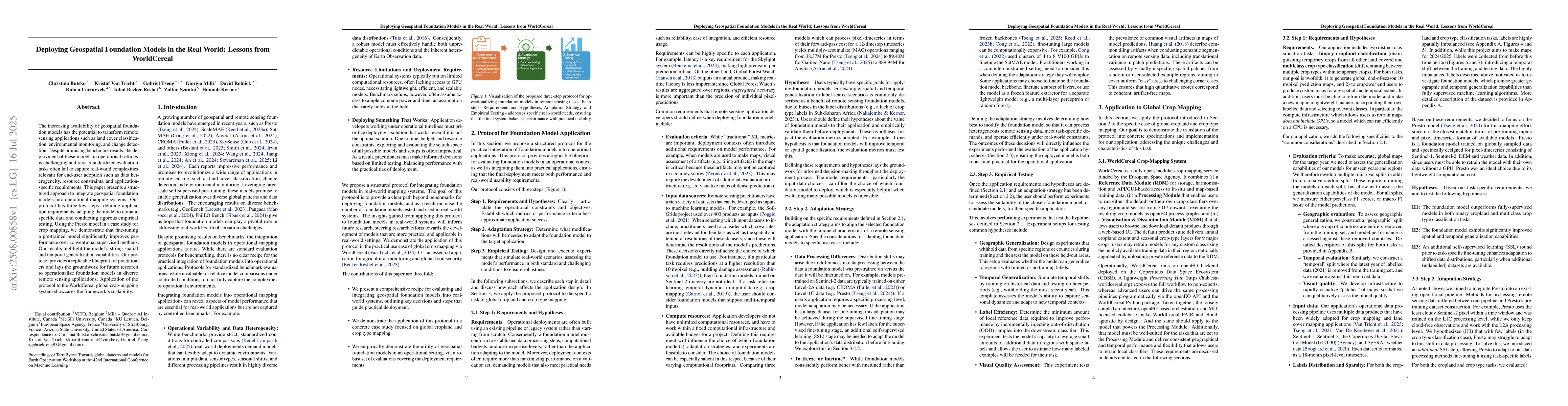
The increasing availability of geospatial foundation models has the potential to transform remote sensing applications such as land cover classification, environmental monitoring, and change detection...
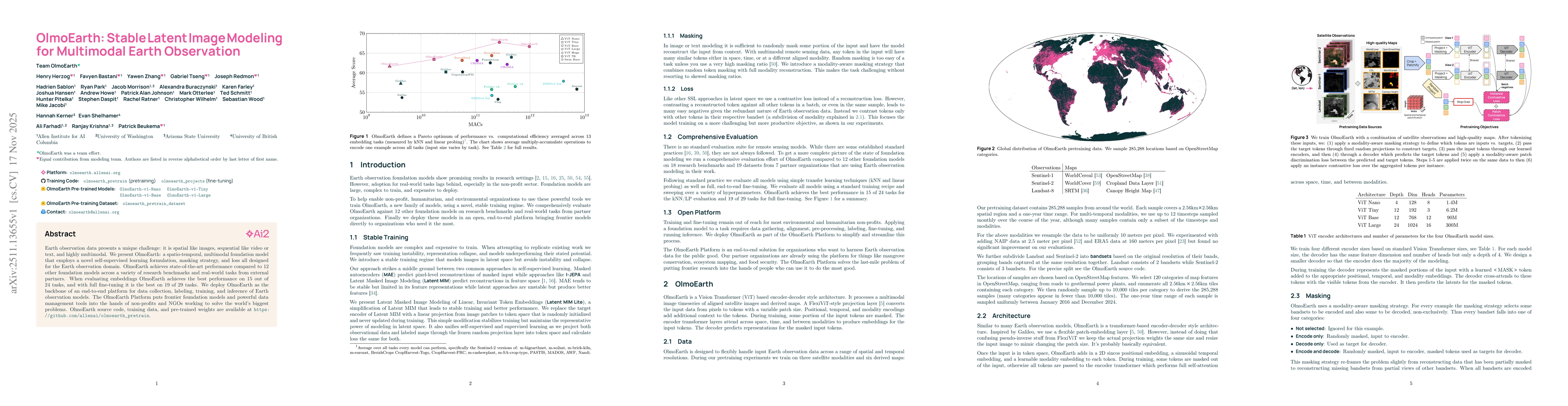
Earth observation data presents a unique challenge: it is spatial like images, sequential like video or text, and highly multimodal. We present OlmoEarth: a multimodal, spatio-temporal foundation mode...
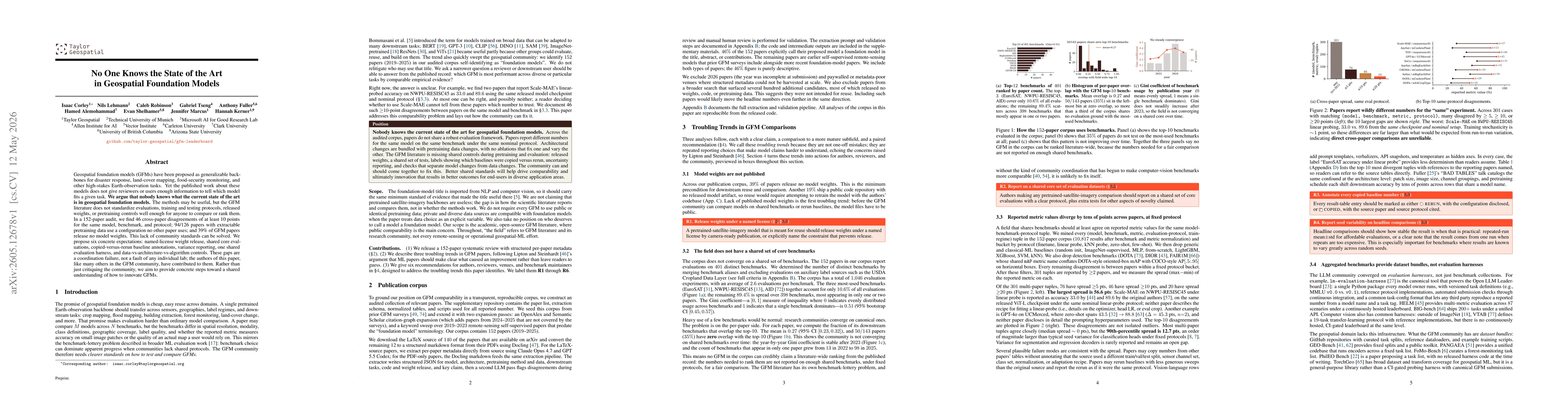
Geospatial foundation models (GFMs) have been proposed as generalizable backbones for disaster response, land-cover mapping, food-security monitoring, and other high-stakes Earth-observation tasks. Ye...
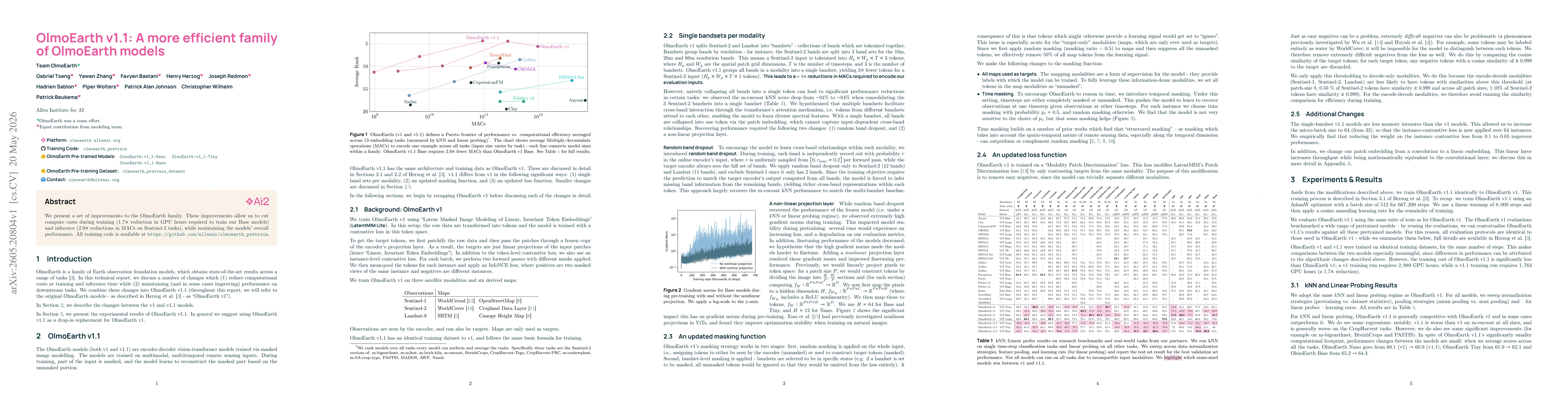
We present a set of improvements to the OlmoEarth family. These improvements allow us to cut compute costs during training ($1.7 \times$ reduction in GPU hours required to train our Base models) and i...