Academic Profile
Statistics
Similar Authors
Papers on arXiv
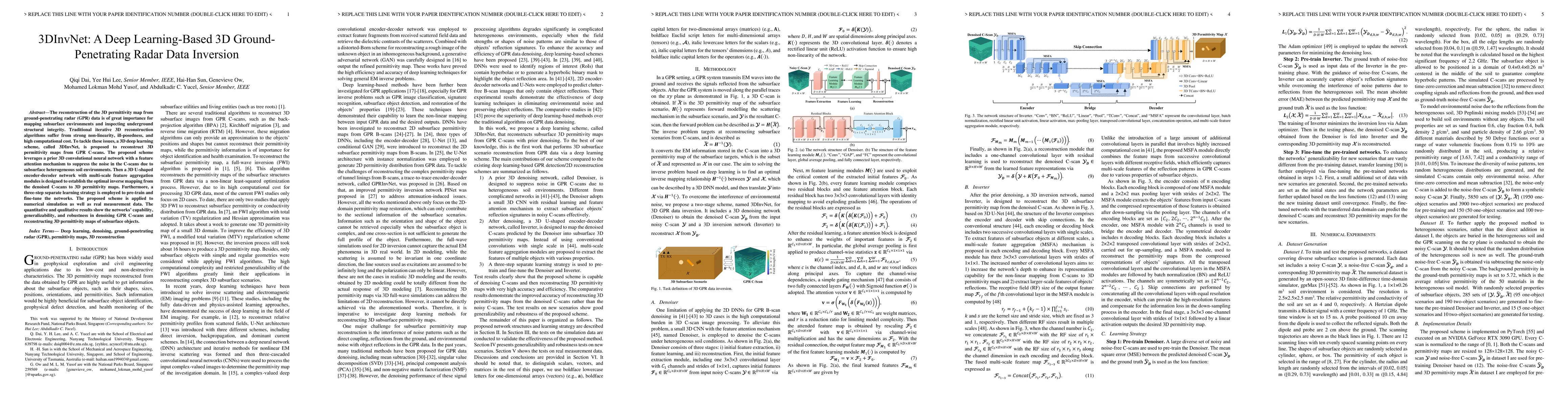
The reconstruction of the 3D permittivity map from ground-penetrating radar (GPR) data is of great importance for mapping subsurface environments and inspecting underground structural integrity. Tra...
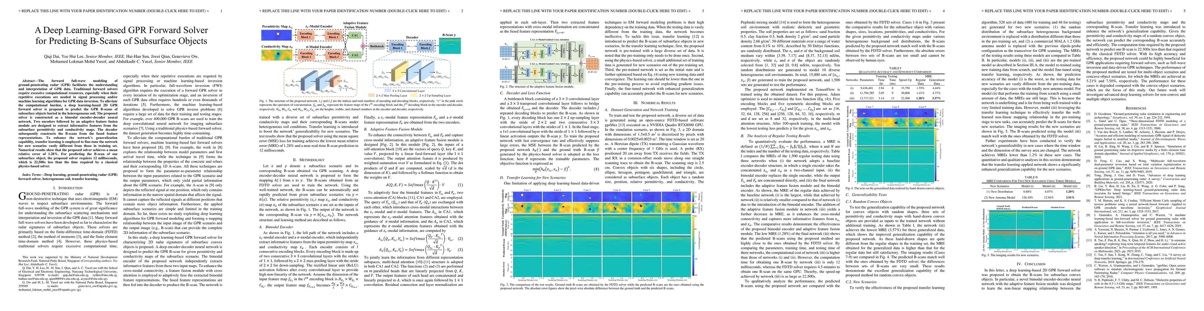
The forward full-wave modeling of ground-penetrating radar (GPR) facilitates the understanding and interpretation of GPR data. Traditional forward solvers require excessive computational resources, ...

Traditional ground-penetrating radar (GPR) data inversion leverages iterative algorithms which suffer from high computation costs and low accuracy when applied to complex subsurface scenarios. Exist...

Accurate monitoring of tree roots using ground penetrating radar (GPR) is very useful in assessing the trees health. In high moisture tropical areas such as Singapore, tree fall due to root rot can ...
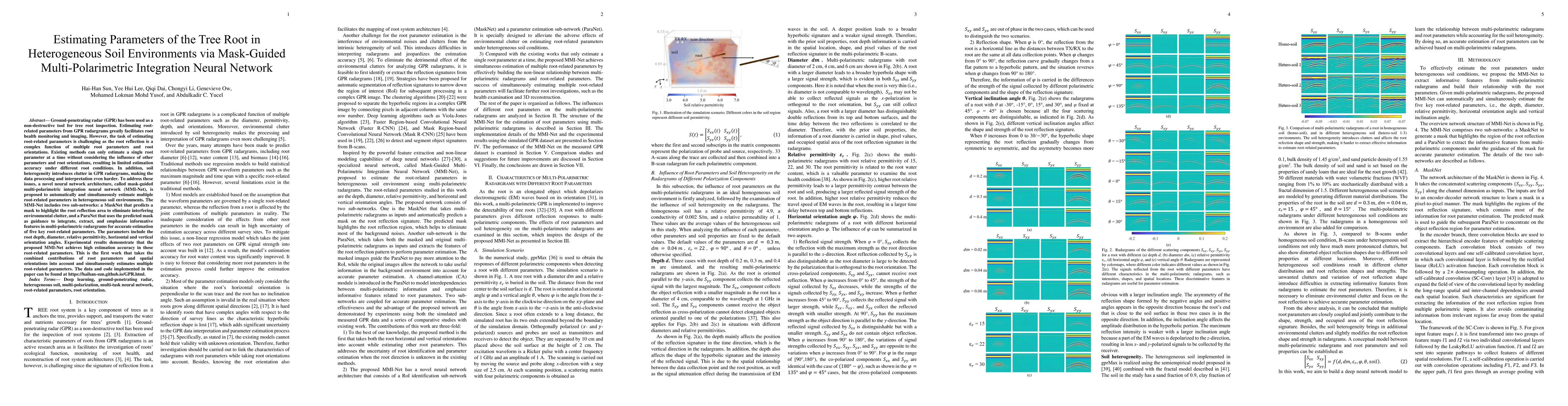
Ground-penetrating radar (GPR) has been used as a non-destructive tool for tree root inspection. Estimating root-related parameters from GPR radargrams greatly facilitates root health monitoring and...
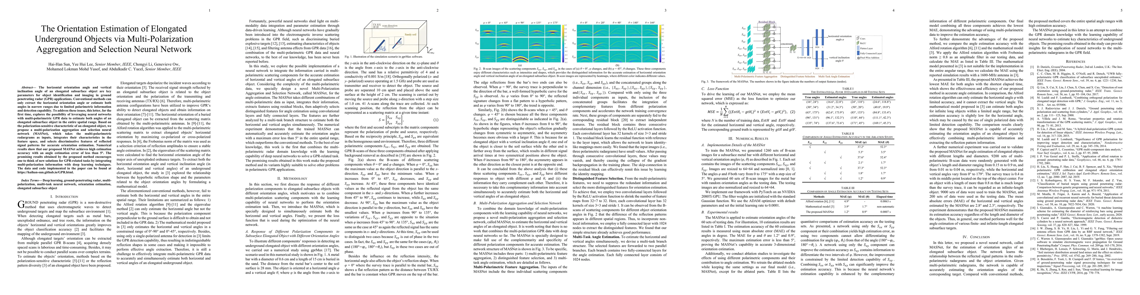
The horizontal orientation angle and vertical inclination angle of an elongated subsurface object are key parameters for object identification and imaging in ground penetrating radar (GPR) applicati...
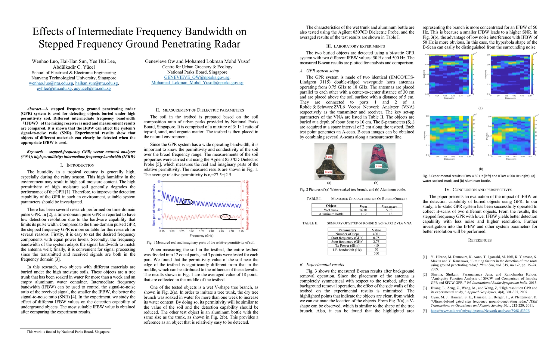
A stepped frequency ground penetrating radar (GPR) system is used for detecting objects buried under high permittivity soil. Different intermediate frequency bandwidth (IFBW) of the mixing receiver ...
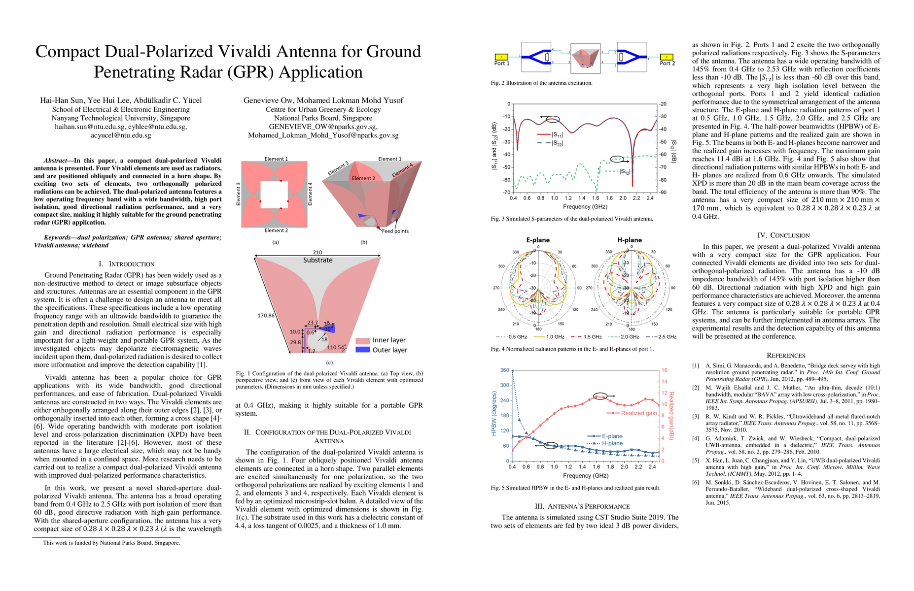
In this paper, a compact dual-polarized Vivaldi antenna is presented. Four Vivaldi elements are used as radiators, and are positioned obliquely and connected in a horn shape. By exciting two sets of...