Academic Profile
Statistics
Similar Authors
Papers on arXiv
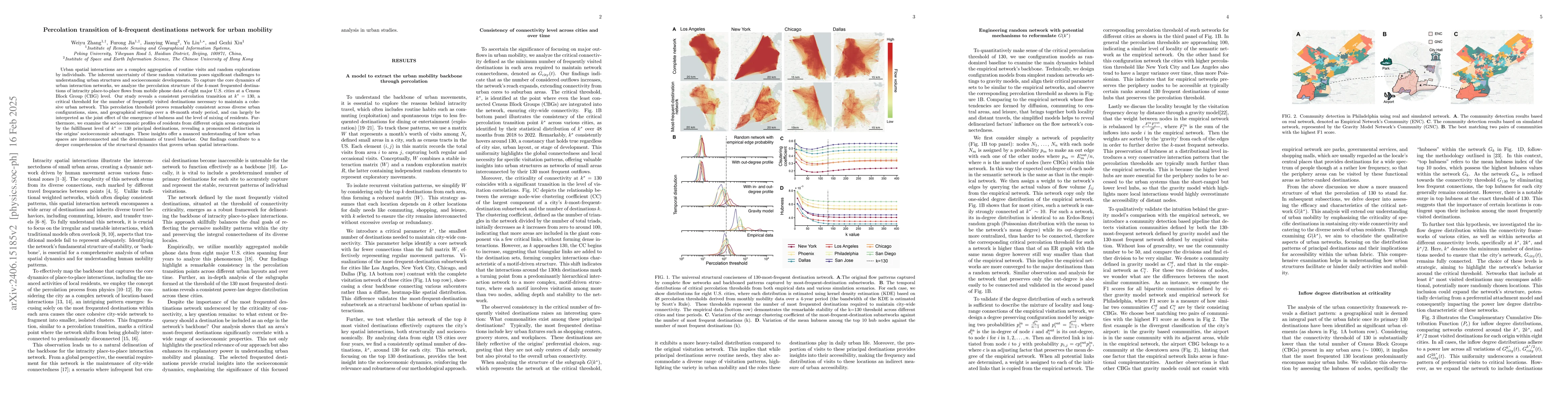
Urban spatial interactions are a complex aggregation of routine visits and random explorations by individuals. The inherent uncertainty of these random visitations poses significant challenges to un...
We propose a new approach to identifying geographical clustering and hotspots of inequality from decadal census data. We use diffusion mapping to study the 181,408 Output Areas in England and Wales,...
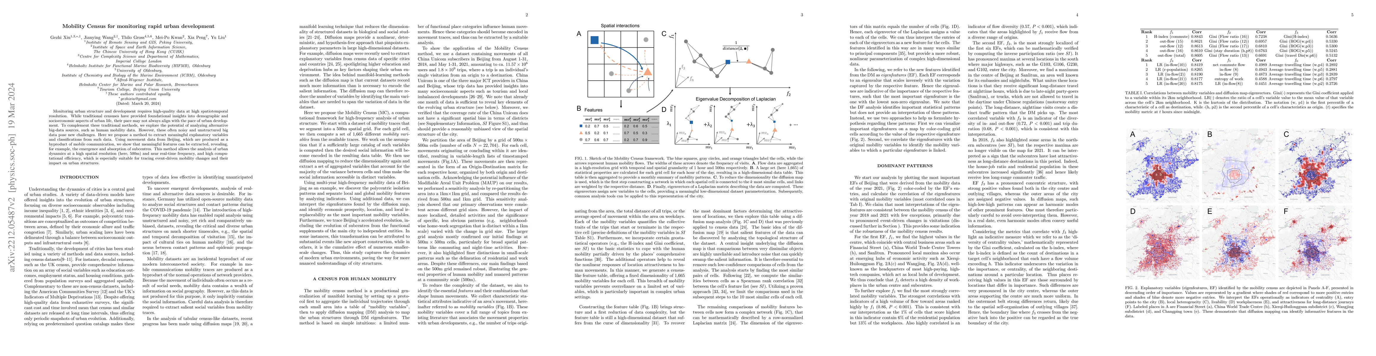
Monitoring urban structure and development requires high-quality data at high spatiotemporal resolution. While traditional censuses have provided foundational insights into demographic and socioecon...