Gilles Quentin Hacheme

4 papers on arXiv

Academic Profile

Name: G. Hacheme
Total Papers: 6

Statistics

arXiv Papers 4
Total Publications 6

Papers on arXiv

Thumbnail for Analyzing Decades-Long Environmental Changes in Namibia Using Archival
  Aerial Photography and Deep Learning

Analyzing Decades-Long Environmental Changes in Namibia Using Archival Aerial Photography and Deep Learning

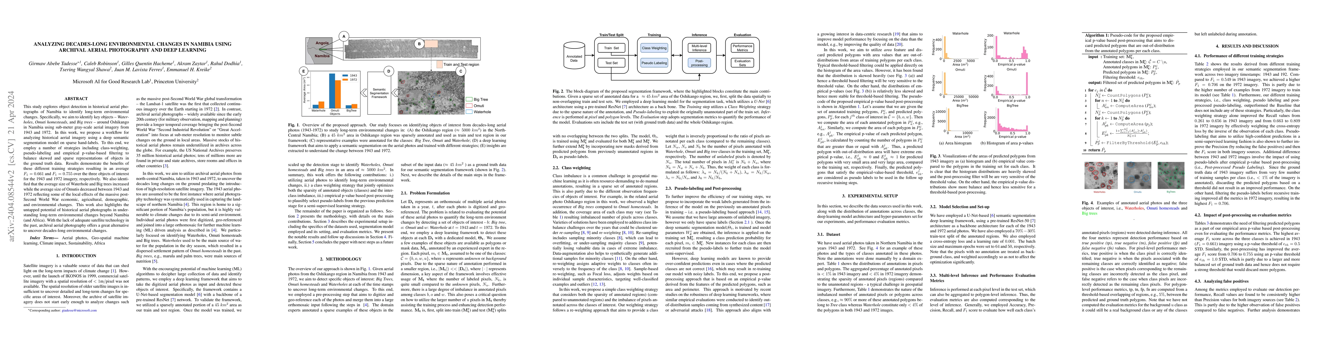
This study explores object detection in historical aerial photographs of Namibia to identify long-term environmental changes. Specifically, we aim to identify key objects -- Waterholes, Omuti homest...

Thumbnail for Weak Labeling for Cropland Mapping in Africa

Weak Labeling for Cropland Mapping in Africa

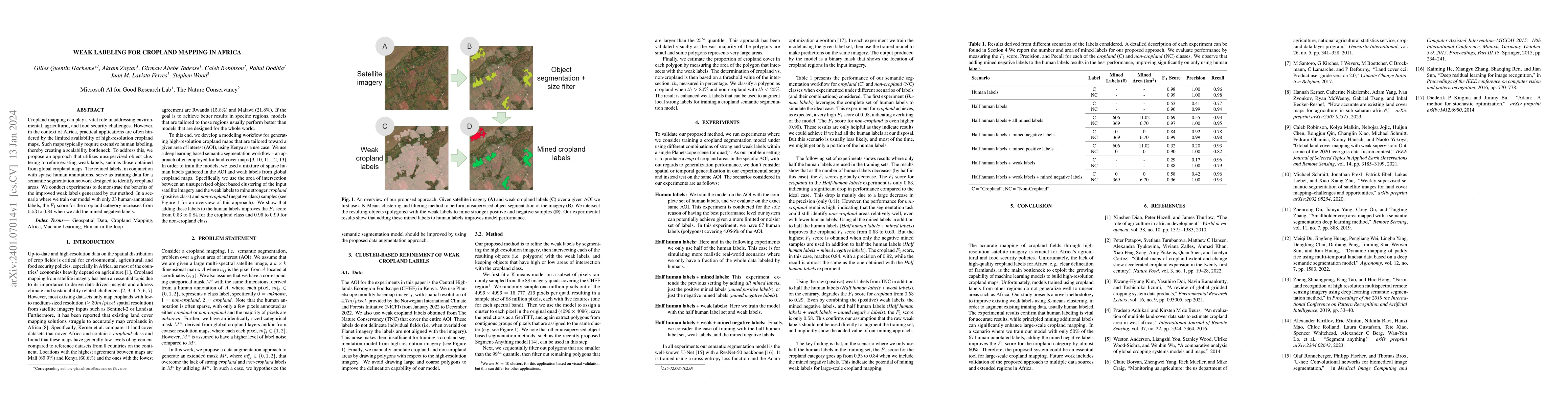
Cropland mapping can play a vital role in addressing environmental, agricultural, and food security challenges. However, in the context of Africa, practical applications are often hindered by the li...

Thumbnail for Local vs. Global: Local Land-Use and Land-Cover Models Deliver Higher
  Quality Maps

Local vs. Global: Local Land-Use and Land-Cover Models Deliver Higher Quality Maps

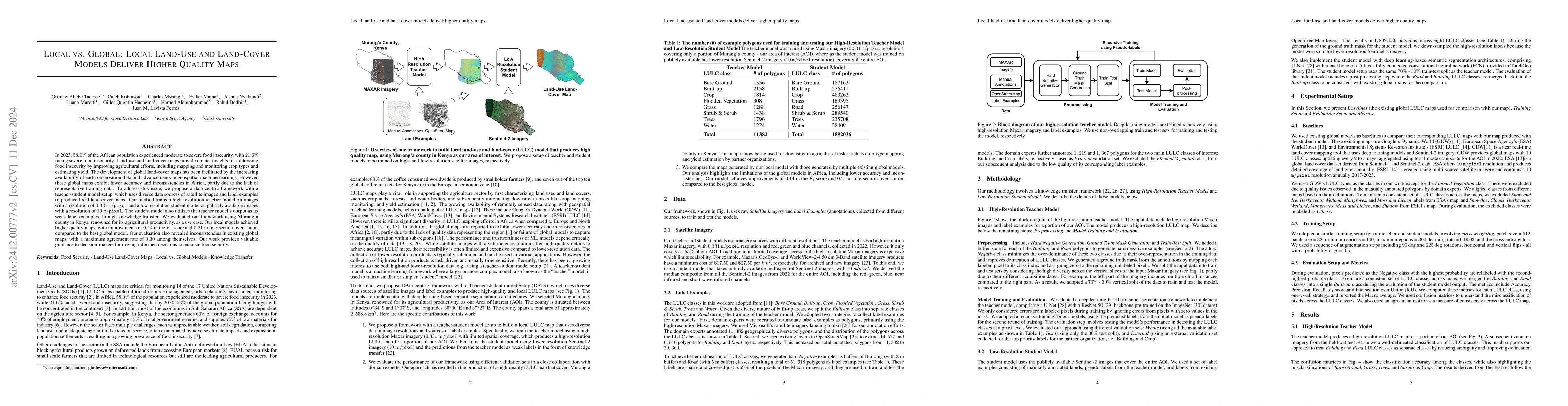
Approximately 20% of Africa's population suffered from undernourishment, and 868 million people experienced moderate to severe food insecurity in 2022. Land-use and land-cover maps provide crucial ins...

Thumbnail for GeoVision Labeler: Zero-Shot Geospatial Classification with Vision and
  Language Models

GeoVision Labeler: Zero-Shot Geospatial Classification with Vision and Language Models

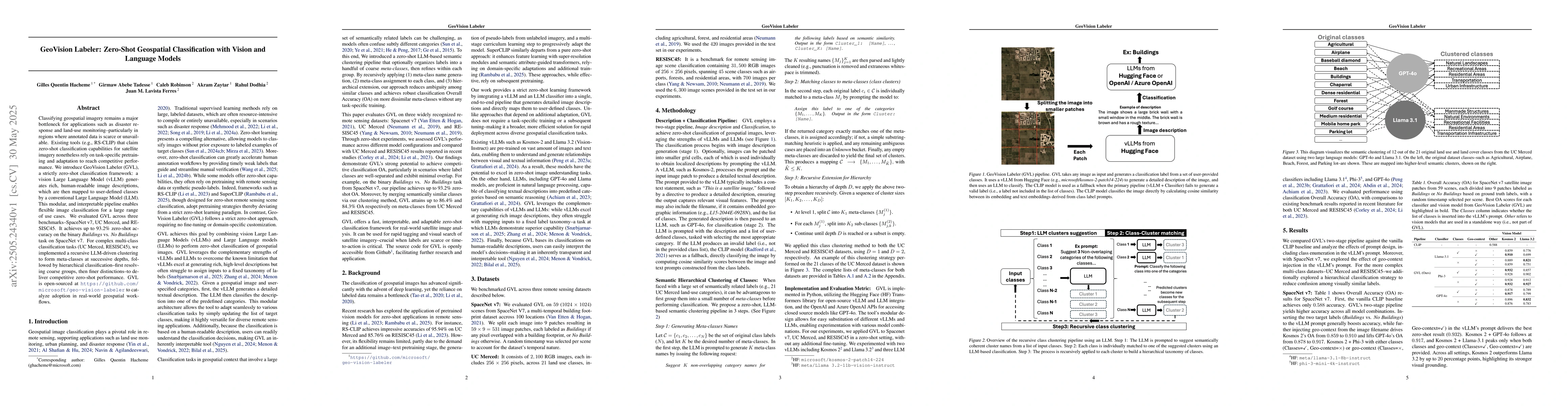
Classifying geospatial imagery remains a major bottleneck for applications such as disaster response and land-use monitoring-particularly in regions where annotated data is scarce or unavailable. Exis...

This website uses cookies to ensure you get the best experience. Learn more