Academic Profile
Statistics
Similar Authors
Papers on arXiv
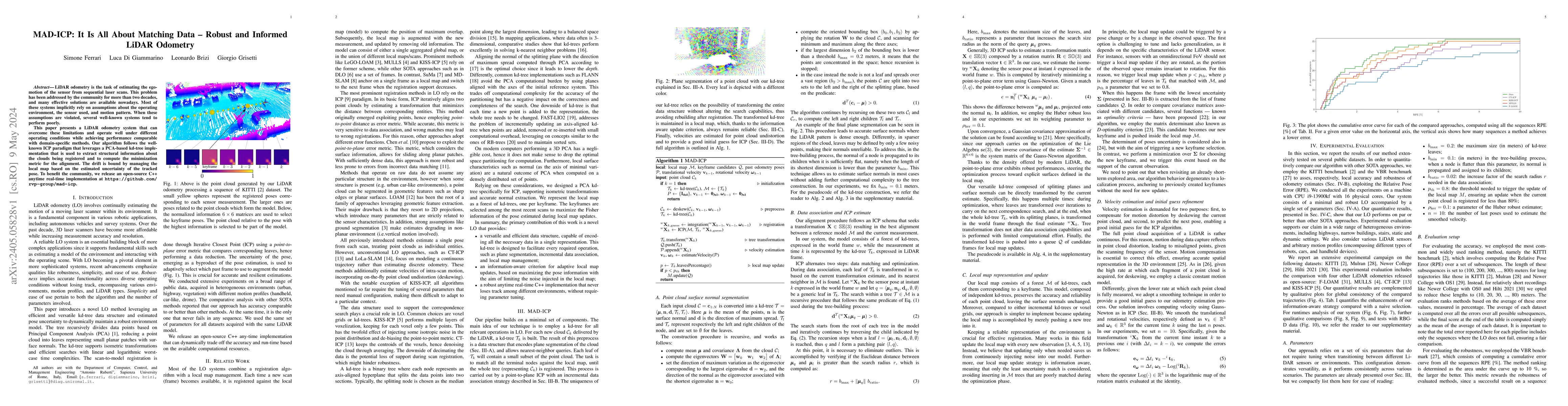
LiDAR odometry is the task of estimating the ego-motion of the sensor from sequential laser scans. This problem has been addressed by the community for more than two decades, and many effective solu...
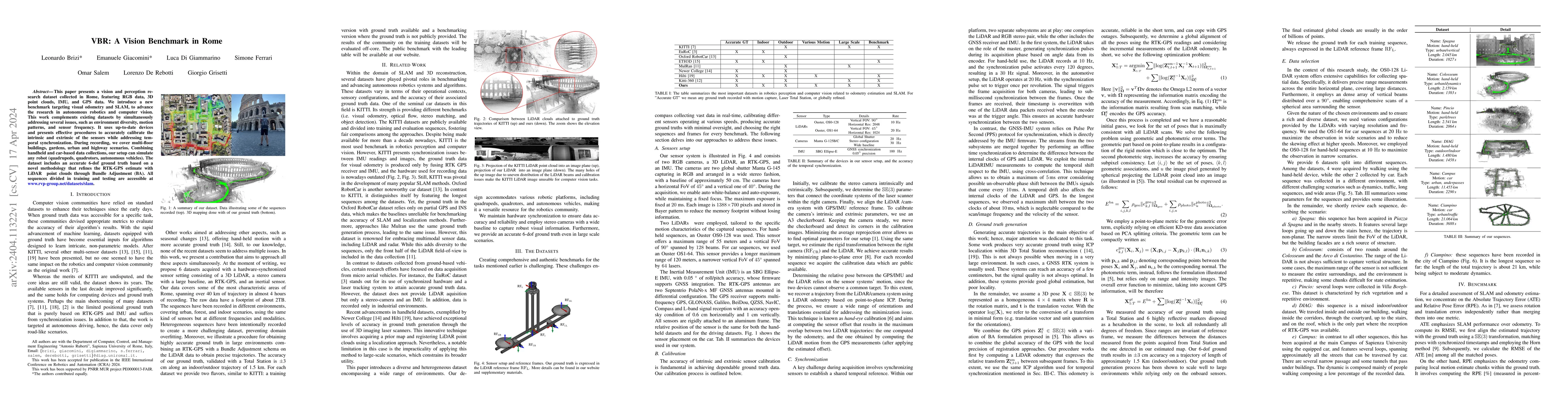
This paper presents a vision and perception research dataset collected in Rome, featuring RGB data, 3D point clouds, IMU, and GPS data. We introduce a new benchmark targeting visual odometry and SLA...
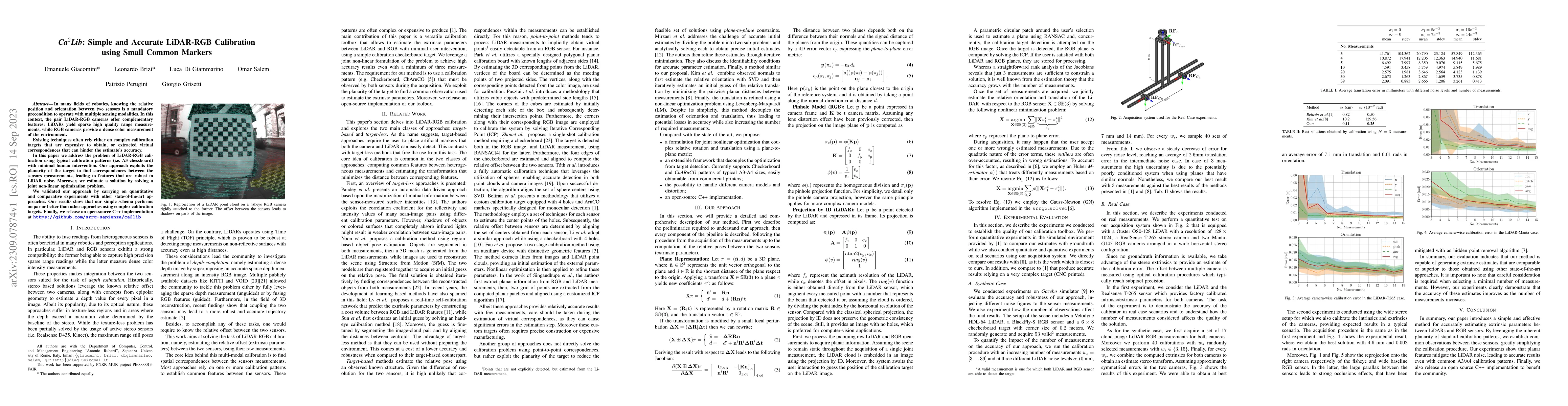
In many fields of robotics, knowing the relative position and orientation between two sensors is a mandatory precondition to operate with multiple sensing modalities. In this context, the pair LiDAR...
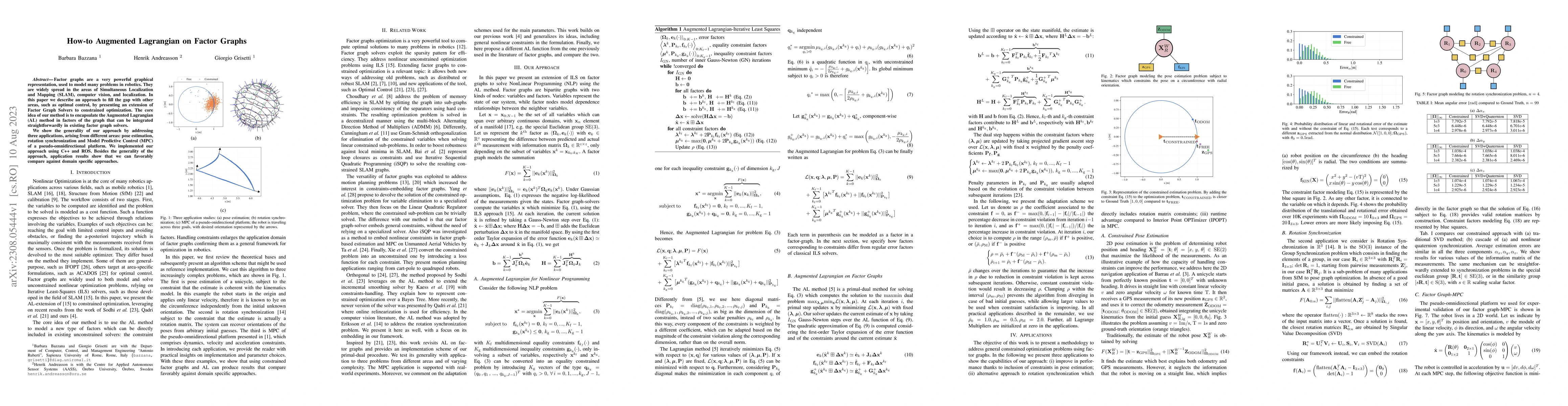
Factor graphs are a very powerful graphical representation, used to model many problems in robotics. They are widely spread in the areas of Simultaneous Localization and Mapping (SLAM), computer vis...
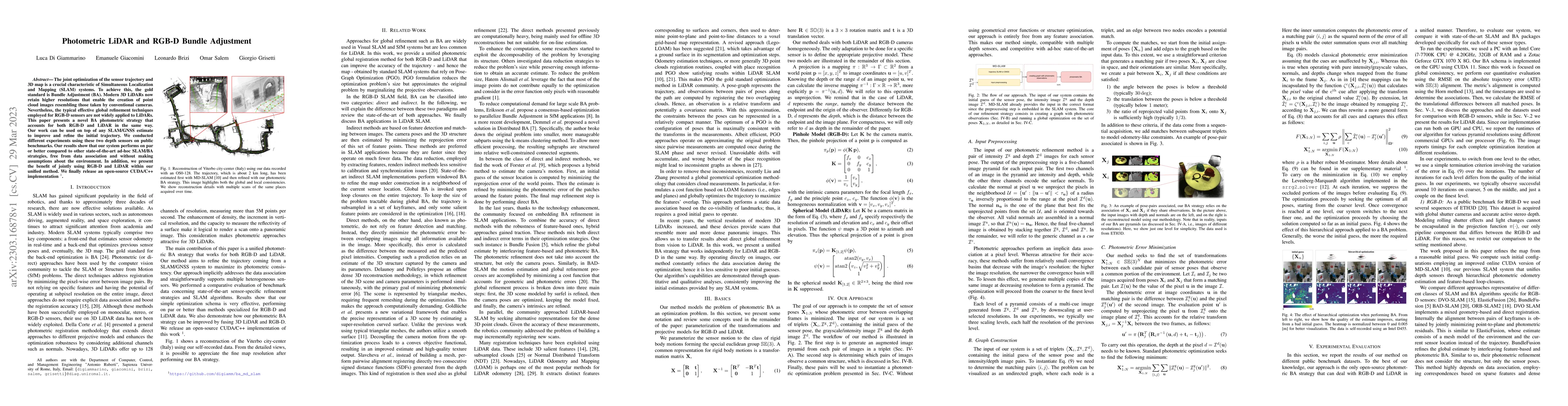
The joint optimization of the sensor trajectory and 3D map is a crucial characteristic of Simultaneous Localization and Mapping (SLAM) systems. To achieve this, the gold standard is Bundle Adjustmen...
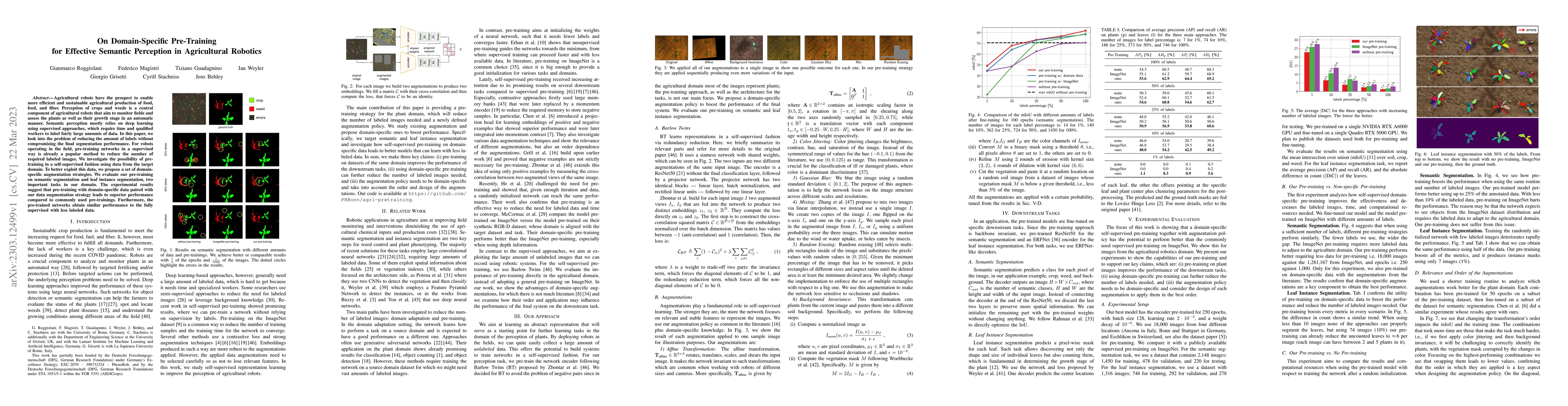
Agricultural robots have the prospect to enable more efficient and sustainable agricultural production of food, feed, and fiber. Perception of crops and weeds is a central component of agricultural ...
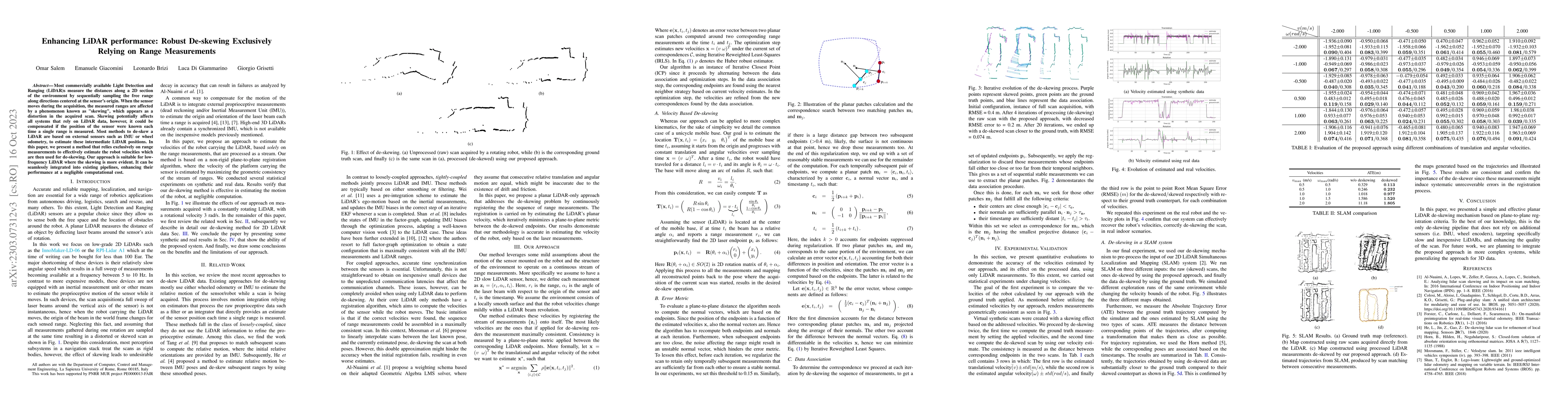
Most commercially available Light Detection and Ranging (LiDAR)s measure the distances along a 2D section of the environment by sequentially sampling the free range along directions centered at the ...
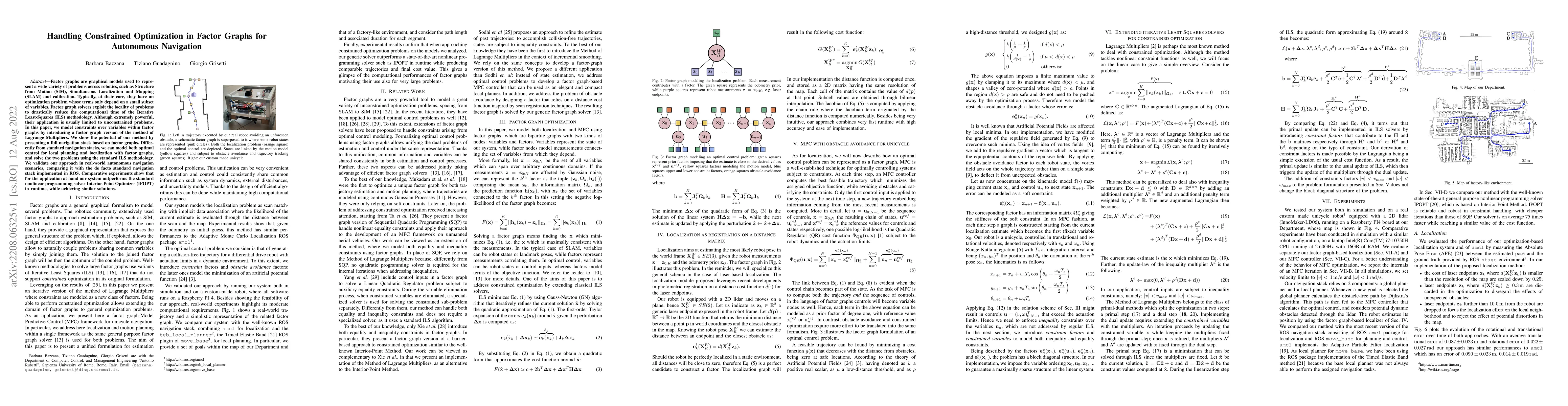
Factor graphs are graphical models used to represent a wide variety of problems across robotics, such as Structure from Motion (SfM), Simultaneous Localization and Mapping (SLAM) and calibration. Ty...
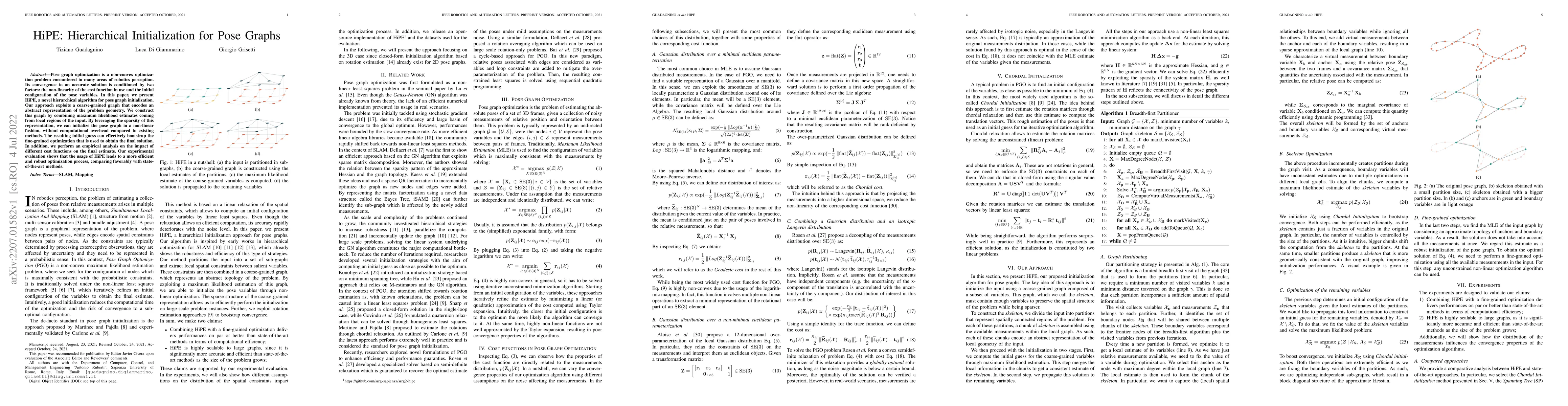
Pose graph optimization is a non-convex optimization problem encountered in many areas of robotics perception. Its convergence to an accurate solution is conditioned by two factors: the non-linearit...
A software architecture defines the blueprints of a large computational system, and is thus a crucial part of the design and development effort. This task has been explored extensively in the contex...
A sensor is a device that converts a physical parameter or an environmental characteristic (e.g., temperature, distance, speed, etc.) into a signal that can be digitally measured and processed to pe...
The state-of-the-art modern pose-graph optimization (PGO) systems are vertex based. In this context the number of variables might be high, albeit the number of cycles in the graph (loop closures) is...
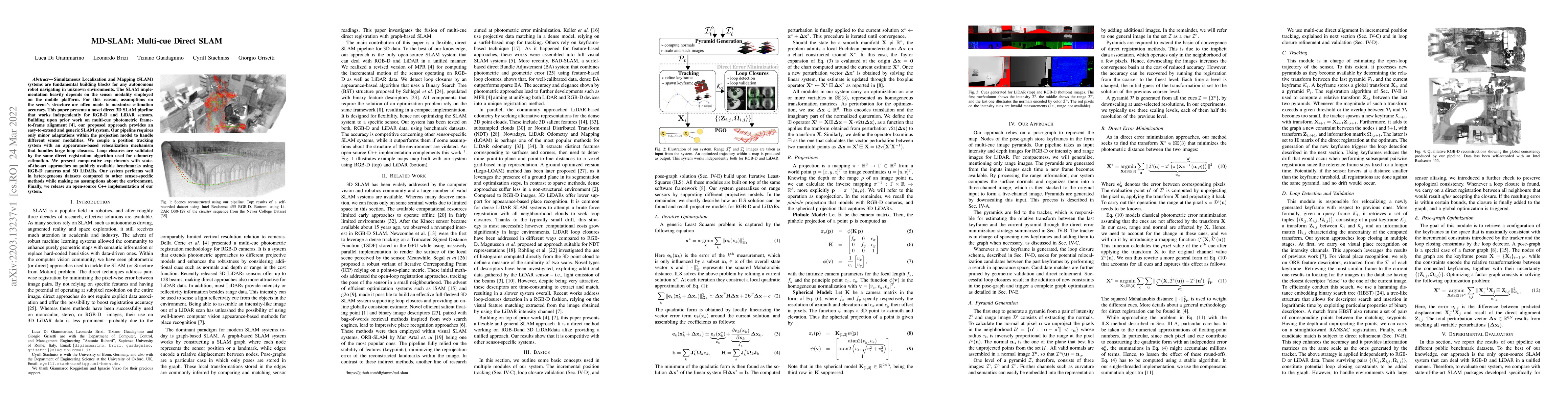
Simultaneous Localization and Mapping (SLAM) systems are fundamental building blocks for any autonomous robot navigating in unknown environments. The SLAM implementation heavily depends on the senso...
Robots and autonomous systems need to know where they are within a map to navigate effectively. Thus, simultaneous localization and mapping or SLAM is a common building block of robot navigation sys...
Nowadays, Non-Linear Least-Squares embodies the foundation of many Robotics and Computer Vision systems. The research community deeply investigated this topic in the last years, and this resulted in...
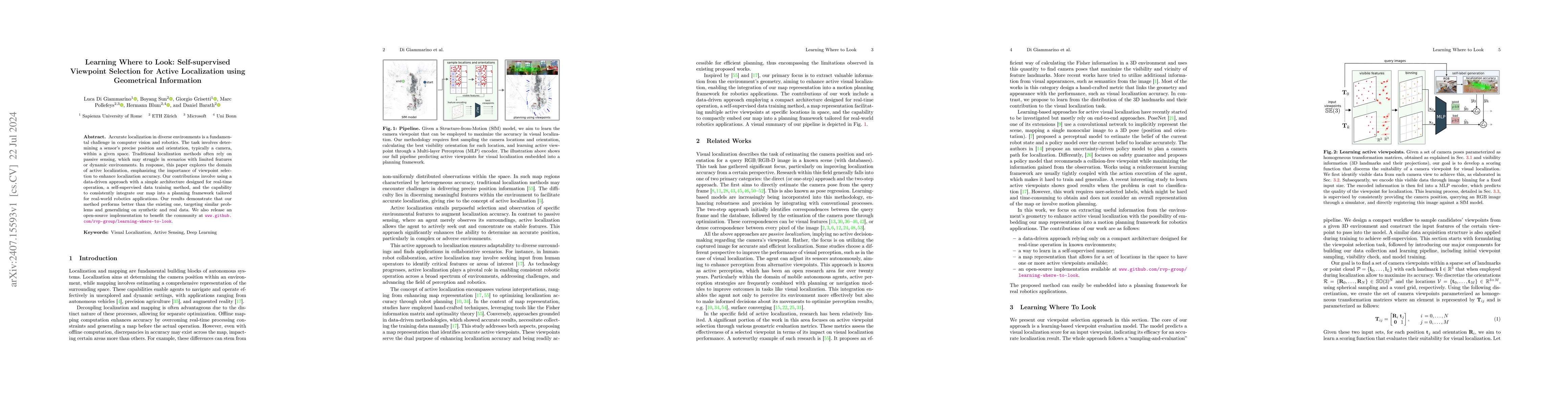
Accurate localization in diverse environments is a fundamental challenge in computer vision and robotics. The task involves determining a sensor's precise position and orientation, typically a camera,...
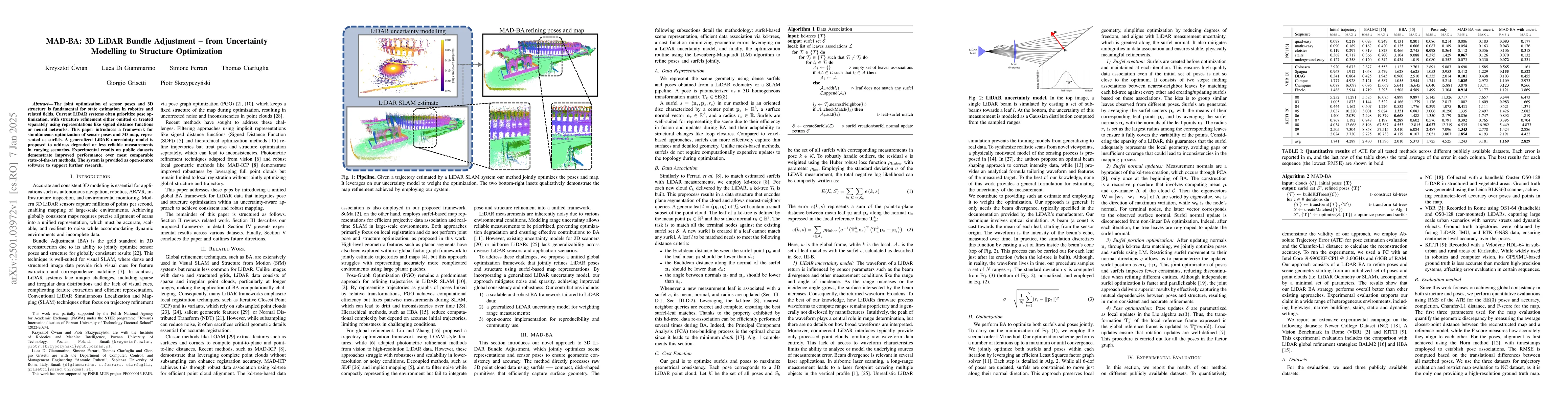
The joint optimization of sensor poses and 3D structure is fundamental for state estimation in robotics and related fields. Current LiDAR systems often prioritize pose optimization, with structure ref...
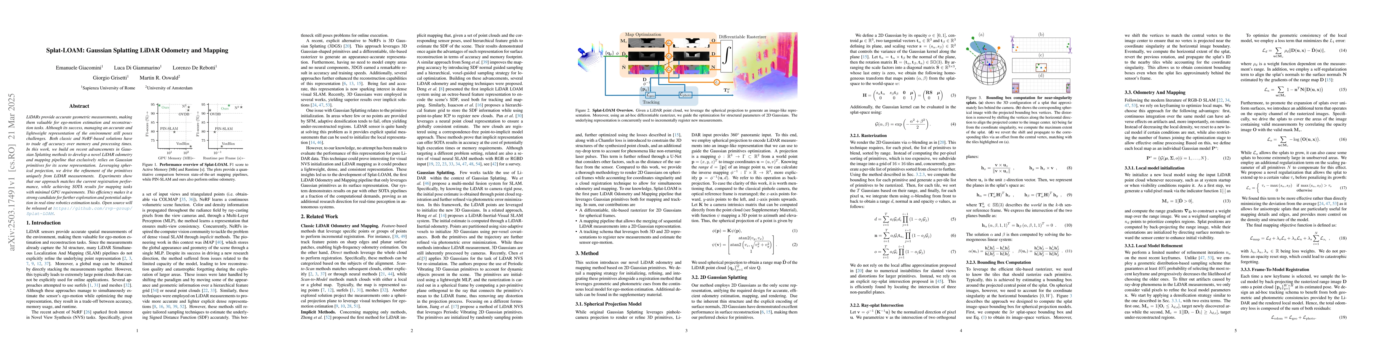
LiDARs provide accurate geometric measurements, making them valuable for ego-motion estimation and reconstruction tasks. Although its success, managing an accurate and lightweight representation of th...
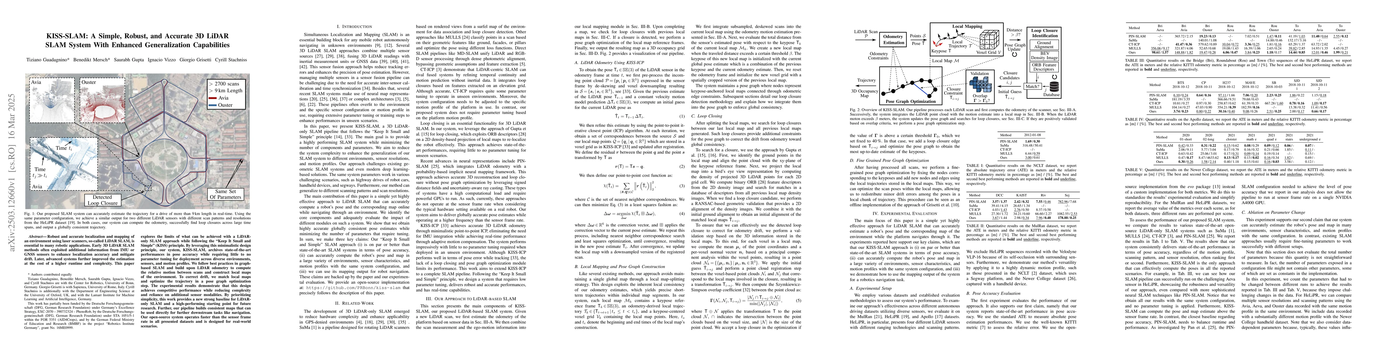
Robust and accurate localization and mapping of an environment using laser scanners, so-called LiDAR SLAM, is essential to many robotic applications. Early 3D LiDAR SLAM methods often exploited additi...
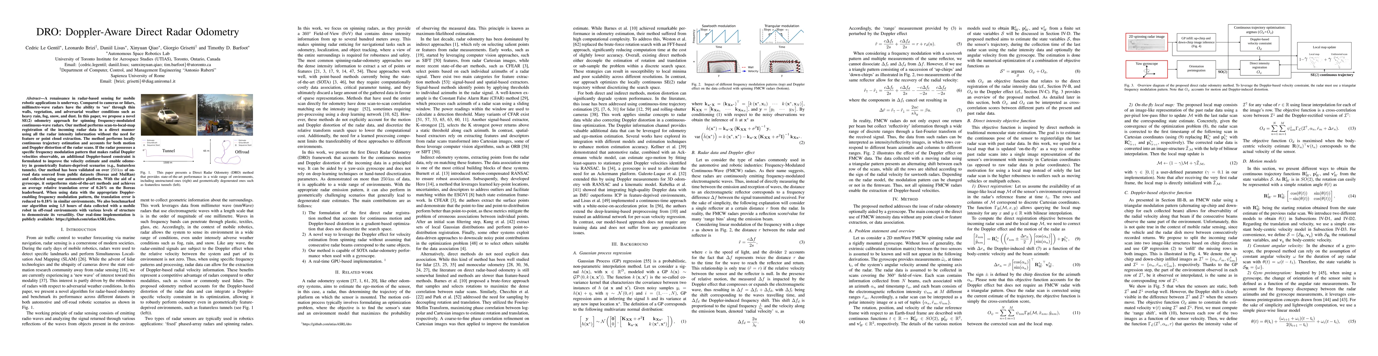
A renaissance in radar-based sensing for mobile robotic applications is underway. Compared to cameras or lidars, millimetre-wave radars have the ability to `see' through thin walls, vegetation, and ad...
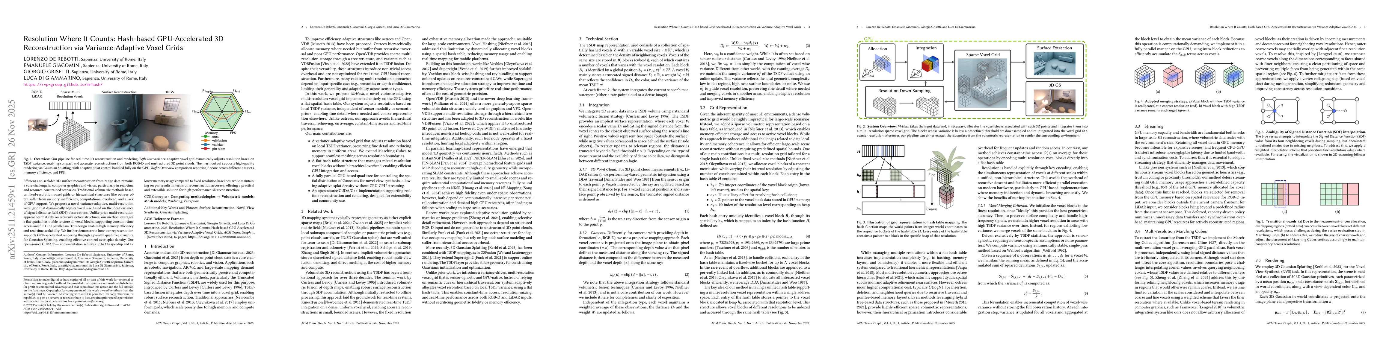
Efficient and scalable 3D surface reconstruction from range data remains a core challenge in computer graphics and vision, particularly in real-time and resource-constrained scenarios. Traditional vol...
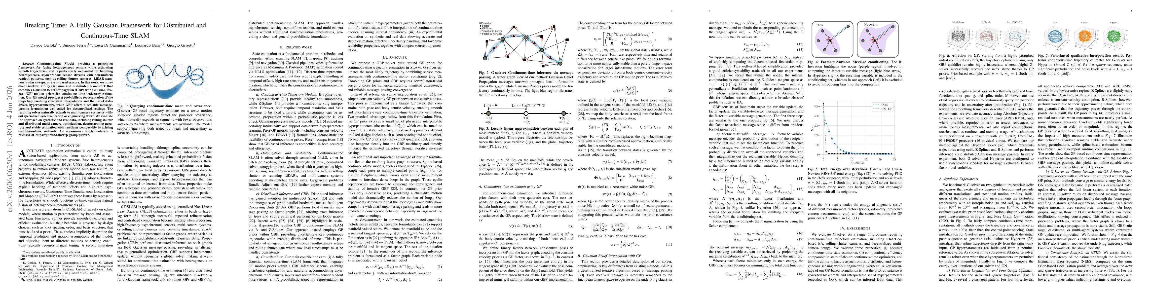
Continuous-time SLAM provides a principled framework for fusing heterogeneous sensors while estimating smooth trajectories, and is particularly well-suited for handling heterogeneous, asynchronous sen...