Academic Profile
Statistics
Similar Authors
Papers on arXiv
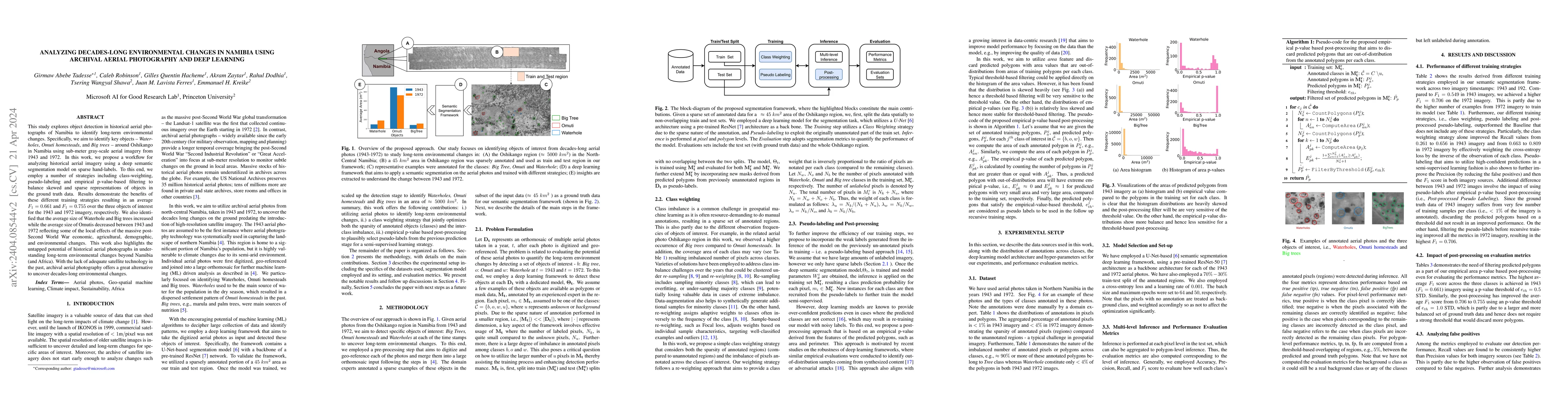
This study explores object detection in historical aerial photographs of Namibia to identify long-term environmental changes. Specifically, we aim to identify key objects -- Waterholes, Omuti homest...
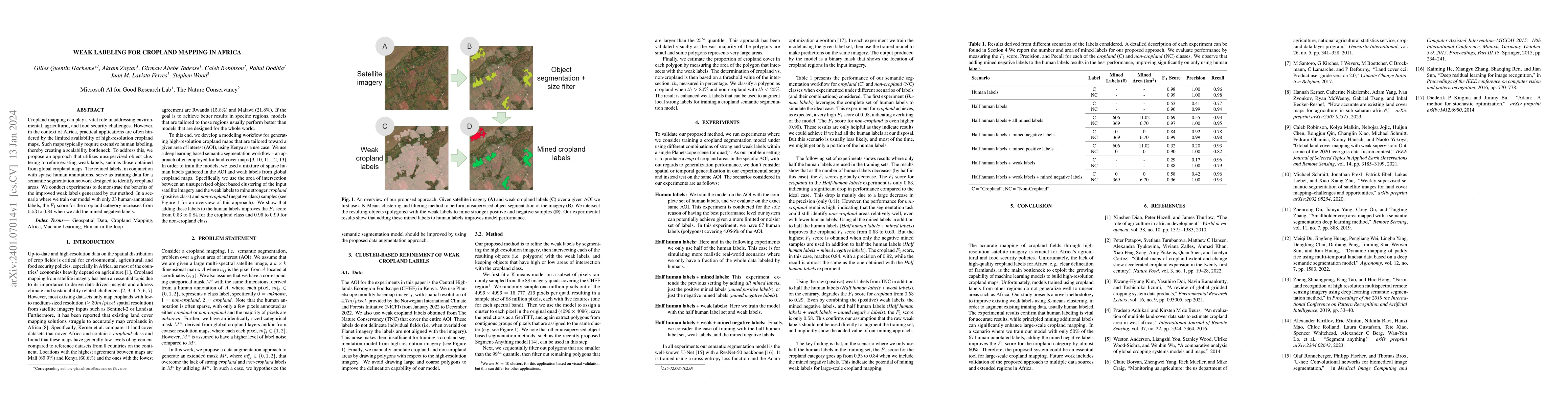
Cropland mapping can play a vital role in addressing environmental, agricultural, and food security challenges. However, in the context of Africa, practical applications are often hindered by the li...
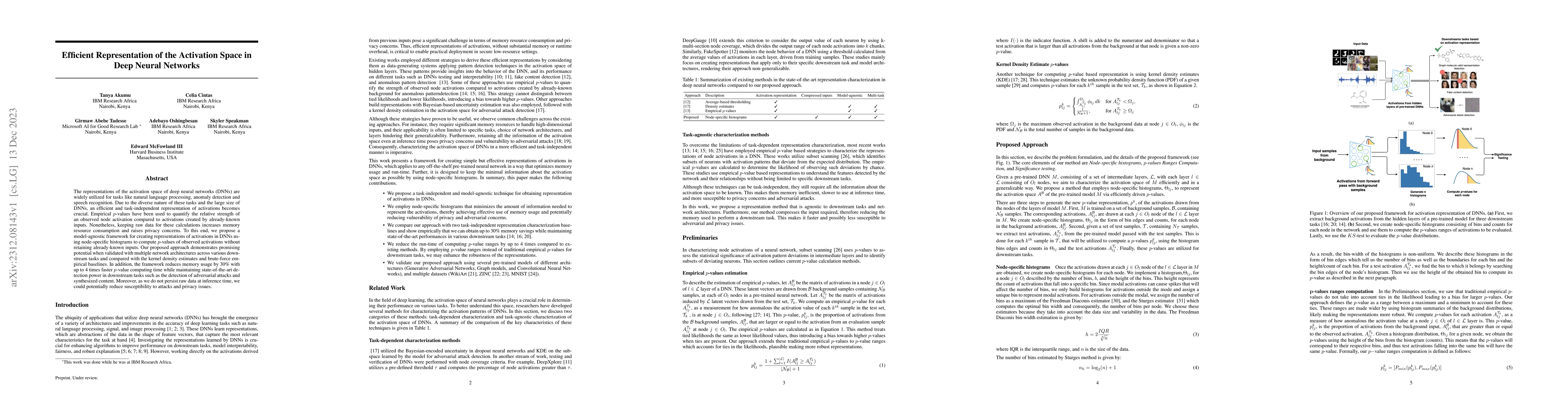
The representations of the activation space of deep neural networks (DNNs) are widely utilized for tasks like natural language processing, anomaly detection and speech recognition. Due to the divers...
Drawing from discussions at the inaugural DMLR workshop at ICML 2023 and meetings prior, in this report we outline the relevance of community engagement and infrastructure development for the creati...
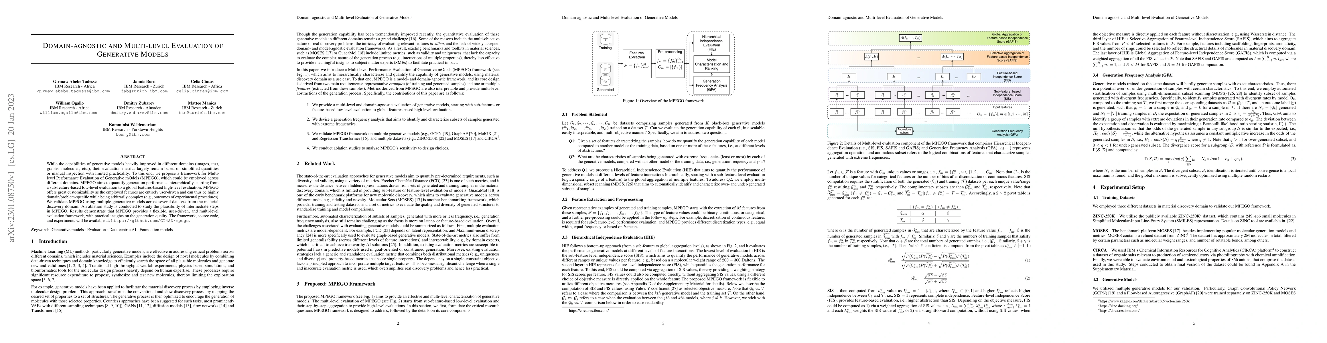
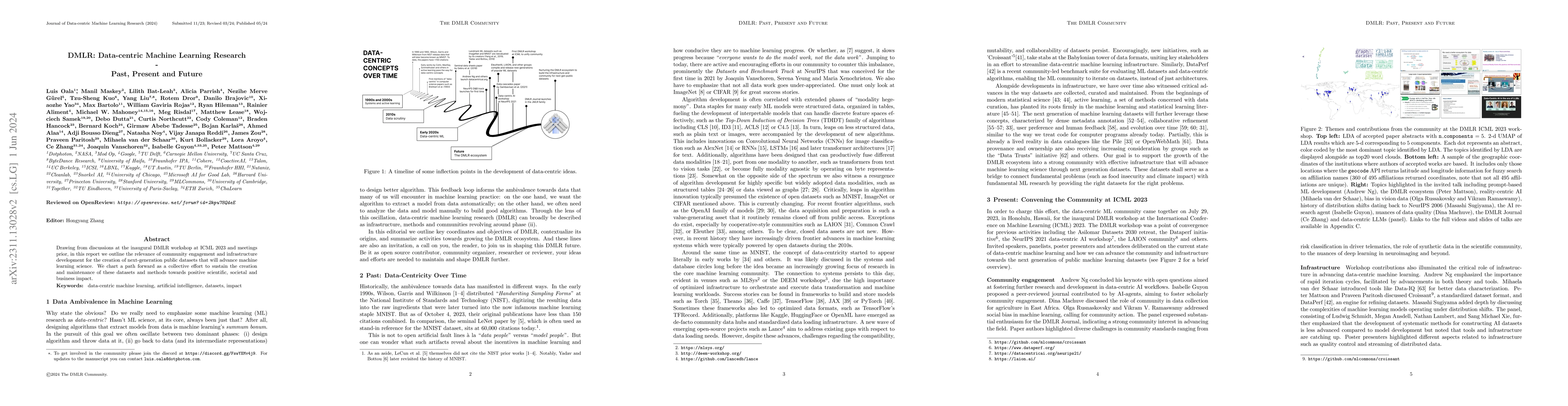
While the capabilities of generative models heavily improved in different domains (images, text, graphs, molecules, etc.), their evaluation metrics largely remain based on simplified quantities or m...
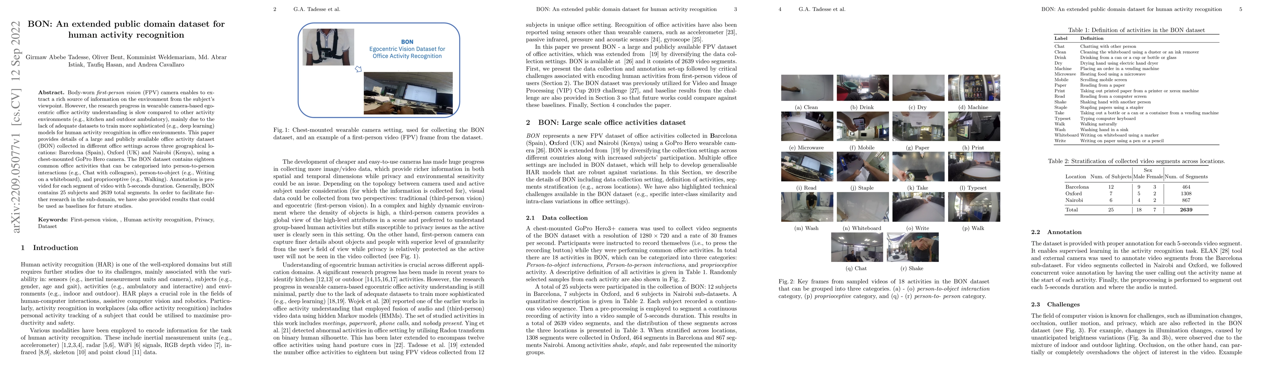
Body-worn first-person vision (FPV) camera enables to extract a rich source of information on the environment from the subject's viewpoint. However, the research progress in wearable camera-based eg...
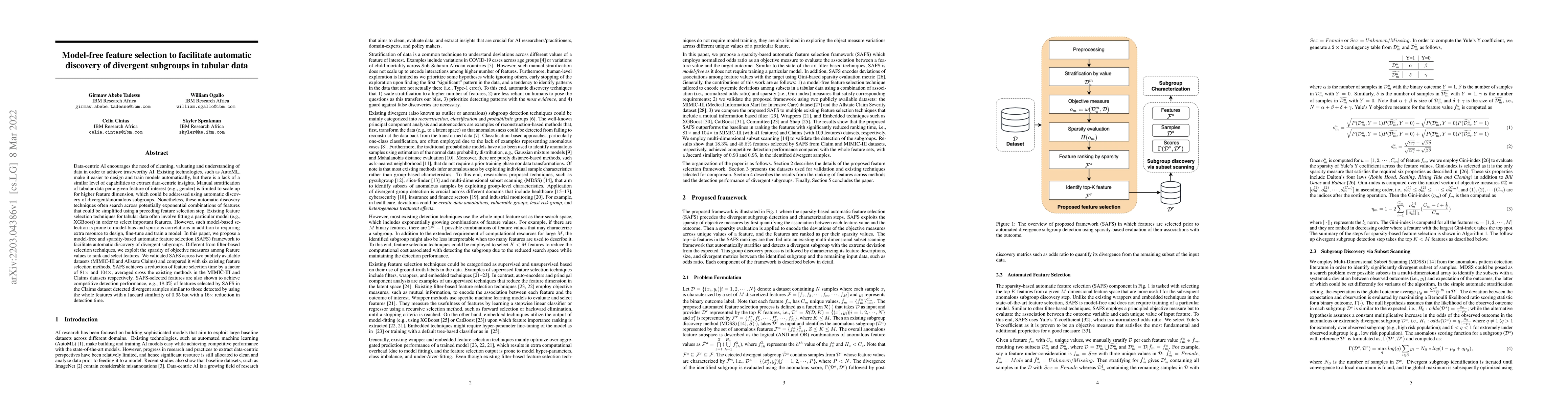
Data-centric AI encourages the need of cleaning and understanding of data in order to achieve trustworthy AI. Existing technologies, such as AutoML, make it easier to design and train models automat...
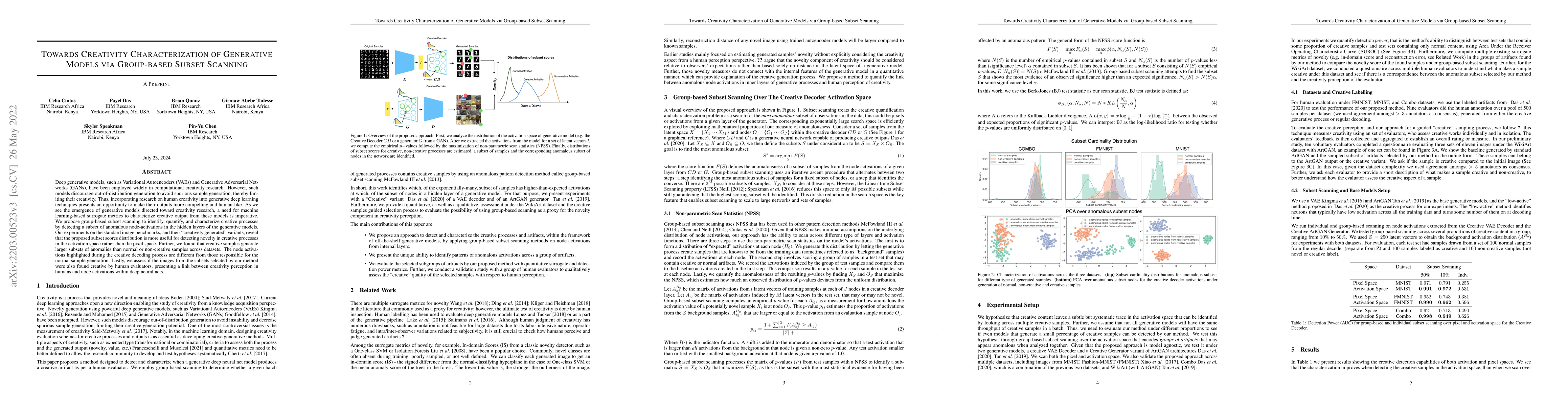
Deep generative models, such as Variational Autoencoders (VAEs) and Generative Adversarial Networks (GANs), have been employed widely in computational creativity research. However, such models disco...
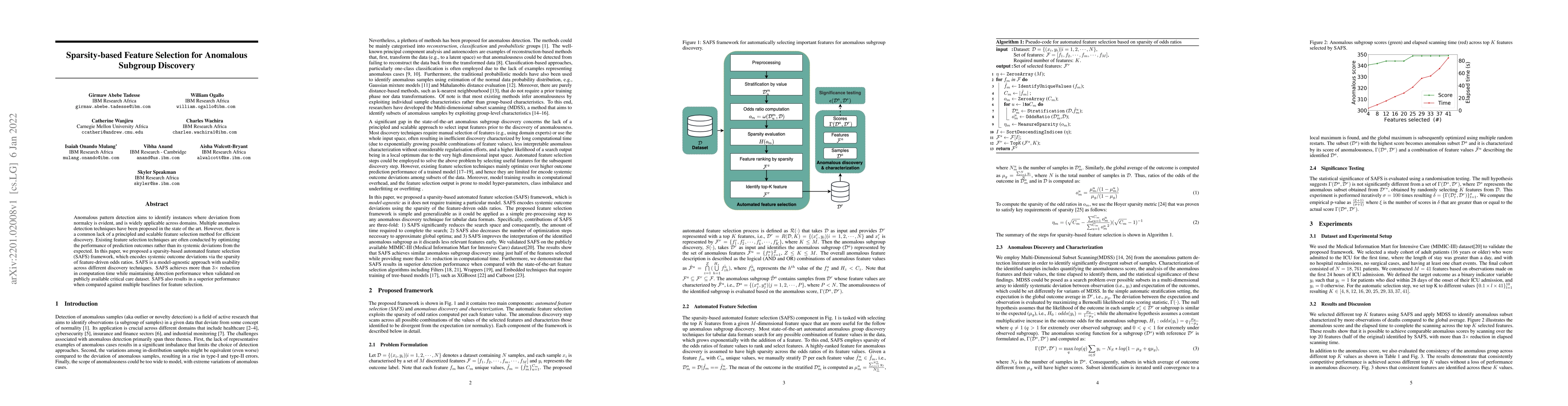
Anomalous pattern detection aims to identify instances where deviation from normalcy is evident, and is widely applicable across domains. Multiple anomalous detection techniques have been proposed i...
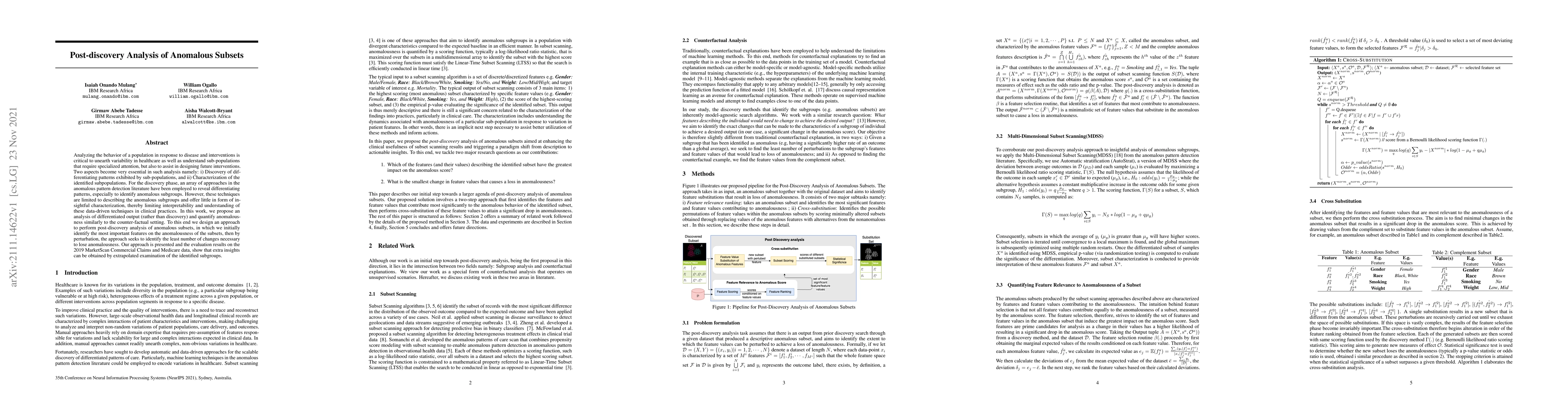
Analyzing the behaviour of a population in response to disease and interventions is critical to unearth variability in healthcare as well as understand sub-populations that require specialized atten...
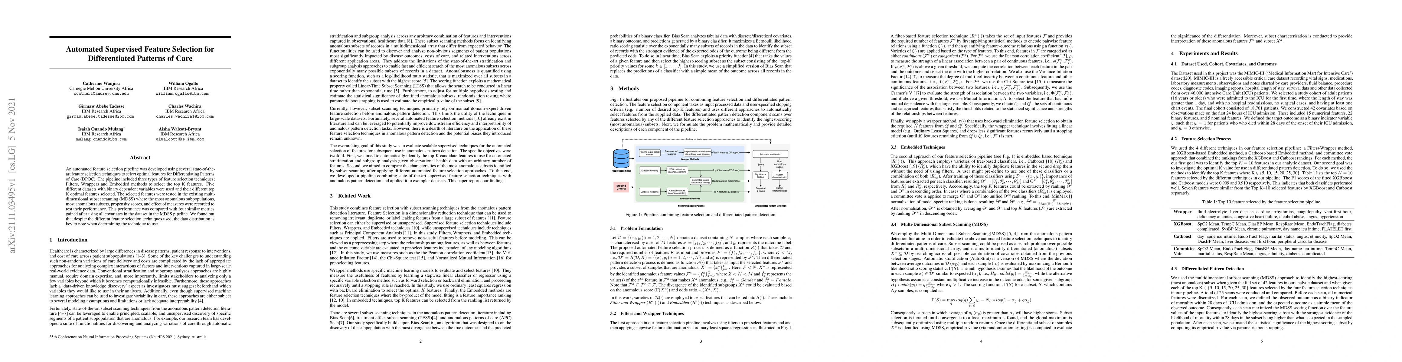
An automated feature selection pipeline was developed using several state-of-the-art feature selection techniques to select optimal features for Differentiating Patterns of Care (DPOC). The pipeline...
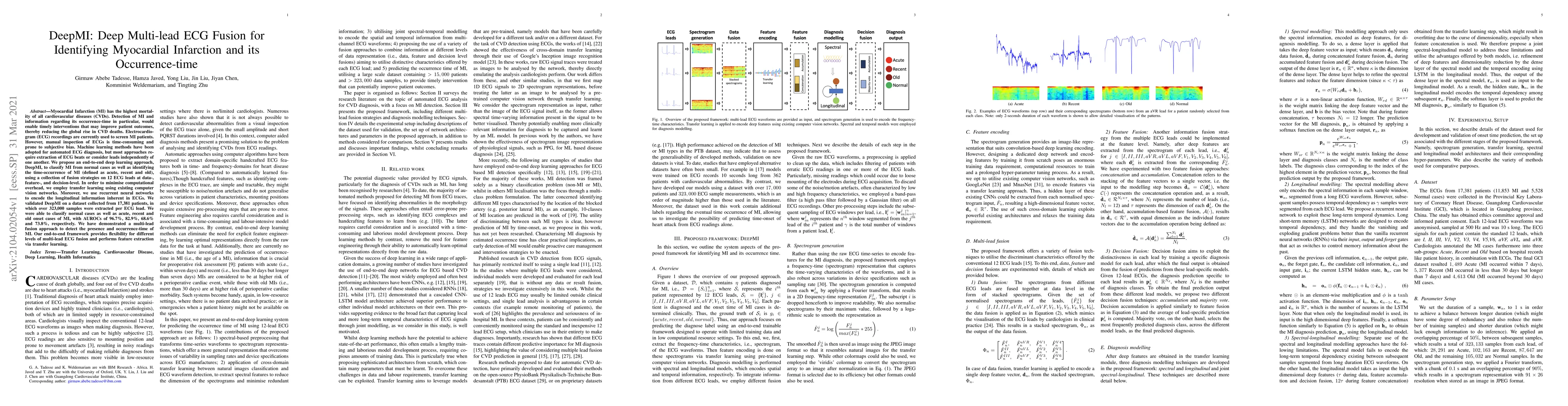
Myocardial Infarction (MI) has the highest mortality of all cardiovascular diseases (CVDs). Detection of MI and information regarding its occurrence-time in particular, would enable timely intervent...
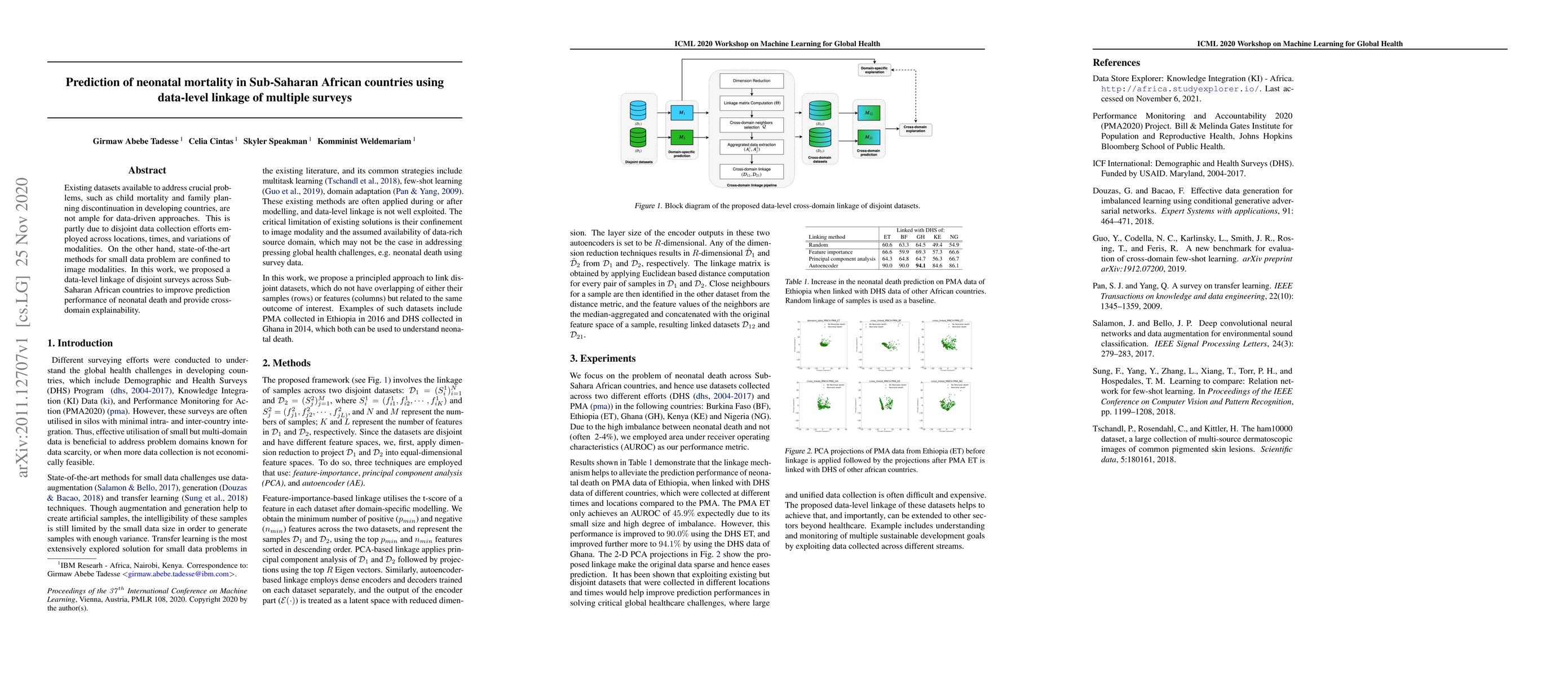
Existing datasets available to address crucial problems, such as child mortality and family planning discontinuation in developing countries, are not ample for data-driven approaches. This is partly...
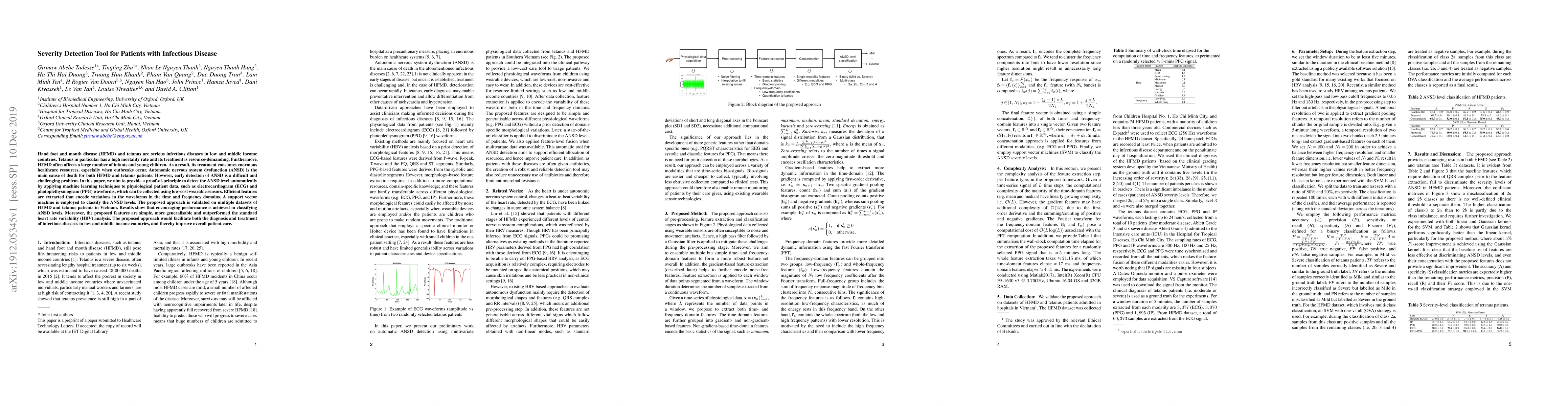
Hand, foot and mouth disease (HFMD) and tetanus are serious infectious diseases in low and middle income countries. Tetanus in particular has a high mortality rate and its treatment is resource-dema...
This white paper is the output of a multidisciplinary workshop in Nairobi (Nov 2023). Led by a cross-organisational team including Microsoft Research, NEPAD, Lelapa AI, and University of Oxford. The w...
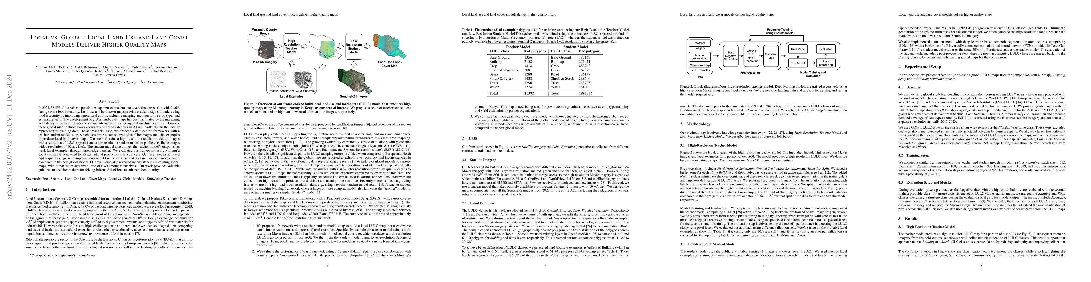
Approximately 20% of Africa's population suffered from undernourishment, and 868 million people experienced moderate to severe food insecurity in 2022. Land-use and land-cover maps provide crucial ins...
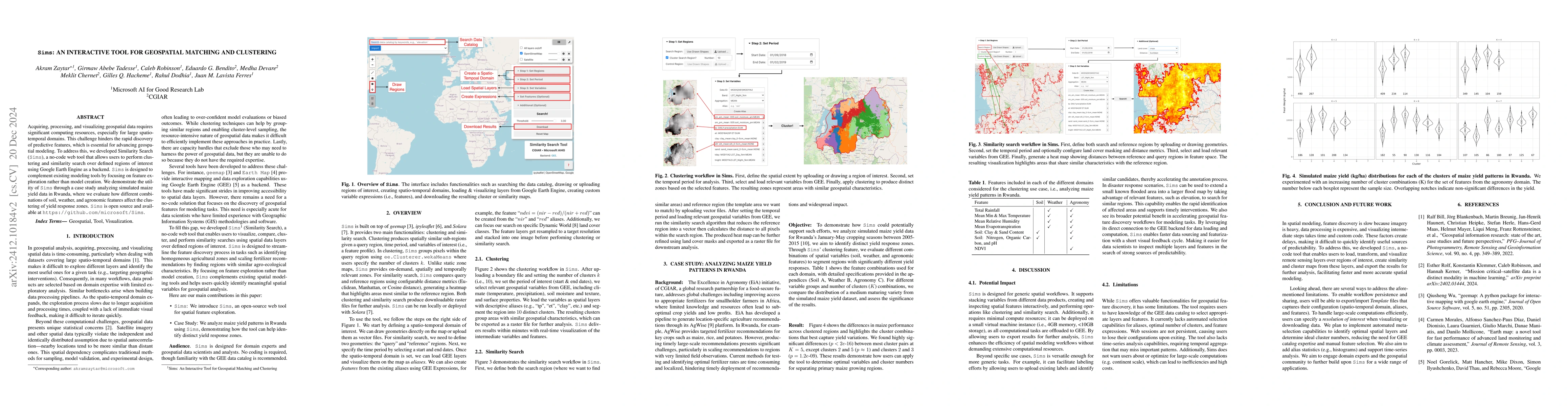
Acquiring, processing, and visualizing geospatial data requires significant computing resources, especially for large spatio-temporal domains. This challenge hinders the rapid discovery of predictive ...
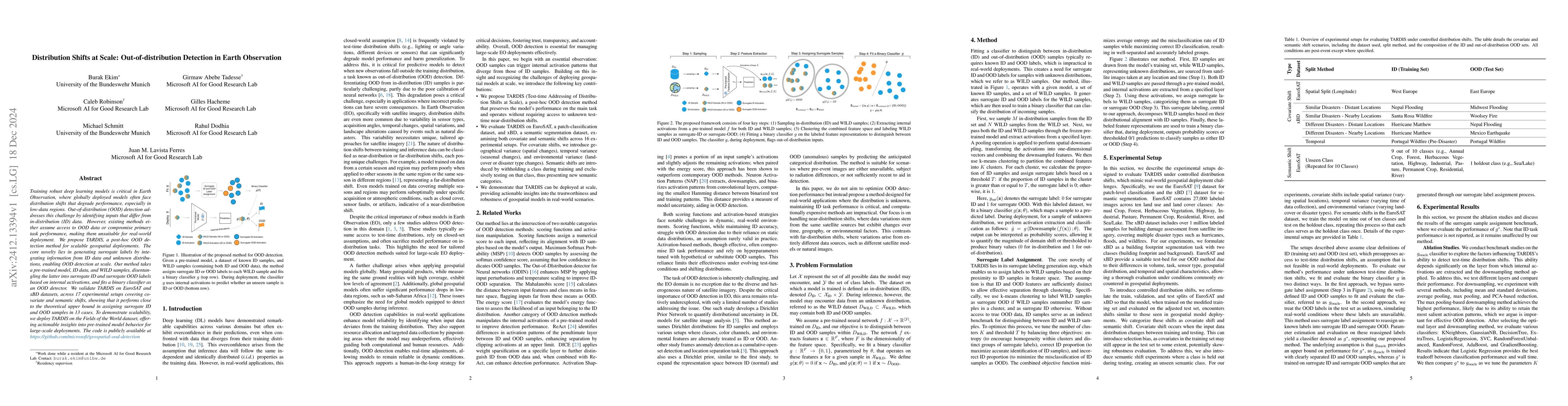
Training robust deep learning models is critical in Earth Observation, where globally deployed models often face distribution shifts that degrade performance, especially in low-data regions. Out-of-di...
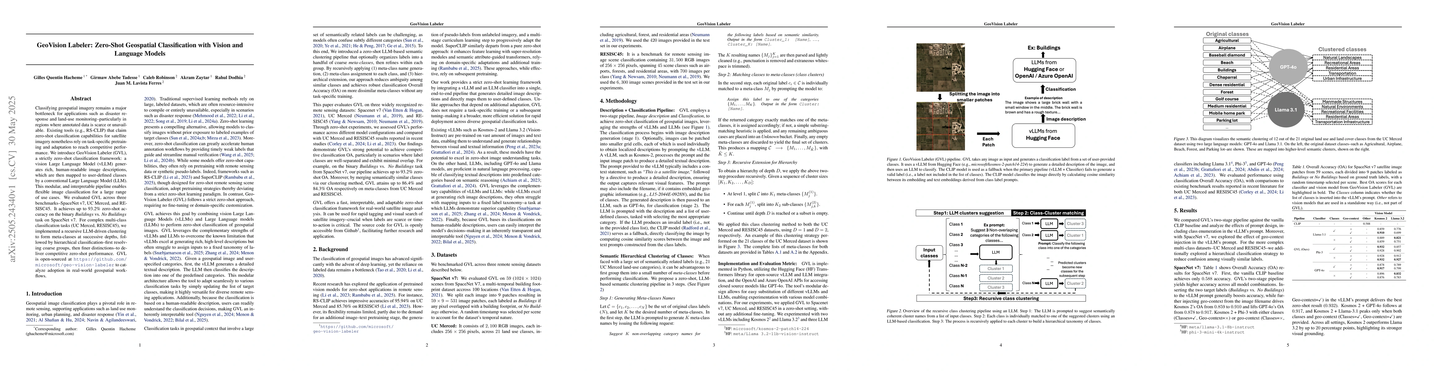
Classifying geospatial imagery remains a major bottleneck for applications such as disaster response and land-use monitoring-particularly in regions where annotated data is scarce or unavailable. Exis...
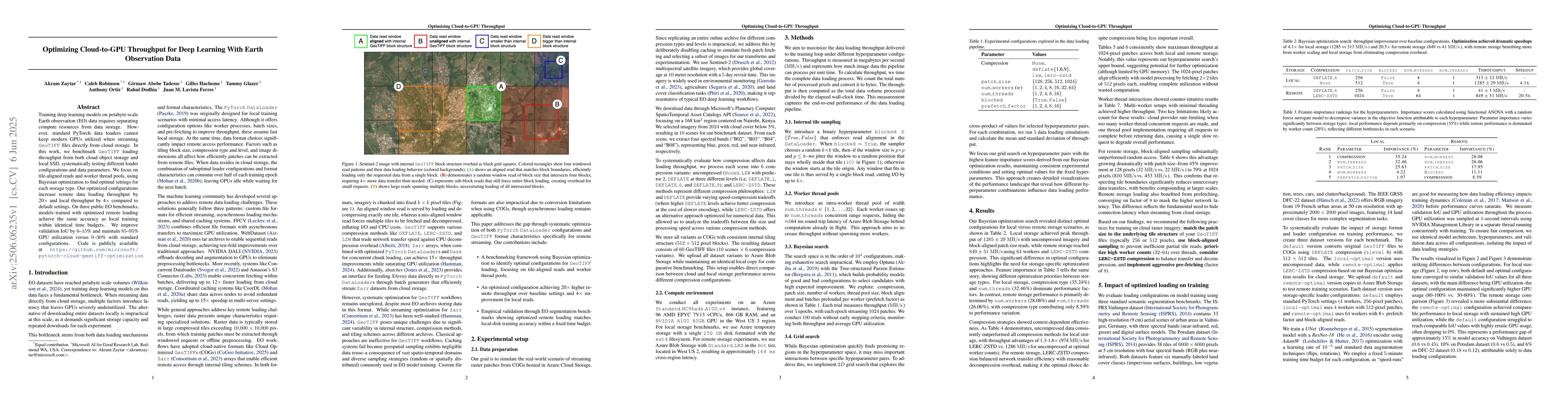
Training deep learning models on petabyte-scale Earth observation (EO) data requires separating compute resources from data storage. However, standard PyTorch data loaders cannot keep modern GPUs util...
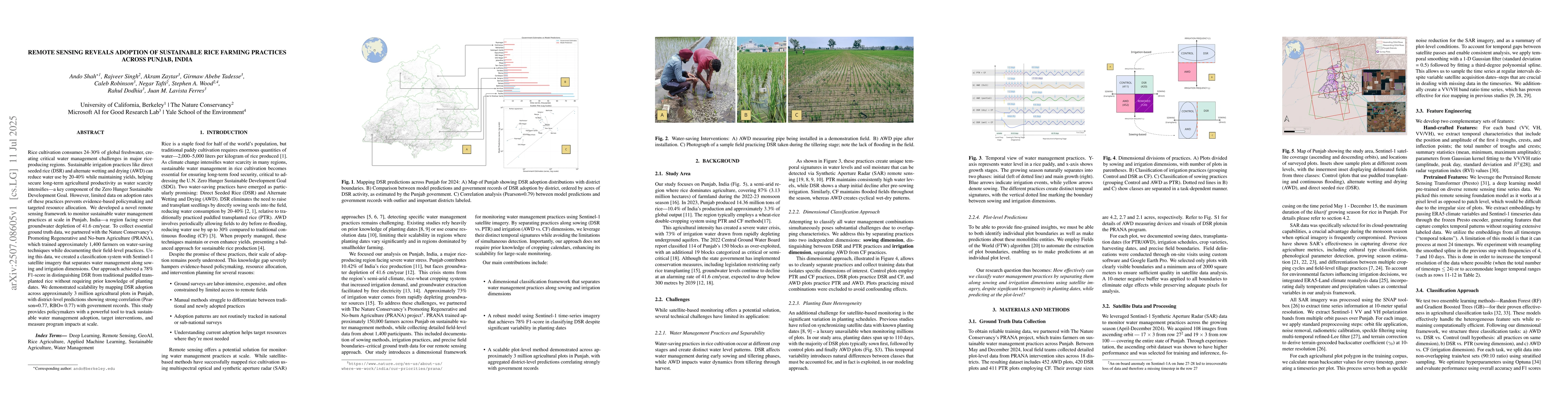
Rice cultivation consumes 24-30% of global freshwater, creating critical water management challenges in major rice-producing regions. Sustainable irrigation practices like direct seeded rice (DSR) and...
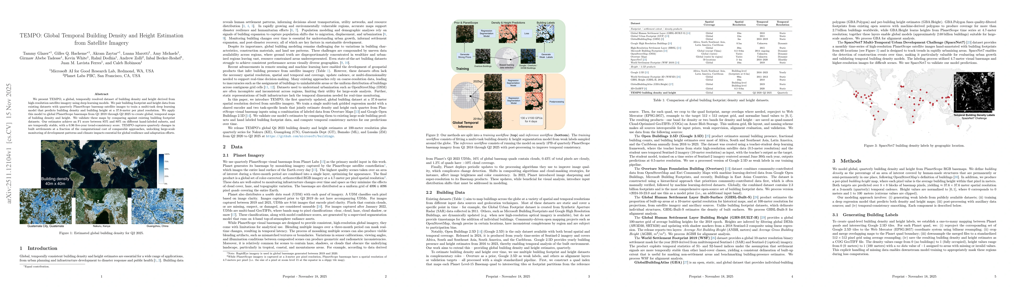
We present TEMPO, a global, temporally resolved dataset of building density and height derived from high-resolution satellite imagery using deep learning models. We pair building footprint and height ...
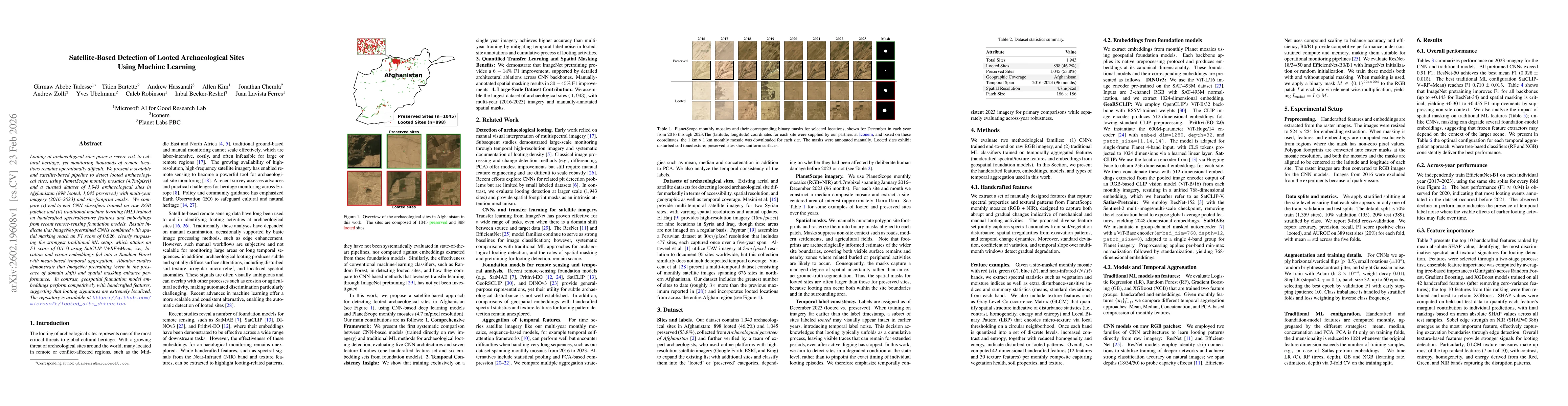
Looting at archaeological sites poses a severe risk to cultural heritage, yet monitoring thousands of remote locations remains operationally difficult. We present a scalable and satellite-based pipeli...
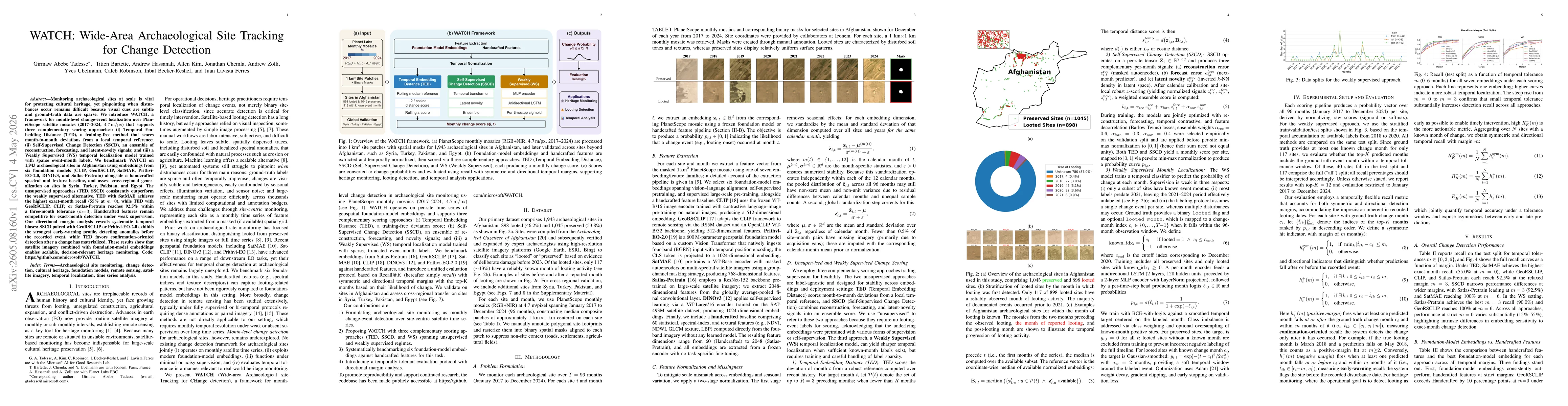
Monitoring archaeological sites at scale is vital for protecting cultural heritage, yet pinpointing when disturbances occur remains difficult because visual cues are subtle and ground-truth data are s...