Academic Profile
Statistics
Similar Authors
Papers on arXiv
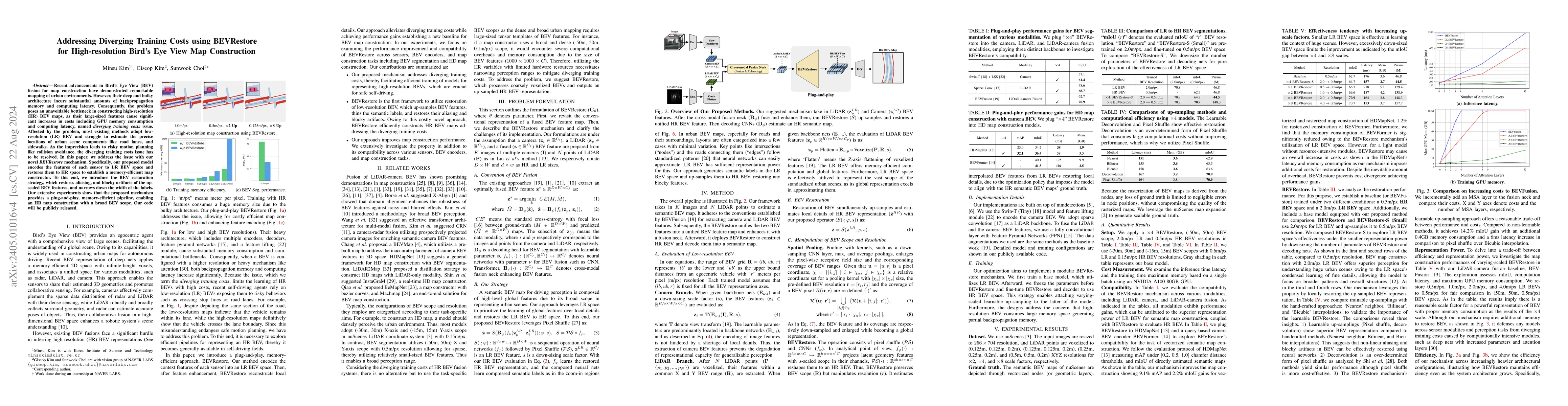
Recent advancements in Bird's Eye View (BEV) fusion for map construction have demonstrated remarkable mapping of urban environments. However, their deep and bulky architecture incurs substantial amo...
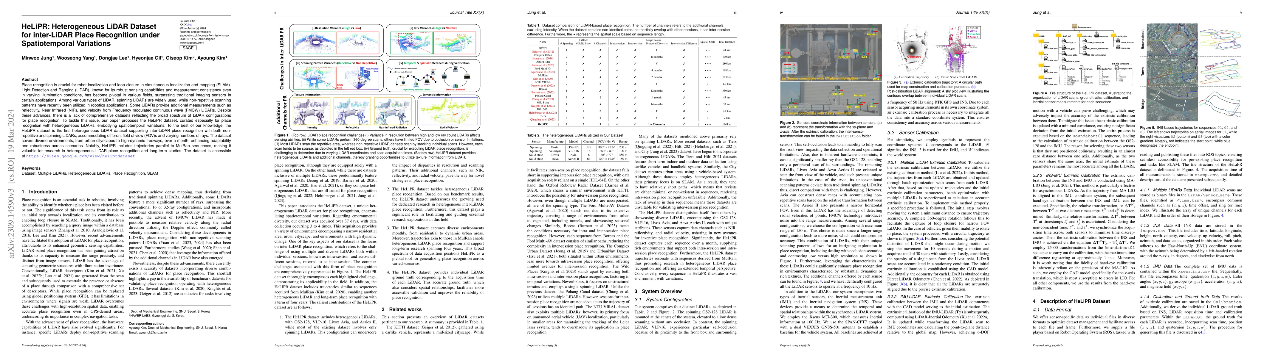
Place recognition is crucial for robot localization and loop closure in simultaneous localization and mapping (SLAM). Light Detection and Ranging (LiDAR), known for its robust sensing capabilities a...
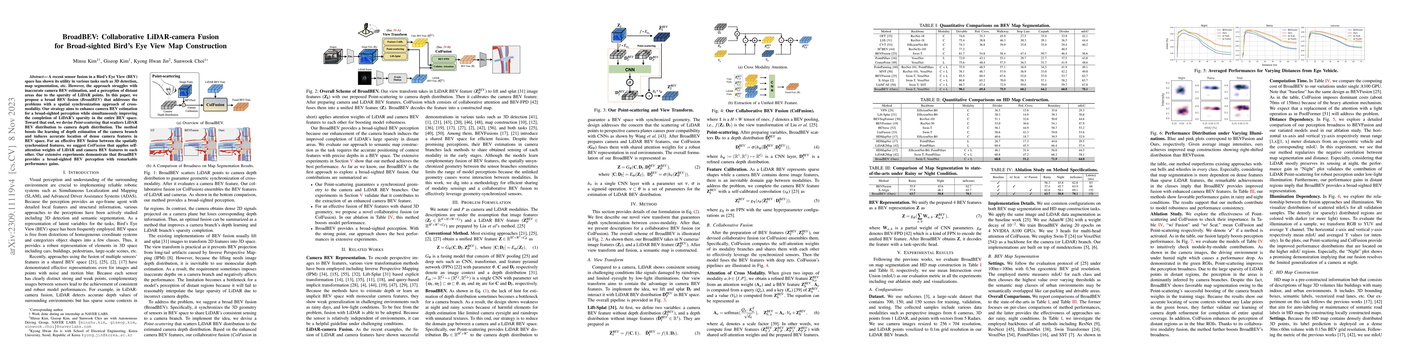
A recent sensor fusion in a Bird's Eye View (BEV) space has shown its utility in various tasks such as 3D detection, map segmentation, etc. However, the approach struggles with inaccurate camera BEV...
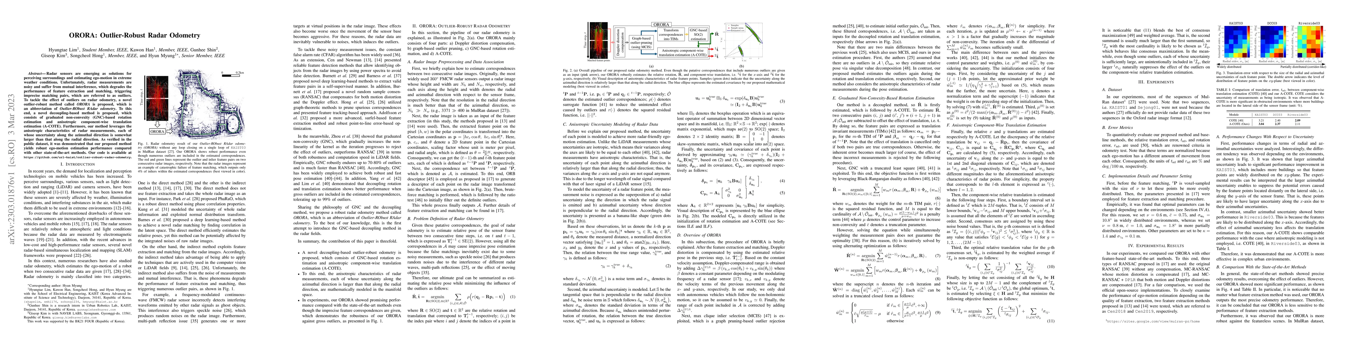
Radar sensors are emerging as solutions for perceiving surroundings and estimating ego-motion in extreme weather conditions. Unfortunately, radar measurements are noisy and suffer from mutual interf...
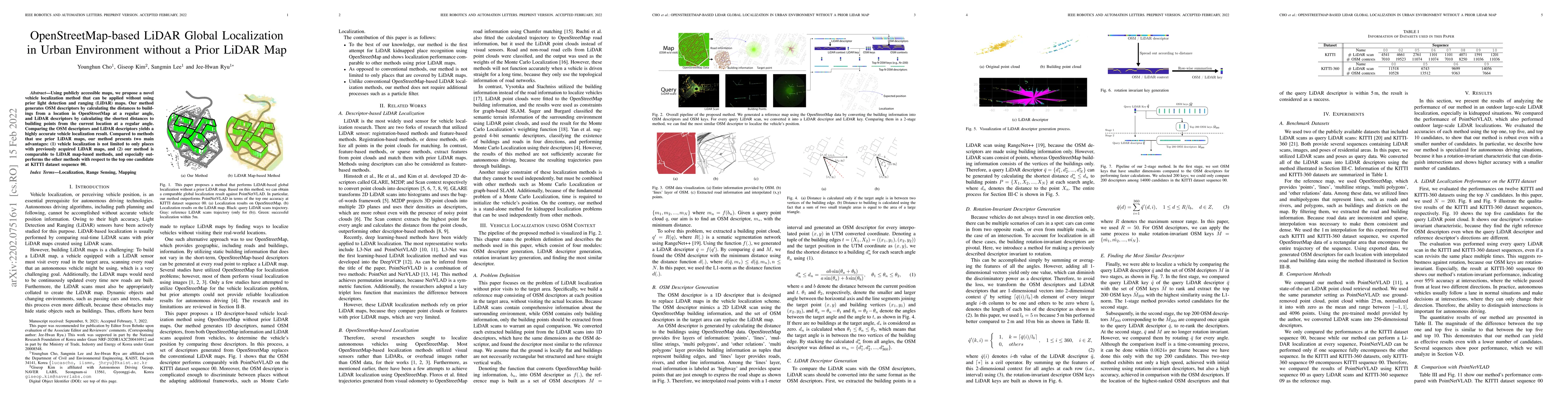
Using publicly accessible maps, we propose a novel vehicle localization method that can be applied without using prior light detection and ranging (LiDAR) maps. Our method generates OSM descriptors ...
Accurate 3D point cloud map generation is a core task for various robot missions or even for data-driven urban analysis. To do so, light detection and ranging (LiDAR) sensor-based simultaneous local...
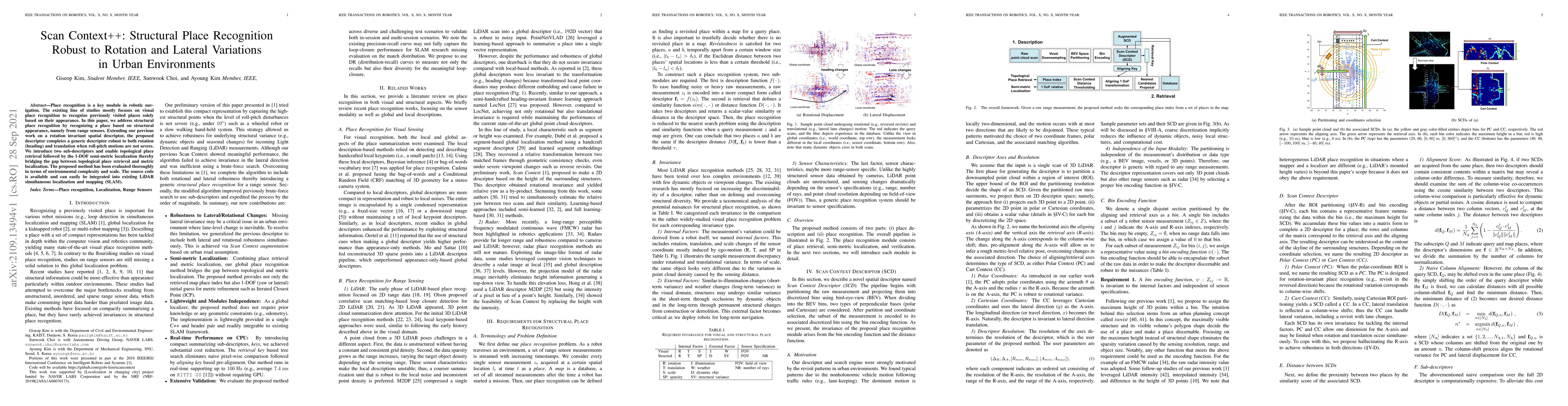
Place recognition is a key module in robotic navigation. The existing line of studies mostly focuses on visual place recognition to recognize previously visited places solely based on their appearan...
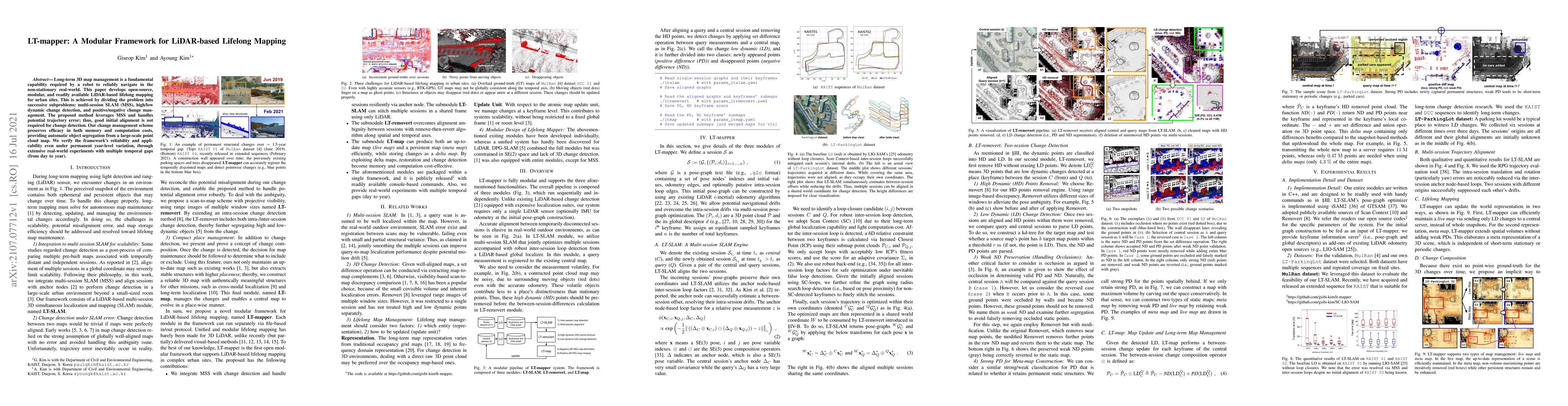
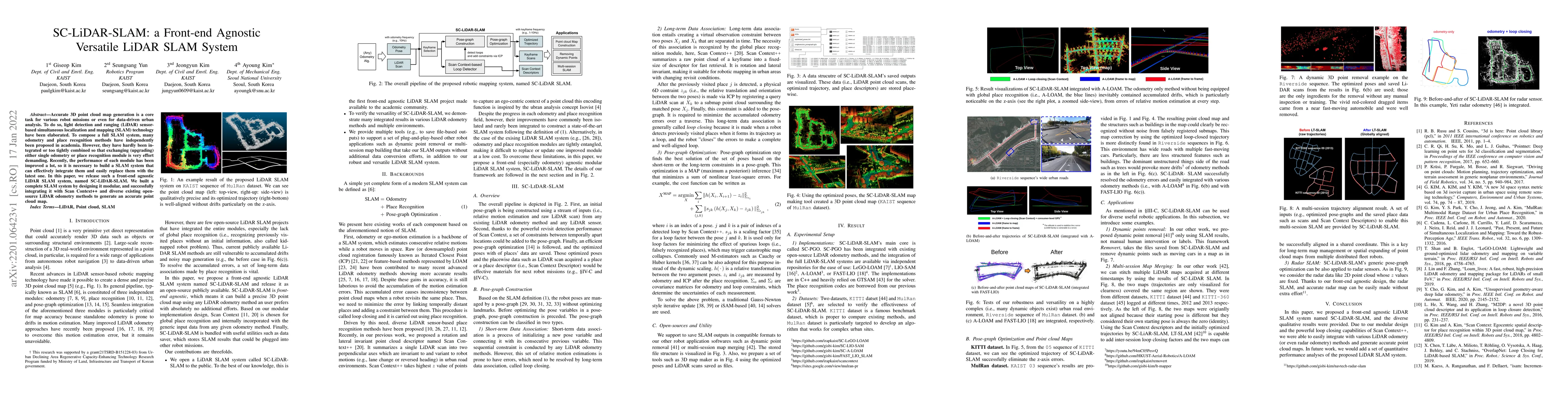
Long-term 3D map management is a fundamental capability required by a robot to reliably navigate in the non-stationary real-world. This paper develops open-source, modular, and readily available LiD...
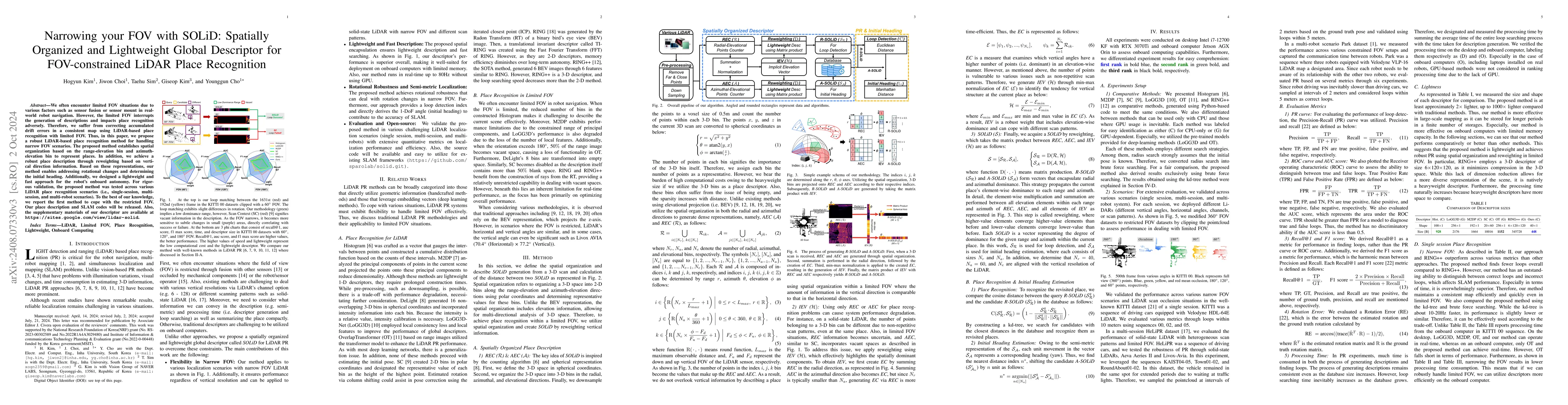
We often encounter limited FOV situations due to various factors such as sensor fusion or sensor mount in real-world robot navigation. However, the limited FOV interrupts the generation of description...
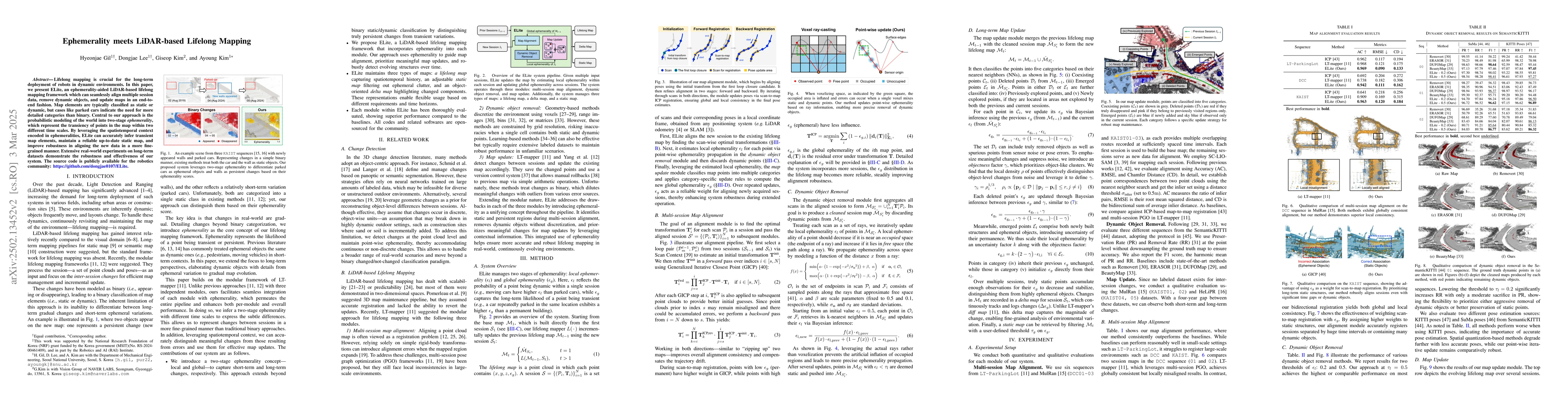
Lifelong mapping is crucial for the long-term deployment of robots in dynamic environments. In this paper, we present ELite, an ephemerality-aided LiDAR-based lifelong mapping framework which can seam...
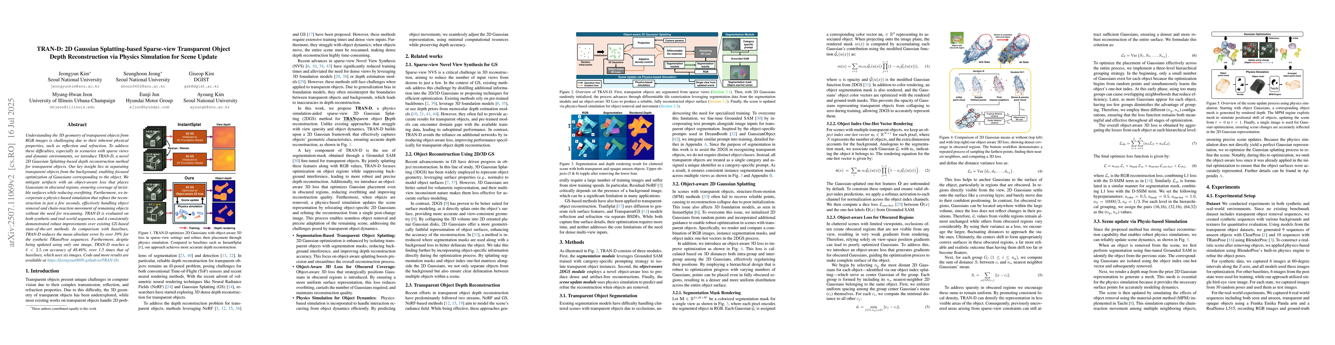
Understanding the 3D geometry of transparent objects from RGB images is challenging due to their inherent physical properties, such as reflection and refraction. To address these difficulties, especia...
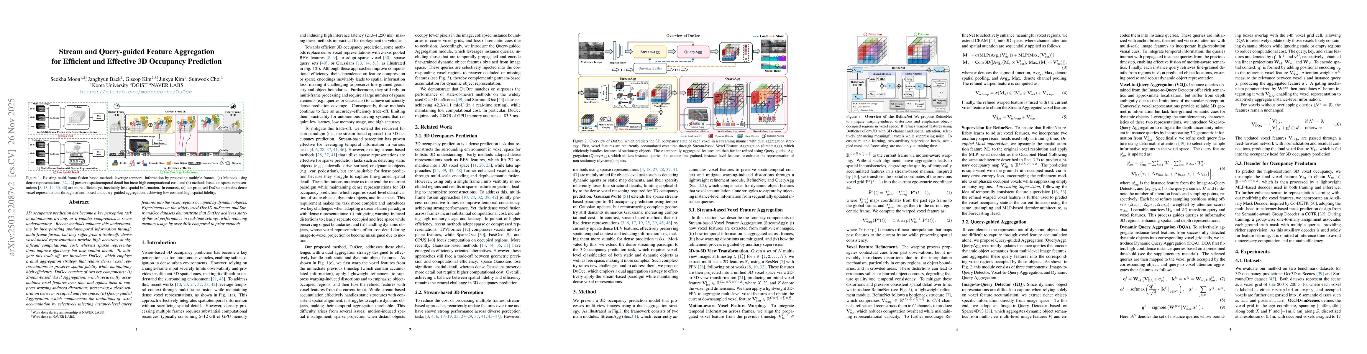
3D occupancy prediction has become a key perception task in autonomous driving, as it enables comprehensive scene understanding. Recent methods enhance this understanding by incorporating spatiotempor...
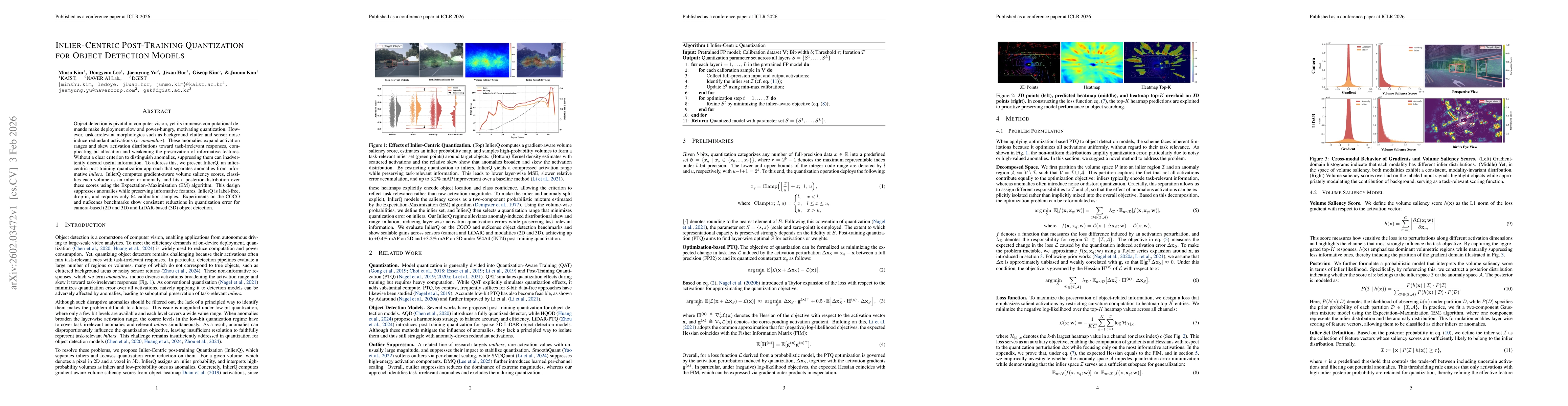
Object detection is pivotal in computer vision, yet its immense computational demands make deployment slow and power-hungry, motivating quantization. However, task-irrelevant morphologies such as back...
Recent advances in vision-language models have made zero-shot navigation feasible, enabling robots to follow natural language instructions without requiring labeling. However, existing methods that ex...
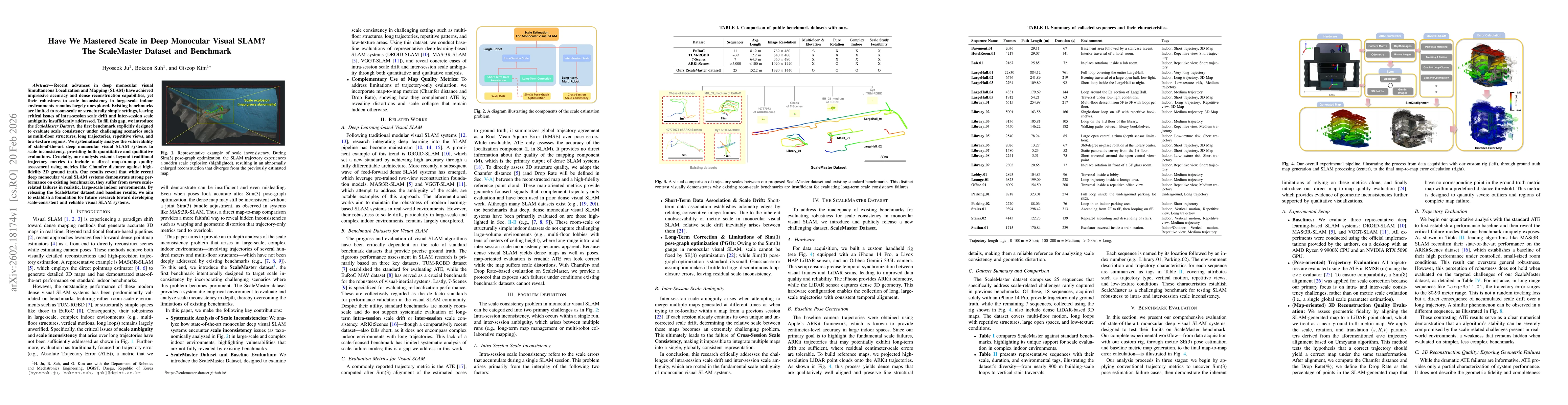
Recent advances in deep monocular visual Simultaneous Localization and Mapping (SLAM) have achieved impressive accuracy and dense reconstruction capabilities, yet their robustness to scale inconsisten...
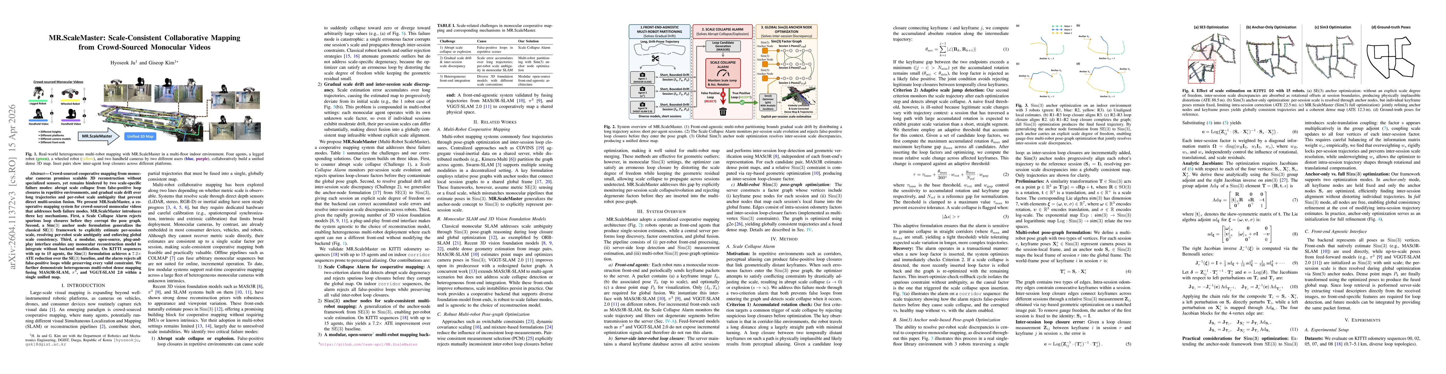
Crowd-sourced cooperative mapping from monocular cameras promises scalable 3D reconstruction without specialized sensors, yet remains hindered by two scale-specific failure modes: abrupt scale collaps...
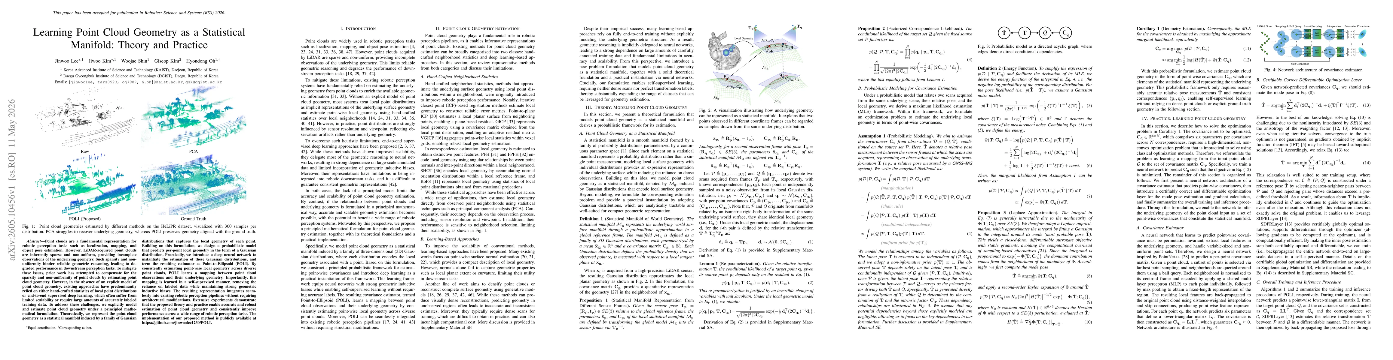
Point clouds are a fundamental representation for robotic perception tasks such as localization, mapping, and object pose estimation. However, LiDAR-acquired point clouds are inherently sparse and non...
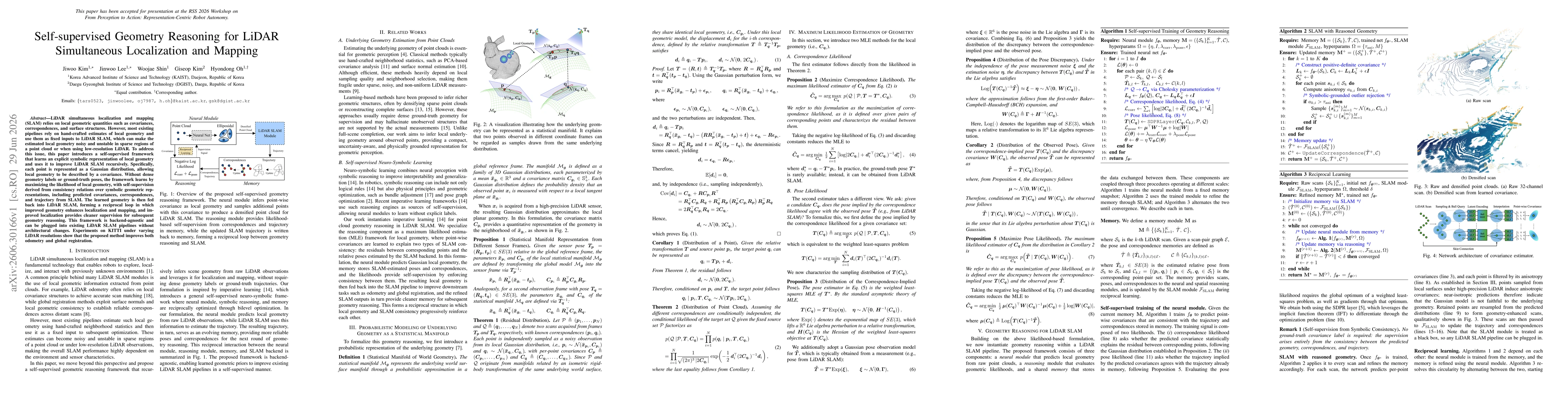
LiDAR simultaneous localization and mapping (SLAM) relies on local geometric quantities such as covariances, correspondences, and surface structures. However, most existing pipelines rely on hand-craf...