ArxivLens
G
Researcher

Giulio Vignoli

5 papers on arXiv

5 arXiv Papers
Profile

Academic Profile

Metrics

Statistics

5 arXiv Papers
Publications

Papers on arXiv

Thumbnail for 1D Stochastic Inversion of Airborne Time-domain Electromag-netic Data
  with Realistic Prior and Accounting for the Forward Modeling Error
arXiv
1D Stochastic Inversion of Airborne Time-domain Electromag-netic Data with Realistic Prior and Accounting for the Forward Modeling Error

Airborne electromagnetic surveys may consist of hundreds of thousands of soundings. In most cases, this makes 3D inversions unfeasible even when the subsurface is characterized by a high level of he...

Thumbnail for Reconstruction, with tunable sparsity levels, of shear-wave velocity
  profiles from surface wave data
arXiv
Reconstruction, with tunable sparsity levels, of shear-wave velocity profiles from surface wave data

The analysis of surface wave dispersion curves is a way to infer the vertical distribution of shear-wave velocity. The range of applicability is extremely wide going, for example, from seismological...

Thumbnail for Multiple-point statistical simulation for hydrogeological models: 3-D
  training image development and conditioning strategies
arXiv
Multiple-point statistical simulation for hydrogeological models: 3-D training image development and conditioning strategies

Most studies on the application of geostatistical simulations based on multiple-point statistics (MPS) to hydrogeological modelling focus on relatively fine-scale models and on the estimation of fac...

Thumbnail for New regional stratigraphic insights from a 3D geological model of the
  Nasia sub-basin, Ghana, developed for hydrogeological purposes and based on
  reprocessed B-field data originally collected for mineral exploration
arXiv
New regional stratigraphic insights from a 3D geological model of the Nasia sub-basin, Ghana, developed for hydrogeological purposes and based on reprocessed B-field data originally collected for mineral exploration

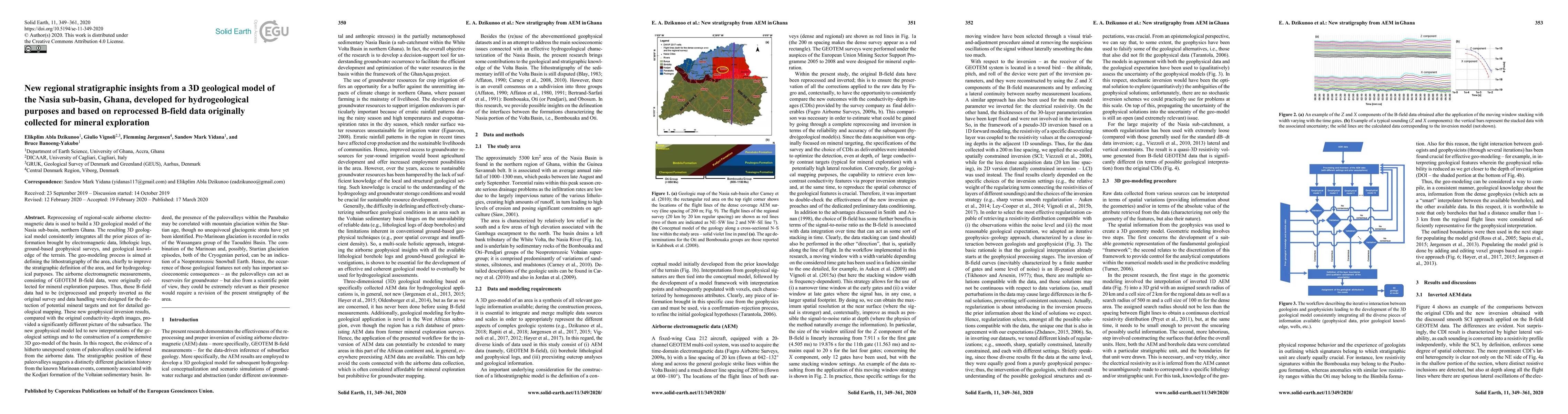
Reprocessing of regional-scale airborne electromagnetic data (AEM) is used to build a 3D geomodel of the Nasia sub-basin. The resulting 3D geomodel integrates all the prior pieces of information bro...

Thumbnail for (Quasi-)Real-Time Inversion of Airborne Time-Domain Electromagnetic Data
  via Artificial Neural Network
arXiv
(Quasi-)Real-Time Inversion of Airborne Time-Domain Electromagnetic Data via Artificial Neural Network

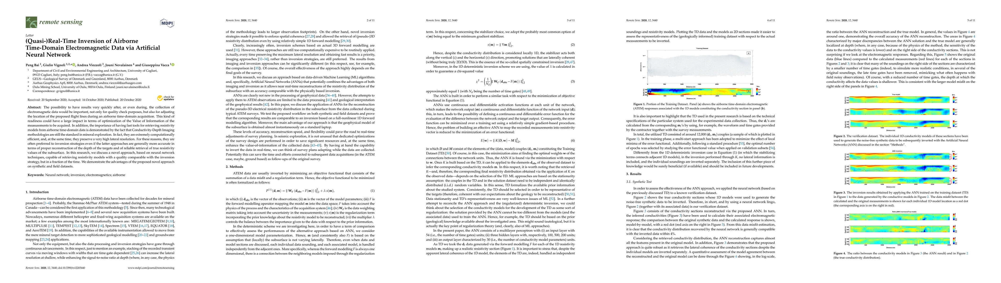
The possibility to have results very quickly after, or even during, the collection of electromagnetic data would be important, not only for quality check purposes, but also for adjusting the locatio...

This website uses cookies to ensure you get the best experience. Learn more