Academic Profile
Statistics
Similar Authors
Papers on arXiv
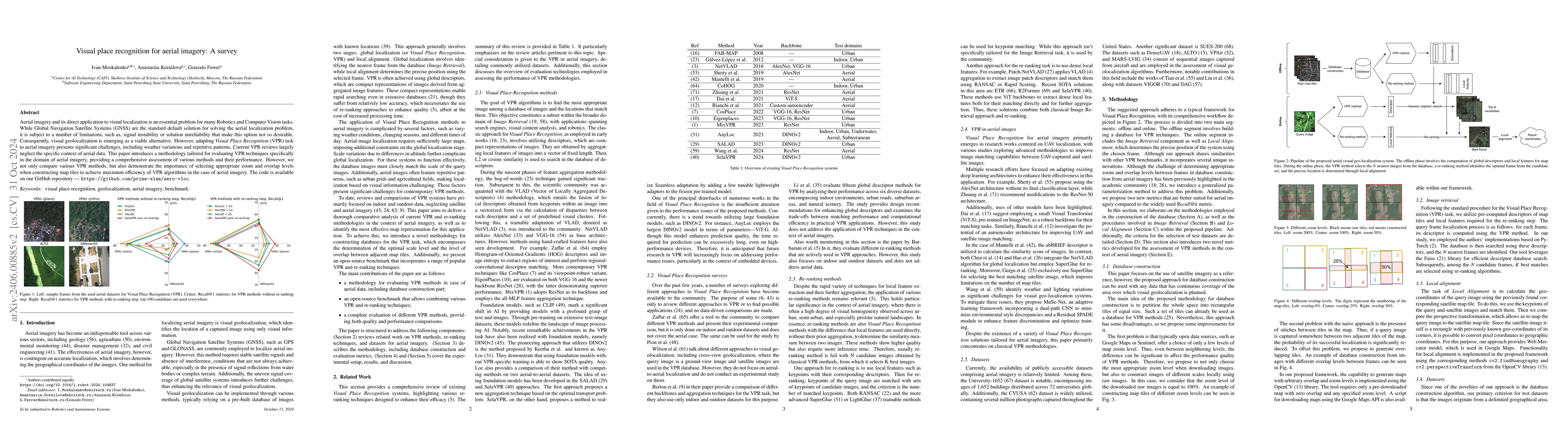
Aerial imagery and its direct application to visual localization is an essential problem for many Robotics and Computer Vision tasks. While Global Navigation Satellite Systems (GNSS) are the standar...
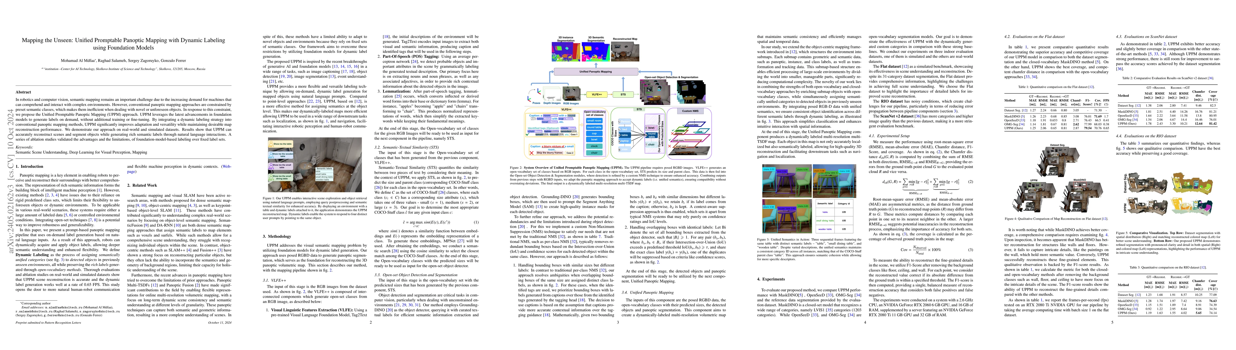
In the field of robotics and computer vision, efficient and accurate semantic mapping remains a significant challenge due to the growing demand for intelligent machines that can comprehend and inter...

Learning a feature point detector presents a challenge both due to the ambiguity of the definition of a keypoint and correspondingly the need for a specially prepared ground truth labels for such po...
This work is dedicated to the study of how uncertainty estimation of the human motion prediction can be embedded into constrained optimization techniques, such as Model Predictive Control (MPC) for ...
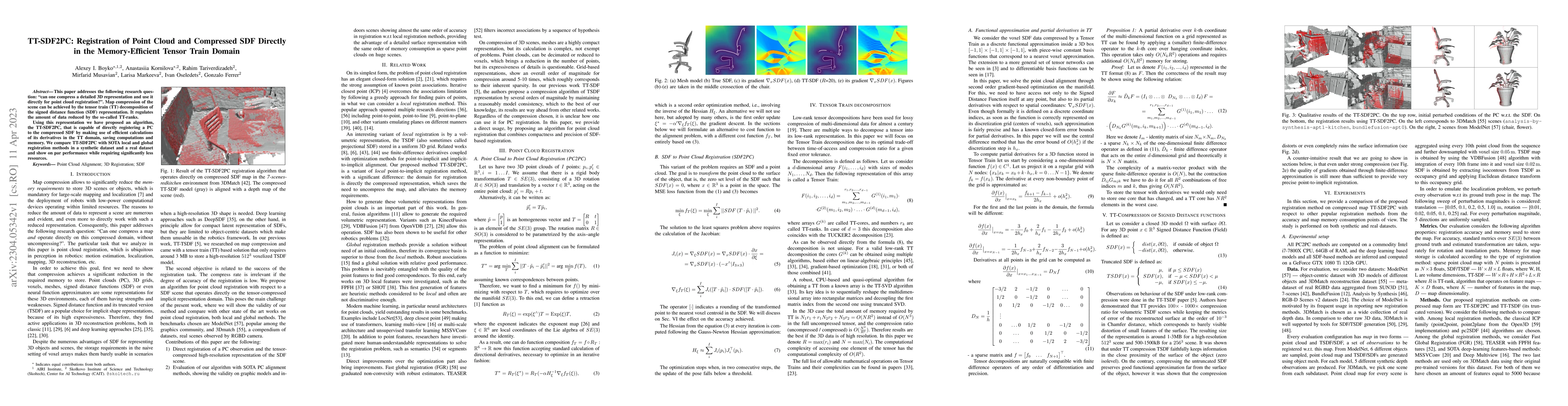
This paper addresses the following research question: ``can one compress a detailed 3D representation and use it directly for point cloud registration?''. Map compression of the scene can be achieve...
Modern depth sensors can generate a huge number of 3D points in few seconds to be latter processed by Localization and Mapping algorithms. Ideally, these algorithms should handle efficiently large s...
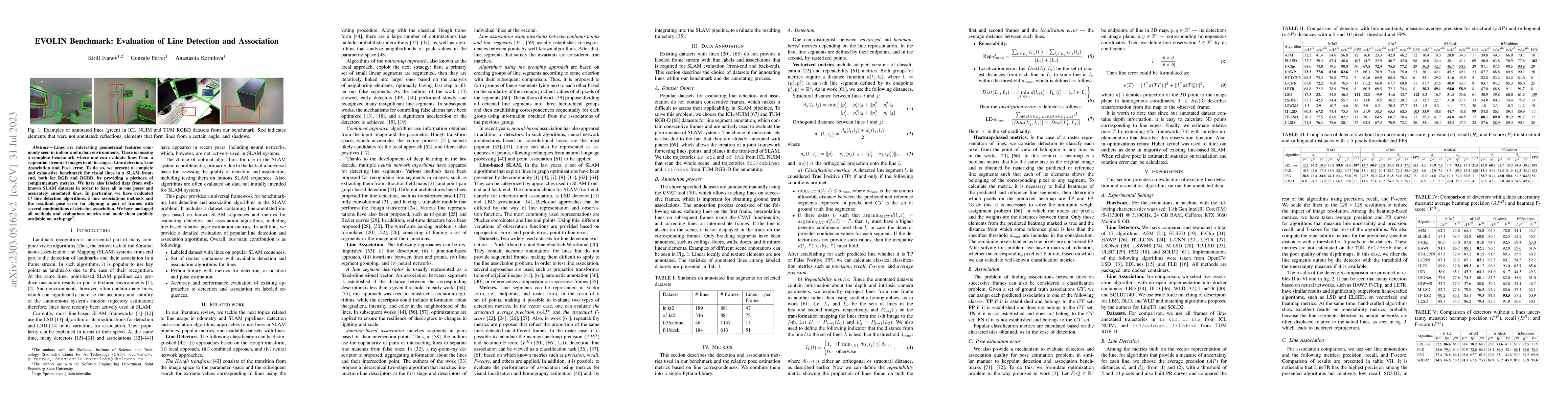
Lines are interesting geometrical features commonly seen in indoor and urban environments. There is missing a complete benchmark where one can evaluate lines from a sequential stream of images in al...
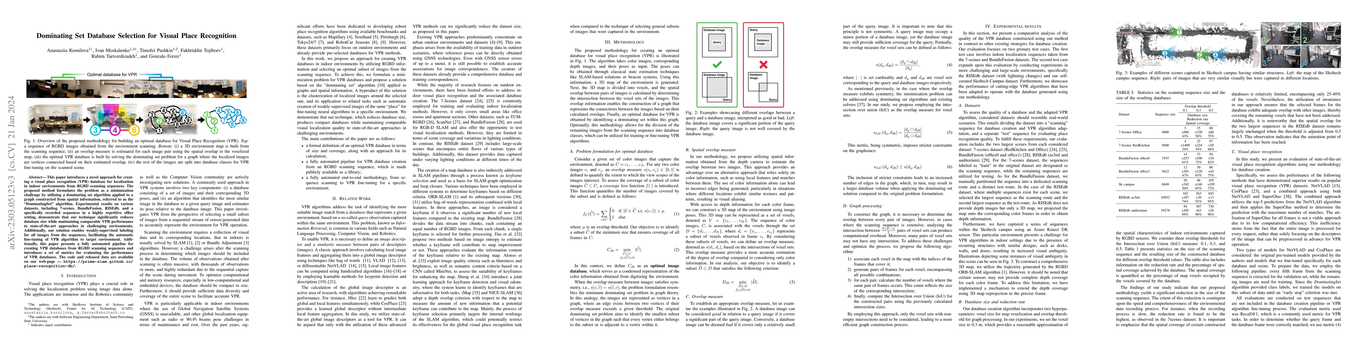
This paper presents an approach for creating a visual place recognition (VPR) database for localization in indoor environments from RGBD scanning sequences. The proposed approach is formulated as a ...
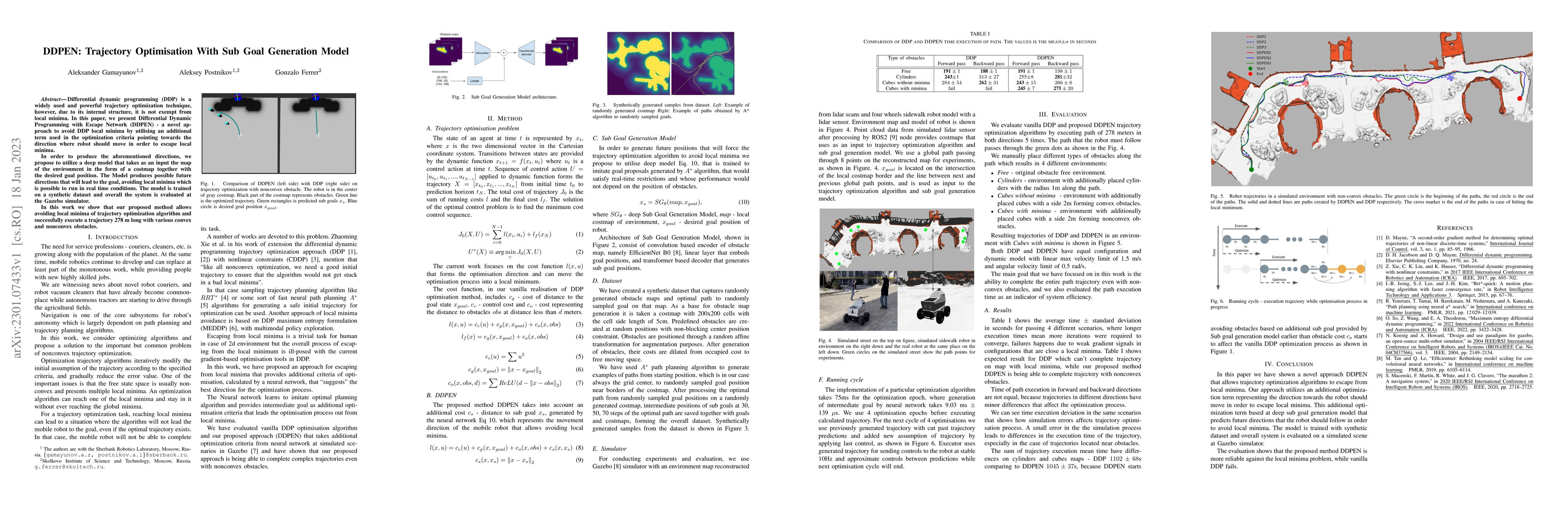
Differential dynamic programming (DDP) is a widely used and powerful trajectory optimization technique, however, due to its internal structure, it is not exempt from local minima. In this paper, we ...
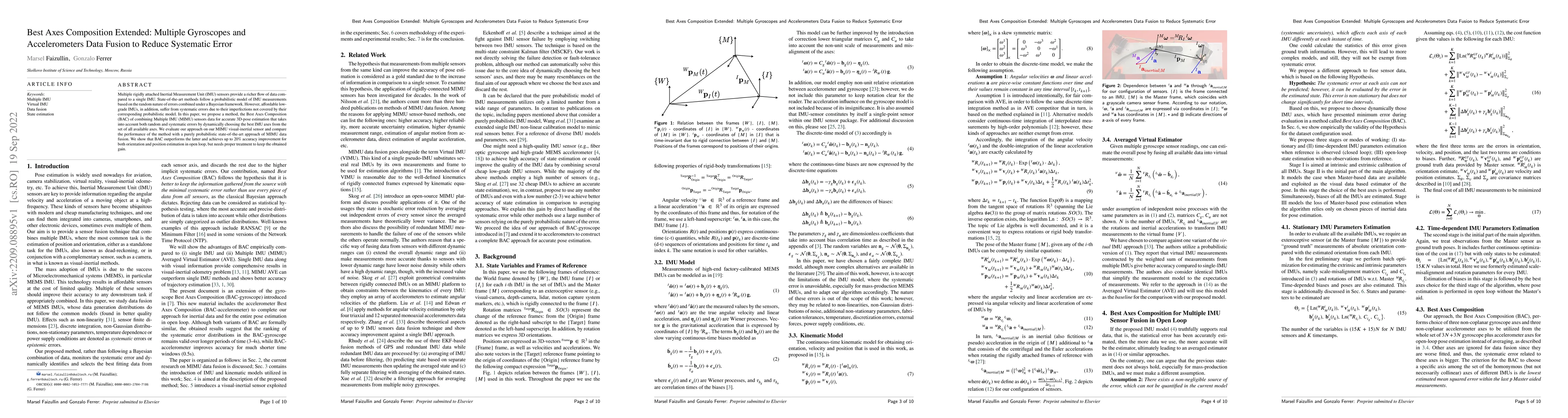
Multiple rigidly attached Inertial Measurement Unit (IMU) sensors provide a richer flow of data compared to a single IMU. State-of-the-art methods follow a probabilistic model of IMU measurements ba...
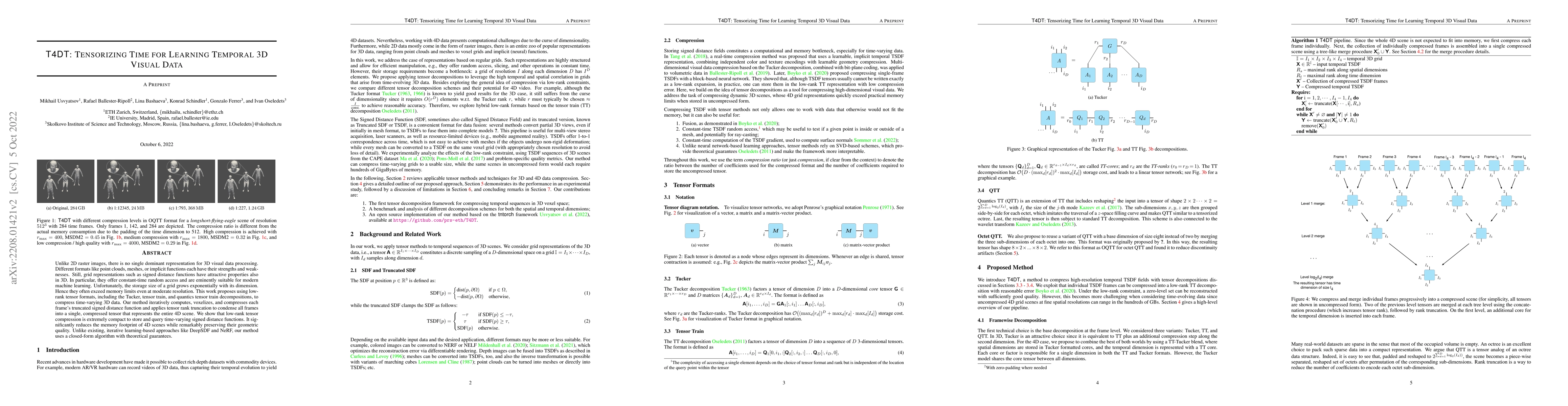
Unlike 2D raster images, there is no single dominant representation for 3D visual data processing. Different formats like point clouds, meshes, or implicit functions each have their strengths and we...
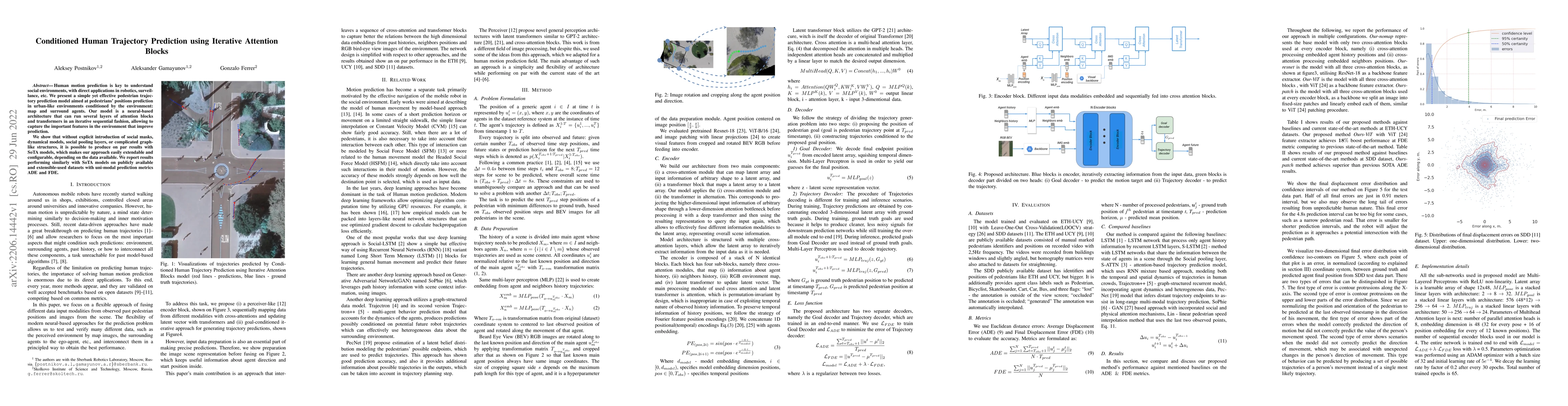
Human motion prediction is key to understand social environments, with direct applications in robotics, surveillance, etc. We present a simple yet effective pedestrian trajectory prediction model ai...
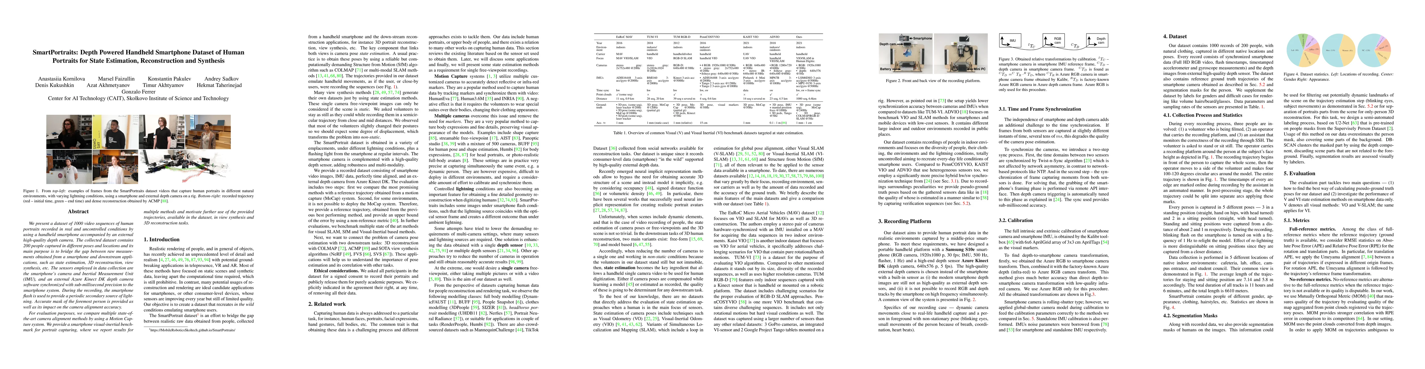
We present a dataset of 1000 video sequences of human portraits recorded in real and uncontrolled conditions by using a handheld smartphone accompanied by an external high-quality depth camera. The ...
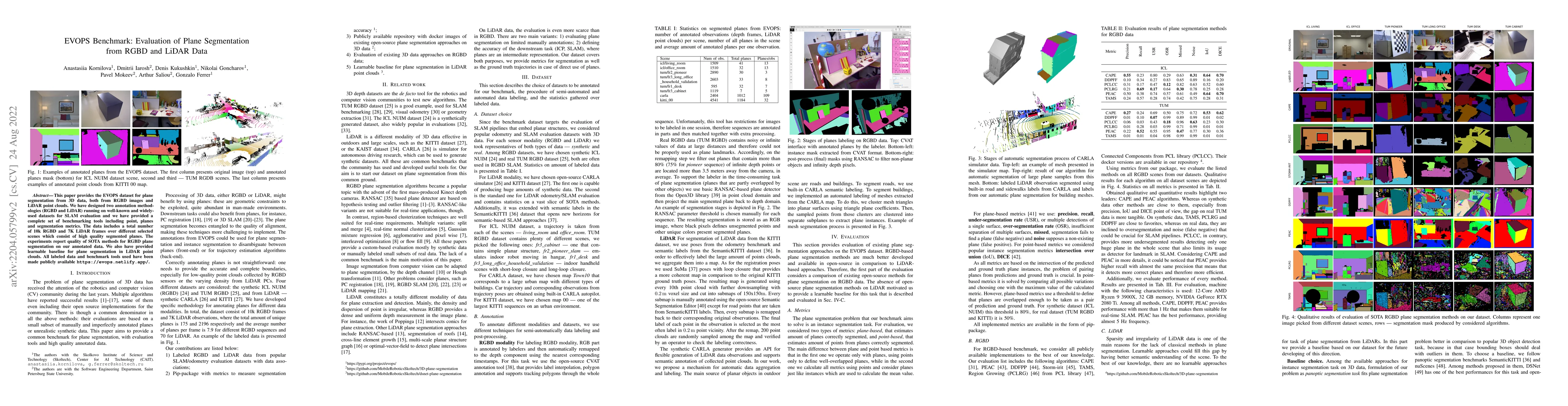
This paper provides the EVOPS dataset for plane segmentation from 3D data, both from RGBD images and LiDAR point clouds. We have designed two annotation methodologies (RGBD and LiDAR) running on wel...
To plan a safe and efficient route, an autonomous vehicle should anticipate future motions of other agents around it. Motion prediction is an extremely challenging task which recently gained signifi...
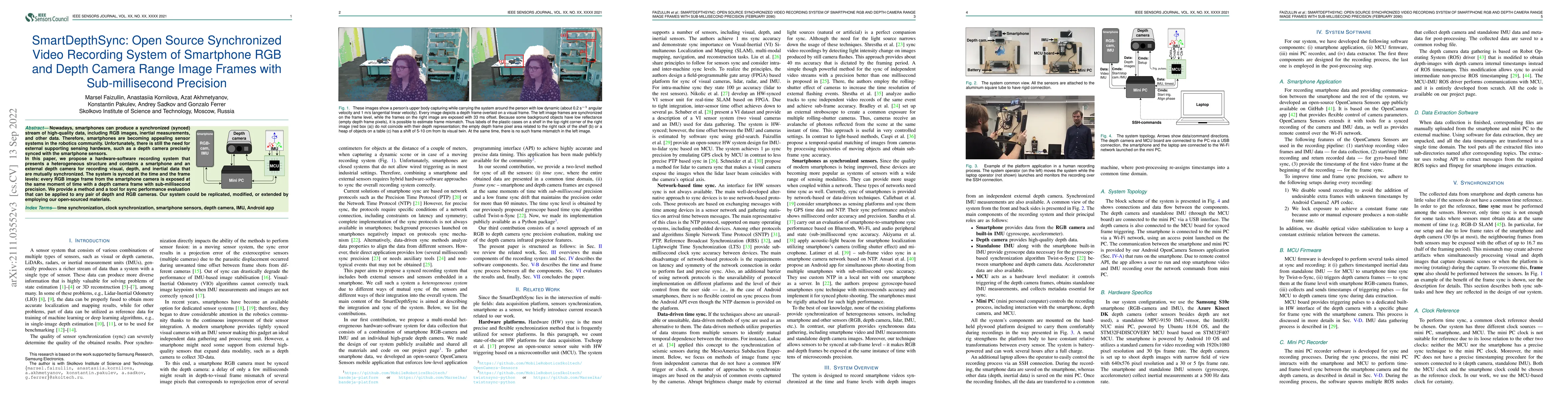
Nowadays, smartphones can produce a synchronized (synced) stream of high-quality data, including RGB images, inertial measurements, and other data. Therefore, smartphones are becoming appealing sens...
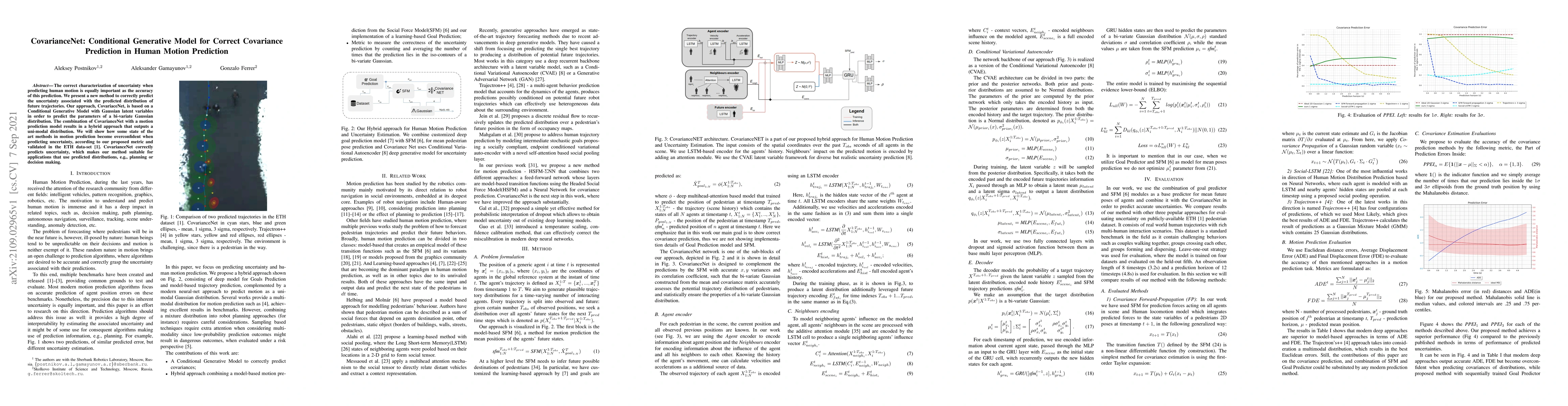
The correct characterization of uncertainty when predicting human motion is equally important as the accuracy of this prediction. We present a new method to correctly predict the uncertainty associa...
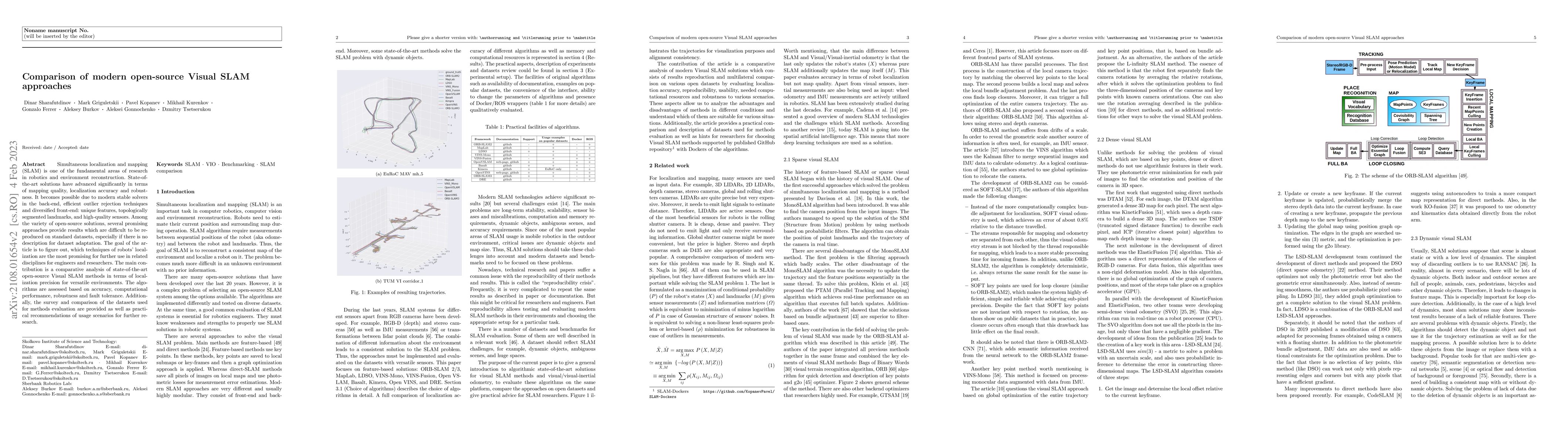
SLAM is one of the most fundamental areas of research in robotics and computer vision. State of the art solutions has advanced significantly in terms of accuracy and stability. Unfortunately, not al...
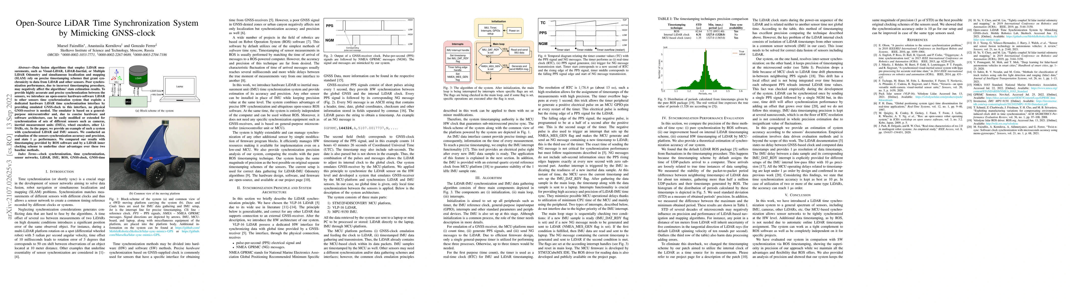
Data fusion algorithms that employ LiDAR measurements, such as Visual-LiDAR, LiDAR-Inertial, or Multiple LiDAR Odometry and simultaneous localization and mapping (SLAM) rely on precise timestamping ...
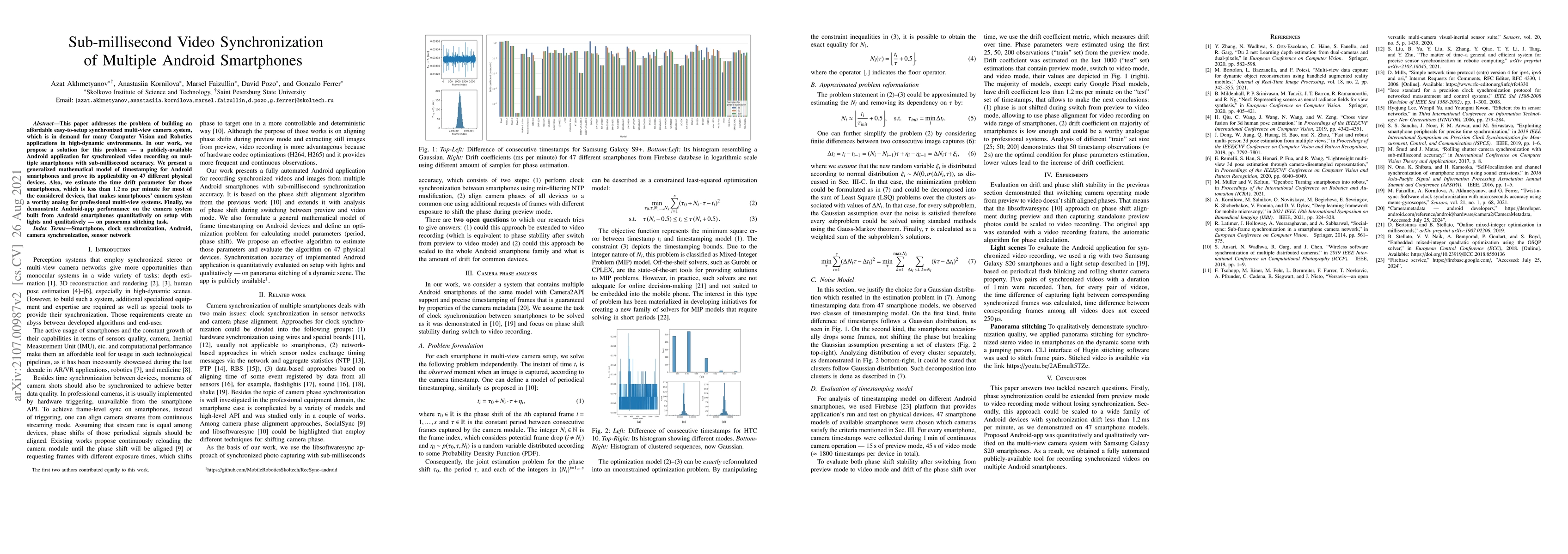
This paper addresses the problem of building an affordable easy-to-setup synchronized multi-view camera system, which is in demand for many Computer Vision and Robotics applications in high-dynamic ...
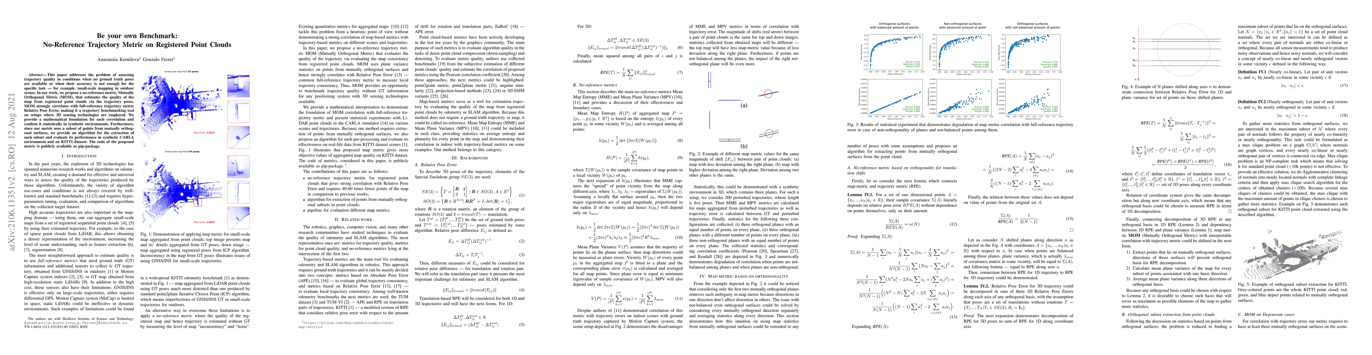
This paper addresses the problem of assessing trajectory quality in conditions when no ground truth poses are available or when their accuracy is not enough for the specific task - for example, smal...
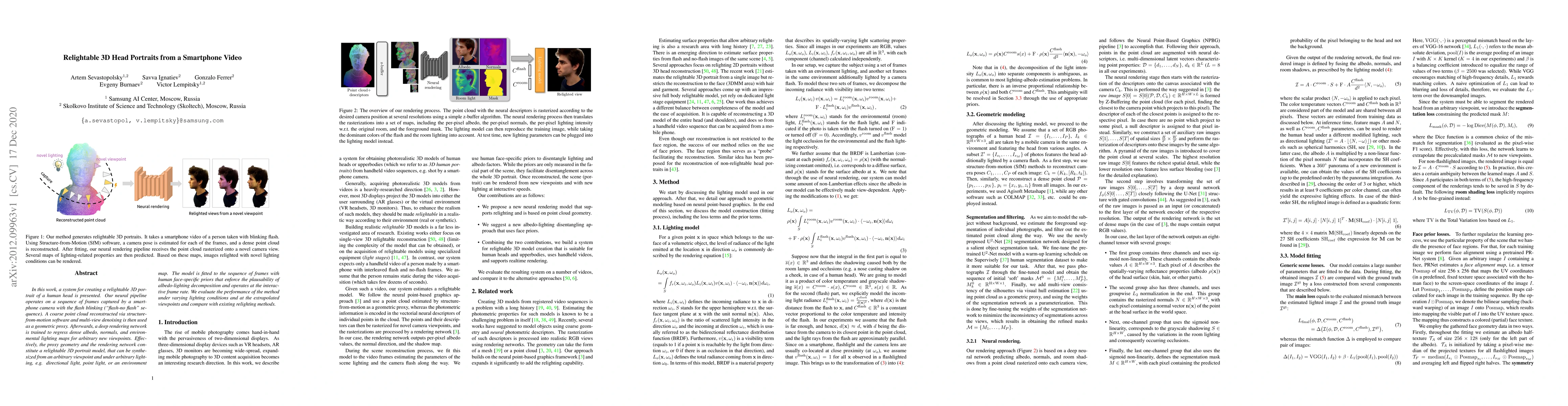
In this work, a system for creating a relightable 3D portrait of a human head is presented. Our neural pipeline operates on a sequence of frames captured by a smartphone camera with the flash blinki...
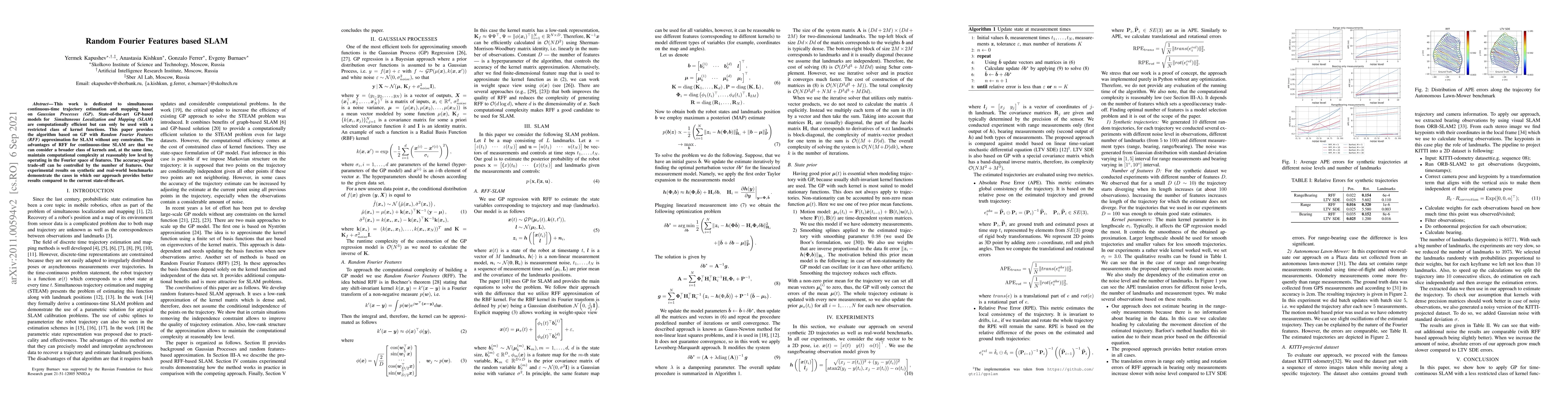
This work is dedicated to simultaneous continuous-time trajectory estimation and mapping based on Gaussian Processes (GP). State-of-the-art GP-based models for Simultaneous Localization and Mapping ...
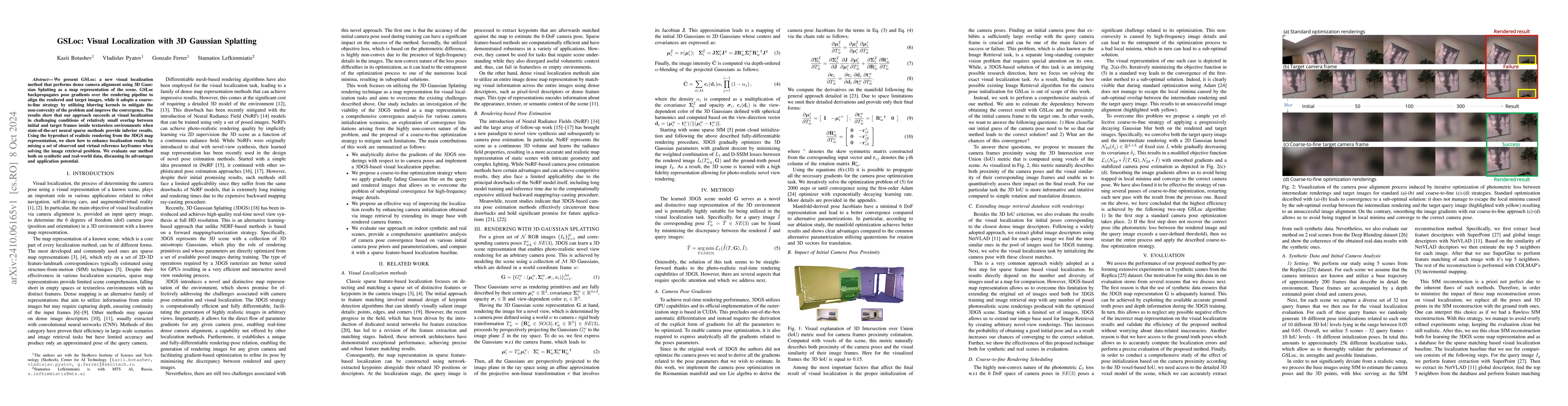
We present GSLoc: a new visual localization method that performs dense camera alignment using 3D Gaussian Splatting as a map representation of the scene. GSLoc backpropagates pose gradients over the r...
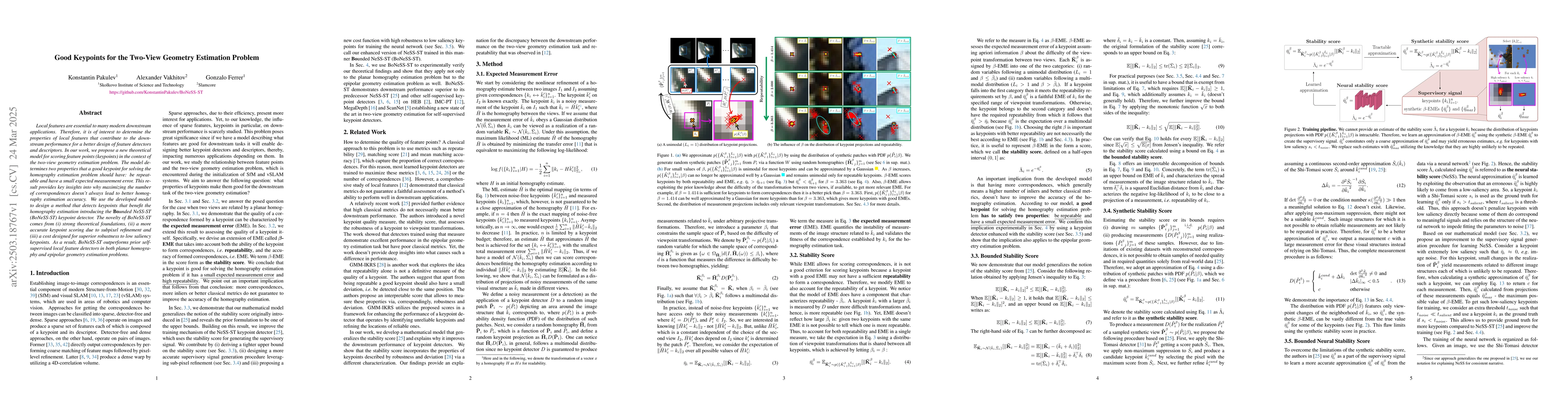
Local features are essential to many modern downstream applications. Therefore, it is of interest to determine the properties of local features that contribute to the downstream performance for a bett...
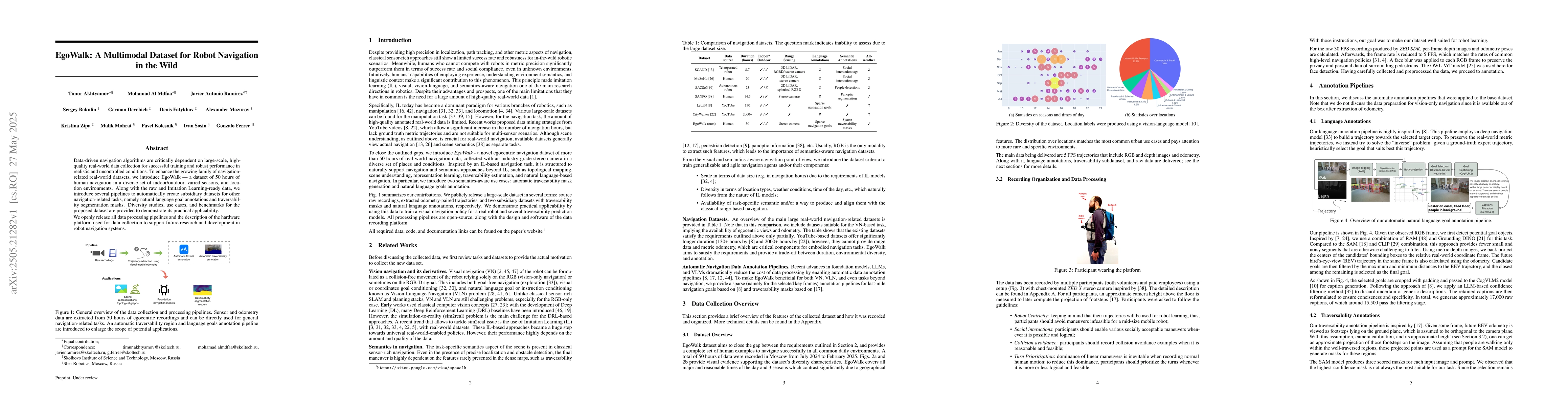
Data-driven navigation algorithms are critically dependent on large-scale, high-quality real-world data collection for successful training and robust performance in realistic and uncontrolled conditio...
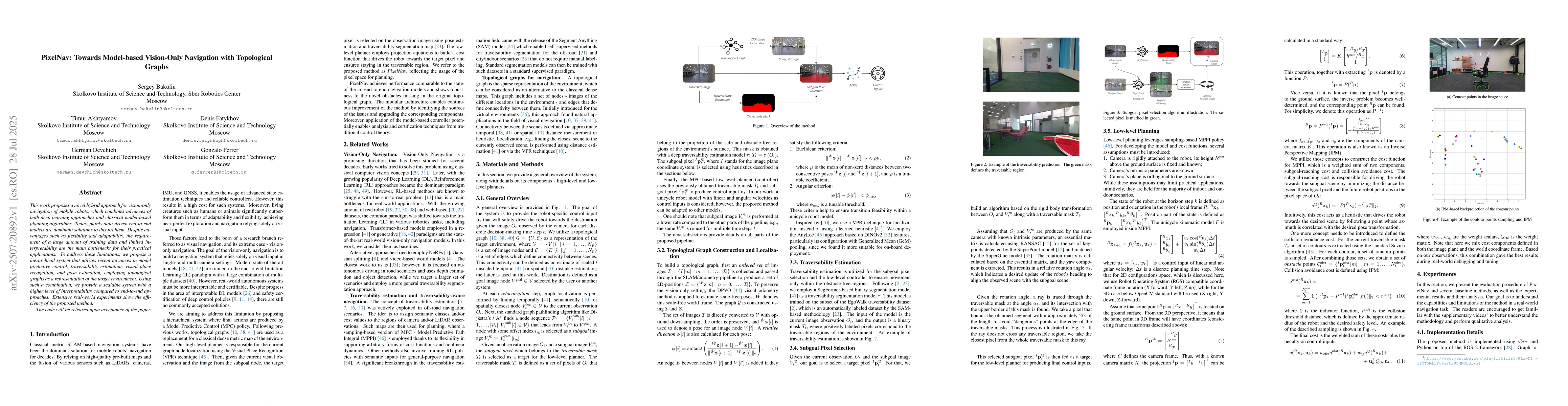
This work proposes a novel hybrid approach for vision-only navigation of mobile robots, which combines advances of both deep learning approaches and classical model-based planning algorithms. Today, p...
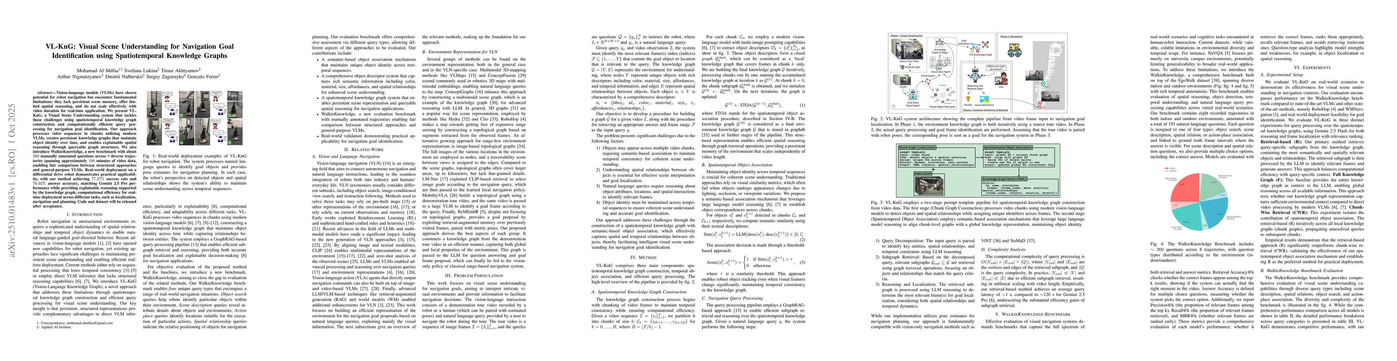
Vision-language models (VLMs) have shown potential for robot navigation but encounter fundamental limitations: they lack persistent scene memory, offer limited spatial reasoning, and do not scale effe...
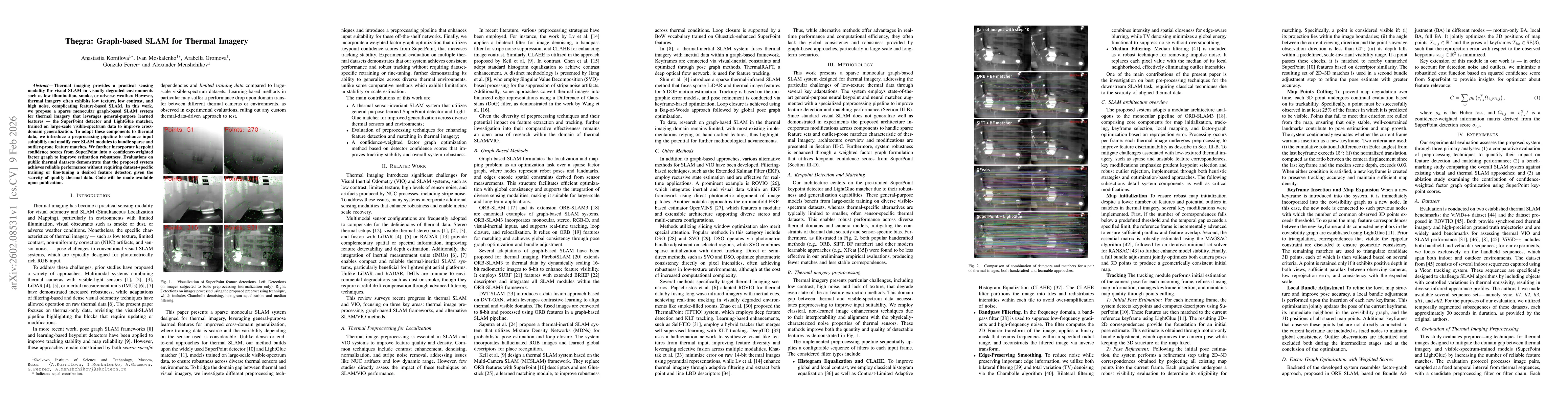
Thermal imaging provides a practical sensing modality for visual SLAM in visually degraded environments such as low illumination, smoke, or adverse weather. However, thermal imagery often exhibits low...
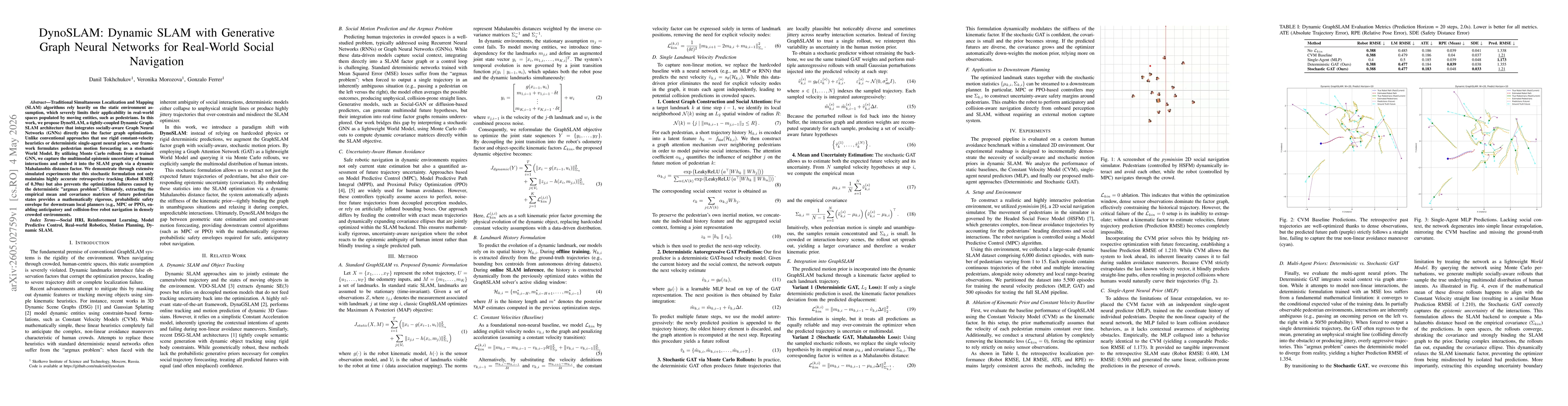
Traditional Simultaneous Localization and Mapping (SLAM) algorithms rely heavily on the static environment assumption, which severely limits their applicability in real-world spaces populated by movin...
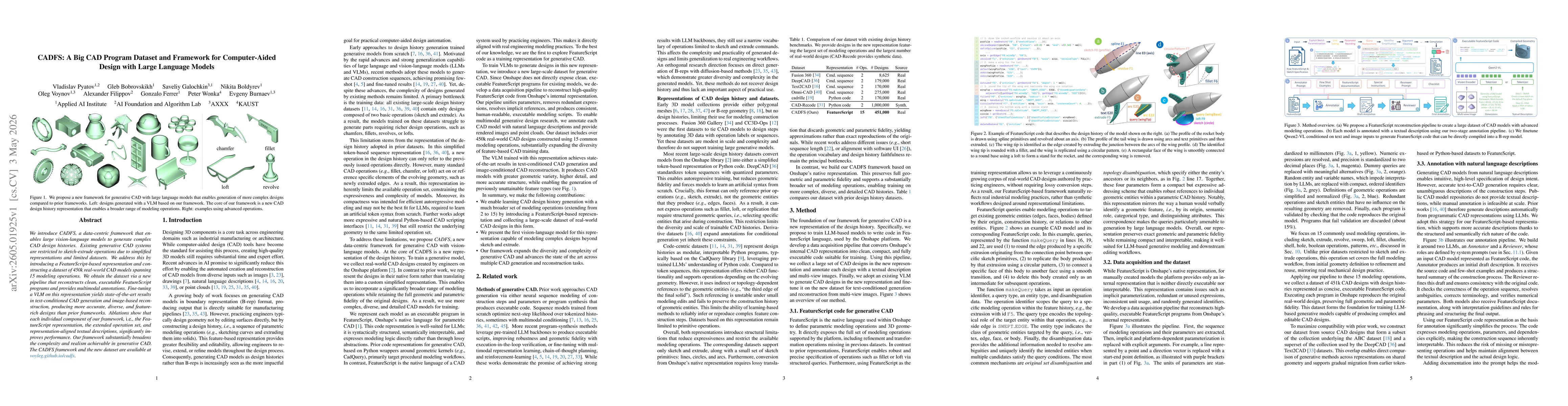
We introduce CADFS, a data-centric framework that enables large vision-language models to generate complex CAD design histories. Existing generative CAD systems are restricted to sketch-extrude operat...
Answering navigation-relevant questions over long egocentric videos requires retrieving and organizing evidence distributed across distant temporal moments while maintaining spatial and contextual con...