Griffin Carter

3 papers on arXiv

Academic Profile

Name: C. J. Griffin
Total Papers: 2

Statistics

arXiv Papers 3
Total Publications 2

Papers on arXiv

Thumbnail for Sub-Meter Tree Height Mapping of California using Aerial Images and
  LiDAR-Informed U-Net Model

Sub-Meter Tree Height Mapping of California using Aerial Images and LiDAR-Informed U-Net Model

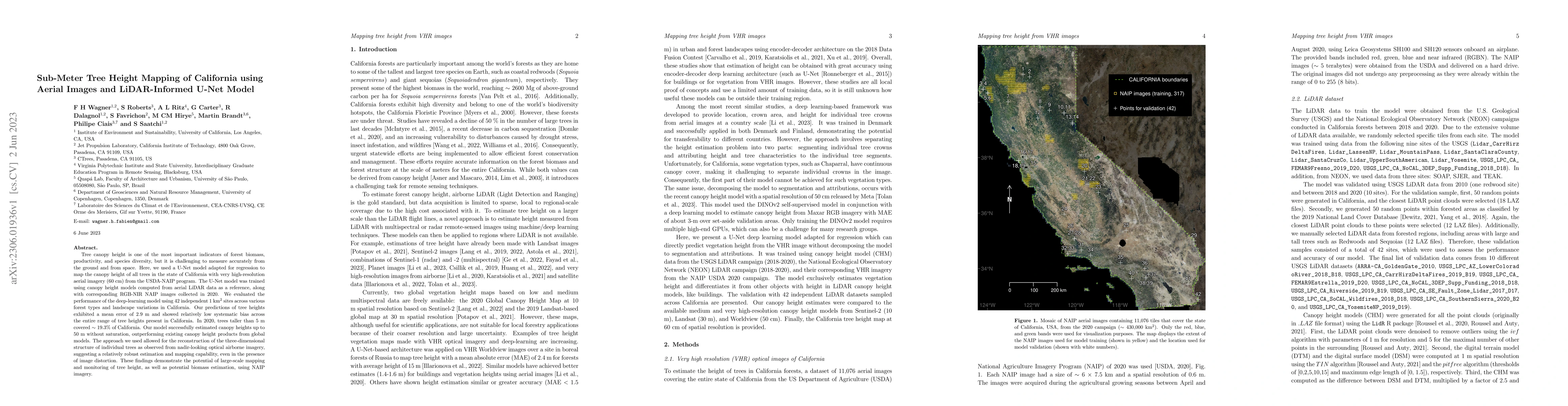
Tree canopy height is one of the most important indicators of forest biomass, productivity, and species diversity, but it is challenging to measure accurately from the ground and from space. Here, w...

Thumbnail for Mapping Tropical Forest Cover and Deforestation with Planet NICFI
  Satellite Images and Deep Learning in Mato Grosso State (Brazil) from 2015 to
  2021

Mapping Tropical Forest Cover and Deforestation with Planet NICFI Satellite Images and Deep Learning in Mato Grosso State (Brazil) from 2015 to 2021

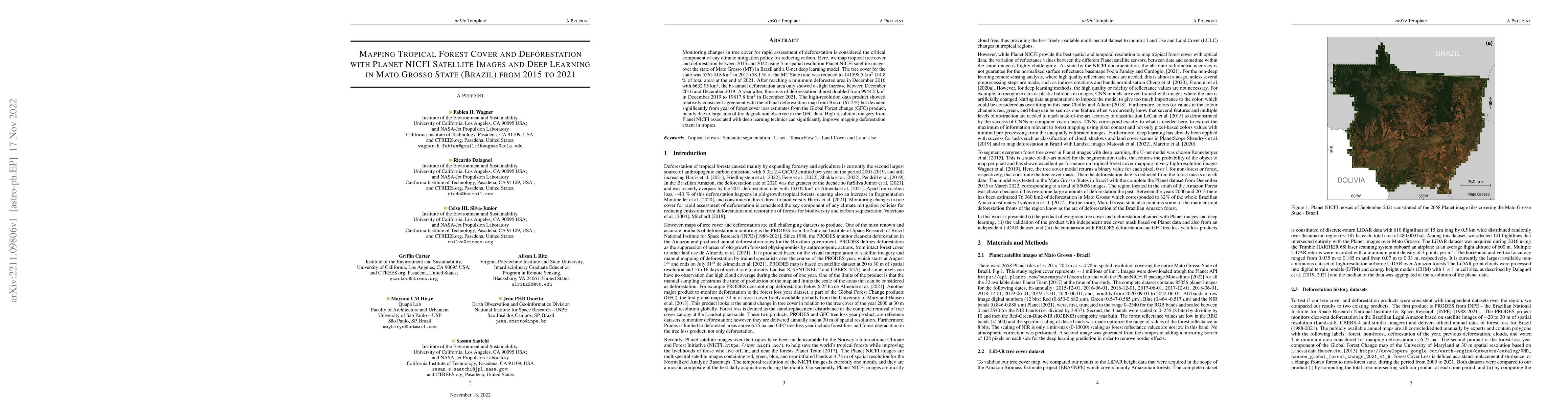
Monitoring changes in tree cover for rapid assessment of deforestation is considered the critical component of any climate mitigation policy for reducing carbon. Here, we map tropical tree cover and...

Thumbnail for High Resolution Tree Height Mapping of the Amazon Forest using Planet
  NICFI Images and LiDAR-Informed U-Net Model

High Resolution Tree Height Mapping of the Amazon Forest using Planet NICFI Images and LiDAR-Informed U-Net Model

Tree canopy height is one of the most important indicators of forest biomass, productivity, and ecosystem structure, but it is challenging to measure accurately from the ground and from space. Here, w...

This website uses cookies to ensure you get the best experience. Learn more