Academic Profile
Statistics
Similar Authors
Papers on arXiv
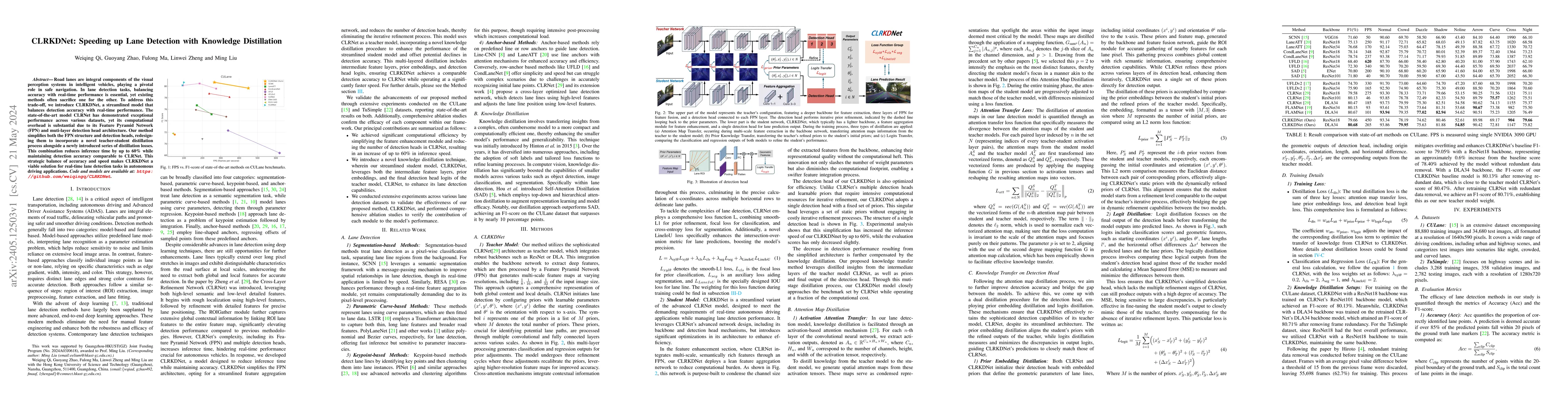
Road lanes are integral components of the visual perception systems in intelligent vehicles, playing a pivotal role in safe navigation. In lane detection tasks, balancing accuracy with real-time per...
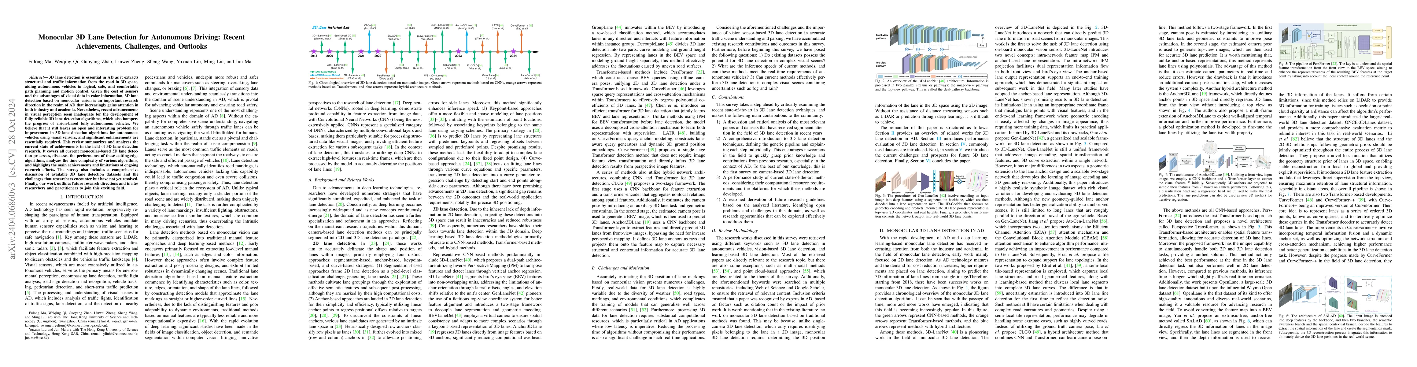
3D lane detection is essential in autonomous driving as it extracts structural and traffic information from the road in three-dimensional space, aiding self-driving cars in logical, safe, and comfor...
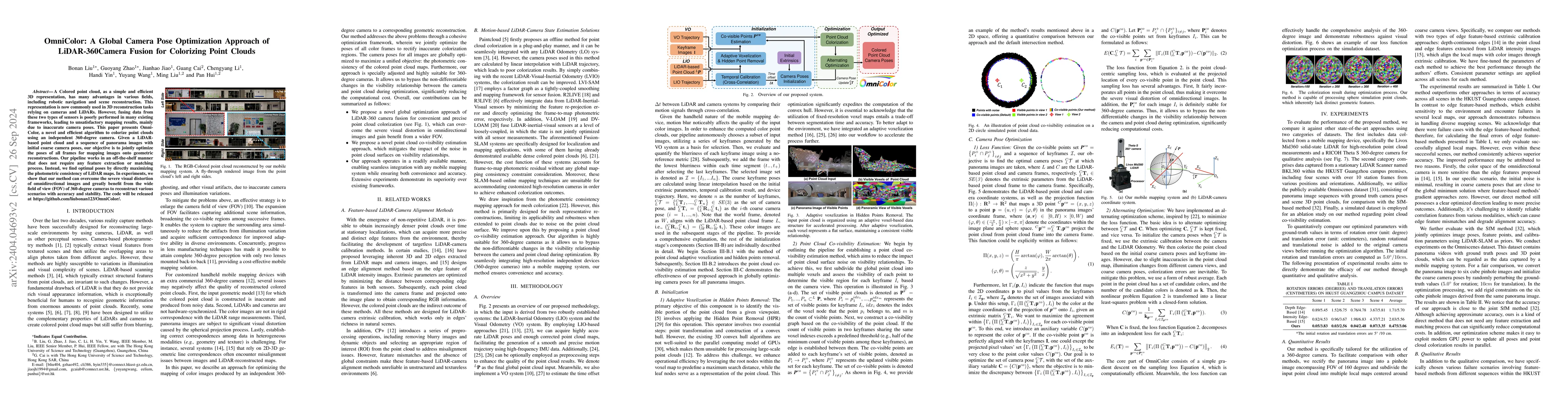
A Colored point cloud, as a simple and efficient 3D representation, has many advantages in various fields, including robotic navigation and scene reconstruction. This representation is now commonly ...
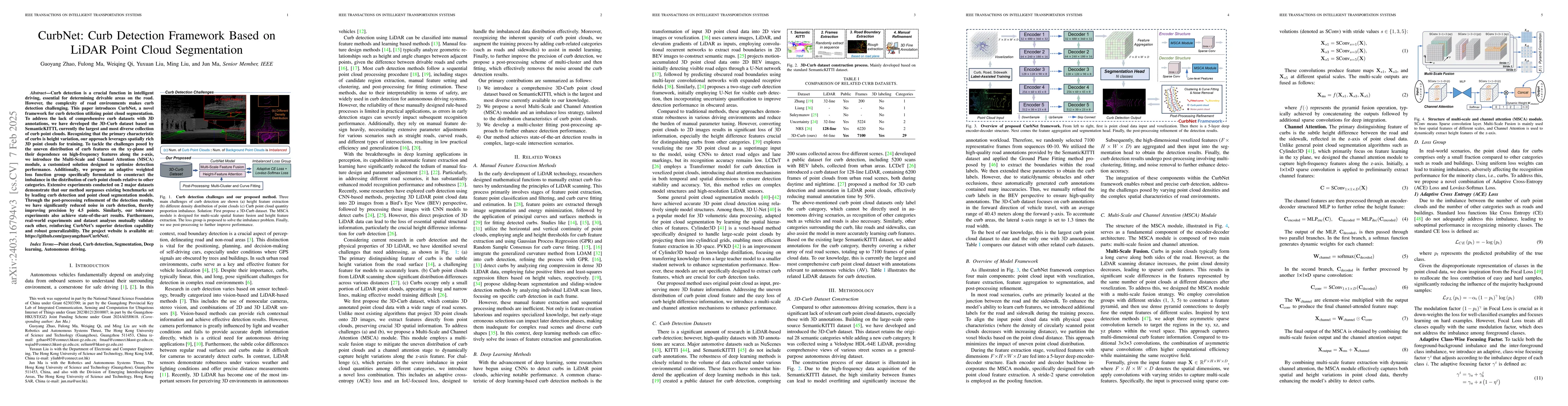
Curb detection is a crucial function in intelligent driving, essential for determining drivable areas on the road. However, the complexity of road environments makes curb detection challenging. This...
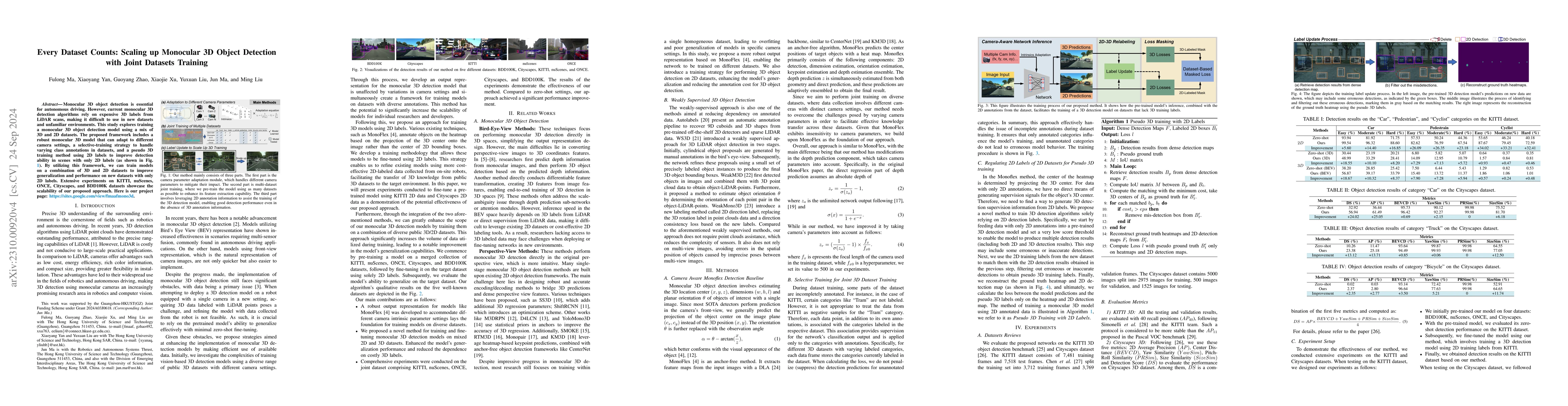
Monocular 3D object detection plays a crucial role in autonomous driving. However, existing monocular 3D detection algorithms depend on 3D labels derived from LiDAR measurements, which are costly to...
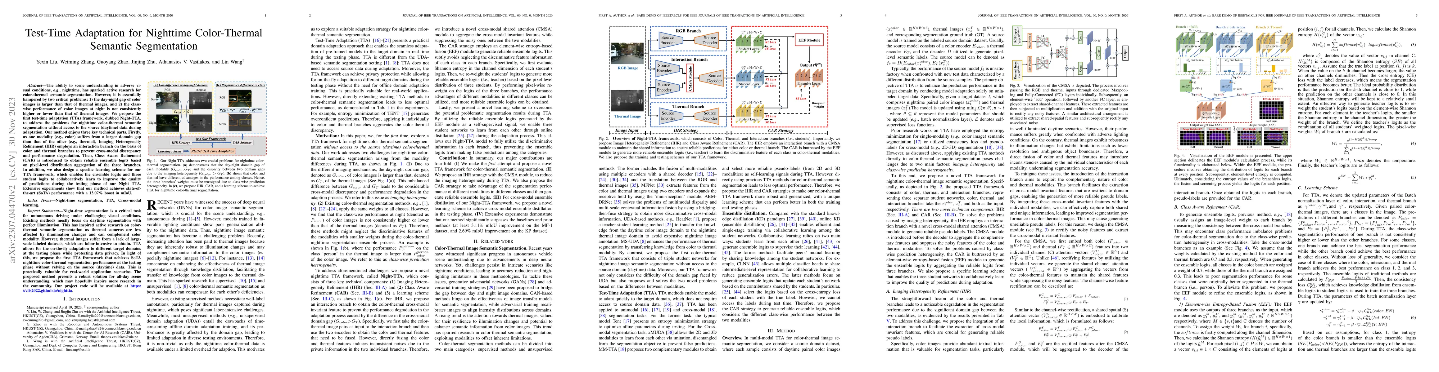
The ability to scene understanding in adverse visual conditions, e.g., nighttime, has sparked active research for RGB-Thermal (RGB-T) semantic segmentation. However, it is essentially hampered by tw...
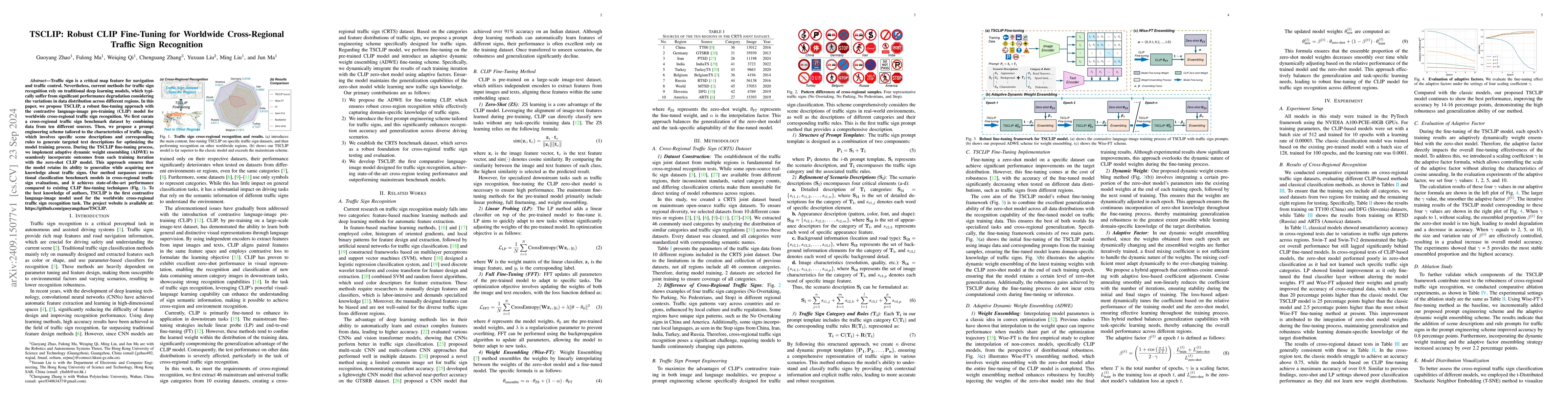
Traffic sign is a critical map feature for navigation and traffic control. Nevertheless, current methods for traffic sign recognition rely on traditional deep learning models, which typically suffer f...
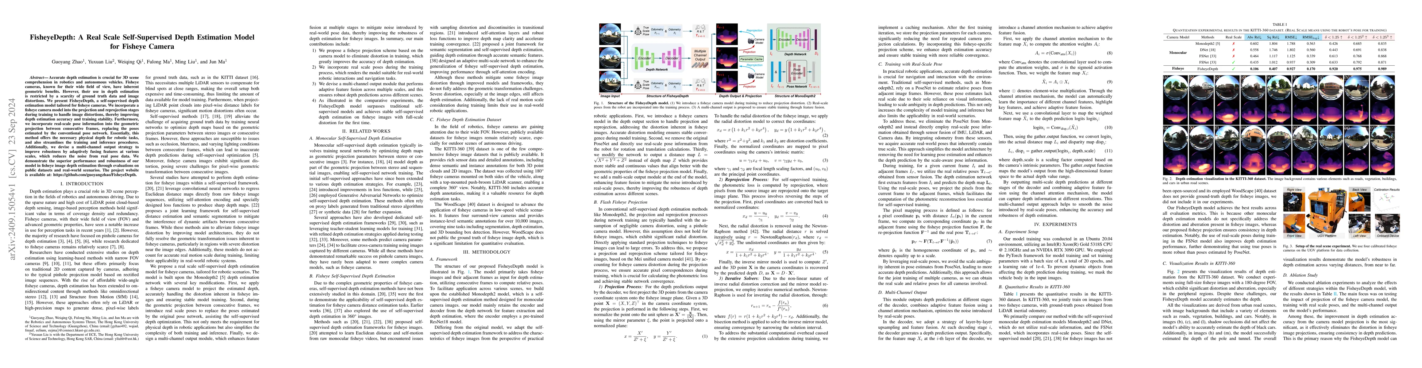
Accurate depth estimation is crucial for 3D scene comprehension in robotics and autonomous vehicles. Fisheye cameras, known for their wide field of view, have inherent geometric benefits. However, the...
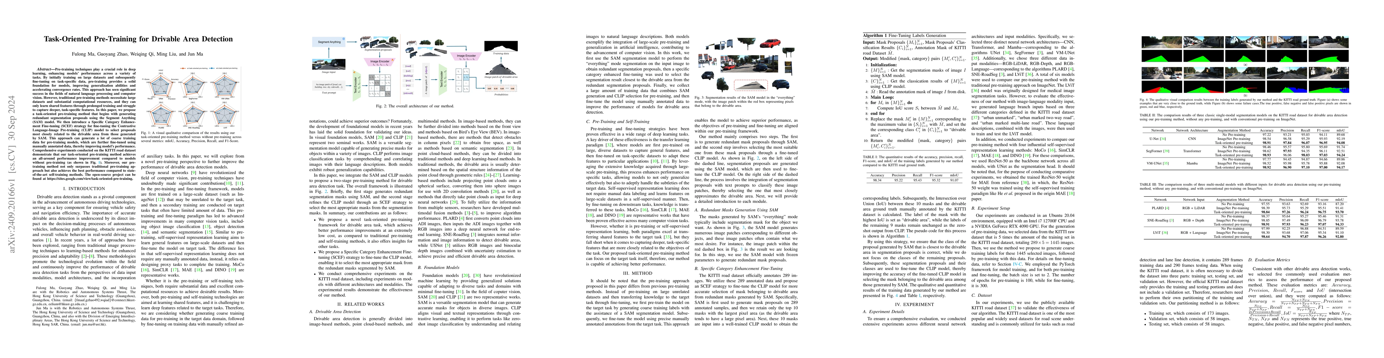
Pre-training techniques play a crucial role in deep learning, enhancing models' performance across a variety of tasks. By initially training on large datasets and subsequently fine-tuning on task-spec...
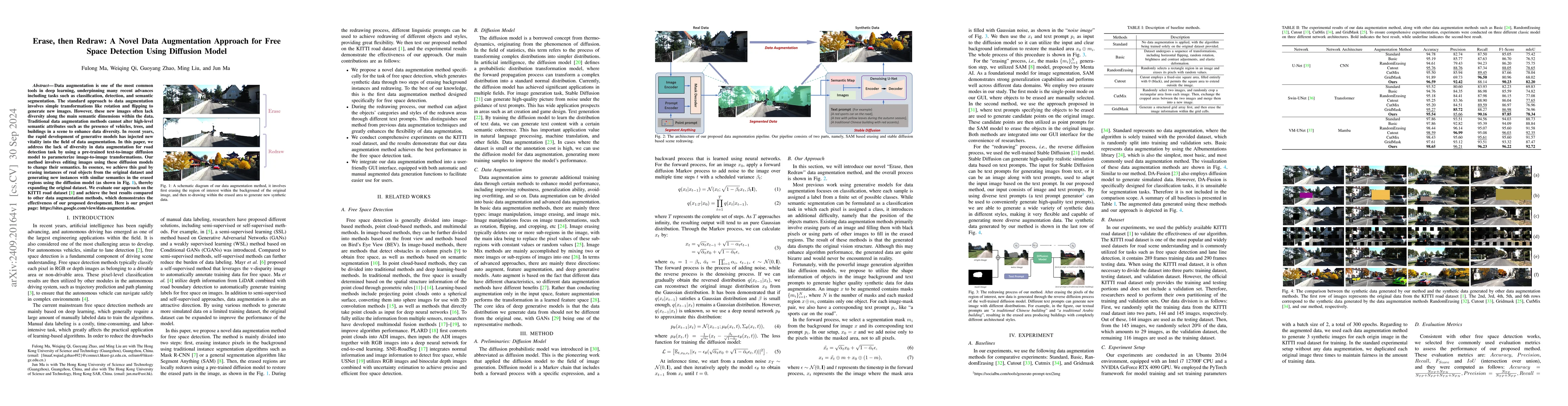
Data augmentation is one of the most common tools in deep learning, underpinning many recent advances including tasks such as classification, detection, and semantic segmentation. The standard approac...
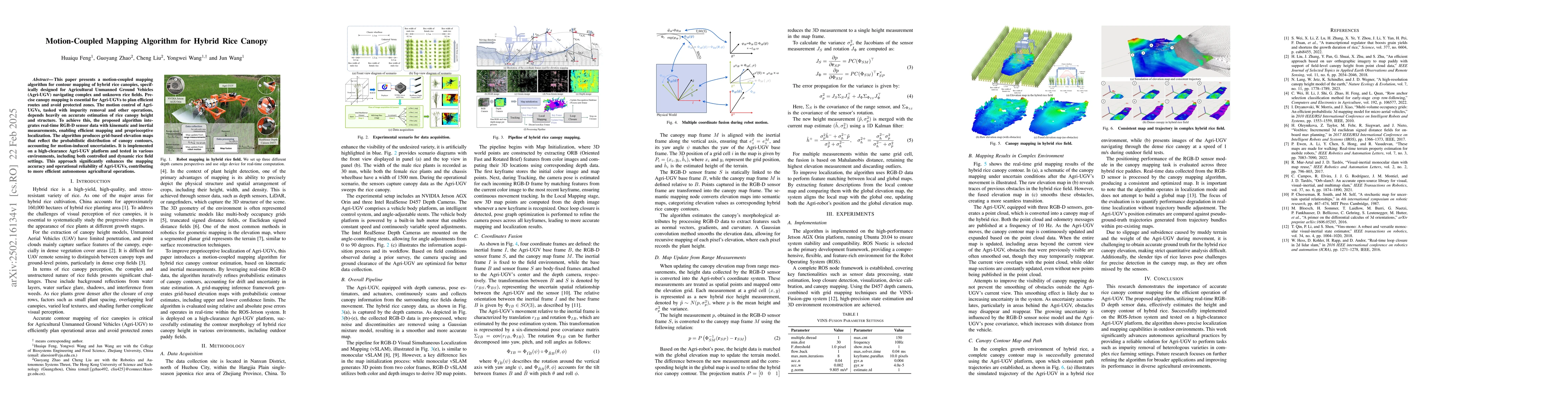
This paper presents a motion-coupled mapping algorithm for contour mapping of hybrid rice canopies, specifically designed for Agricultural Unmanned Ground Vehicles (Agri-UGV) navigating complex and un...
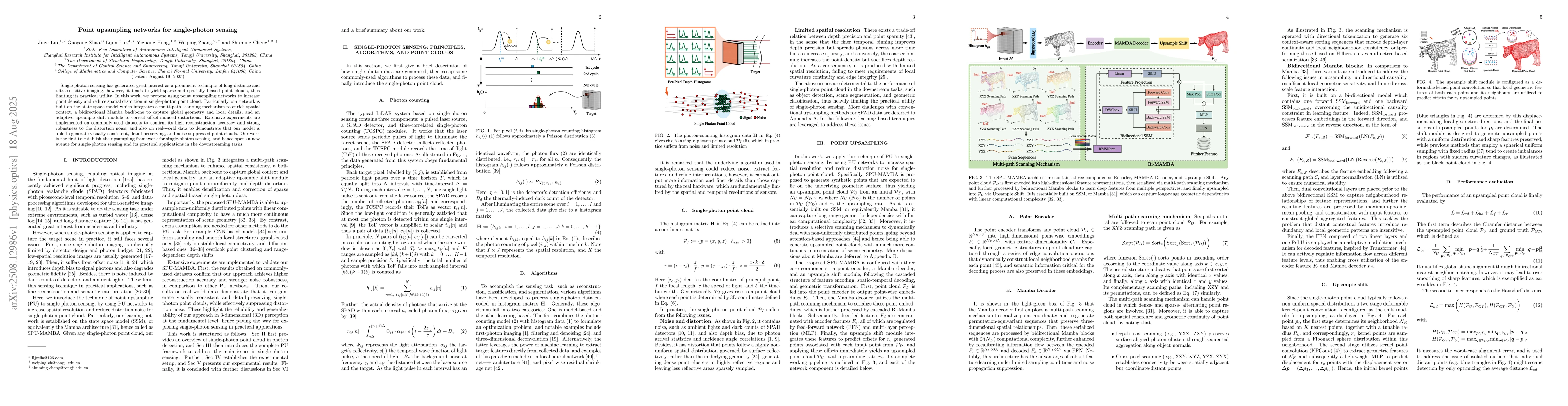
Single-photon sensing has generated great interest as a prominent technique of long-distance and ultra-sensitive imaging, however, it tends to yield sparse and spatially biased point clouds, thus limi...
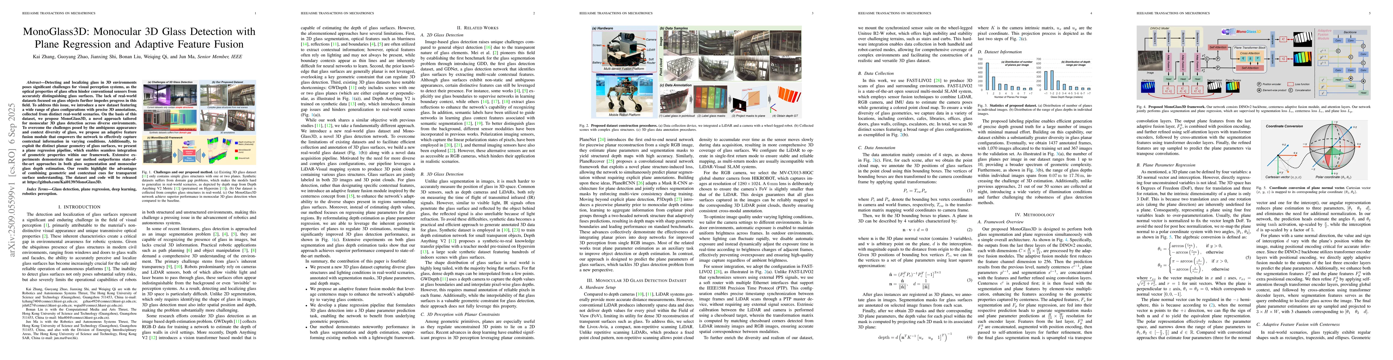
Detecting and localizing glass in 3D environments poses significant challenges for visual perception systems, as the optical properties of glass often hinder conventional sensors from accurately disti...
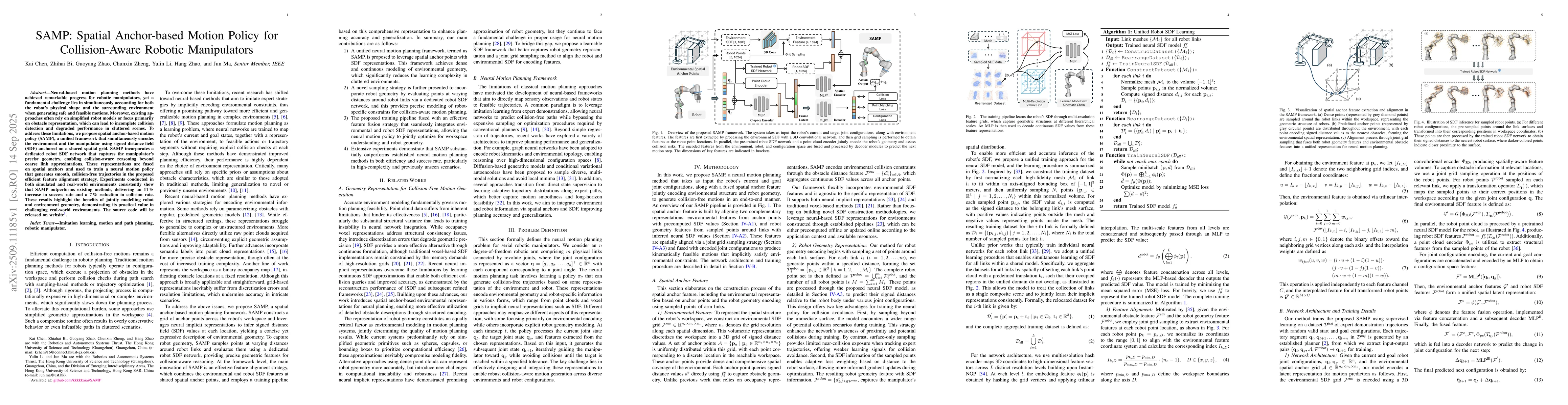
Neural-based motion planning methods have achieved remarkable progress for robotic manipulators, yet a fundamental challenge lies in simultaneously accounting for both the robot's physical shape and t...
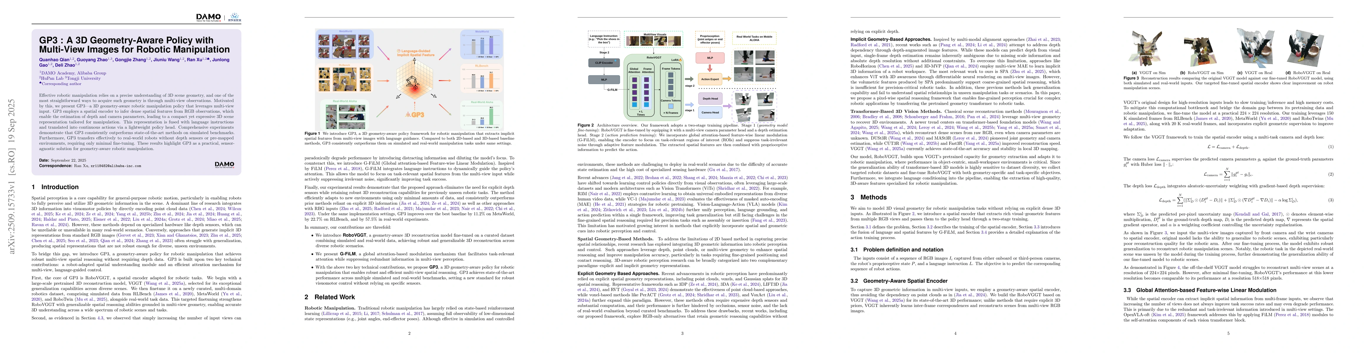
Effective robotic manipulation relies on a precise understanding of 3D scene geometry, and one of the most straightforward ways to acquire such geometry is through multi-view observations. Motivated b...
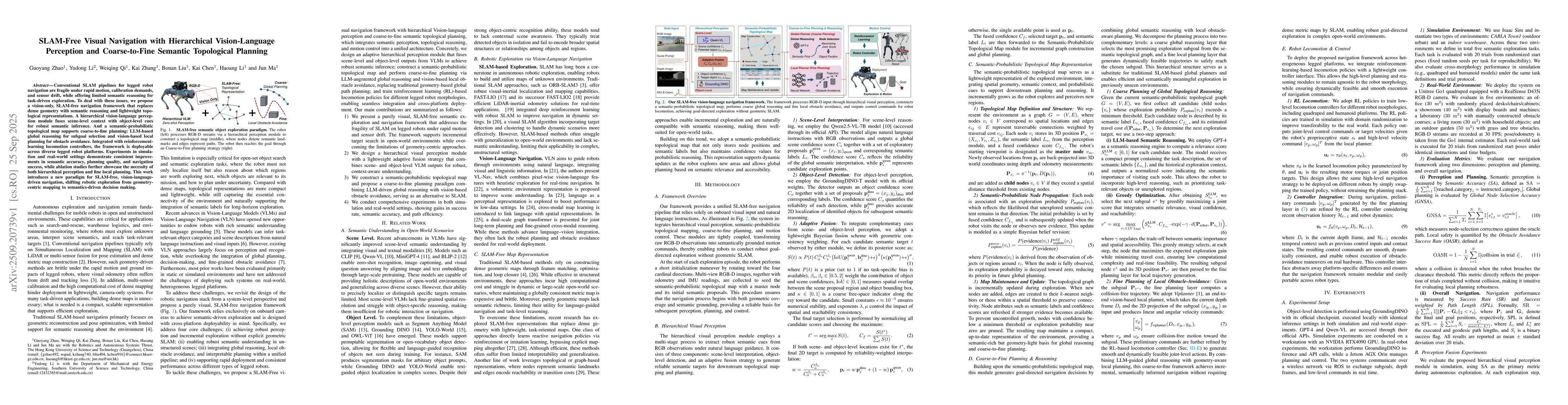
Conventional SLAM pipelines for legged robot navigation are fragile under rapid motion, calibration demands, and sensor drift, while offering limited semantic reasoning for task-driven exploration. To...
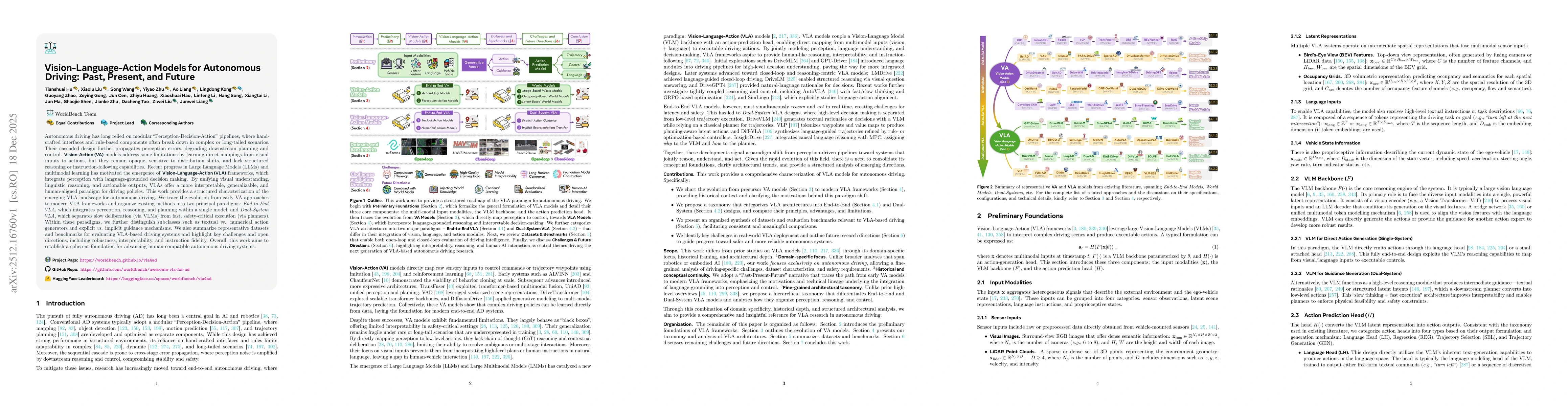
Autonomous driving has long relied on modular "Perception-Decision-Action" pipelines, where hand-crafted interfaces and rule-based components often break down in complex or long-tailed scenarios. Thei...
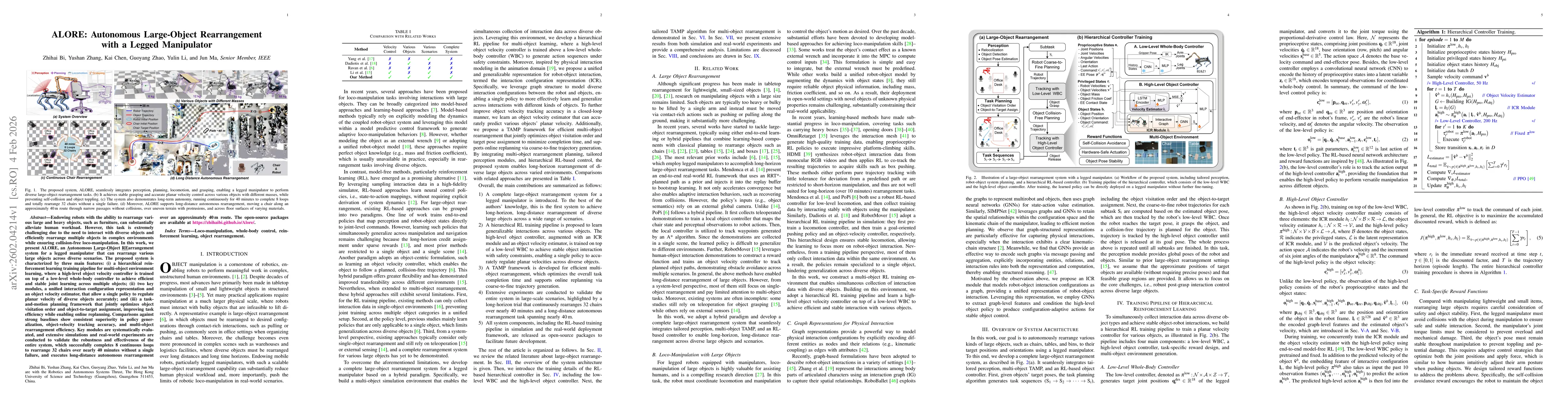
Endowing robots with the ability to rearrange various large and heavy objects, such as furniture, can substantially alleviate human workload. However, this task is extremely challenging due to the nee...

Reconstructing physically valid 3D scenes from single-view observations is a prerequisite for bridging the gap between visual perception and robotic control. However, in scenarios requiring precise co...
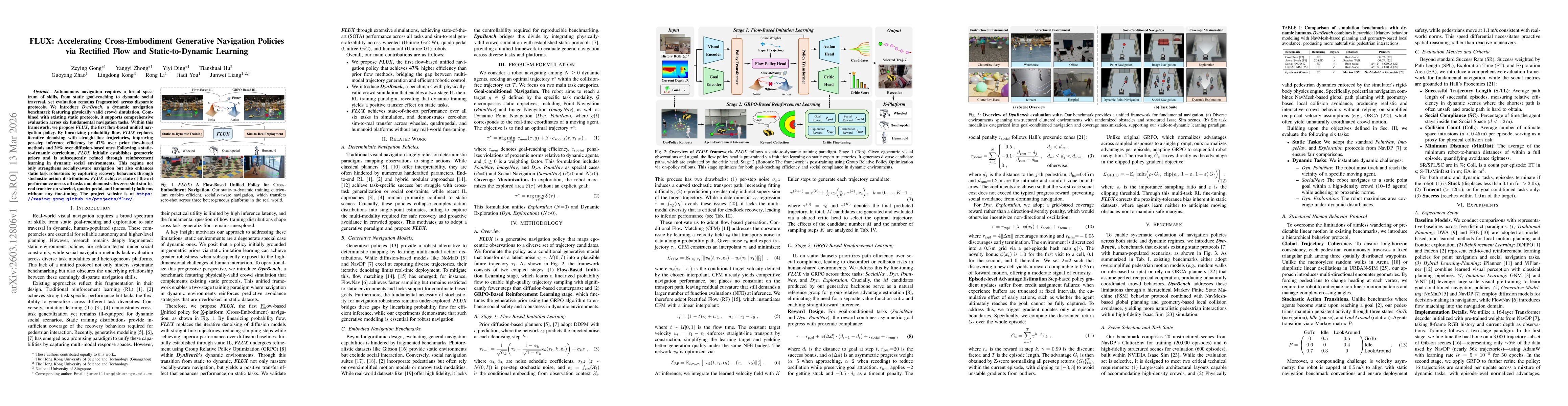
Autonomous navigation requires a broad spectrum of skills, from static goal-reaching to dynamic social traversal, yet evaluation remains fragmented across disparate protocols. We introduce DynBench, a...
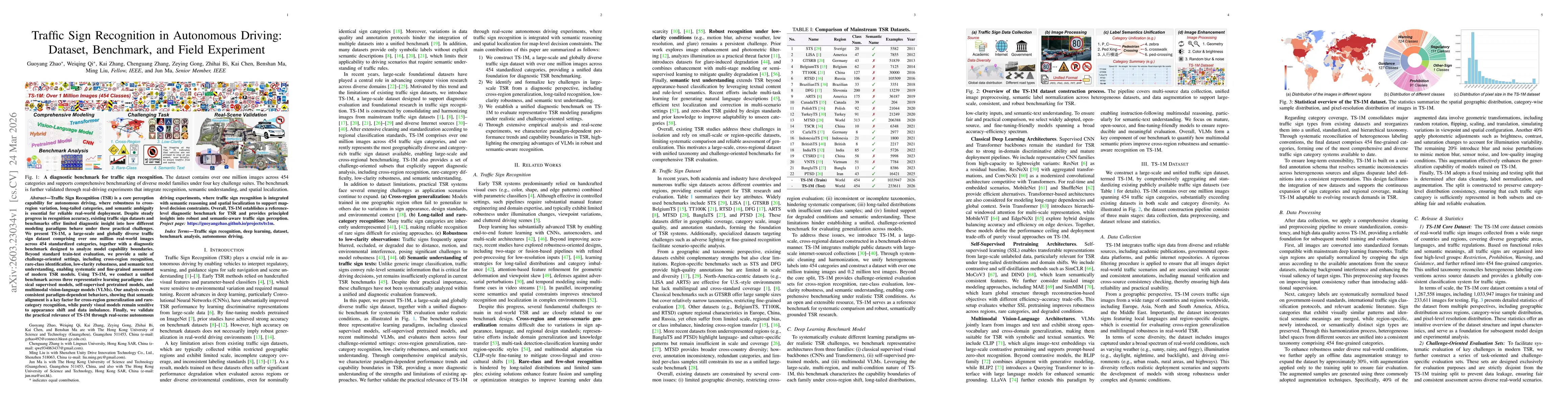
Traffic Sign Recognition (TSR) is a core perception capability for autonomous driving, where robustness to cross-region variation, long-tailed categories, and semantic ambiguity is essential for relia...
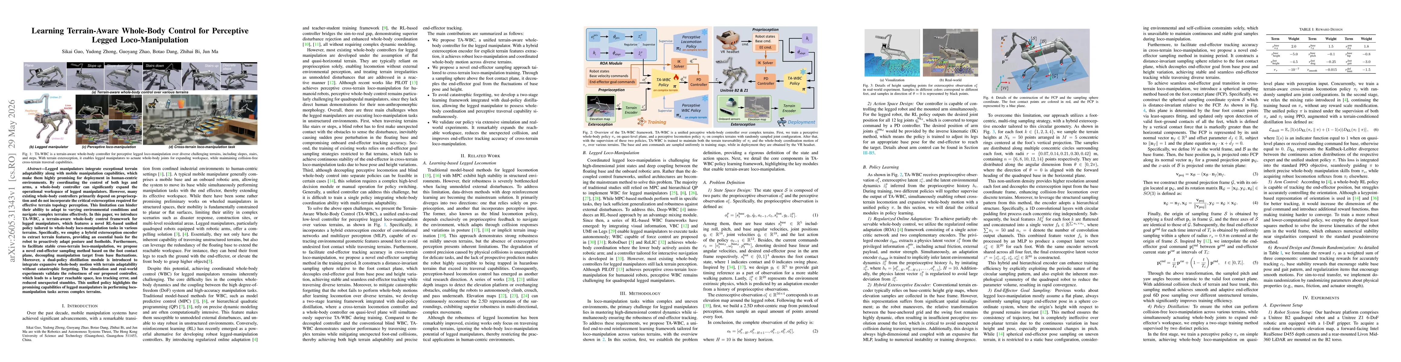
Legged manipulators integrate exceptional terrain adaptability along with mobile manipulation capabilities, which make them highly promising for deployment in human-centric environments. By coordinati...
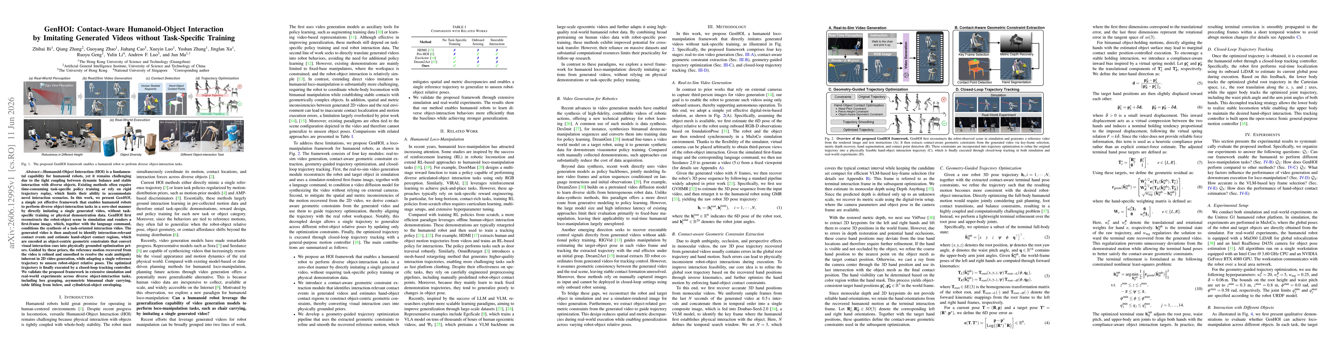
Humanoid-Object Interaction (HOI) is a fundamental capability for humanoid robots, yet it remains challenging due to the tight coupling between dynamic balance and stable interaction with diverse obje...