Academic Profile
Statistics
Similar Authors
Papers on arXiv
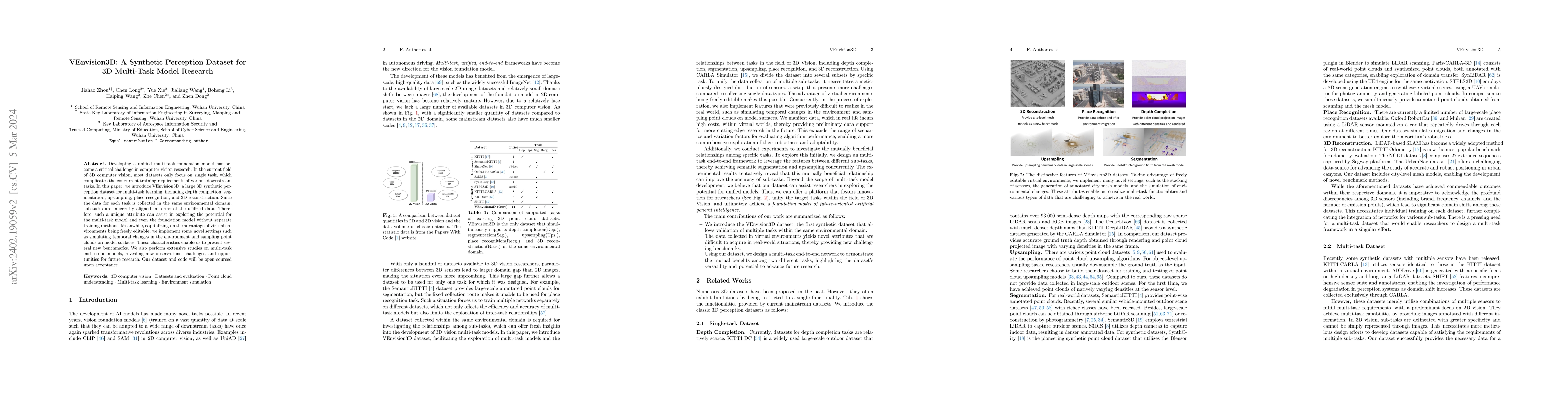
Developing a unified multi-task foundation model has become a critical challenge in computer vision research. In the current field of 3D computer vision, most datasets only focus on single task, whi...
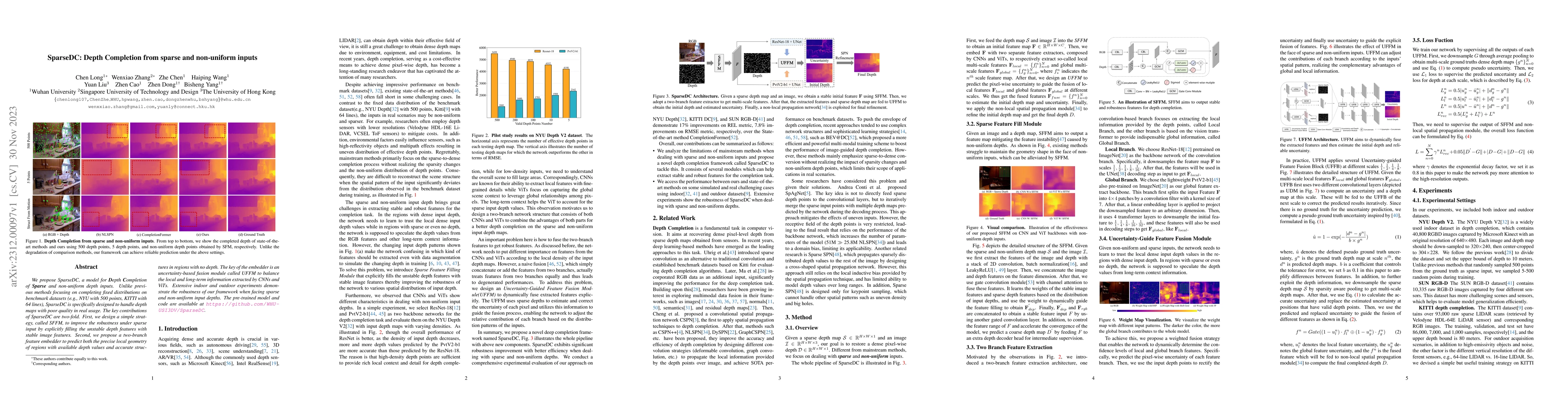
We propose SparseDC, a model for Depth Completion of Sparse and non-uniform depth inputs. Unlike previous methods focusing on completing fixed distributions on benchmark datasets (e.g., NYU with 500...
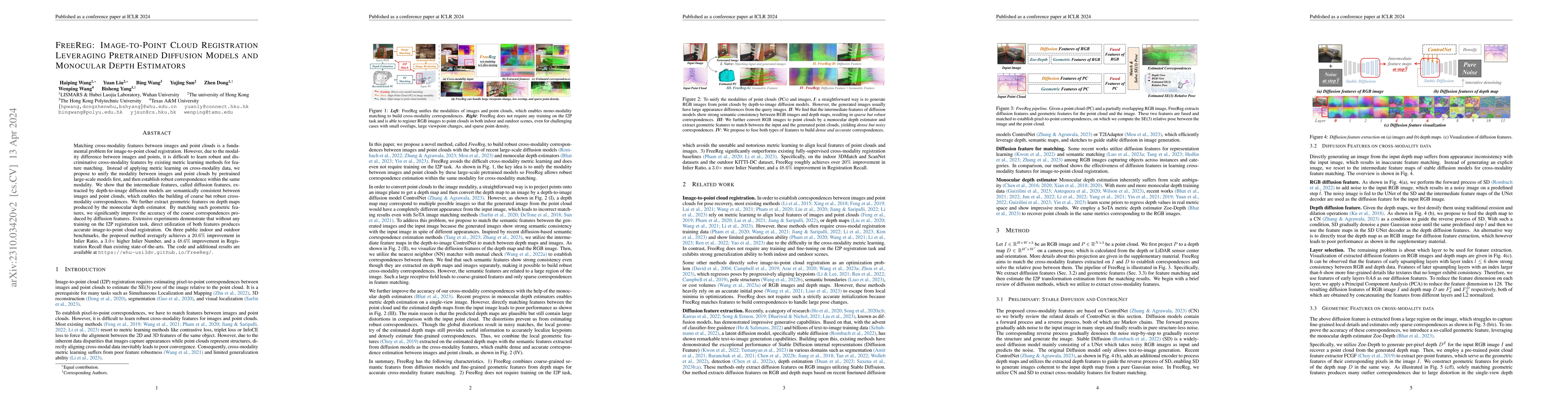
Matching cross-modality features between images and point clouds is a fundamental problem for image-to-point cloud registration. However, due to the modality difference between images and points, it...
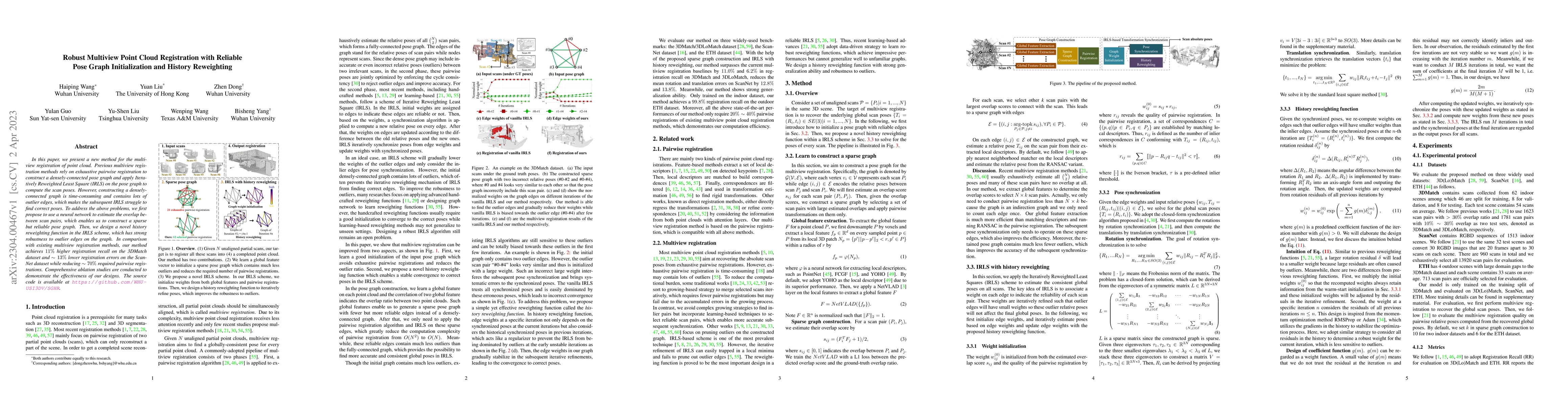
In this paper, we present a new method for the multiview registration of point cloud. Previous multiview registration methods rely on exhaustive pairwise registration to construct a densely-connecte...
At present, the anchor-based or anchor-free models that use LiDAR point clouds for 3D object detection use the center assigner strategy to infer the 3D bounding boxes. However, in a real world scene...
In this paper, we propose a novel local descriptor-based framework, called You Only Hypothesize Once (YOHO), for the registration of two unaligned point clouds. In contrast to most existing local de...
Corbino-geometry has well-known applications in physics, as in the design of graphene heterostructures for detecting fractional quantum Hall states or superconducting waveguides for illustrating cir...
Dashboard cameras (dashcams) record millions of driving videos daily, offering a valuable potential data source for various applications, including driving map production and updates. A necessary step...
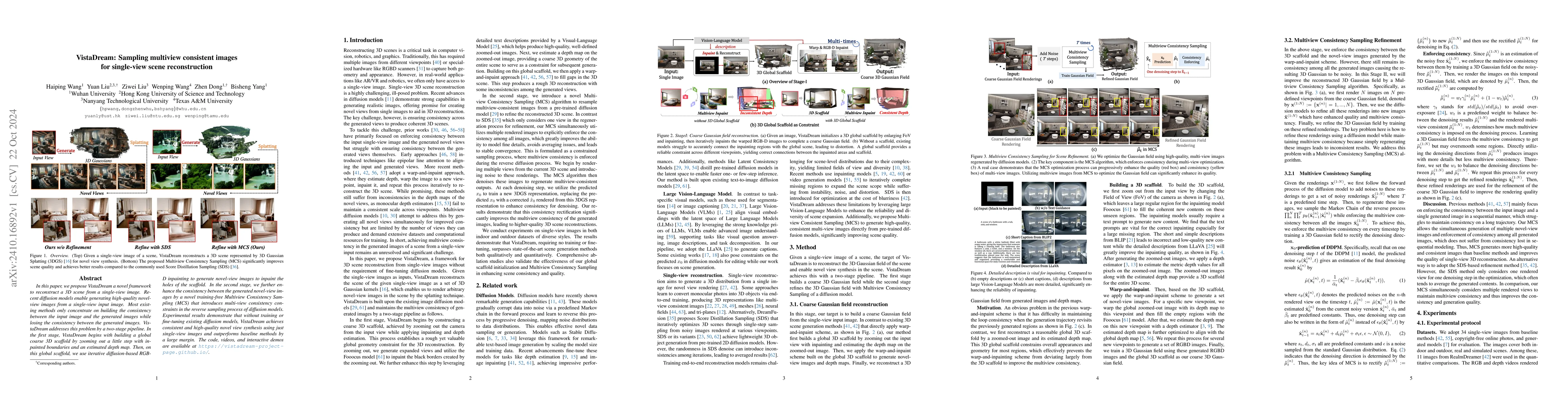
In this paper, we propose VistaDream a novel framework to reconstruct a 3D scene from a single-view image. Recent diffusion models enable generating high-quality novel-view images from a single-view i...
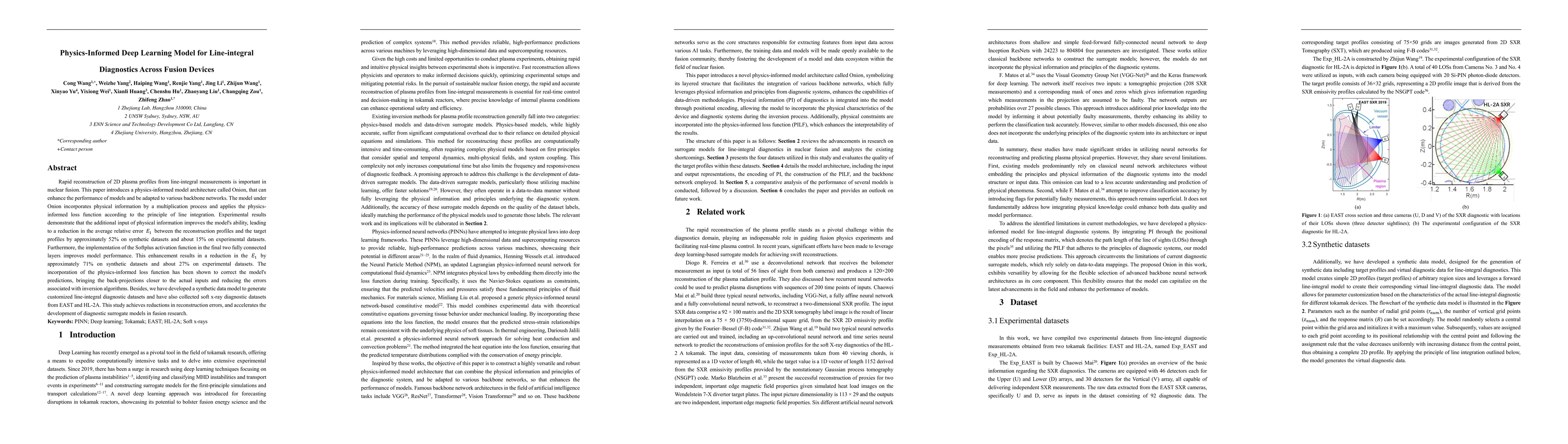
This paper introduces a Physics-Informed model architecture that can be adapted to various backbone networks. The model incorporates physical information as additional input and is constrained by a Ph...
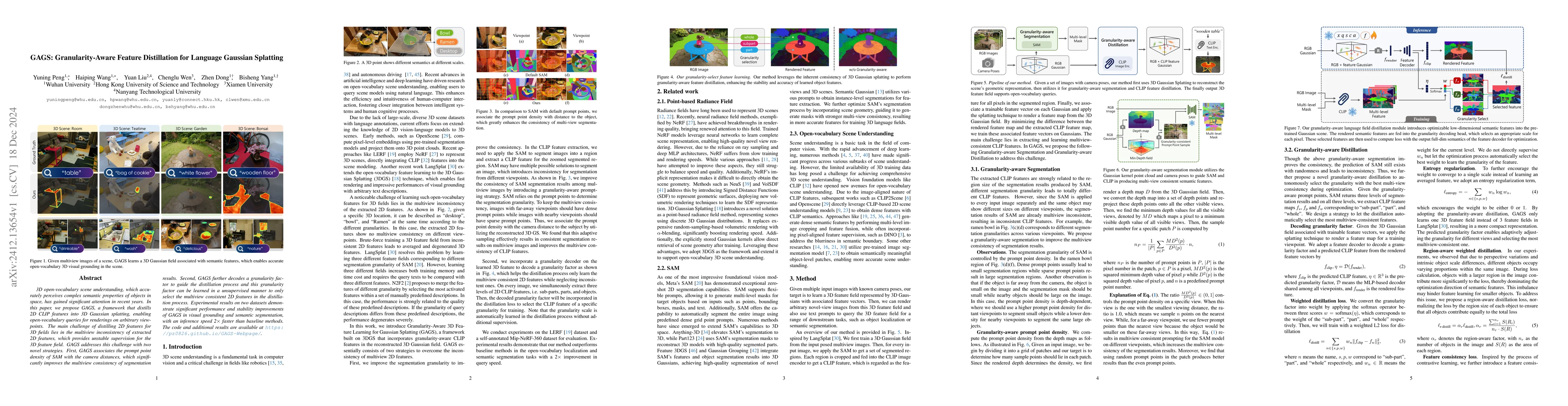
3D open-vocabulary scene understanding, which accurately perceives complex semantic properties of objects in space, has gained significant attention in recent years. In this paper, we propose GAGS, a ...
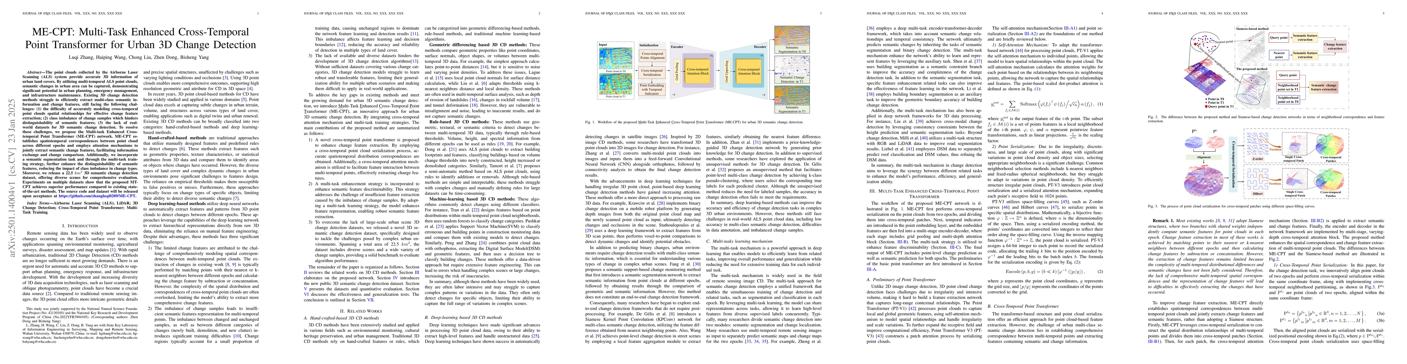
The point clouds collected by the Airborne Laser Scanning (ALS) system provide accurate 3D information of urban land covers. By utilizing multi-temporal ALS point clouds, semantic changes in urban are...
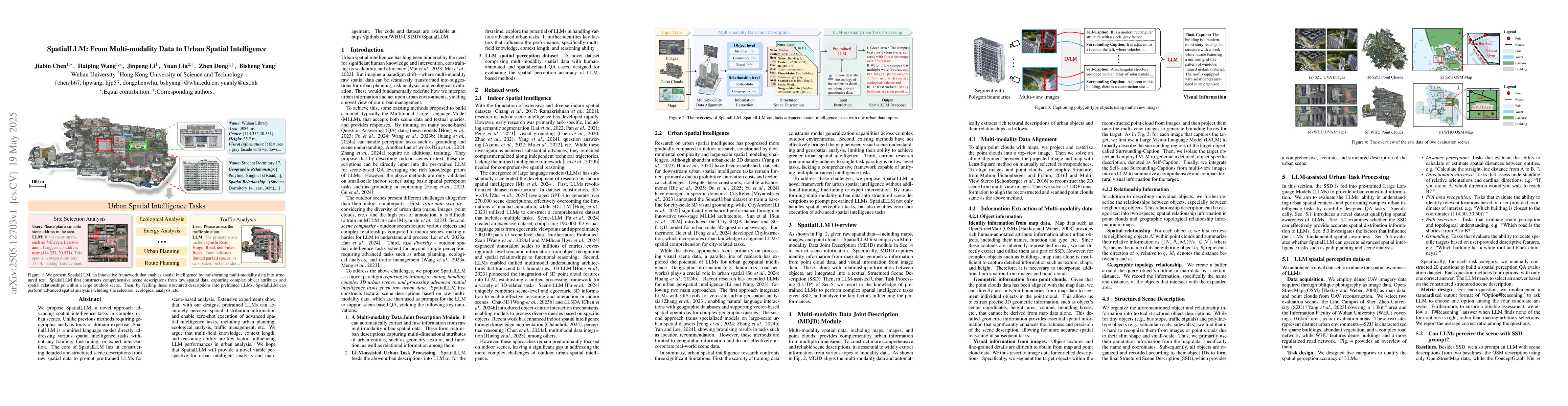
We propose SpatialLLM, a novel approach advancing spatial intelligence tasks in complex urban scenes. Unlike previous methods requiring geographic analysis tools or domain expertise, SpatialLLM is a u...
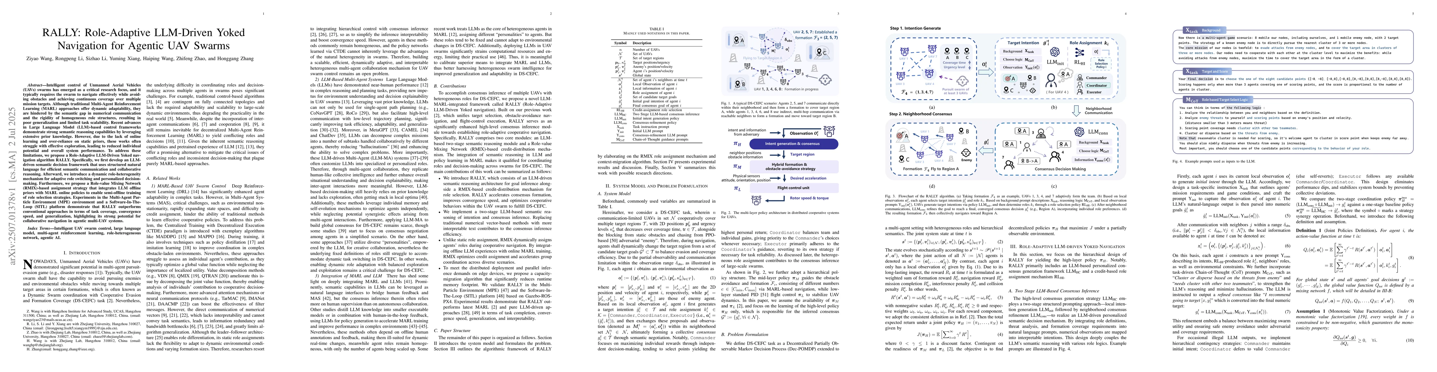
Intelligent control of Unmanned Aerial Vehicles (UAVs) swarms has emerged as a critical research focus, and it typically requires the swarm to navigate effectively while avoiding obstacles and achievi...
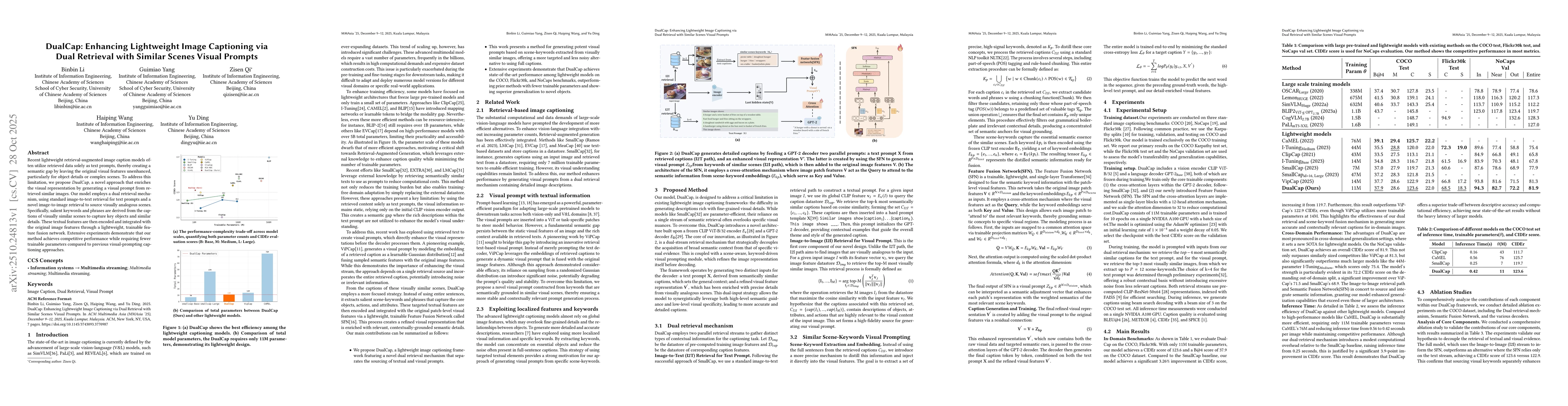
Recent lightweight retrieval-augmented image caption models often utilize retrieved data solely as text prompts, thereby creating a semantic gap by leaving the original visual features unenhanced, par...