Academic Profile
Statistics
Similar Authors
Papers on arXiv
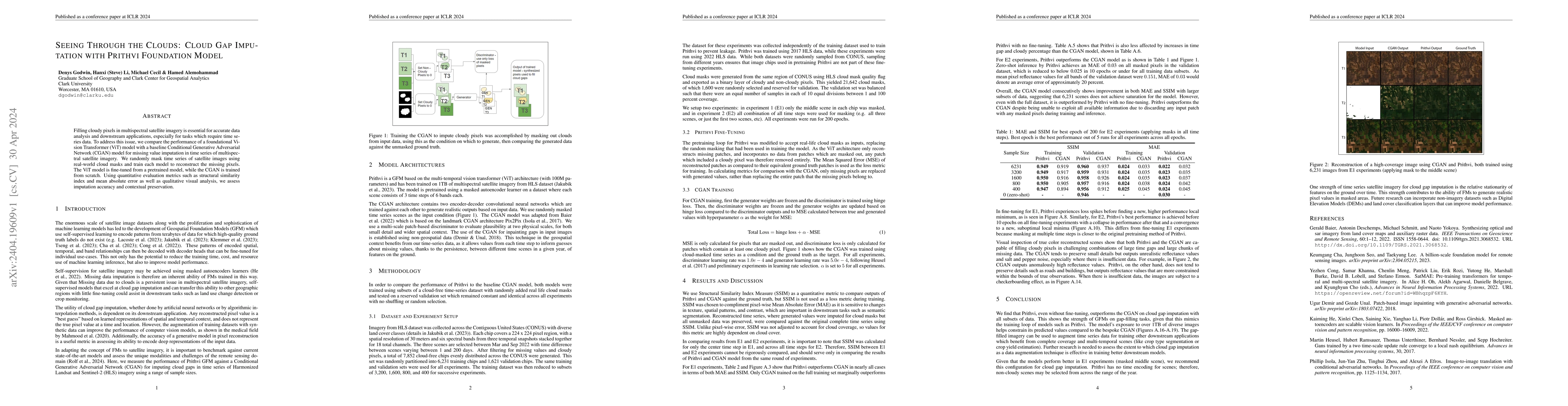
Filling cloudy pixels in multispectral satellite imagery is essential for accurate data analysis and downstream applications, especially for tasks which require time series data. To address this iss...
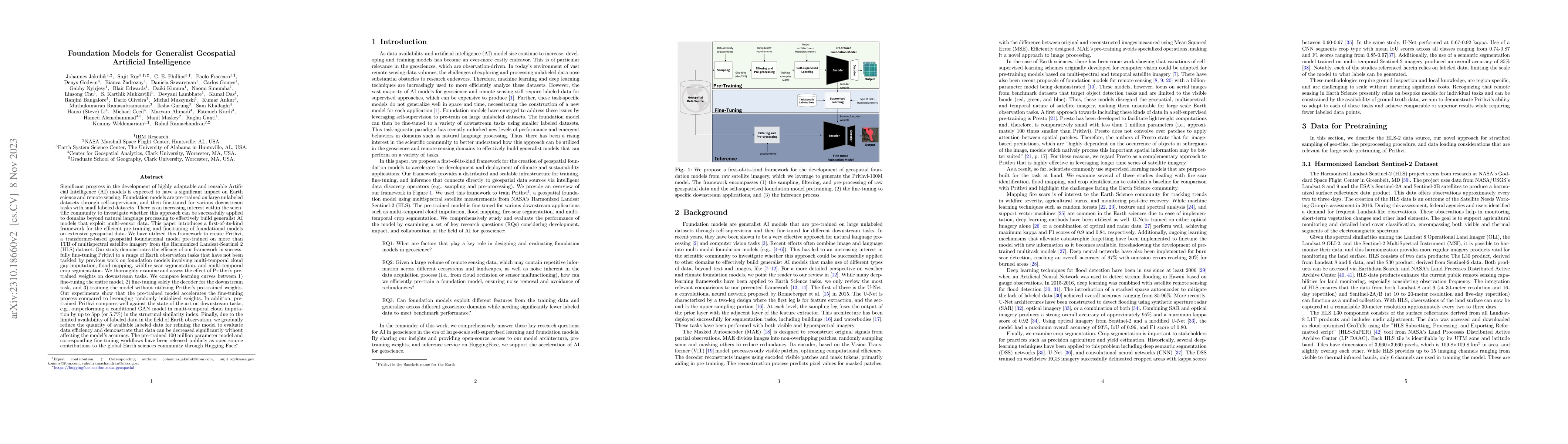
Significant progress in the development of highly adaptable and reusable Artificial Intelligence (AI) models is expected to have a significant impact on Earth science and remote sensing. Foundation ...
Recent progress in self-supervision has shown that pre-training large neural networks on vast amounts of unsupervised data can lead to substantial increases in generalization to downstream tasks. Su...
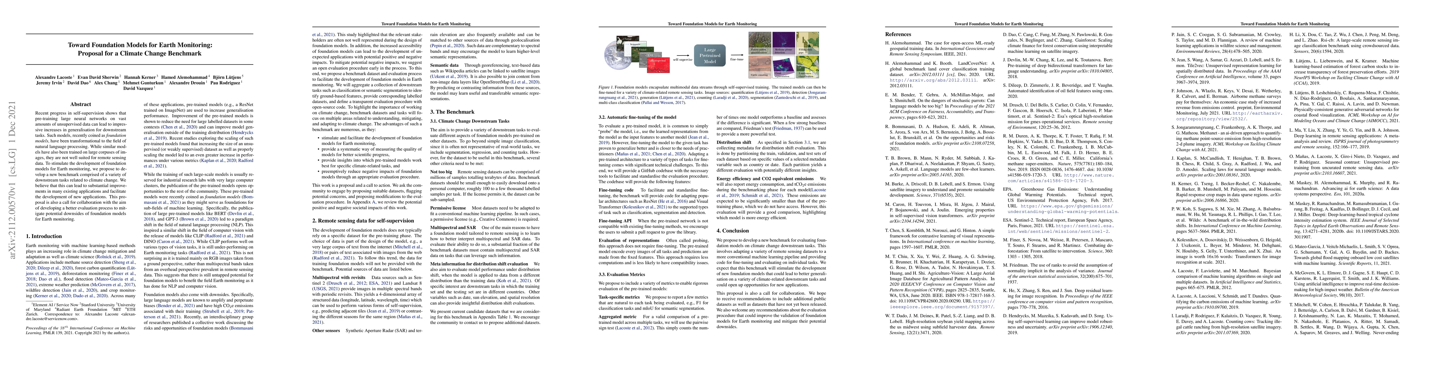
Recent progress in self-supervision shows that pre-training large neural networks on vast amounts of unsupervised data can lead to impressive increases in generalisation for downstream tasks. Such m...
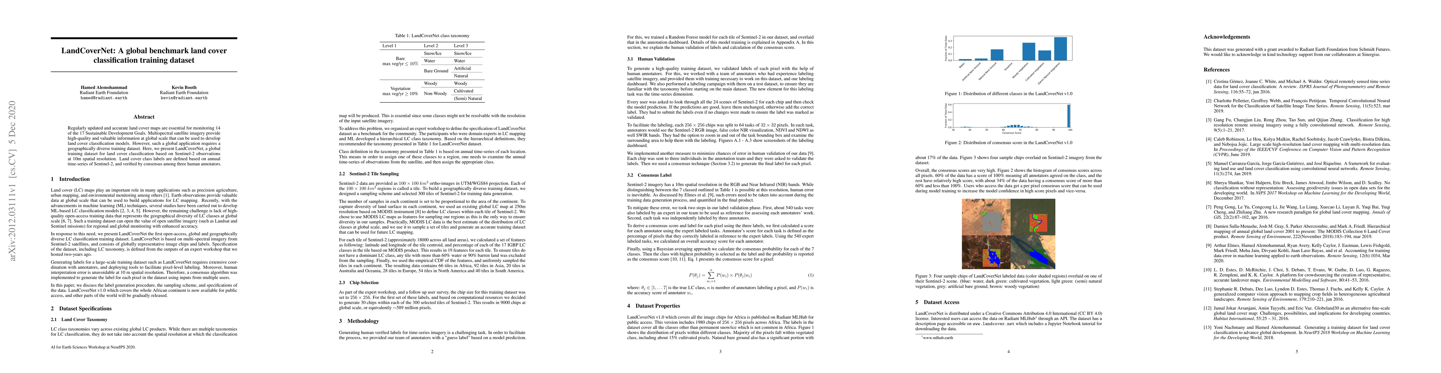
Regularly updated and accurate land cover maps are essential for monitoring 14 of the 17 Sustainable Development Goals. Multispectral satellite imagery provide high-quality and valuable information ...
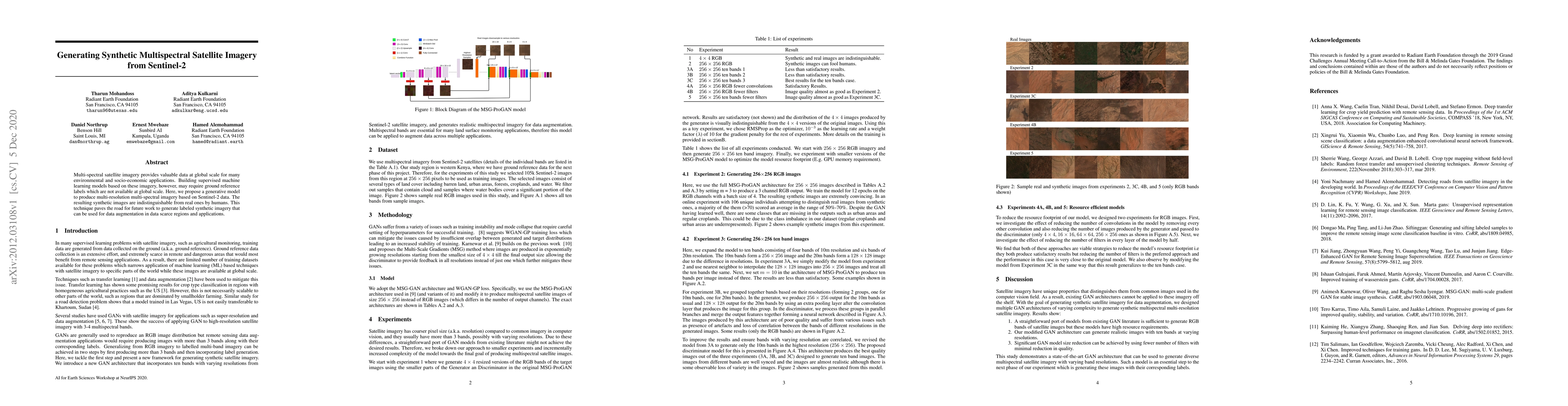
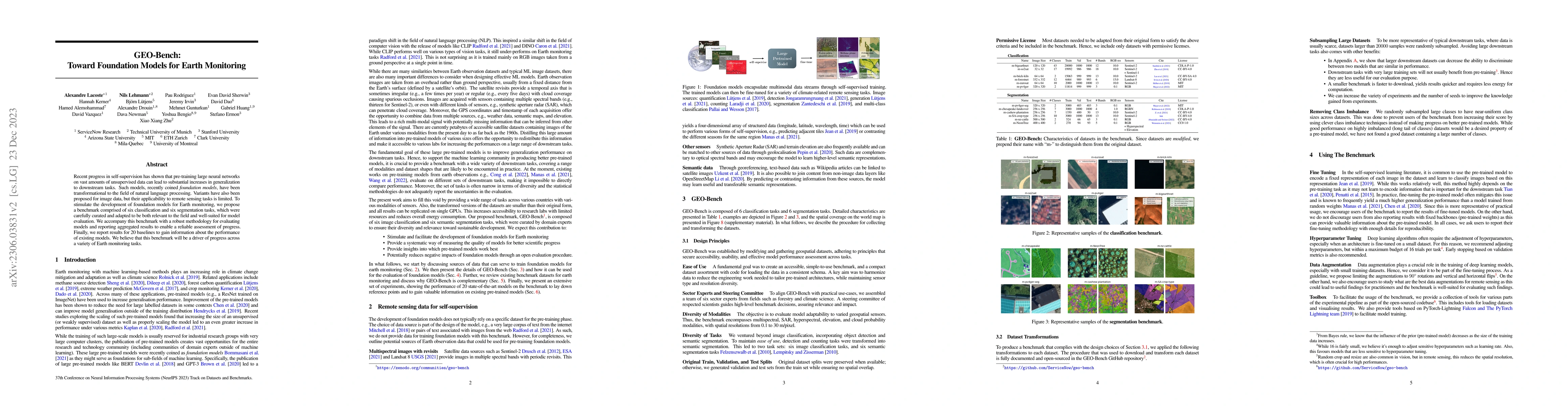
Multi-spectral satellite imagery provides valuable data at global scale for many environmental and socio-economic applications. Building supervised machine learning models based on these imagery, ho...
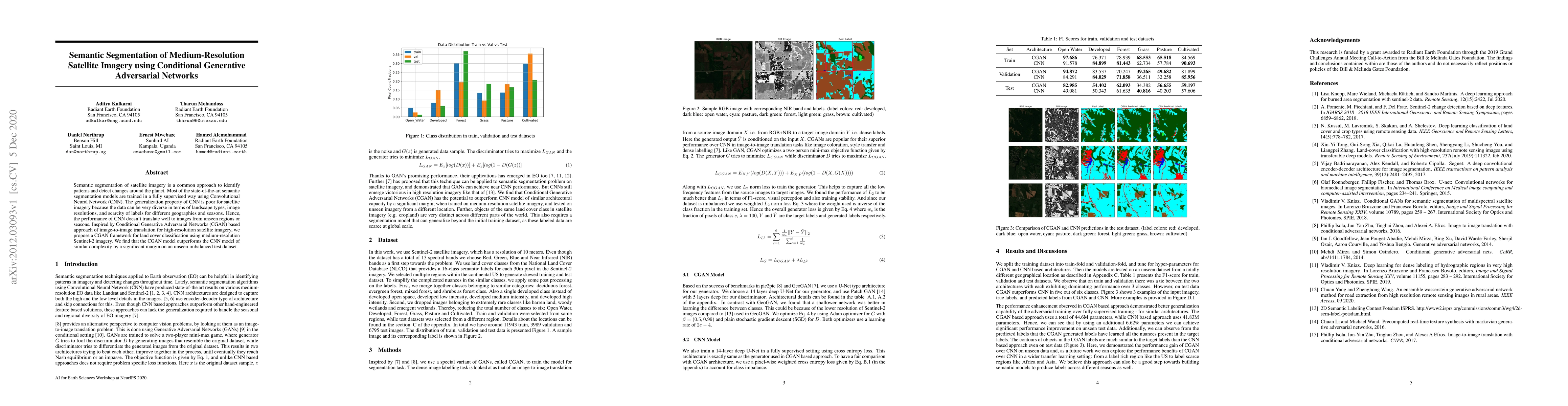
Semantic segmentation of satellite imagery is a common approach to identify patterns and detect changes around the planet. Most of the state-of-the-art semantic segmentation models are trained in a ...
The accuracy of mapping agricultural fields across large areas is steadily improving with high-resolution satellite imagery and deep learning (DL) models, even in regions where fields are small and ge...
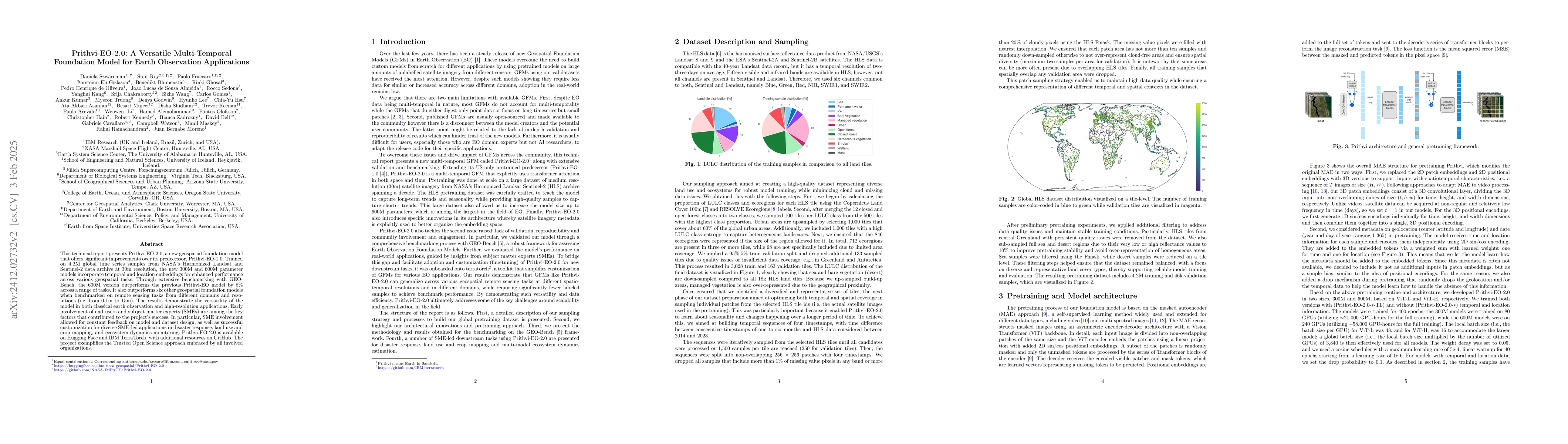
This technical report presents Prithvi-EO-2.0, a new geospatial foundation model that offers significant improvements over its predecessor, Prithvi-EO-1.0. Trained on 4.2M global time series samples f...
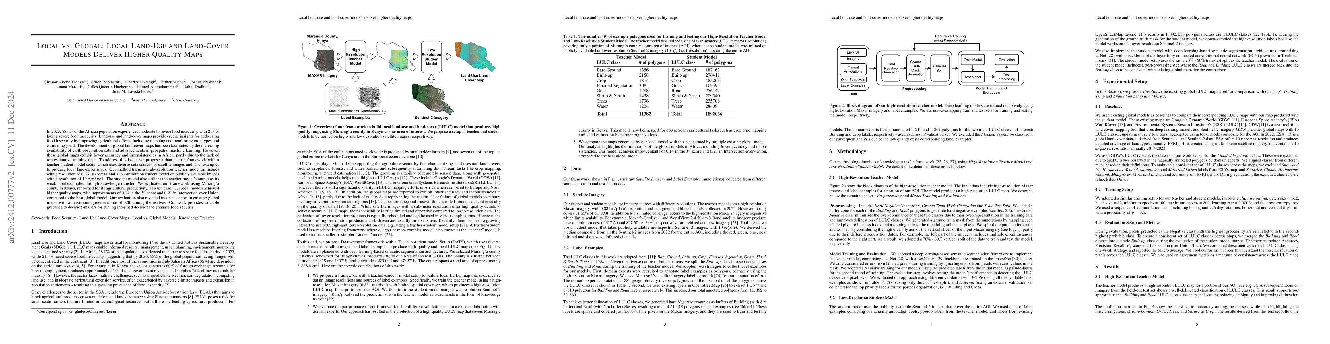
Approximately 20% of Africa's population suffered from undernourishment, and 868 million people experienced moderate to severe food insecurity in 2022. Land-use and land-cover maps provide crucial ins...
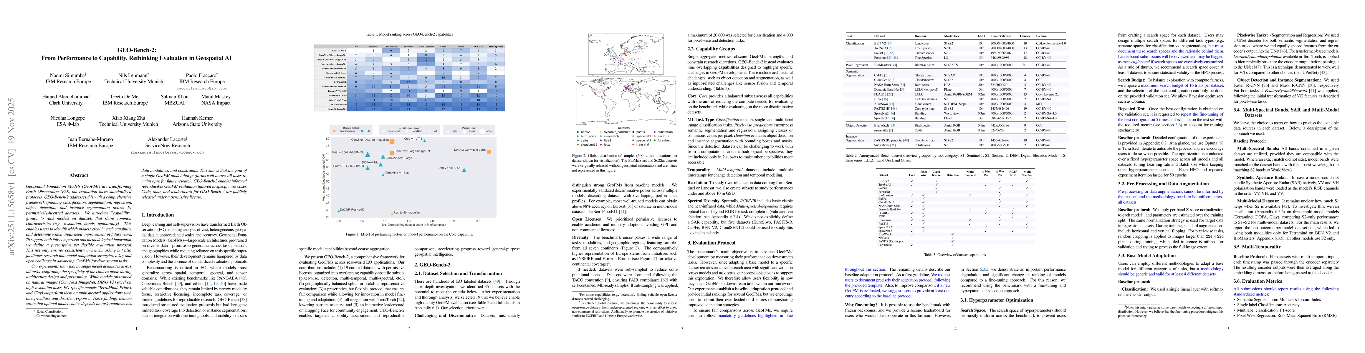
Geospatial Foundation Models (GeoFMs) are transforming Earth Observation (EO), but evaluation lacks standardized protocols. GEO-Bench-2 addresses this with a comprehensive framework spanning classific...
Floods are among the most damaging weather-related hazards, and in 2024, the warmest year on record, extreme flood events affected communities across five continents. Earth observation (EO) satellites...
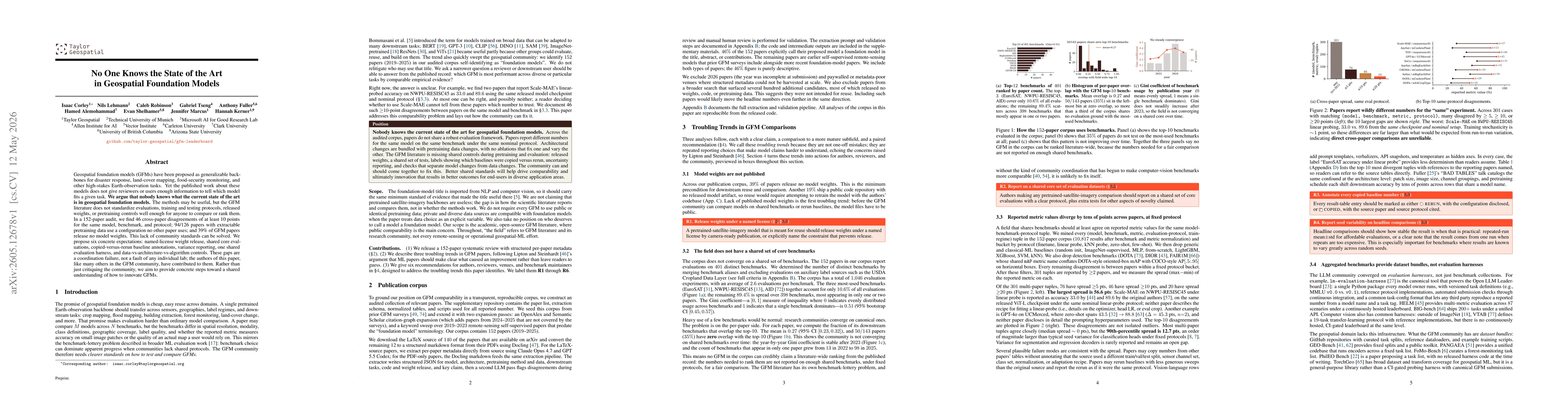
Geospatial foundation models (GFMs) have been proposed as generalizable backbones for disaster response, land-cover mapping, food-security monitoring, and other high-stakes Earth-observation tasks. Ye...