Academic Profile
Statistics
Similar Authors
Papers on arXiv
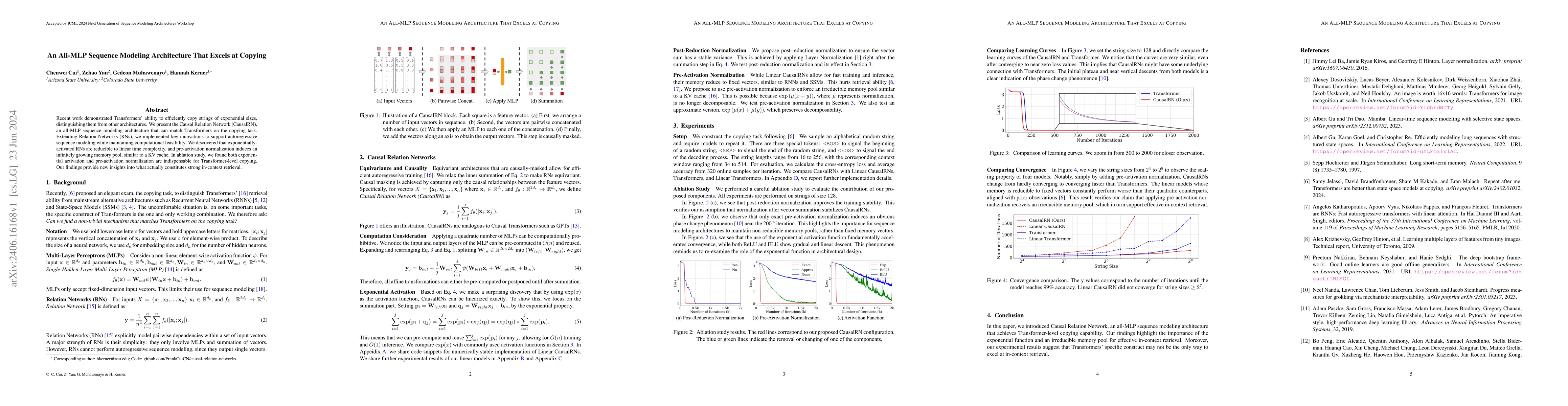
Recent work demonstrated Transformers' ability to efficiently copy strings of exponential sizes, distinguishing them from other architectures. We present the Causal Relation Network (CausalRN), an all...
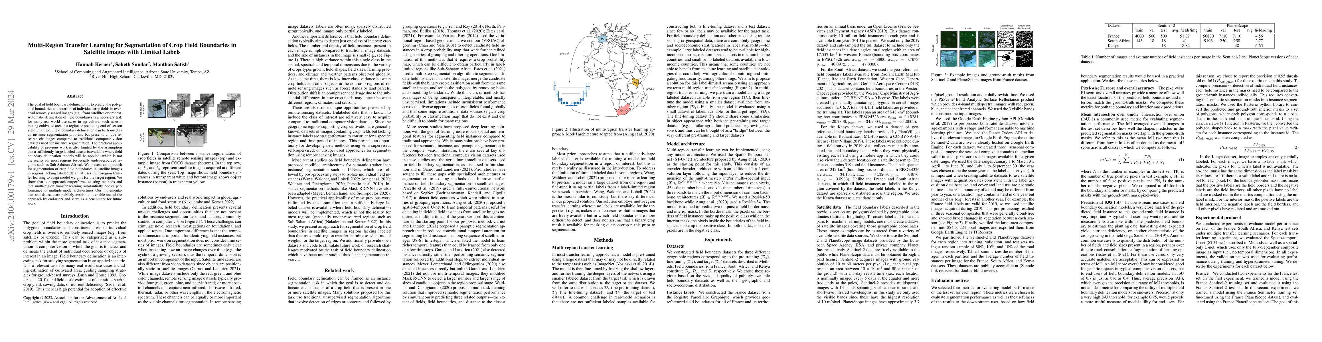
The goal of field boundary delineation is to predict the polygonal boundaries and interiors of individual crop fields in overhead remotely sensed images (e.g., from satellites or drones). Automatic ...
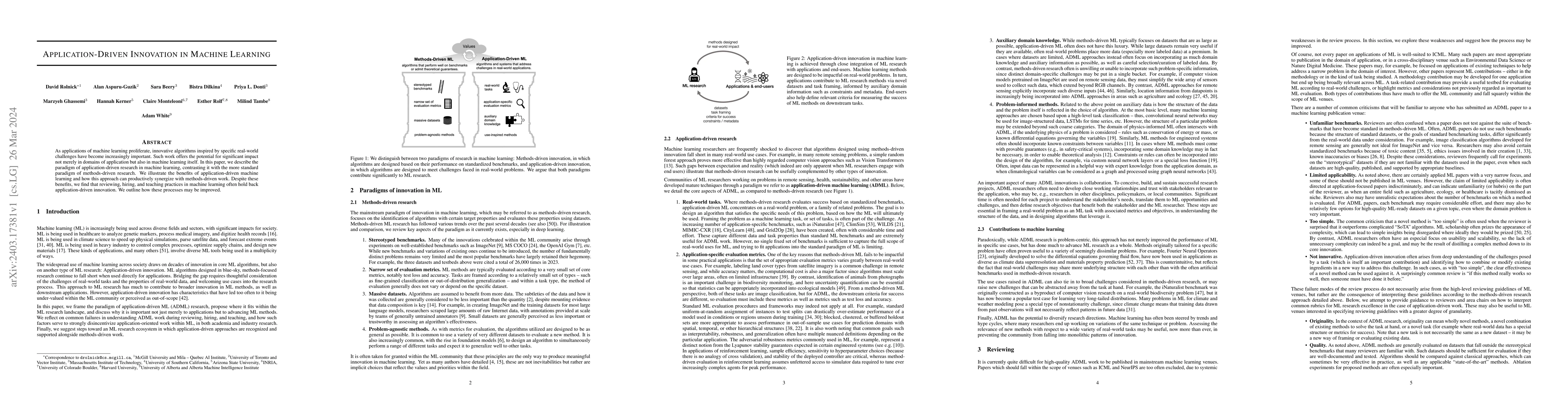
As applications of machine learning proliferate, innovative algorithms inspired by specific real-world challenges have become increasingly important. Such work offers the potential for significant i...
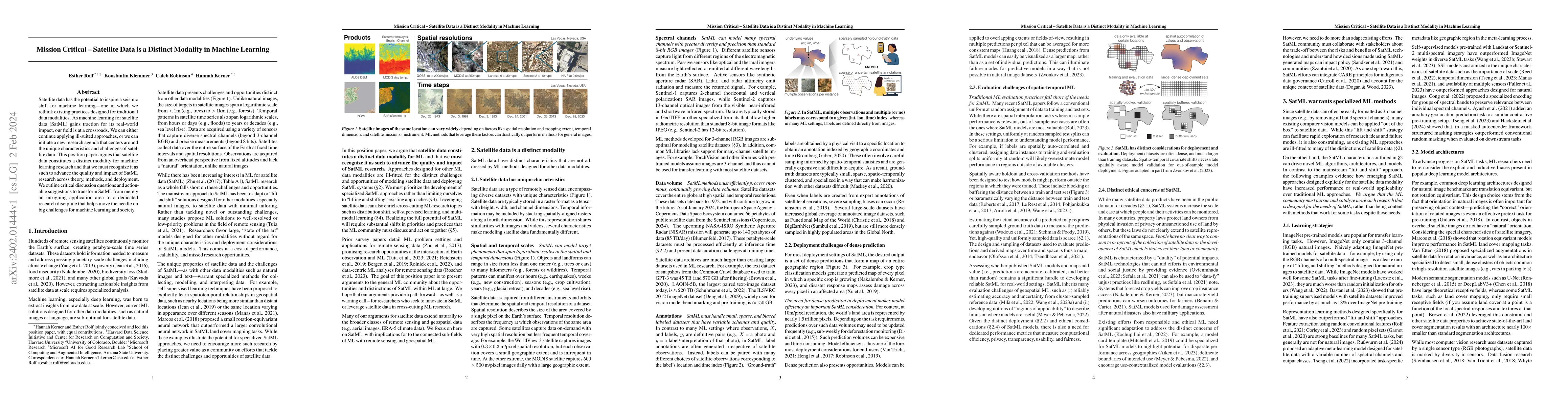
Satellite data has the potential to inspire a seismic shift for machine learning -- one in which we rethink existing practices designed for traditional data modalities. As machine learning for satel...
Boulders form from a variety of geological processes, which their size, shape, and orientation may help us better understand. Furthermore, they represent potential hazards to spacecraft landing that...
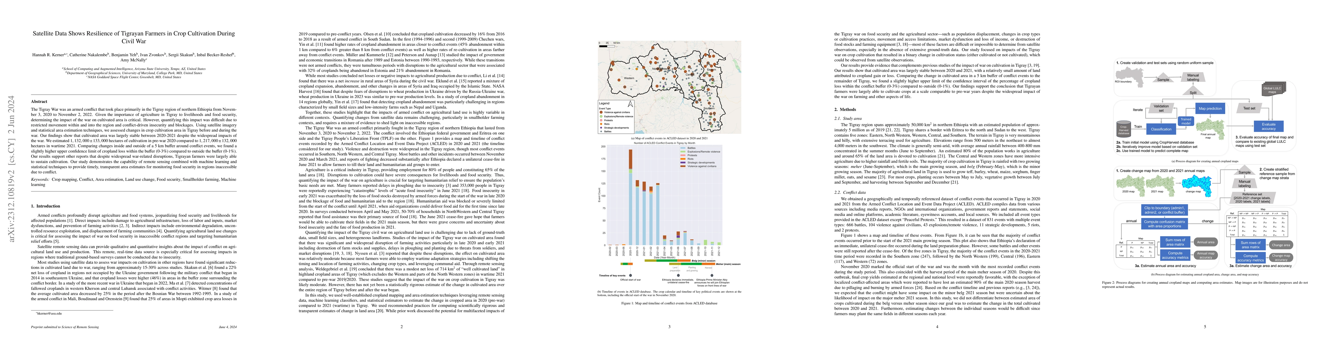
The Tigray War was an armed conflict that took place primarily in the Tigray region of northern Ethiopia from November 3, 2020 to November 2, 2022. Given the importance of agriculture in Tigray to l...
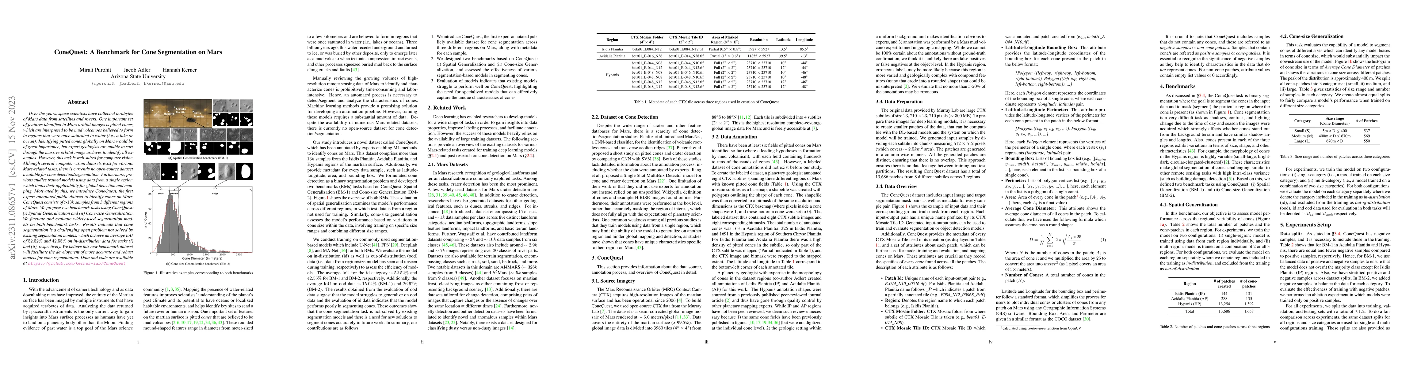
Over the years, space scientists have collected terabytes of Mars data from satellites and rovers. One important set of features identified in Mars orbital images is pitted cones, which are interpre...
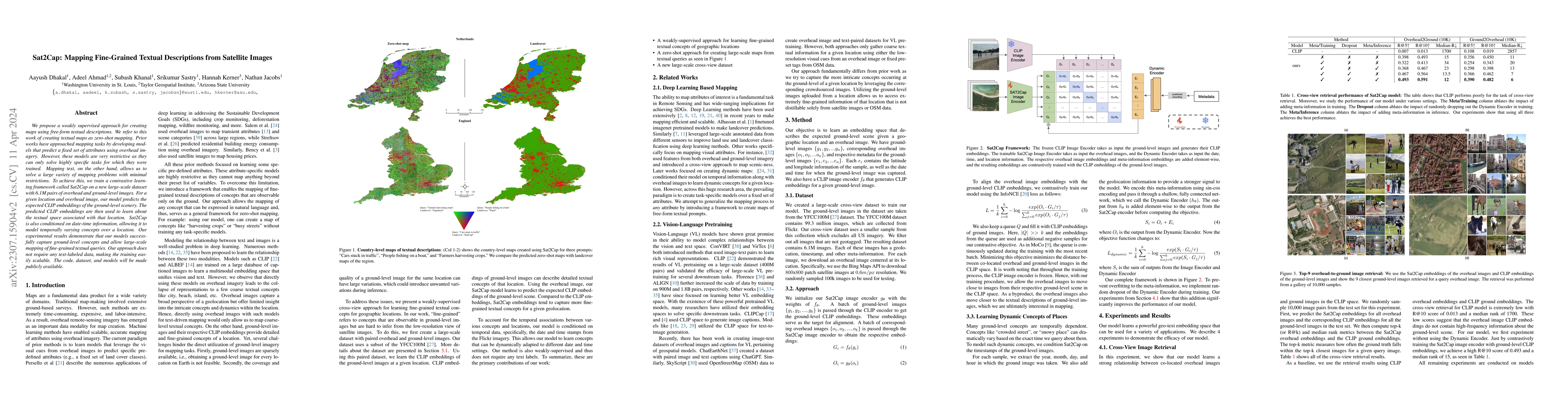
We propose a weakly supervised approach for creating maps using free-form textual descriptions. We refer to this work of creating textual maps as zero-shot mapping. Prior works have approached mappi...
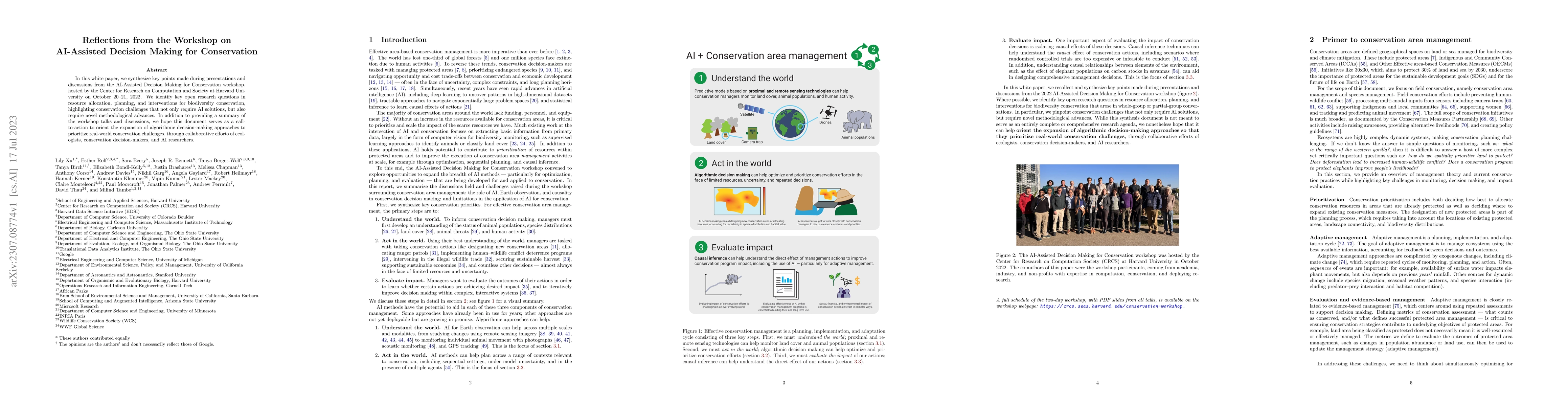
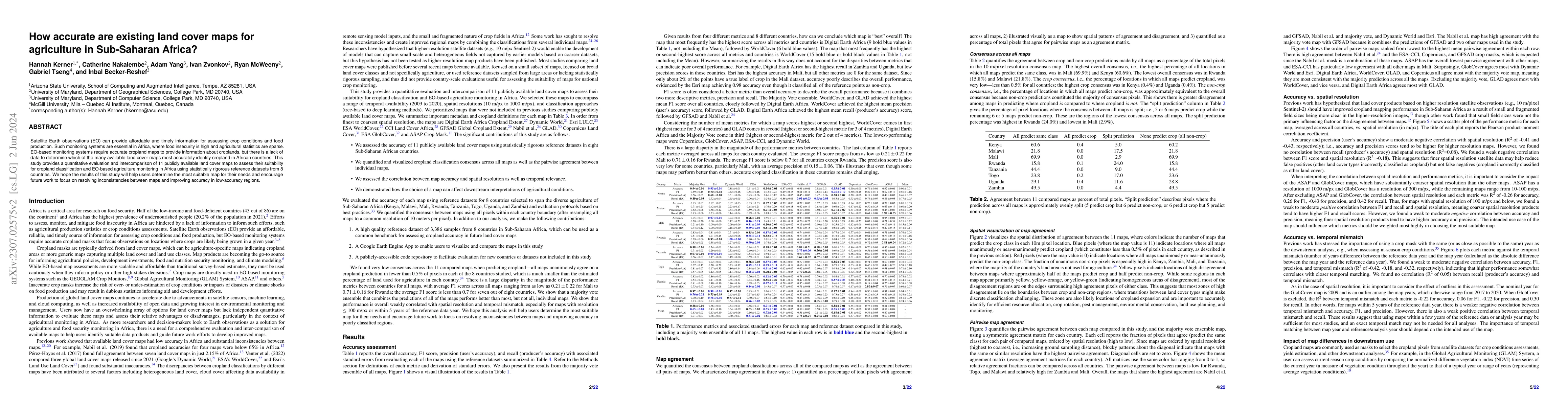
In this white paper, we synthesize key points made during presentations and discussions from the AI-Assisted Decision Making for Conservation workshop, hosted by the Center for Research on Computati...
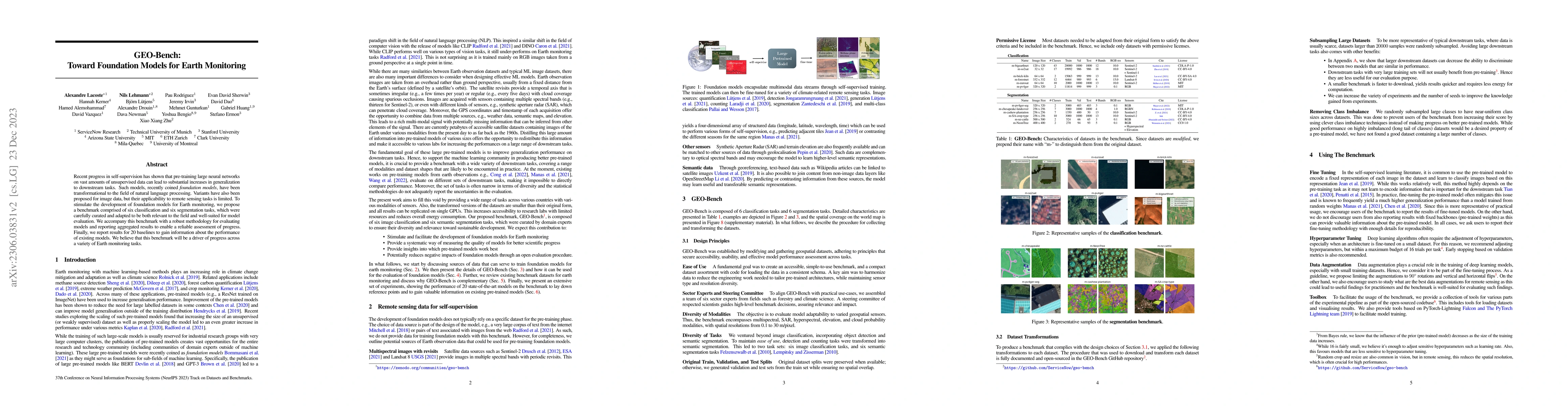
Satellite Earth observations (EO) can provide affordable and timely information for assessing crop conditions and food production. Such monitoring systems are essential in Africa, where there is hig...
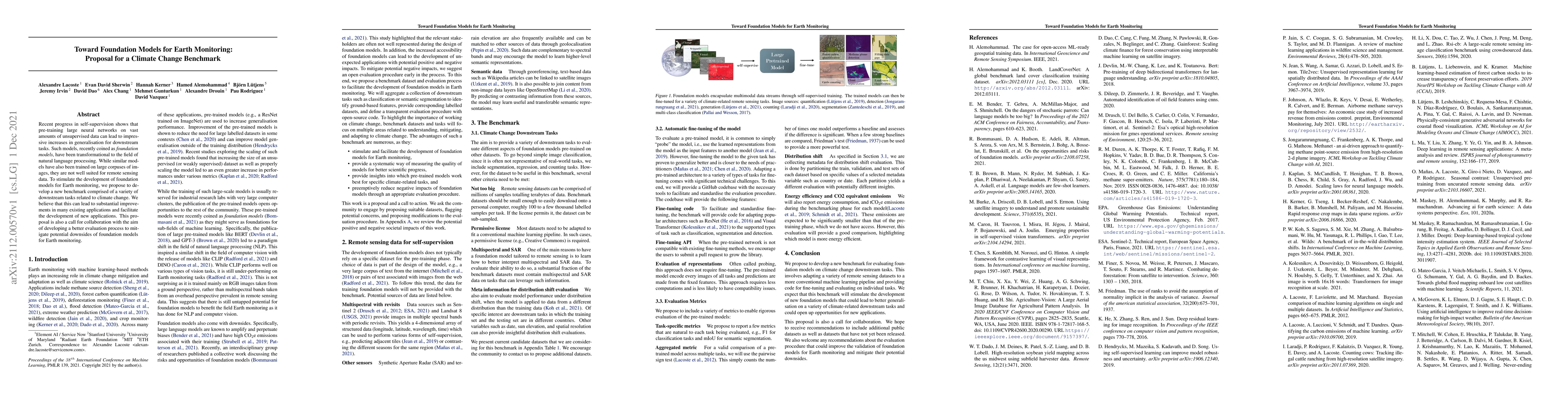
Recent progress in self-supervision has shown that pre-training large neural networks on vast amounts of unsupervised data can lead to substantial increases in generalization to downstream tasks. Su...
Machine learning methods for satellite data have a range of societally relevant applications, but labels used to train models can be difficult or impossible to acquire. Self-supervision is a natural...

Labeled datasets for agriculture are extremely spatially imbalanced. When developing algorithms for data-sparse regions, a natural approach is to use transfer learning from data-rich regions. While ...
Recent progress in self-supervision shows that pre-training large neural networks on vast amounts of unsupervised data can lead to impressive increases in generalisation for downstream tasks. Such m...
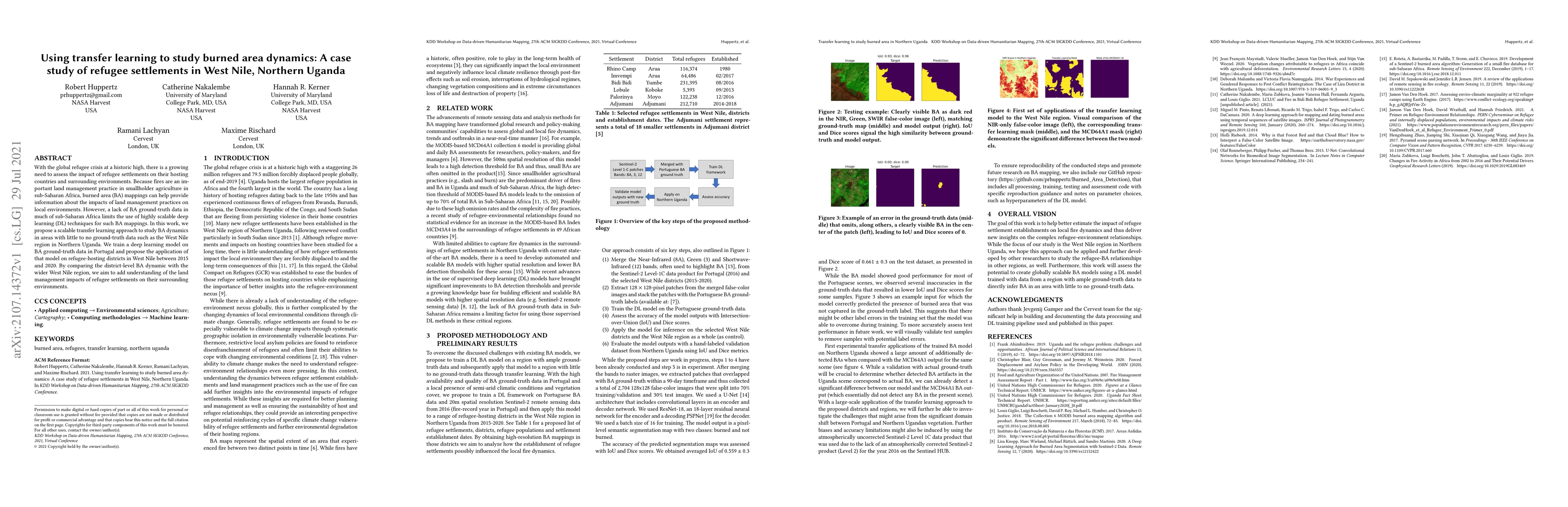
With the global refugee crisis at a historic high, there is a growing need to assess the impact of refugee settlements on their hosting countries and surrounding environments. Because fires are an i...
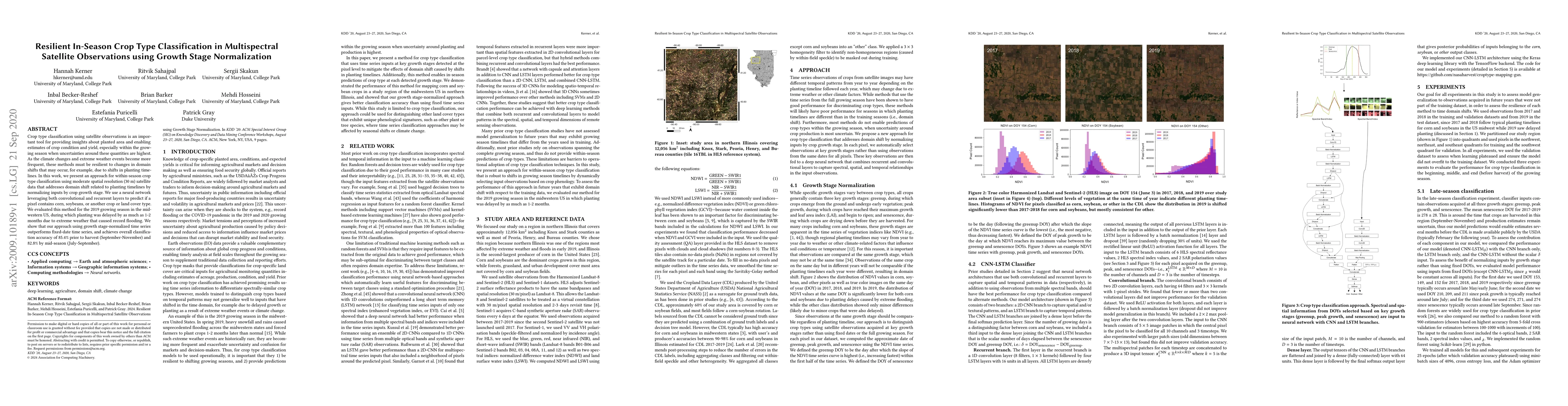
Crop type classification using satellite observations is an important tool for providing insights about planted area and enabling estimates of crop condition and yield, especially within the growing...
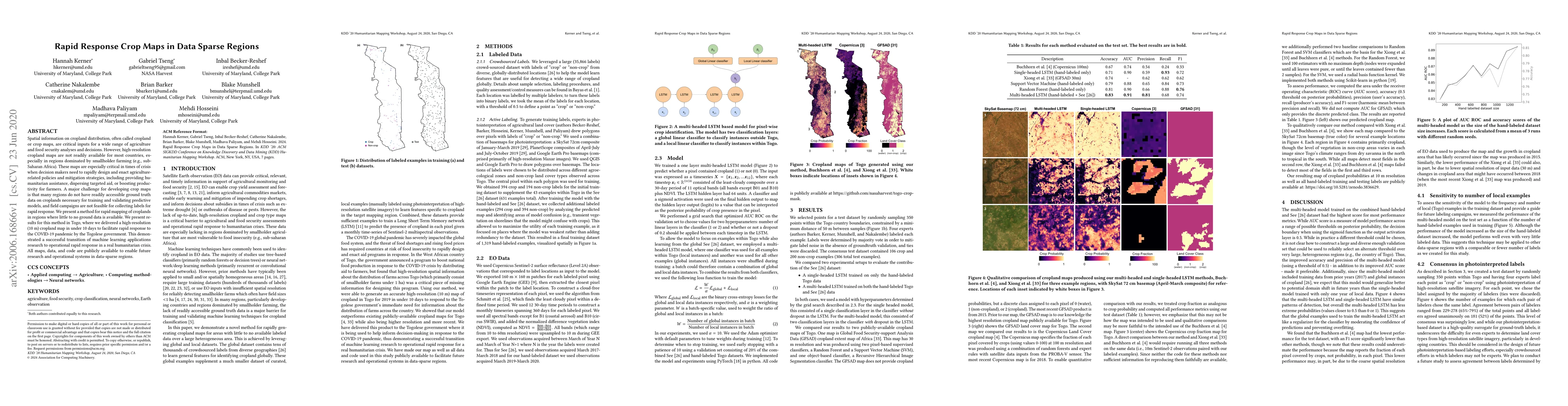
Spatial information on cropland distribution, often called cropland or crop maps, are critical inputs for a wide range of agriculture and food security analyses and decisions. However, high-resoluti...
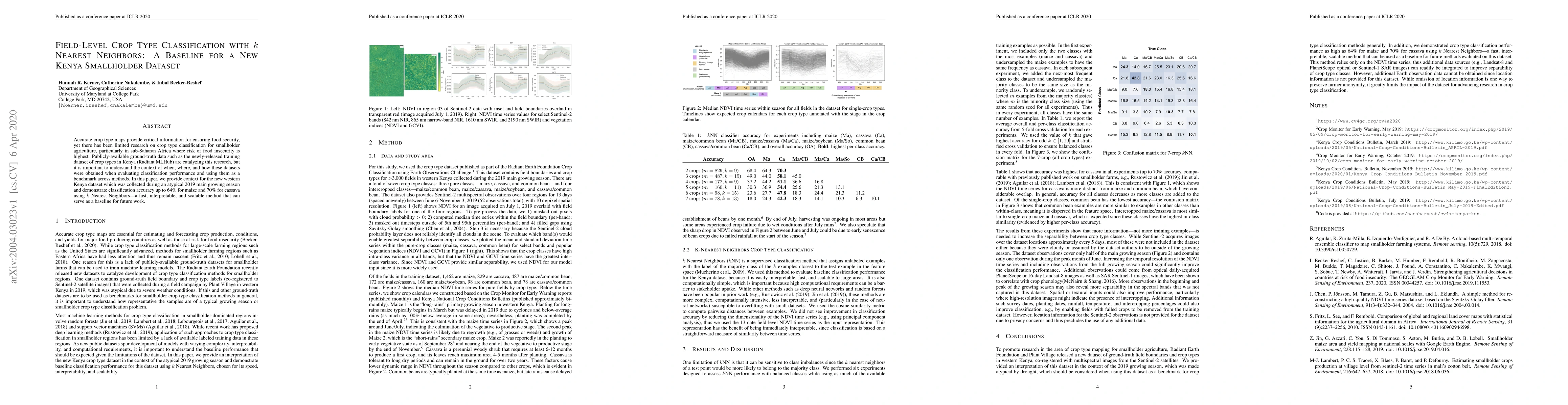
Accurate crop type maps provide critical information for ensuring food security, yet there has been limited research on crop type classification for smallholder agriculture, particularly in sub-Saha...
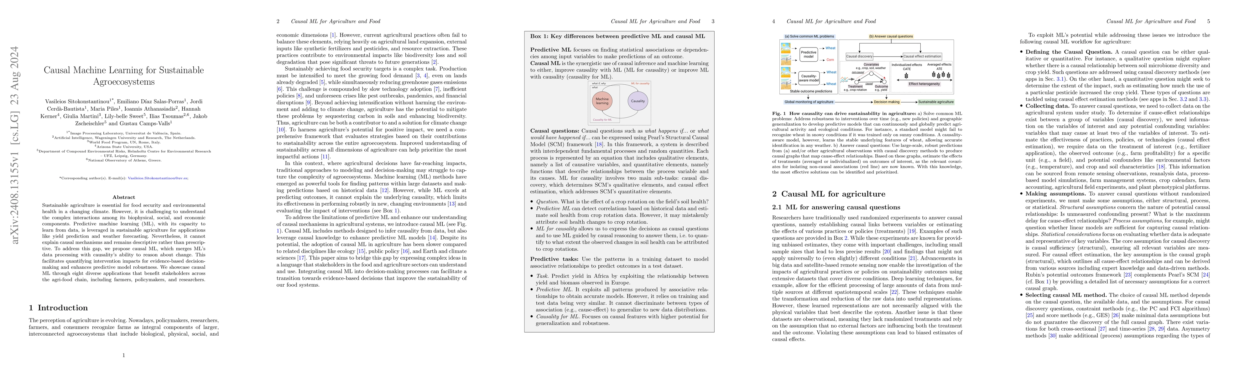
In a changing climate, sustainable agriculture is essential for food security and environmental health. However, it is challenging to understand the complex interactions among its biophysical, social,...
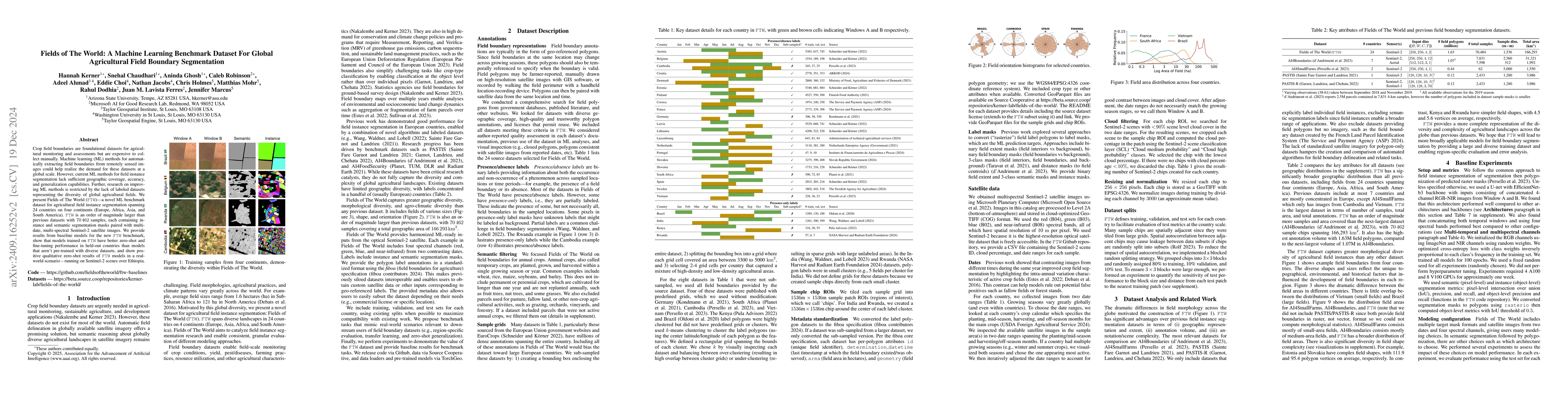
Crop field boundaries are foundational datasets for agricultural monitoring and assessments but are expensive to collect manually. Machine learning (ML) methods for automatically extracting field boun...
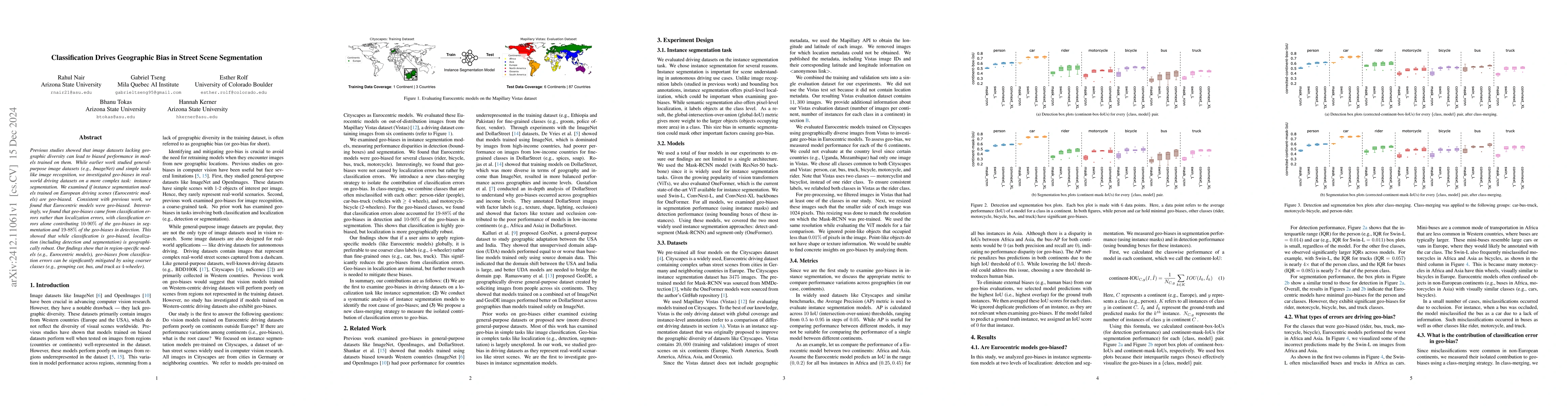
Previous studies showed that image datasets lacking geographic diversity can lead to biased performance in models trained on them. While earlier work studied general-purpose image datasets (e.g., Imag...
Most of the ML datasets we use today are biased. When we train models on these biased datasets, they often not only learn dataset biases but can also amplify them -- a phenomenon known as bias amplifi...
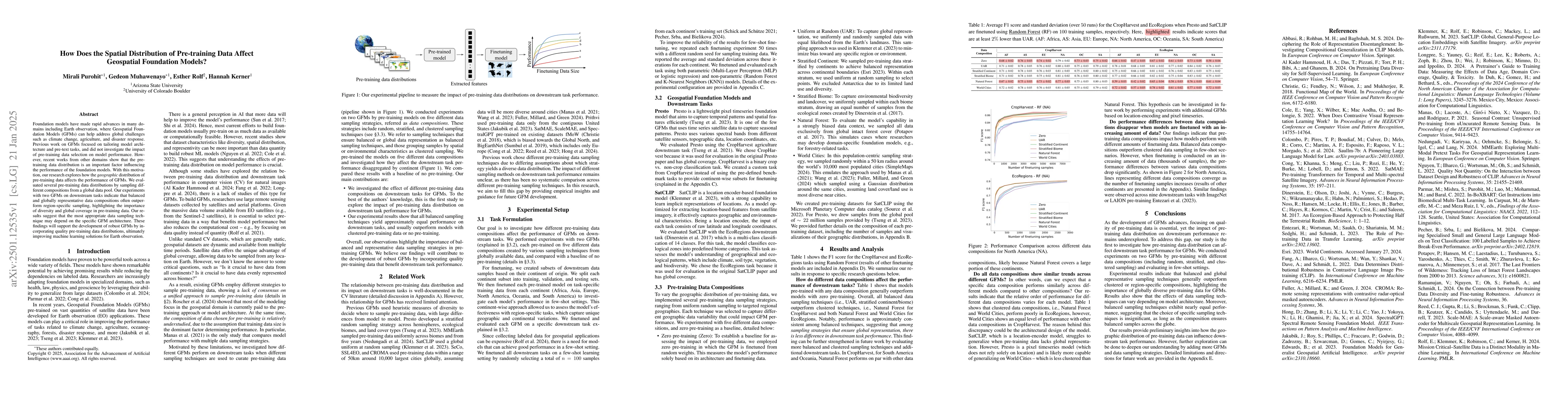
Foundation models have made rapid advances in many domains including Earth observation, where Geospatial Foundation Models (GFMs) can help address global challenges such as climate change, agriculture...

From crop mapping to flood detection, machine learning in remote sensing has a wide range of societally beneficial applications. The commonalities between remote sensing data in these applications pre...
When we train models on biased ML datasets, they not only learn these biases but can inflate them at test time - a phenomenon called bias amplification. To measure bias amplification in ML datasets, m...
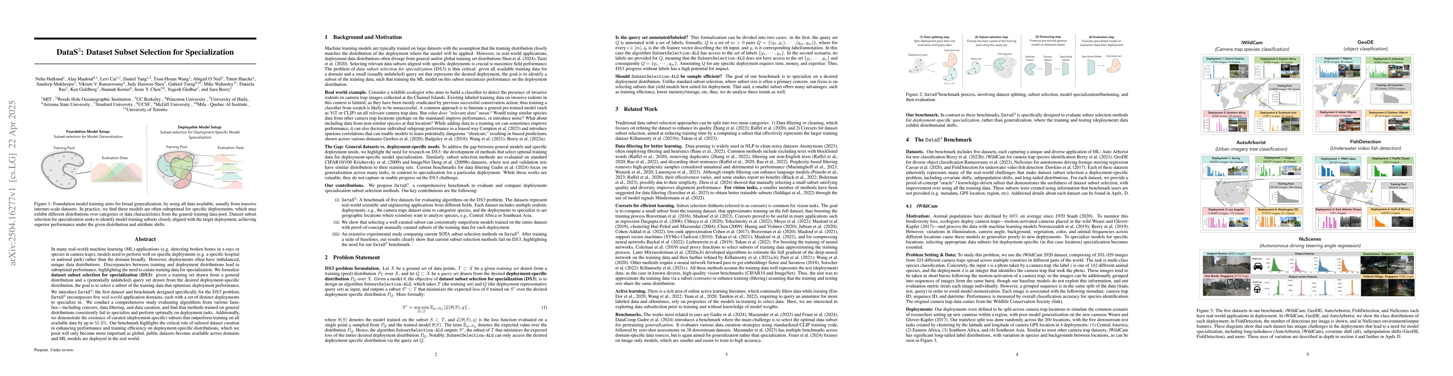
In many real-world machine learning (ML) applications (e.g. detecting broken bones in x-ray images, detecting species in camera traps), in practice models need to perform well on specific deployments ...
The increasing availability of geospatial foundation models has the potential to transform remote sensing applications such as land cover classification, environmental monitoring, and change detection...
Foundation models have enabled rapid progress across many specialized domains by leveraging large-scale pre-training on unlabeled data, demonstrating strong generalization to a variety of downstream t...
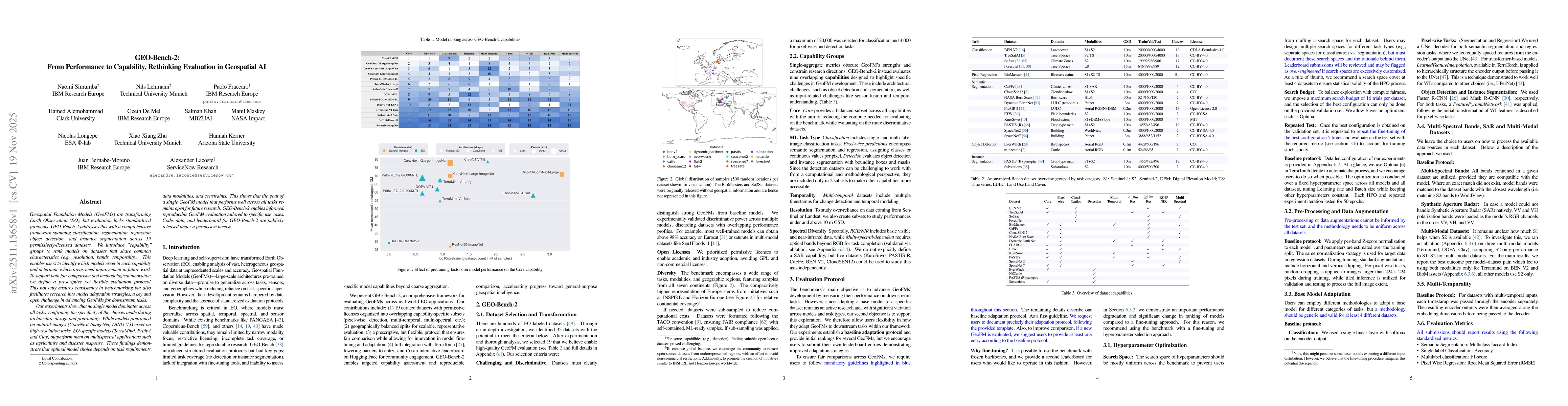
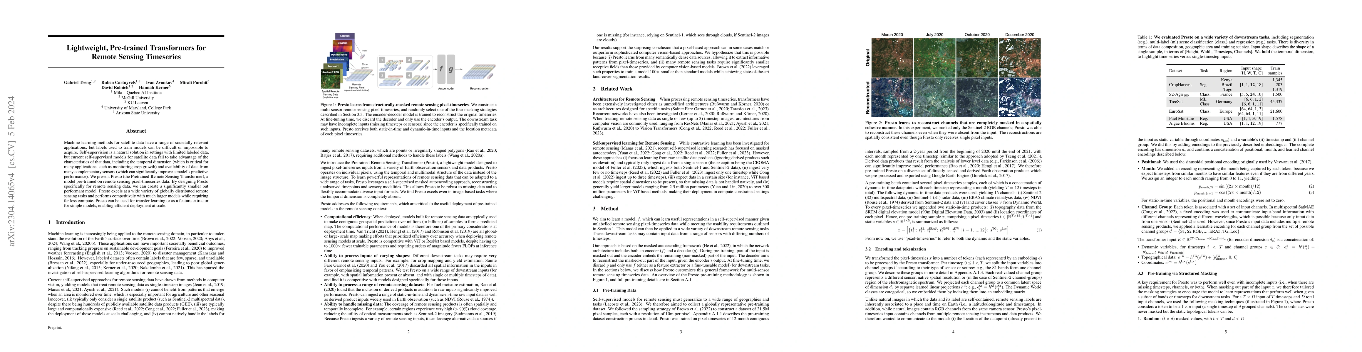
Geospatial Foundation Models (GeoFMs) are transforming Earth Observation (EO), but evaluation lacks standardized protocols. GEO-Bench-2 addresses this with a comprehensive framework spanning classific...
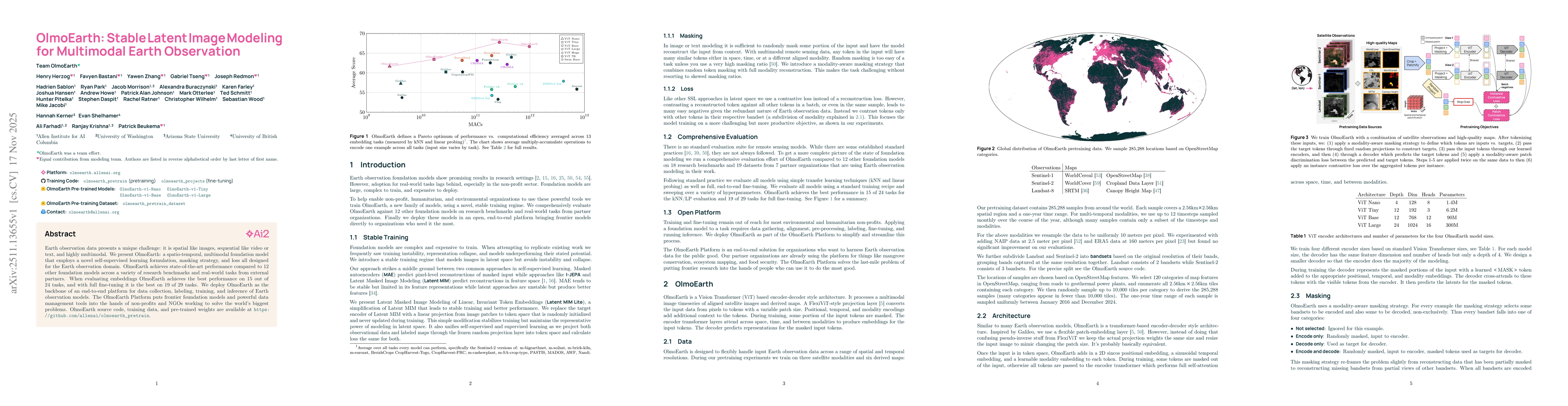
Earth observation data presents a unique challenge: it is spatial like images, sequential like video or text, and highly multimodal. We present OlmoEarth: a multimodal, spatio-temporal foundation mode...
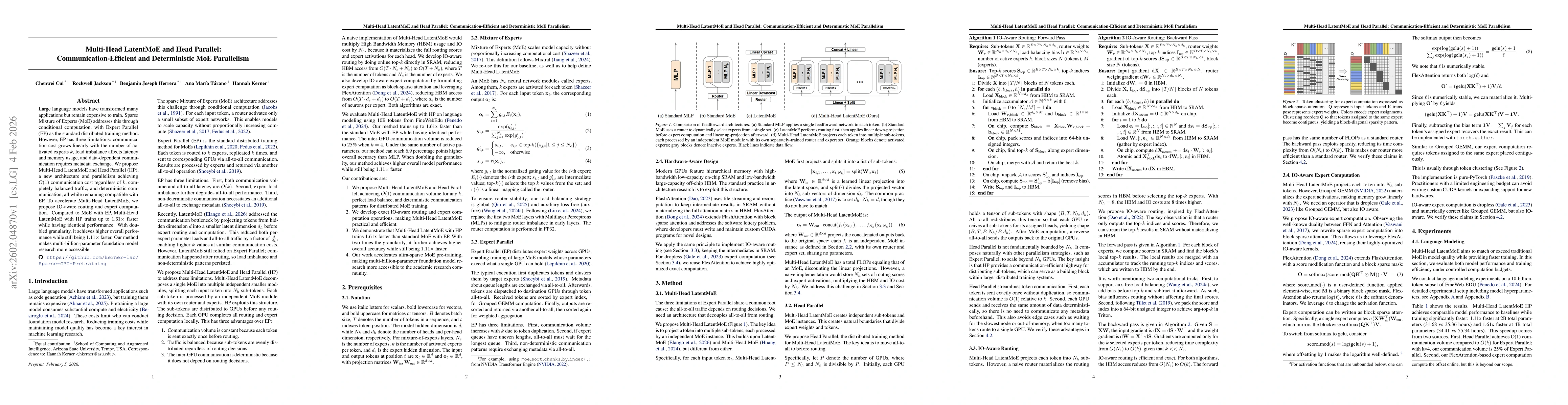
Large language models have transformed many applications but remain expensive to train. Sparse Mixture of Experts (MoE) addresses this through conditional computation, with Expert Parallel (EP) as the...
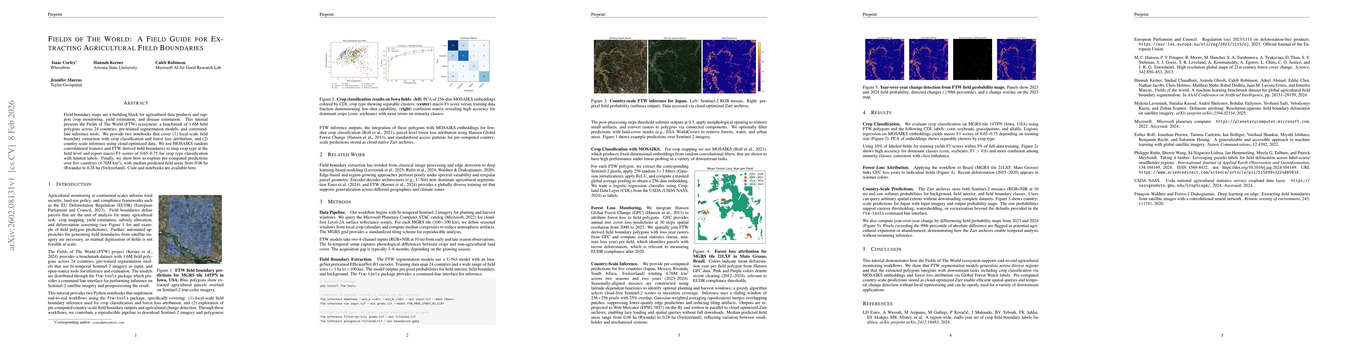
Field boundary maps are a building block for agricultural data products and support crop monitoring, yield estimation, and disease estimation. This tutorial presents the Fields of The World (FTW) ecos...
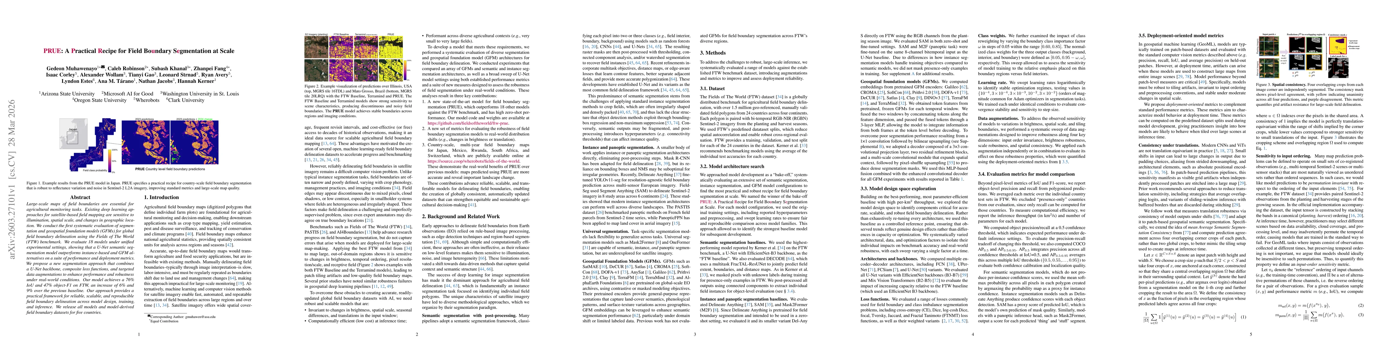
Large-scale maps of field boundaries are essential for agricultural monitoring tasks. Existing deep learning approaches for satellite-based field mapping are sensitive to illumination, spatial scale, ...
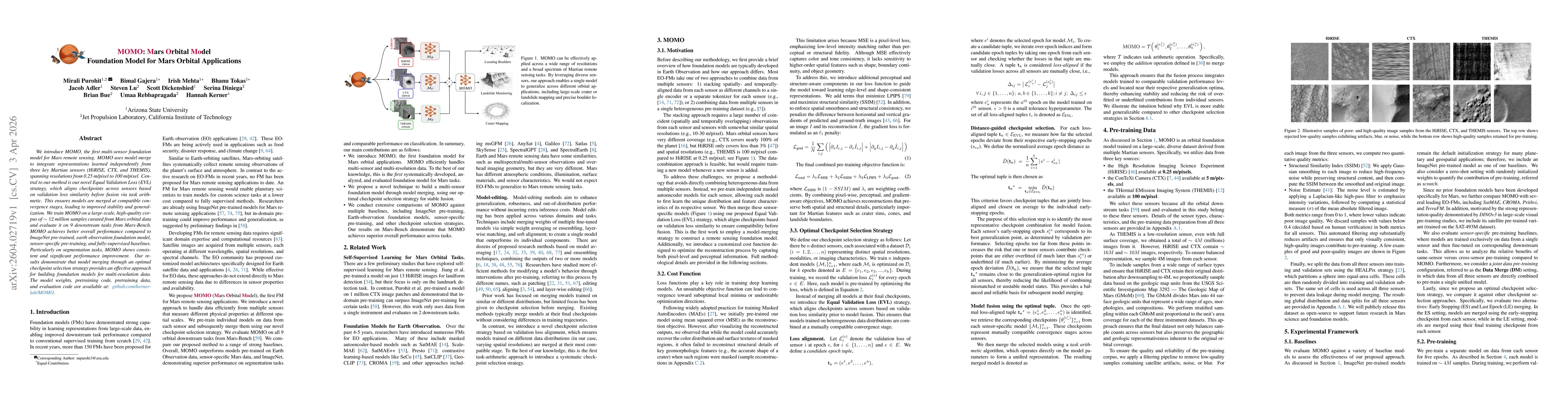
We introduce MOMO, the first multi-sensor foundation model for Mars remote sensing. MOMO uses model merge to integrate representations learned independently from three key Martian sensors (HiRISE, CTX...
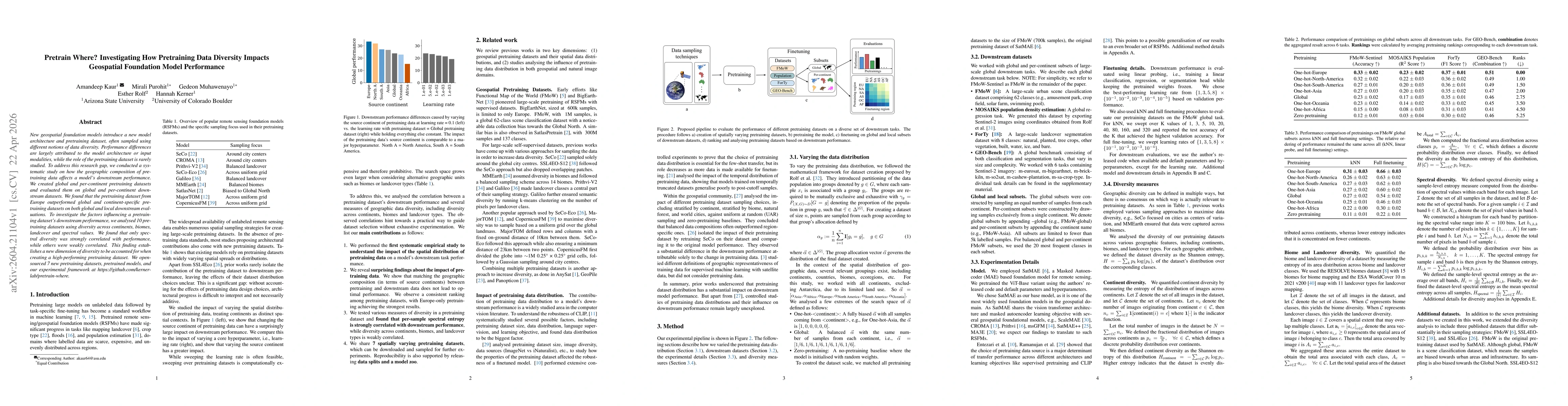
New geospatial foundation models introduce a new model architecture and pretraining dataset, often sampled using different notions of data diversity. Performance differences are largely attributed to ...
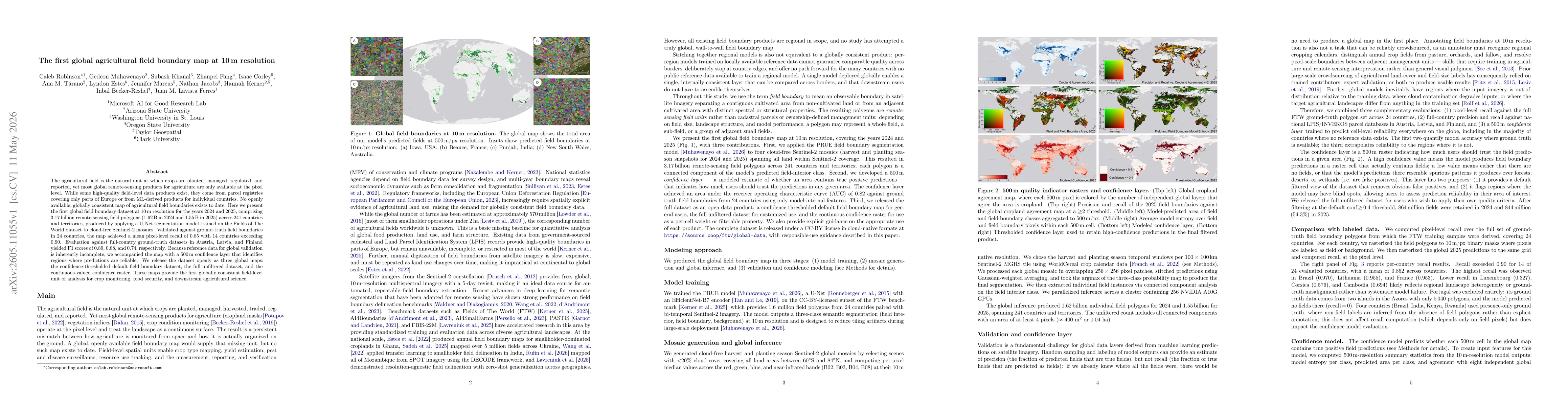
The agricultural field is the natural unit at which crops are planted, managed, regulated, and reported, yet most global remote-sensing products for agriculture are only available at the pixel level. ...
Geospatial foundation models (GFMs) have been proposed as generalizable backbones for disaster response, land-cover mapping, food-security monitoring, and other high-stakes Earth-observation tasks. Ye...
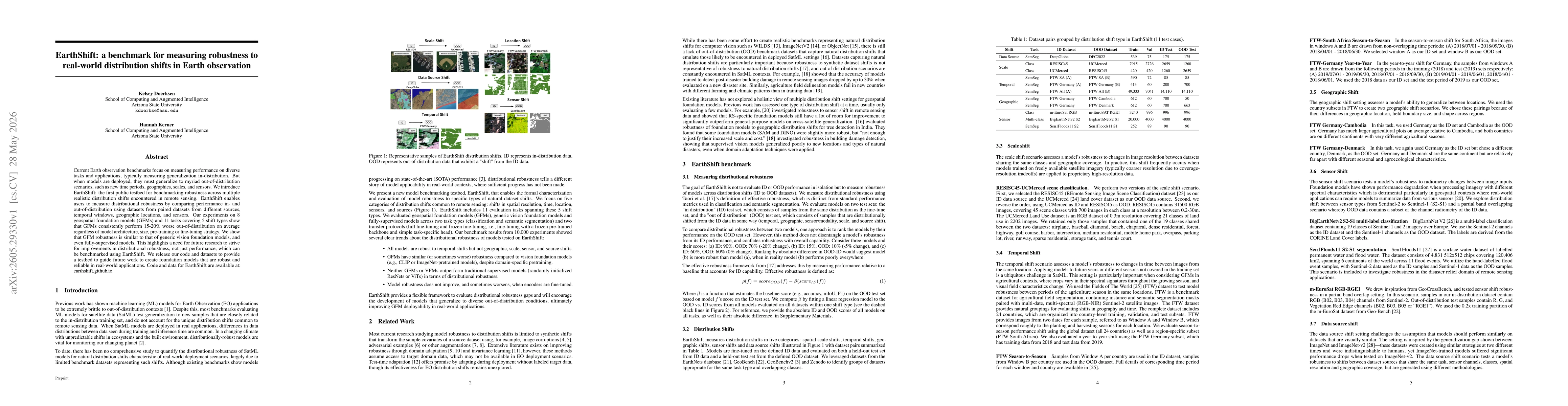
Current Earth observation benchmarks focus on measuring performance on diverse tasks and applications, typically measuring generalization in-distribution. But when models are deployed, they must gener...