ArxivLens
H
Researcher

Hardik Prajapati

6 papers on arXiv

6 arXiv Papers
17 Total Publications
Profile

Academic Profile

Name Hardikkumar Prajapati
Total Papers 17
Scholar Profile View on Semantic Scholar
Metrics

Statistics

6 arXiv Papers
17 Total Publications
Publications

Papers on arXiv

Thumbnail for A Tiny Machine Learning Model for Point Cloud Object Classification
arXiv
A Tiny Machine Learning Model for Point Cloud Object Classification

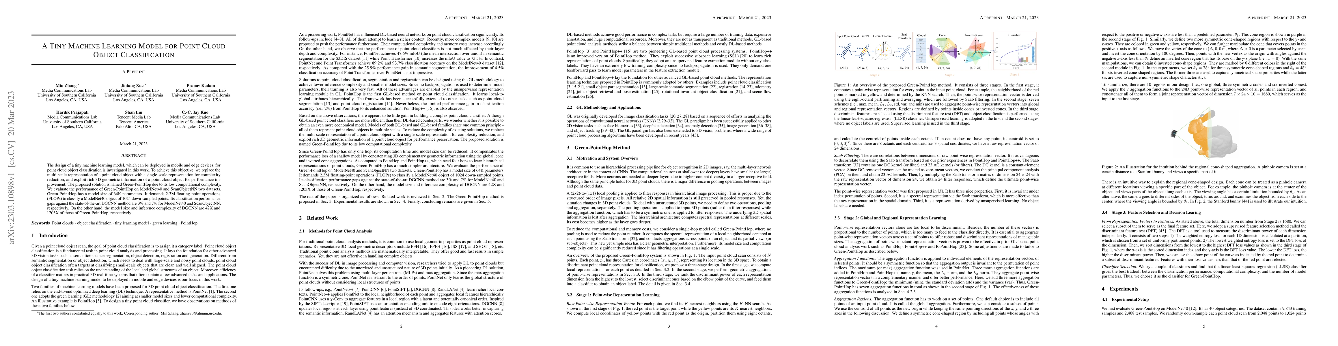
The design of a tiny machine learning model, which can be deployed in mobile and edge devices, for point cloud object classification is investigated in this work. To achieve this objective, we repla...

Thumbnail for S3I-PointHop: SO(3)-Invariant PointHop for 3D Point Cloud Classification
arXiv
S3I-PointHop: SO(3)-Invariant PointHop for 3D Point Cloud Classification

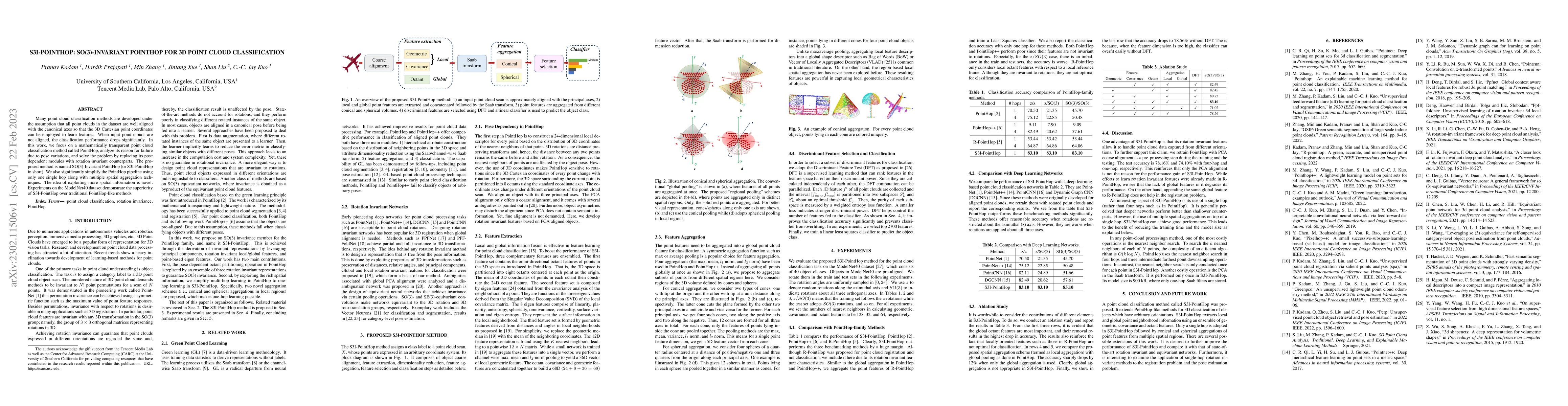
Many point cloud classification methods are developed under the assumption that all point clouds in the dataset are well aligned with the canonical axes so that the 3D Cartesian point coordinates ca...

Thumbnail for Temporally Consistent Dynamic Scene Graphs: An End-to-End Approach for
  Action Tracklet Generation
arXiv
Temporally Consistent Dynamic Scene Graphs: An End-to-End Approach for Action Tracklet Generation

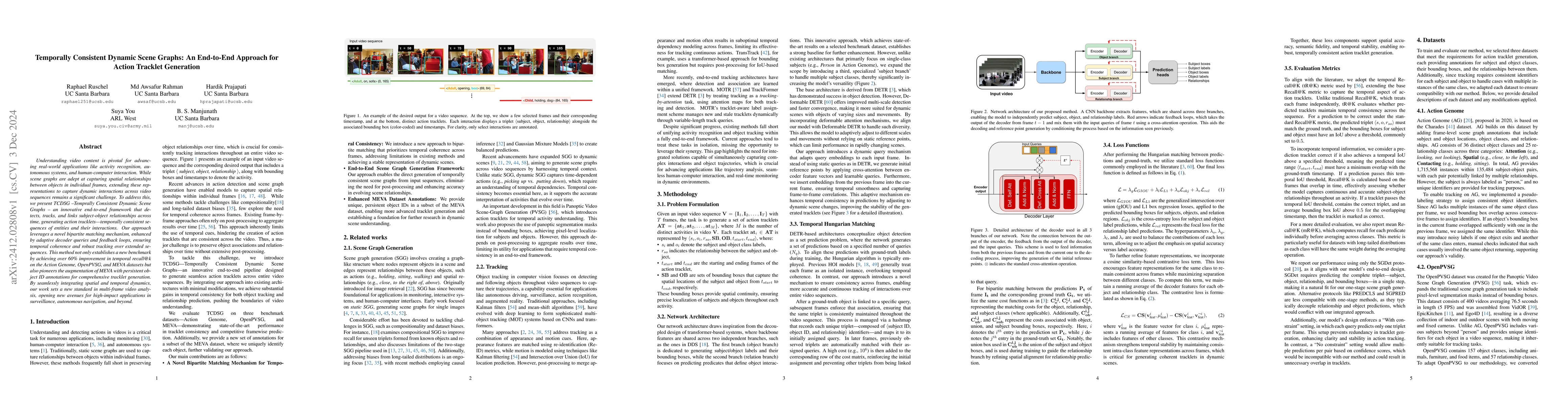
Understanding video content is pivotal for advancing real-world applications like activity recognition, autonomous systems, and human-computer interaction. While scene graphs are adept at capturing sp...

Thumbnail for A Lightweight CNN-Attention-BiLSTM Architecture for Multi-Class Arrhythmia Classification on Standard and Wearable ECGs
arXiv
A Lightweight CNN-Attention-BiLSTM Architecture for Multi-Class Arrhythmia Classification on Standard and Wearable ECGs

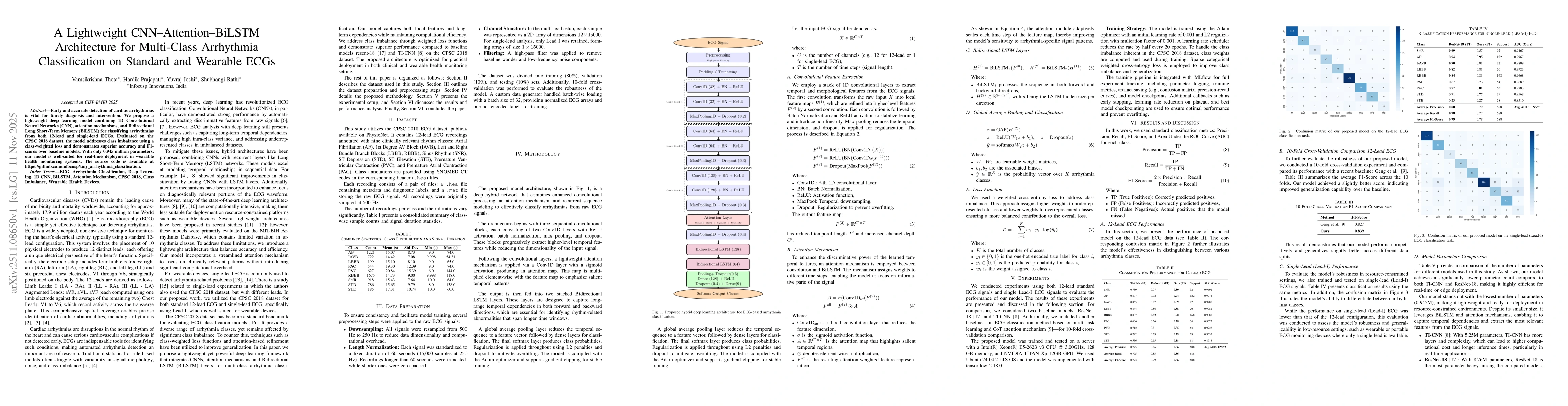
Early and accurate detection of cardiac arrhythmias is vital for timely diagnosis and intervention. We propose a lightweight deep learning model combining 1D Convolutional Neural Networks (CNN), atten...

Thumbnail for Wrivinder: Towards Spatial Intelligence for Geo-locating Ground Images onto Satellite Imagery
arXiv
Wrivinder: Towards Spatial Intelligence for Geo-locating Ground Images onto Satellite Imagery

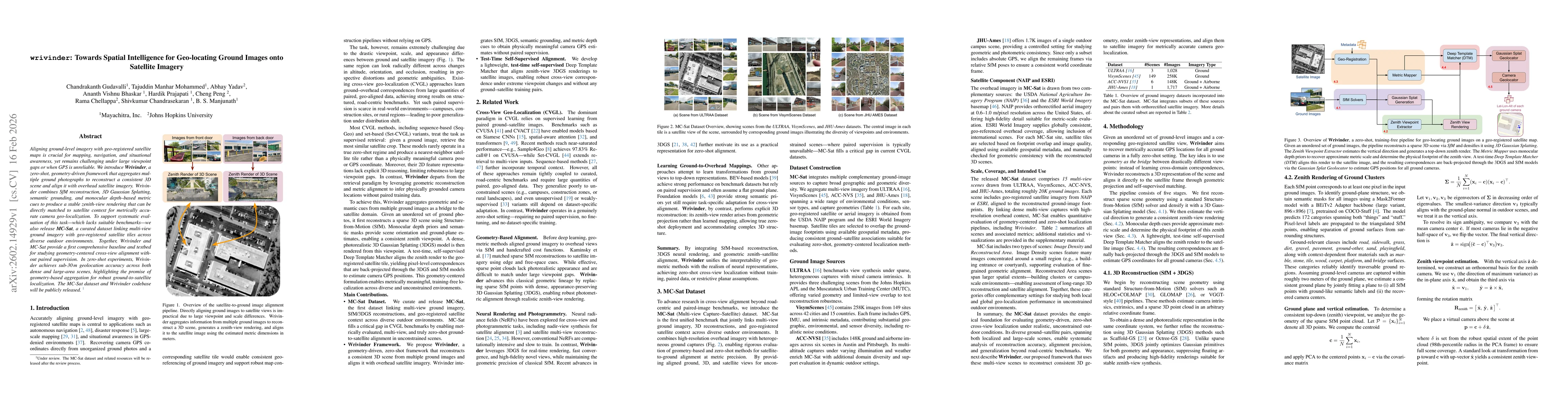
Aligning ground-level imagery with geo-registered satellite maps is crucial for mapping, navigation, and situational awareness, yet remains challenging under large viewpoint gaps or when GPS is unreli...

Thumbnail for Hyperspectral Trajectory Image for Multi-Month Trajectory Anomaly Detection
arXiv
Hyperspectral Trajectory Image for Multi-Month Trajectory Anomaly Detection

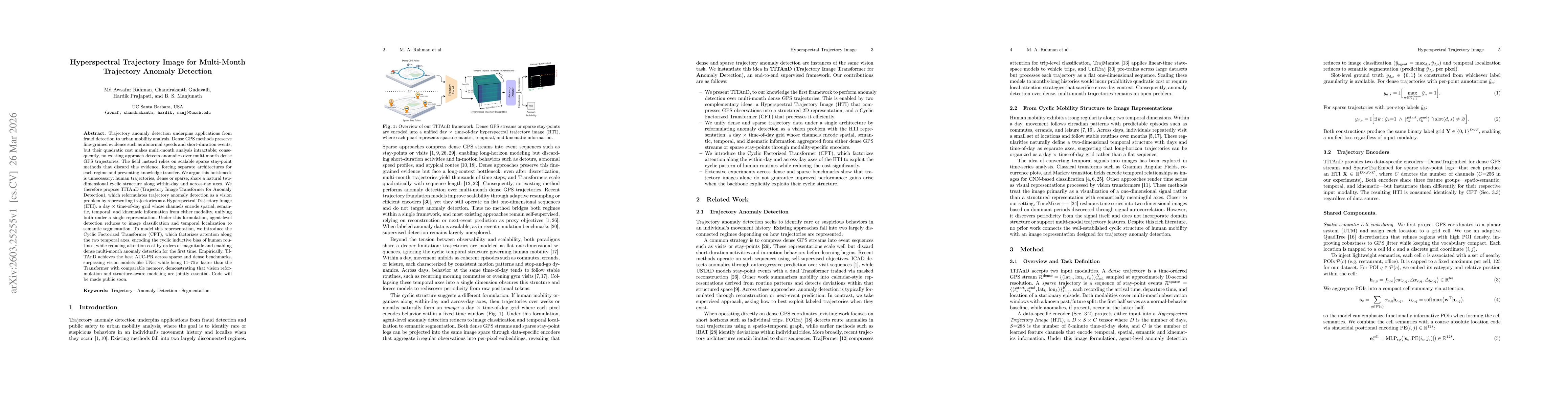
Trajectory anomaly detection underpins applications from fraud detection to urban mobility analysis. Dense GPS methods preserve fine-grained evidence such as abnormal speeds and short-duration events,...

This website uses cookies to ensure you get the best experience. Learn more