Academic Profile
Statistics
Similar Authors
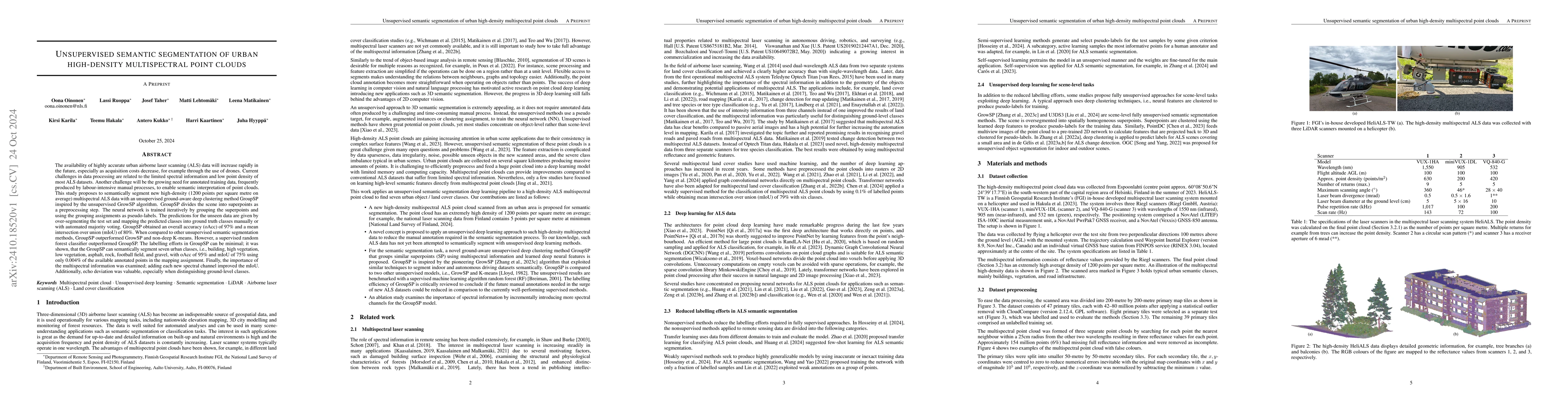
Papers on arXiv
The availability of highly accurate urban airborne laser scanning (ALS) data will increase rapidly in the future, especially as acquisition costs decrease, for example through the use of drones. Curre...
Point clouds captured with laser scanning systems from forest environments can be utilized in a wide variety of applications within forestry and plant ecology, such as the estimation of tree stem attr...
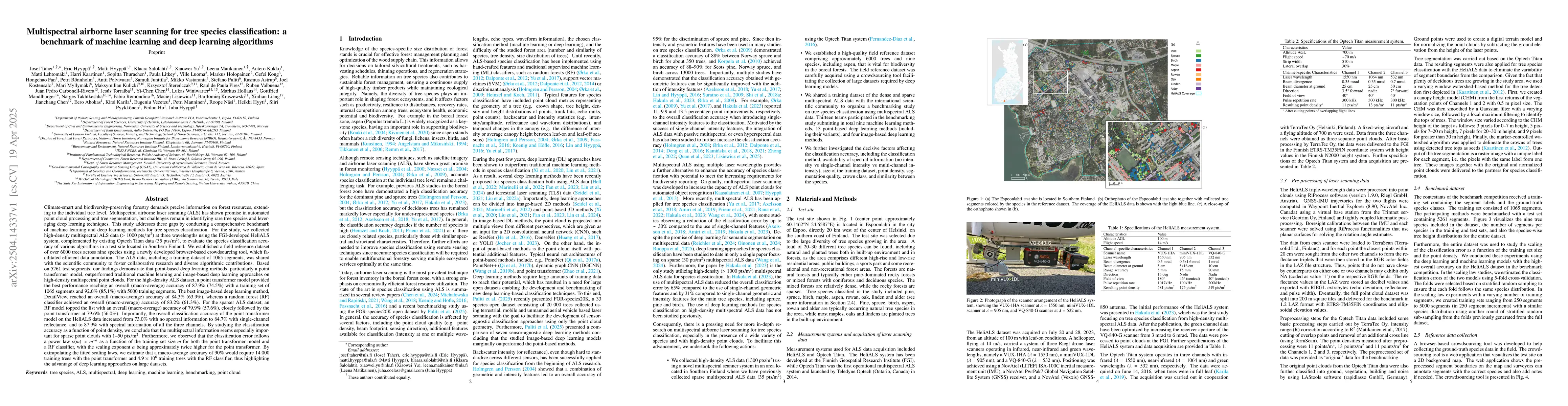
Climate-smart and biodiversity-preserving forestry demands precise information on forest resources, extending to the individual tree level. Multispectral airborne laser scanning (ALS) has shown promis...
Accurate land cover mapping in riverine environments is essential for effective river management, ecological understanding, and geomorphic change monitoring. This study explores the use of Point Trans...
The shift from stand-level to individual-tree-level forest assessments supports improved biodiversity mapping, particularly in boreal ecosystems where tree species like aspen (Populus tremula L.) play...