Academic Profile
Statistics
Similar Authors
Papers on arXiv
CityGML is a widely adopted standard by the Open Geospatial Consortium (OGC) for representing and exchanging 3D city models. The representation of semantic and topological properties in CityGML make...
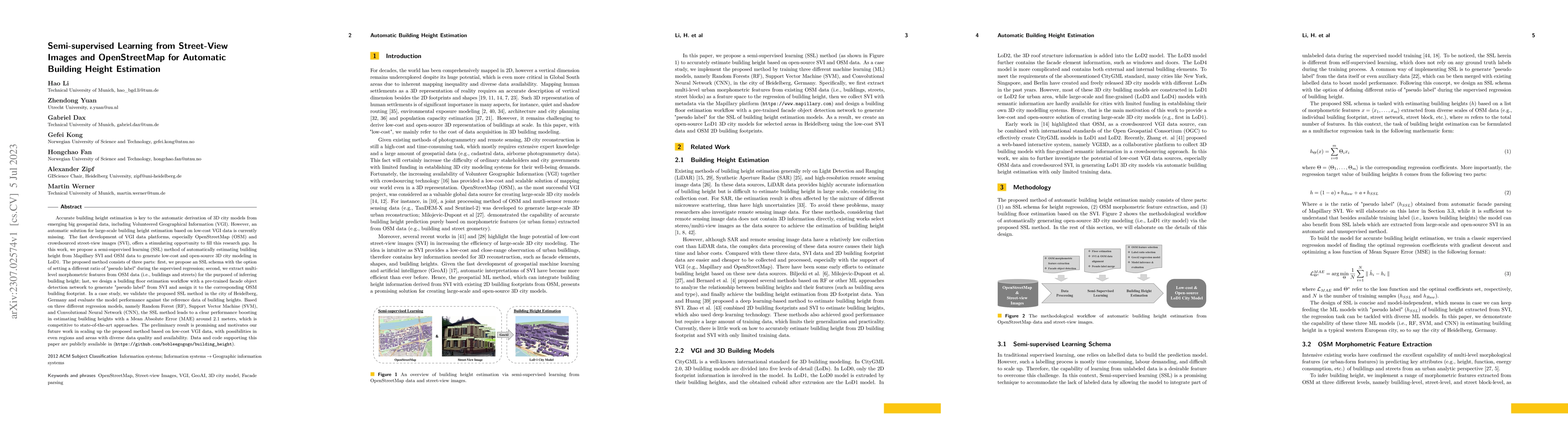
Accurate building height estimation is key to the automatic derivation of 3D city models from emerging big geospatial data, including Volunteered Geographical Information (VGI). However, an automati...
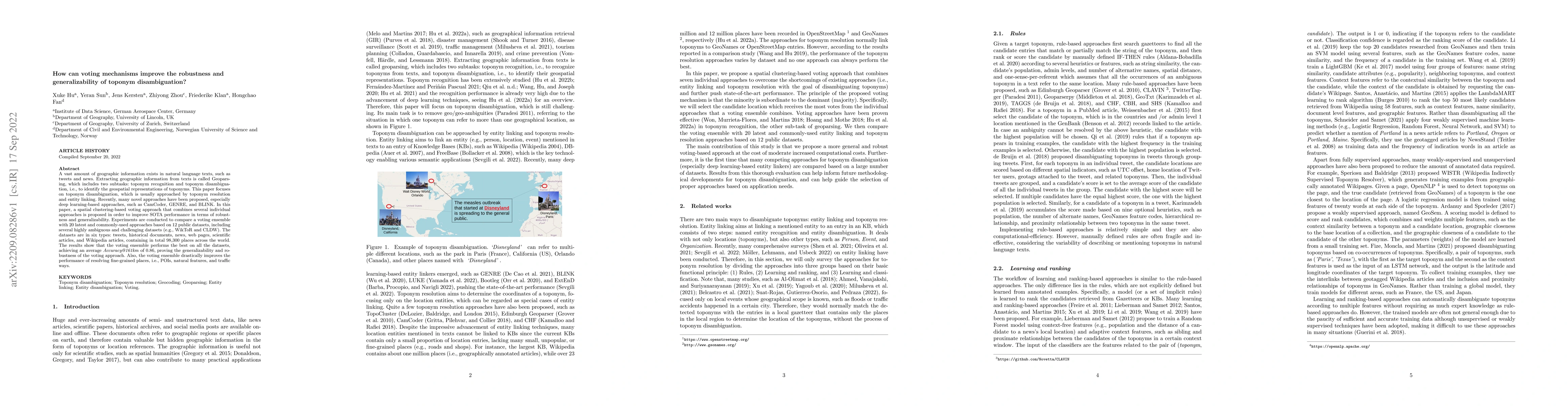
A vast amount of geographic information exists in natural language texts, such as tweets and news. Extracting geographic information from texts is called Geoparsing, which includes two subtasks: top...
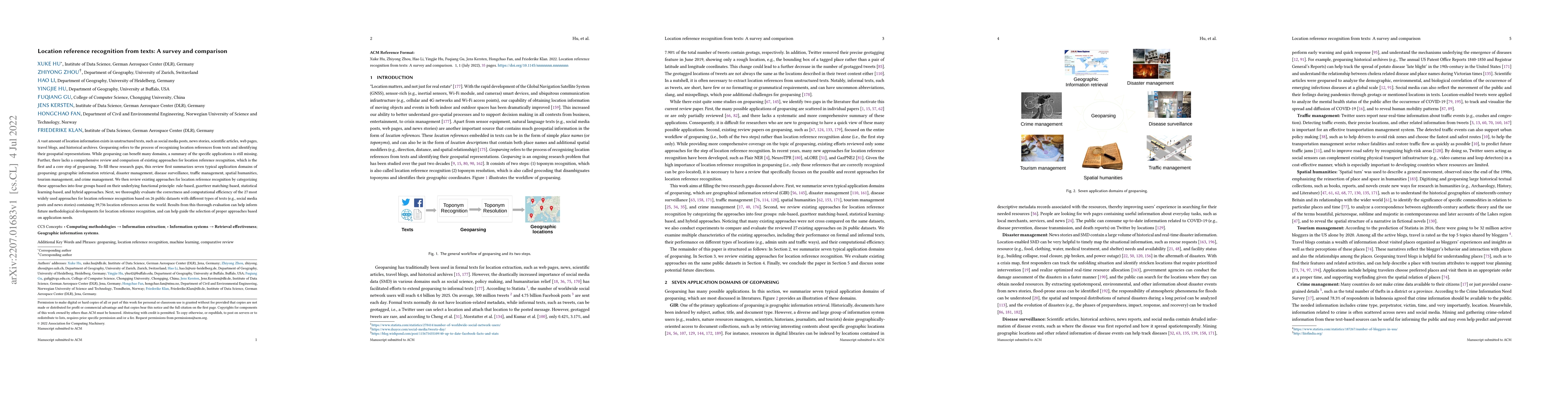
A vast amount of location information exists in unstructured texts, such as social media posts, news stories, scientific articles, web pages, travel blogs, and historical archives. Geoparsing refers...
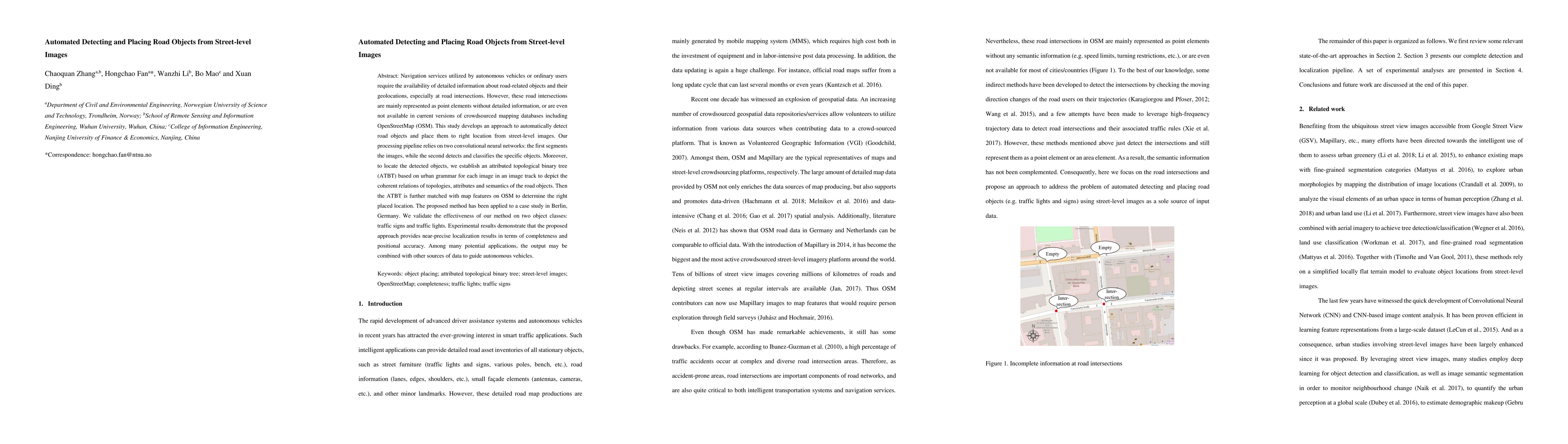
Navigation services utilized by autonomous vehicles or ordinary users require the availability of detailed information about road-related objects and their geolocations, especially at road intersect...
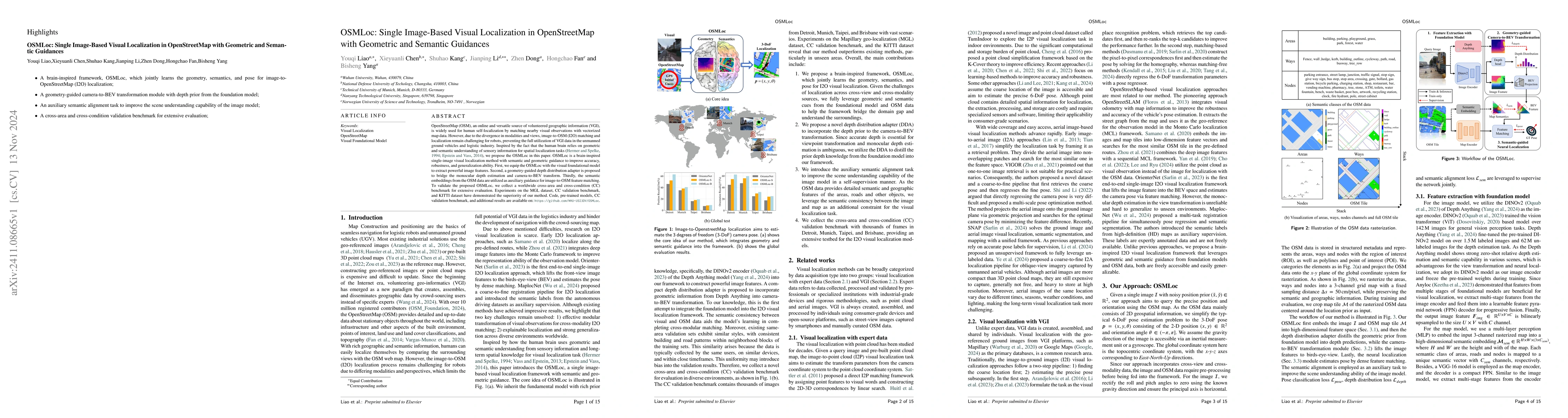
OpenStreetMap (OSM), an online and versatile source of volunteered geographic information (VGI), is widely used for human self-localization by matching nearby visual observations with vectorized map d...
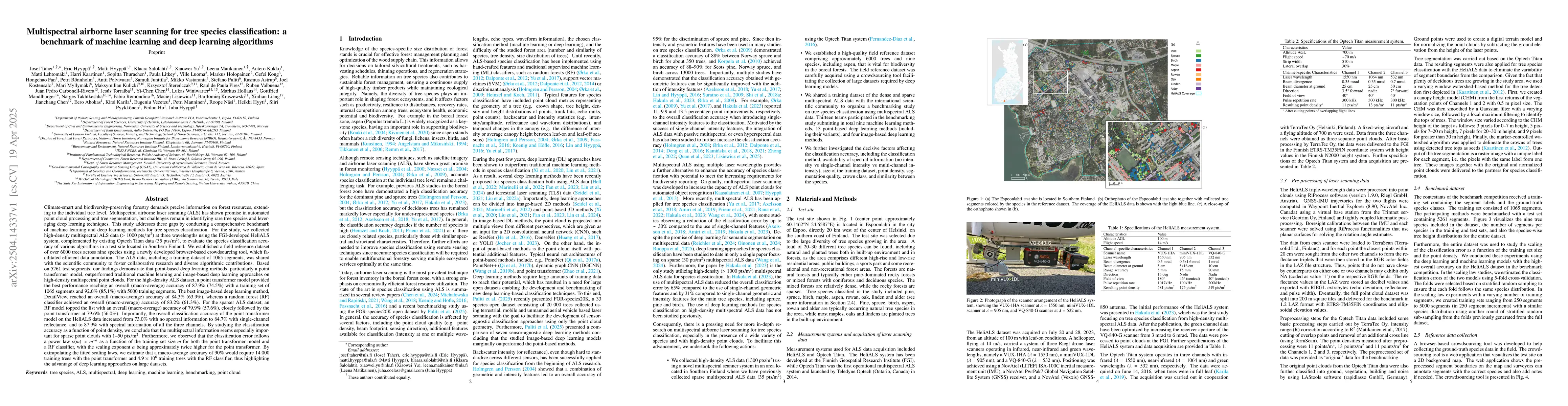
Climate-smart and biodiversity-preserving forestry demands precise information on forest resources, extending to the individual tree level. Multispectral airborne laser scanning (ALS) has shown promis...
Transforming road network data into vector representations using deep learning has proven effective for road network analysis. However, urban road networks' heterogeneous and hierarchical nature poses...
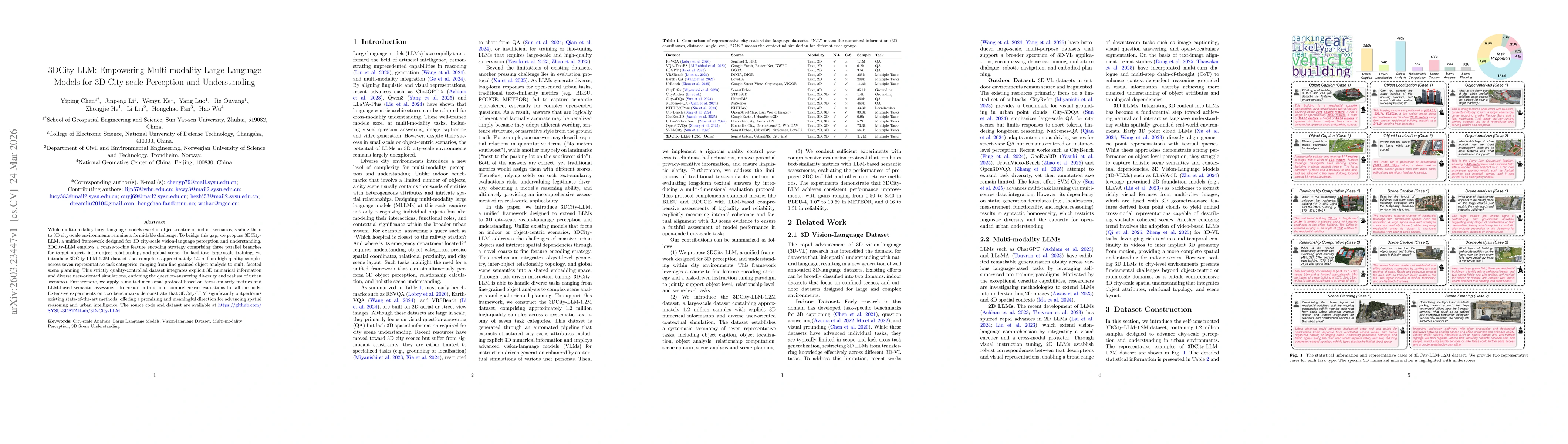
While multi-modality large language models excel in object-centric or indoor scenarios, scaling them to 3D city-scale environments remains a formidable challenge. To bridge this gap, we propose 3DCity...