Academic Profile
Statistics
Similar Authors
Papers on arXiv
3D urban scene reconstruction and modelling is a crucial research area in remote sensing with numerous applications in academia, commerce, industry, and administration. Recent advancements in view s...
Neural Radiance Field (NeRF) has recently become a significant development in the field of Computer Vision, allowing for implicit, neural network-based scene representation and novel view synthesis....
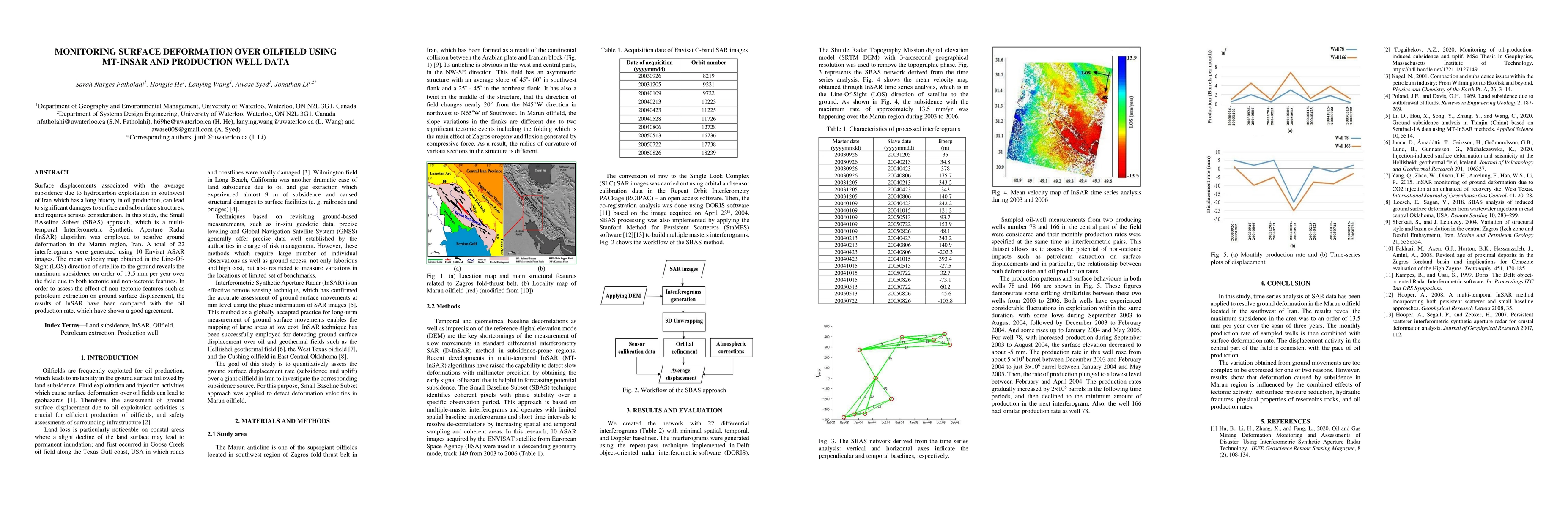
Surface displacements associated with the average subsidence due to hydrocarbon exploitation in southwest of Iran which has a long history in oil production, can lead to significant damages to surfa...
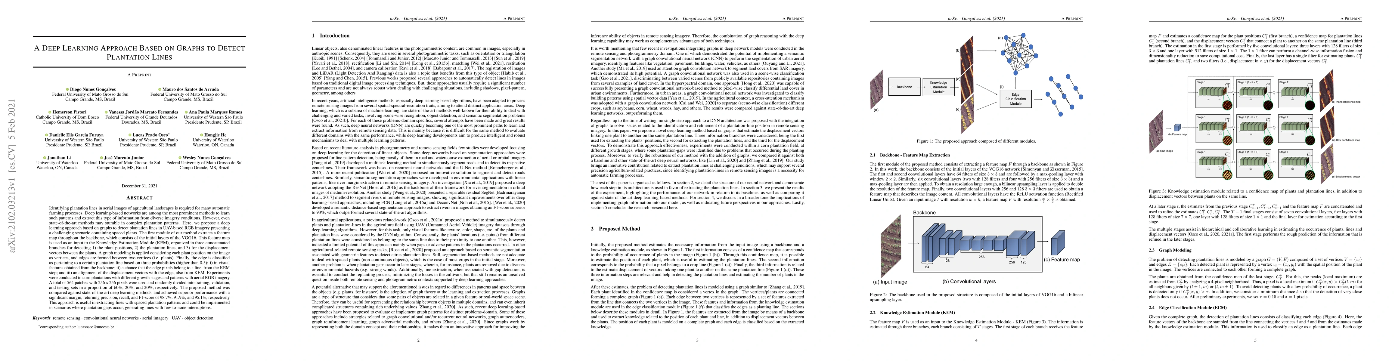
Deep learning-based networks are among the most prominent methods to learn linear patterns and extract this type of information from diverse imagery conditions. Here, we propose a deep learning appr...
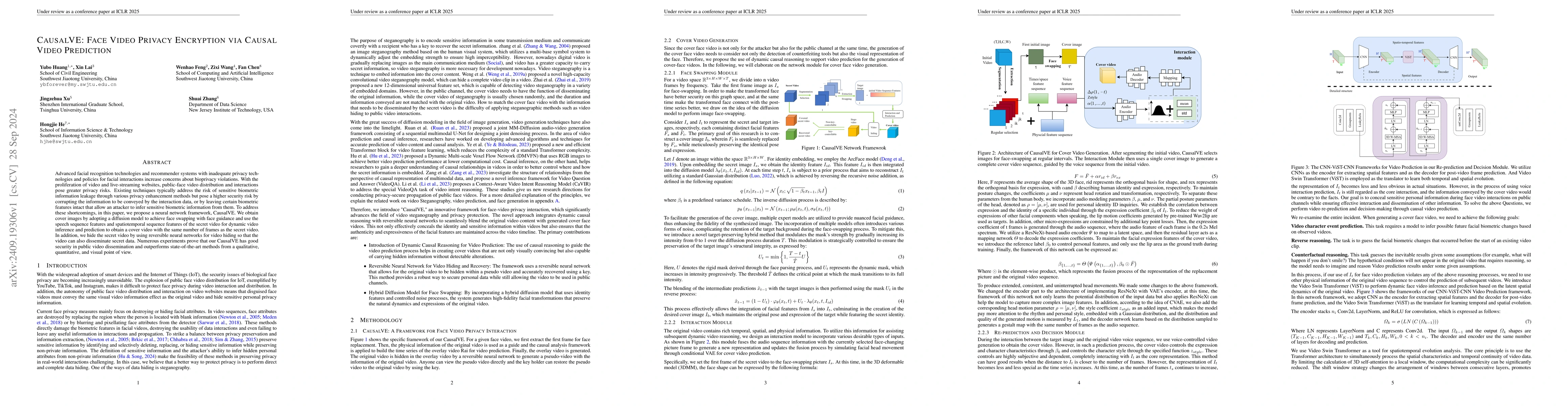
Advanced facial recognition technologies and recommender systems with inadequate privacy technologies and policies for facial interactions increase concerns about bioprivacy violations. With the proli...
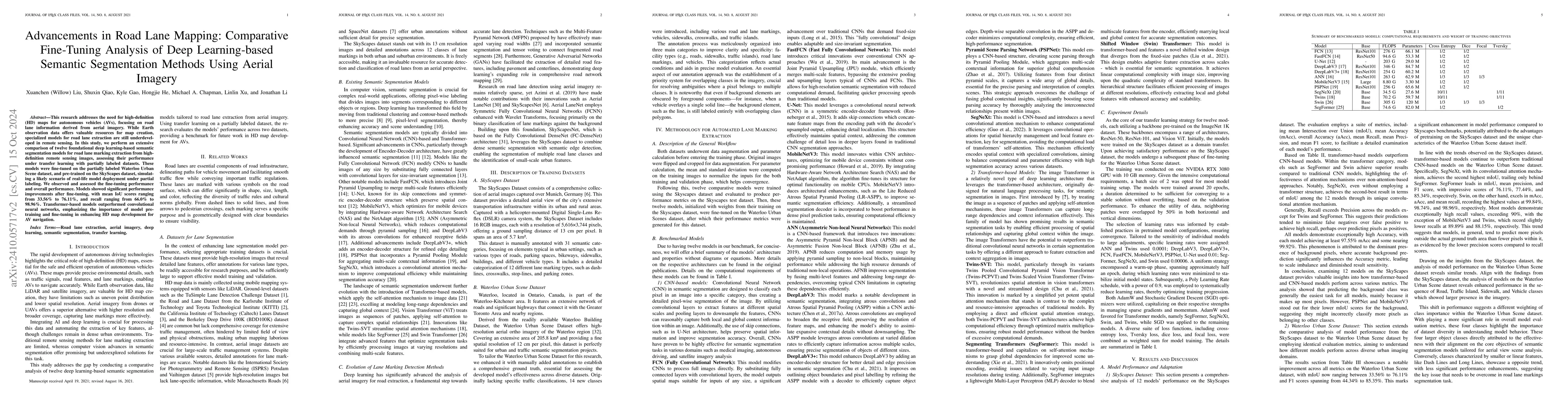
This research addresses the need for high-definition (HD) maps for autonomous vehicles (AVs), focusing on road lane information derived from aerial imagery. While Earth observation data offers valuabl...
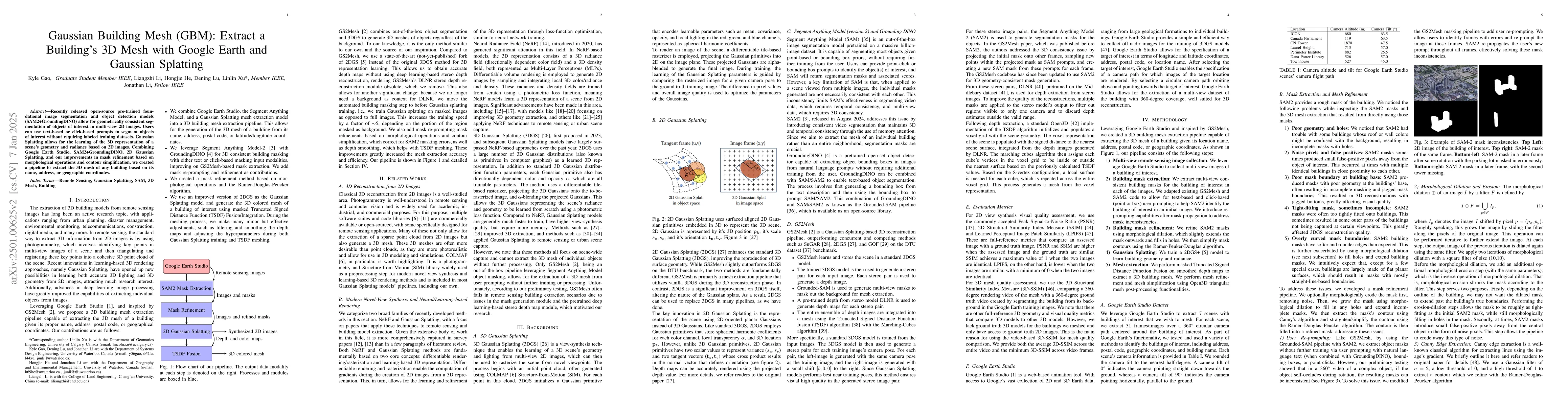
Recently released open-source pre-trained foundational image segmentation and object detection models (SAM2+GroundingDINO) allow for geometrically consistent segmentation of objects of interest in mul...
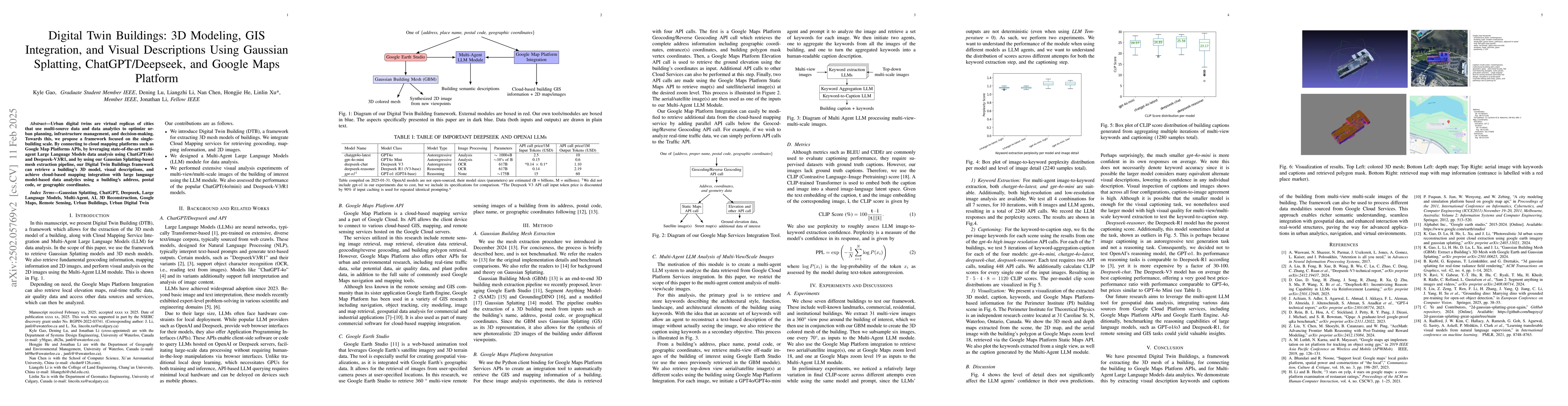
Urban digital twins are virtual replicas of cities that use multi-source data and data analytics to optimize urban planning, infrastructure management, and decision-making. Towards this, we propose a ...
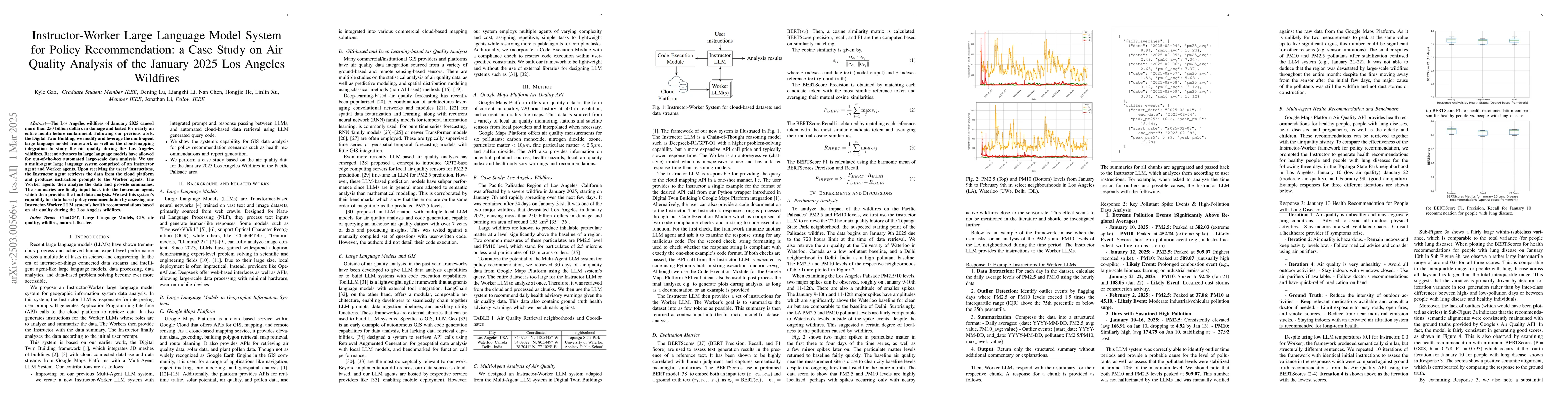
The Los Angeles wildfires of January 2025 caused more than 250 billion dollars in damage and lasted for nearly an entire month before containment. Following our previous work, the Digital Twin Buildin...
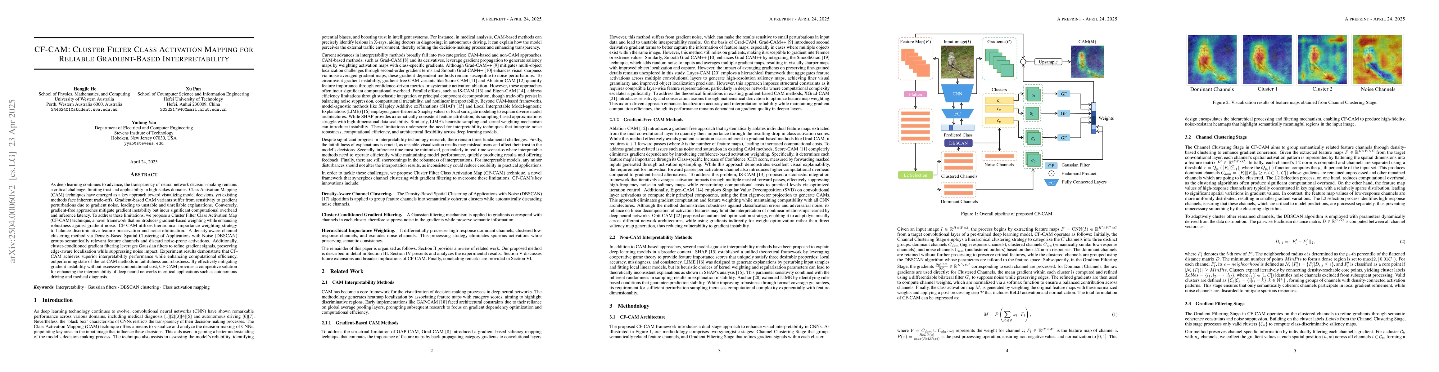
As deep learning continues to advance, the transparency of neural network decision-making remains a critical challenge, limiting trust and applicability in high-stakes domains. Class Activation Mappin...
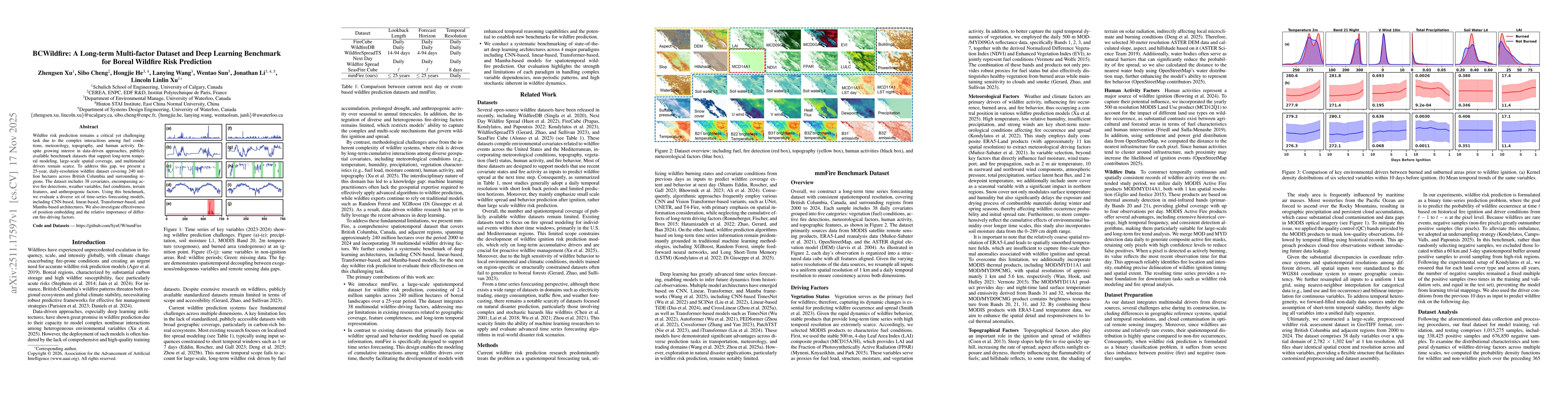
Wildfire risk prediction remains a critical yet challenging task due to the complex interactions among fuel conditions, meteorology, topography, and human activity. Despite growing interest in data-dr...
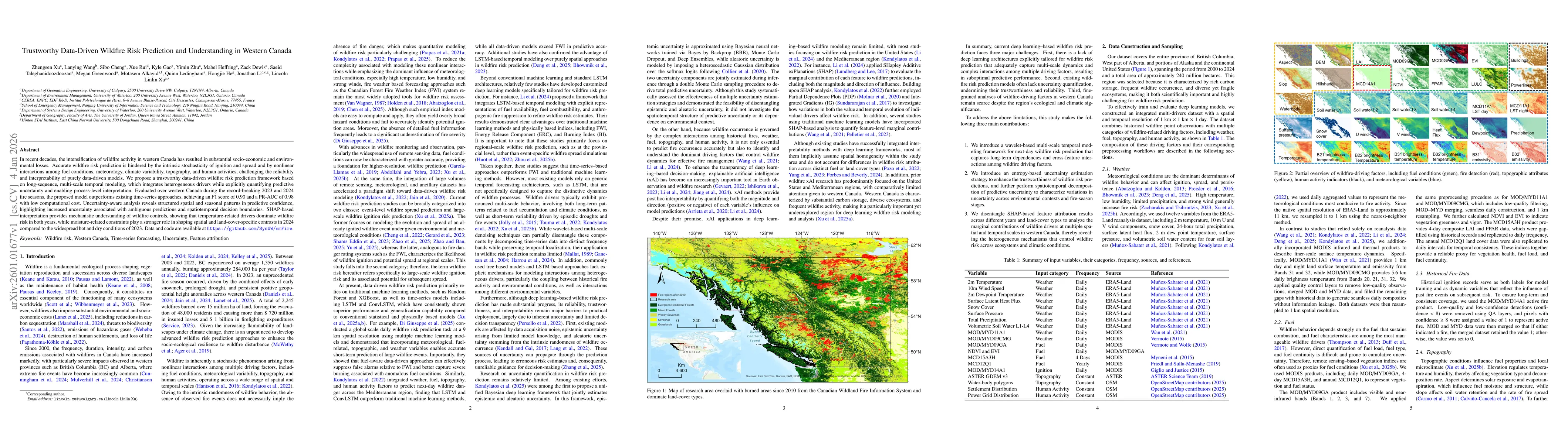
In recent decades, the intensification of wildfire activity in western Canada has resulted in substantial socio-economic and environmental losses. Accurate wildfire risk prediction is hindered by the ...
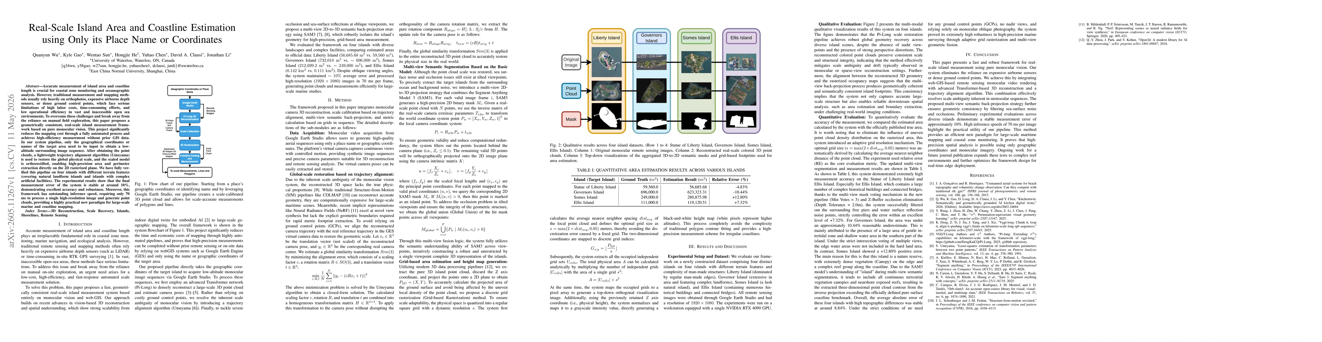
Accurate measurement of island area and coastline length is crucial for coastal zone monitoring and oceanographic analysis. However, traditional measurement and mapping methods usually rely heavily on...