Academic Profile
Statistics
Similar Authors
Papers on arXiv
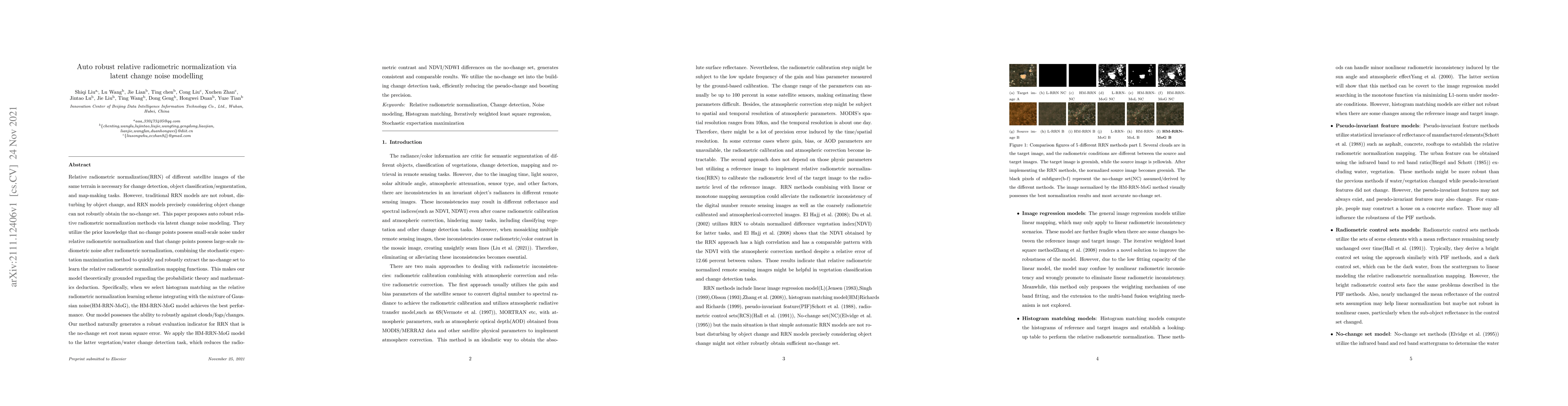
Relative radiometric normalization(RRN) of different satellite images of the same terrain is necessary for change detection, object classification/segmentation, and map-making tasks. However, tradit...
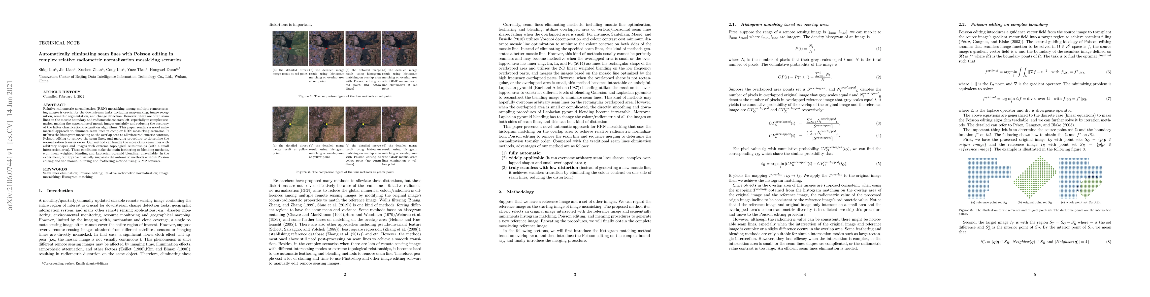
Relative radiometric normalization (RRN) mosaicking among multiple remote sensing images is crucial for the downstream tasks, including map-making, image recognition, semantic segmentation, and chan...
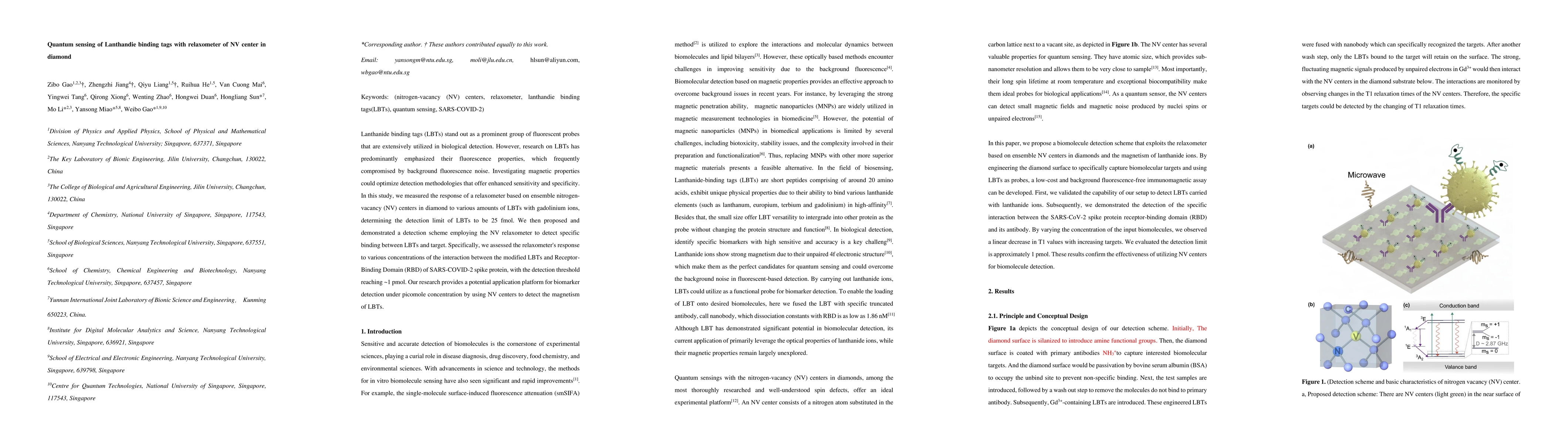
Lanthanide binding tags (LBTs) stand out as a prominent group of fluorescent probes that are extensively utilized in biological detection. However, research on LBTs has predominantly emphasized their ...
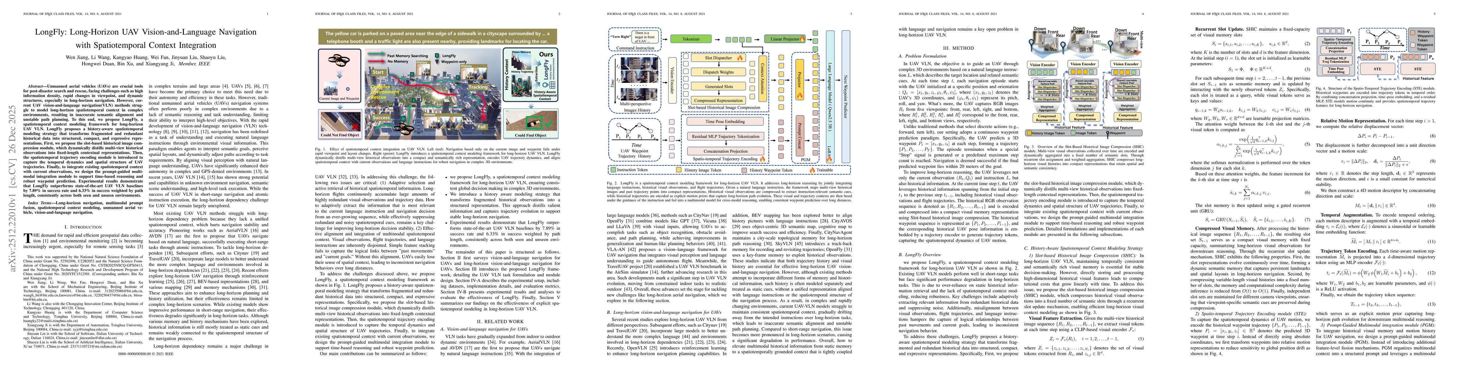
Unmanned aerial vehicles (UAVs) are crucial tools for post-disaster search and rescue, facing challenges such as high information density, rapid changes in viewpoint, and dynamic structures, especiall...
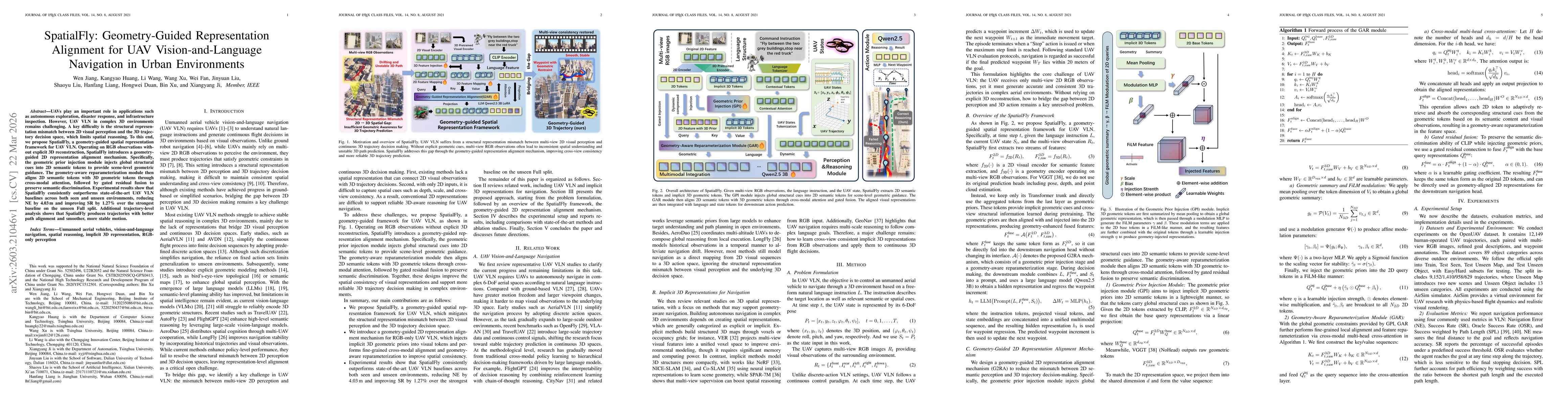
UAVs play an important role in applications such as autonomous exploration, disaster response, and infrastructure inspection. However, UAV VLN in complex 3D environments remains challenging. A key dif...
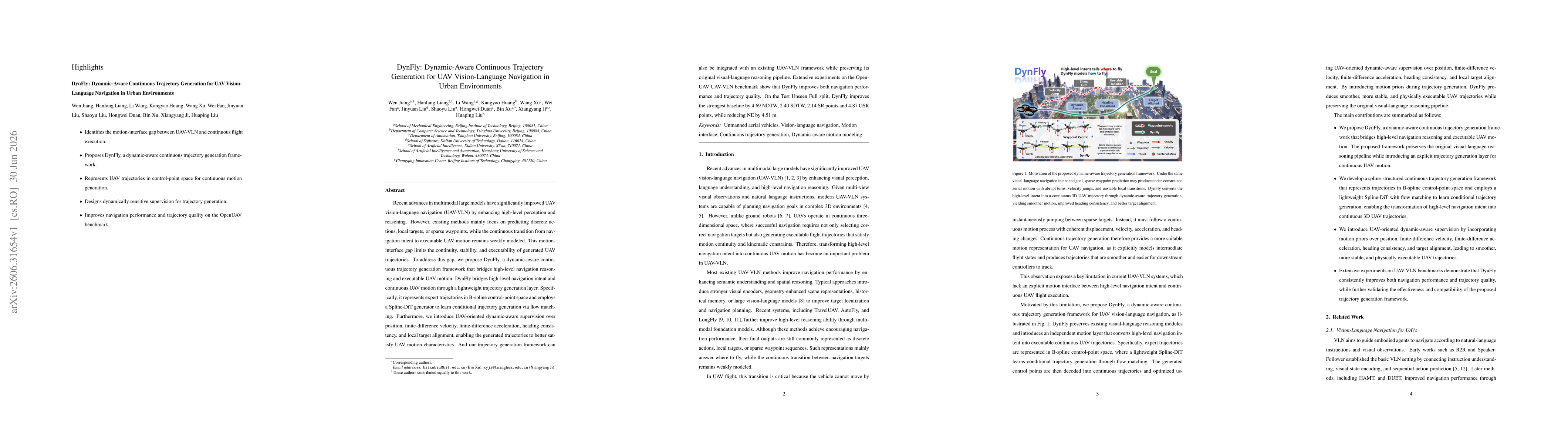
Recent advances in multimodal large models have significantly improved UAV vision-language navigation (UAV-VLN) by enhancing high-level perception and reasoning. However, existing methods mainly focus...