Academic Profile
Statistics
Similar Authors
Papers on arXiv
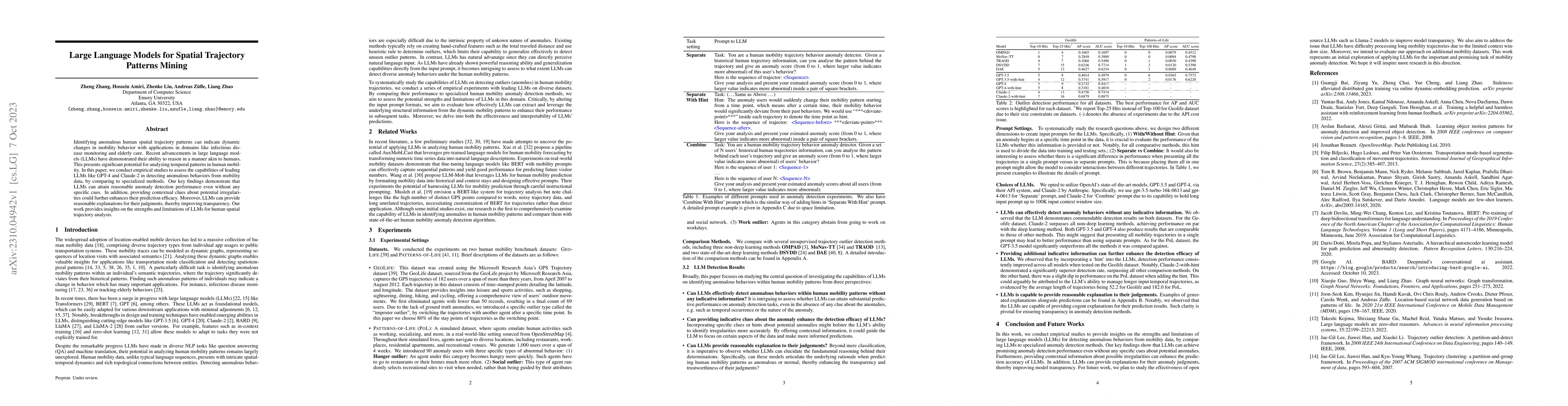
Identifying anomalous human spatial trajectory patterns can indicate dynamic changes in mobility behavior with applications in domains like infectious disease monitoring and elderly care. Recent adv...
Human trajectory anomaly detection has become increasingly important across a wide range of applications, including security surveillance and public health. However, existing trajectory anomaly detect...
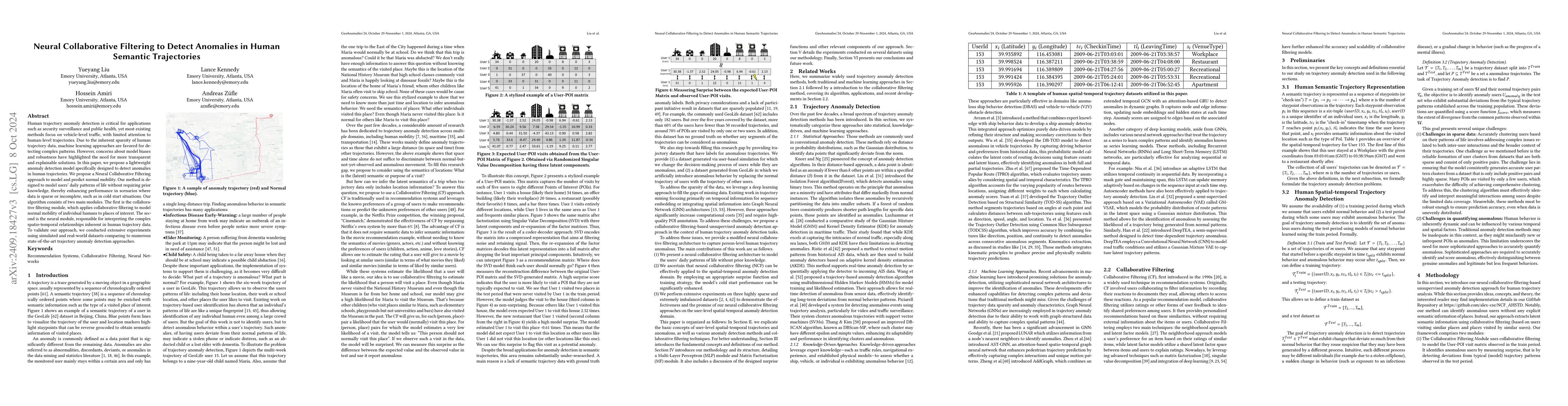
Semantic trajectories, which enrich spatial-temporal data with textual information such as trip purposes or location activities, are key for identifying outlier behaviors critical to healthcare, socia...
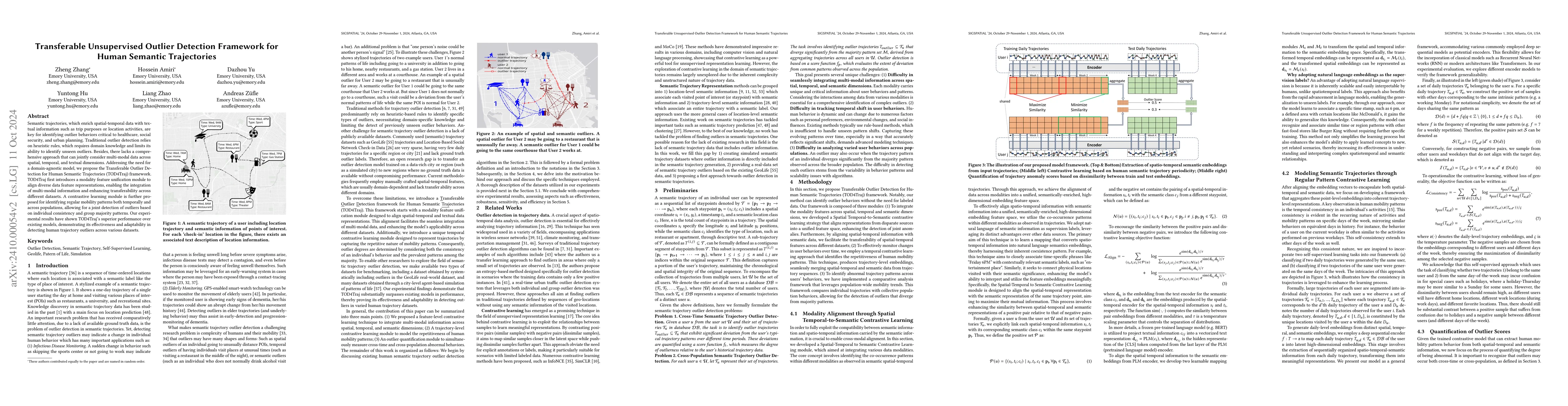
Analyzing individual human trajectory data helps our understanding of human mobility and finds many commercial and academic applications. There are two main approaches to accessing trajectory data for...
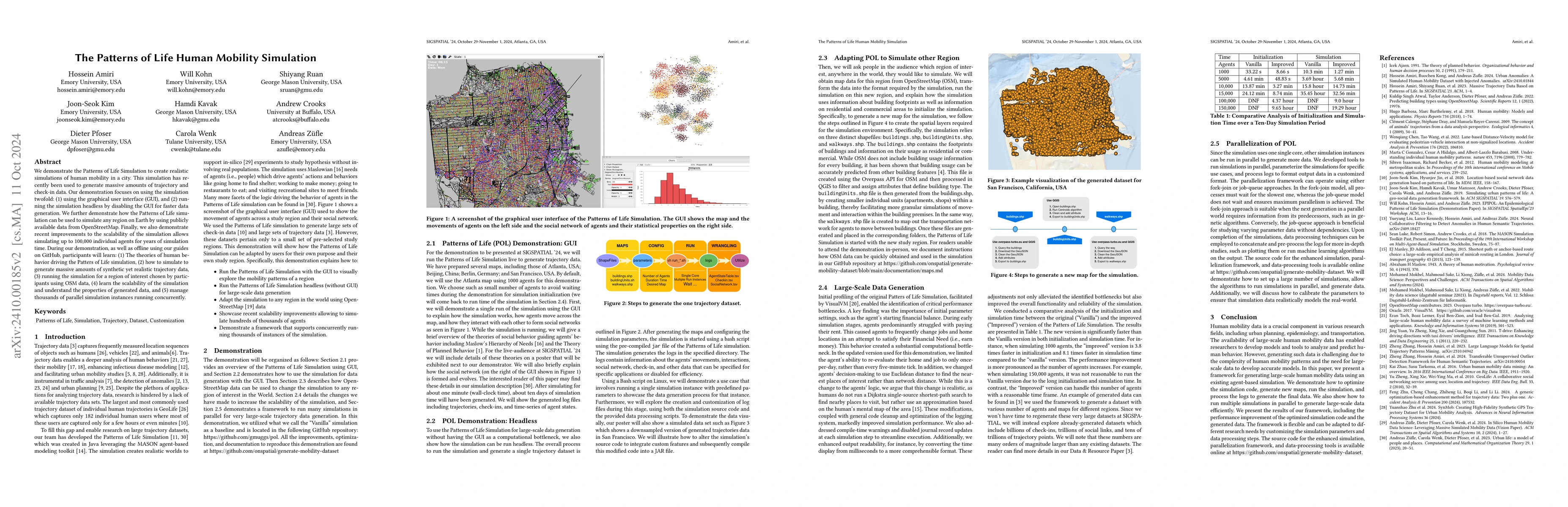
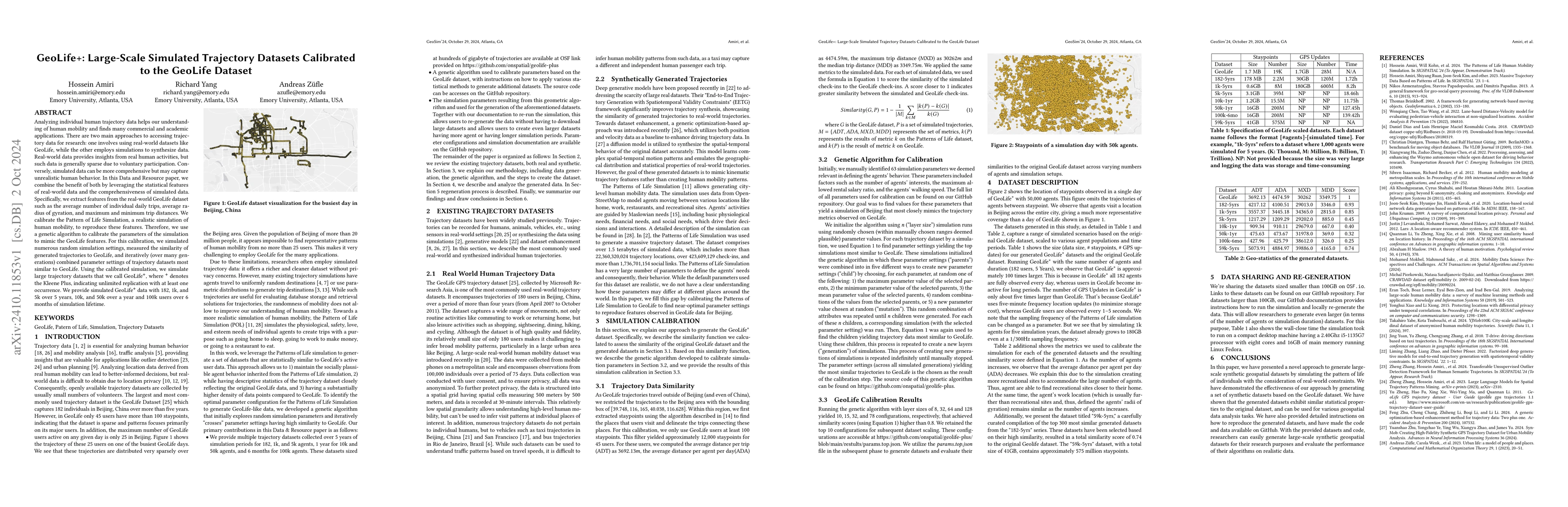
We demonstrate the Patterns of Life Simulation to create realistic simulations of human mobility in a city. This simulation has recently been used to generate massive amounts of trajectory and check-i...
Human mobility anomaly detection based on location is essential in areas such as public health, safety, welfare, and urban planning. Developing models and approaches for location-based anomaly detecti...
We present a comprehensive dataset capturing patterns of human mobility across the United States from January 2019 to January 2023, based on anonymized mobile device data. Aggregated weekly, the datas...
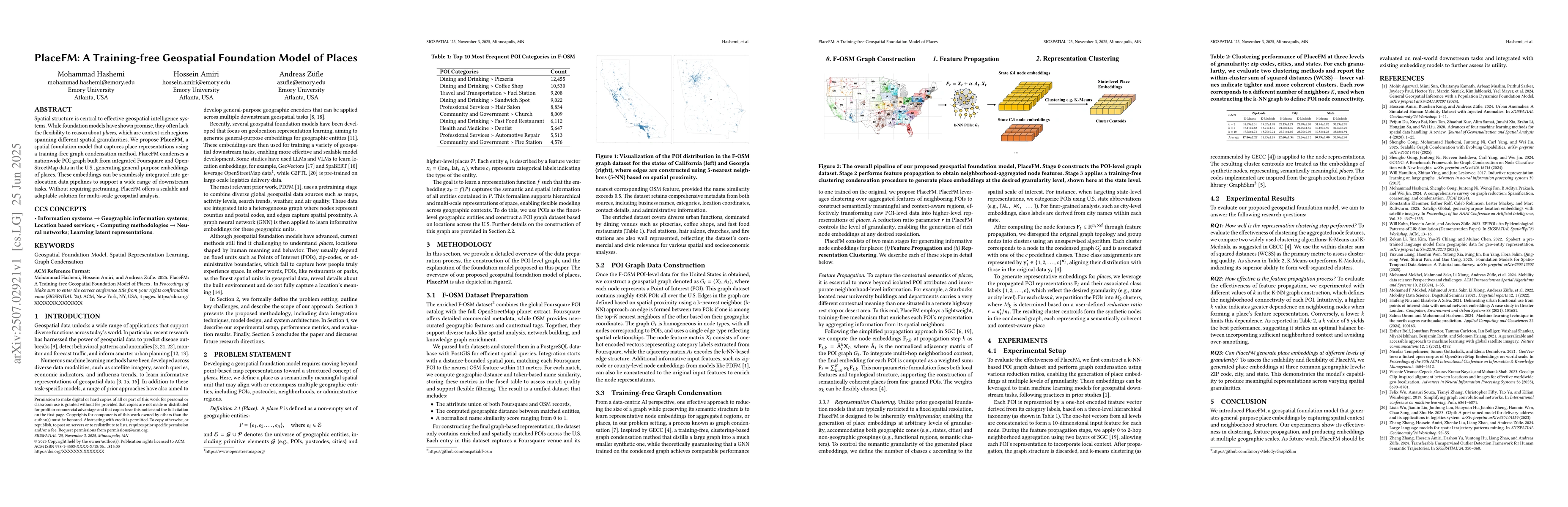
Spatial structure is central to effective geospatial intelligence systems. While foundation models have shown promise, they often lack the flexibility to reason about places, which are context-rich re...

Recently, Foursquare released a global dataset with more than 100 million points of interest (POIs), each representing a real-world business on its platform. However, many entries lack complete metada...
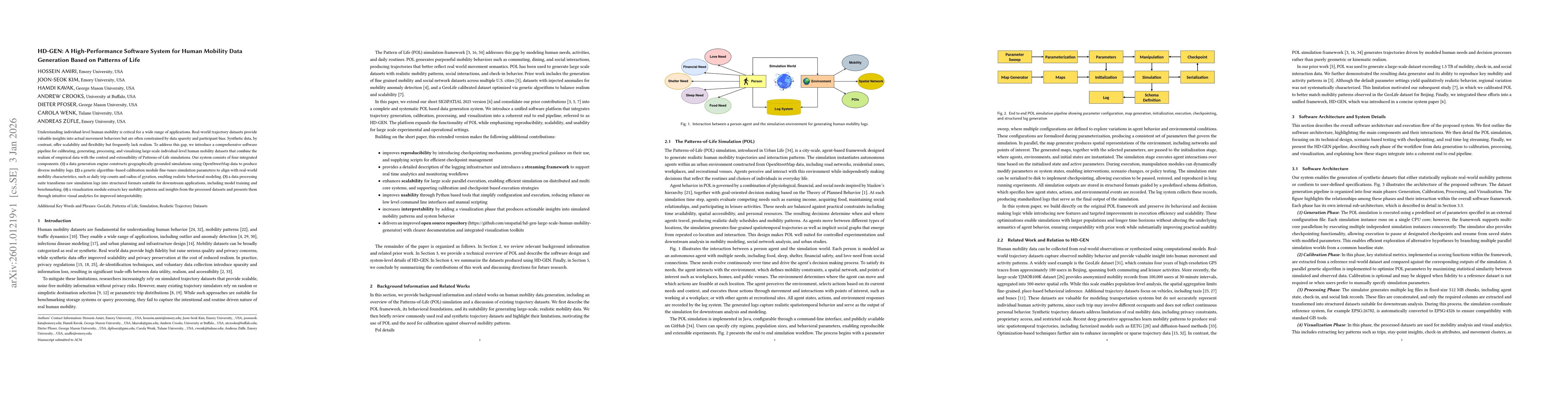
Understanding individual-level human mobility is critical for a wide range of applications. Real-world trajectory datasets provide valuable insights into actual movement behaviors but are often constr...
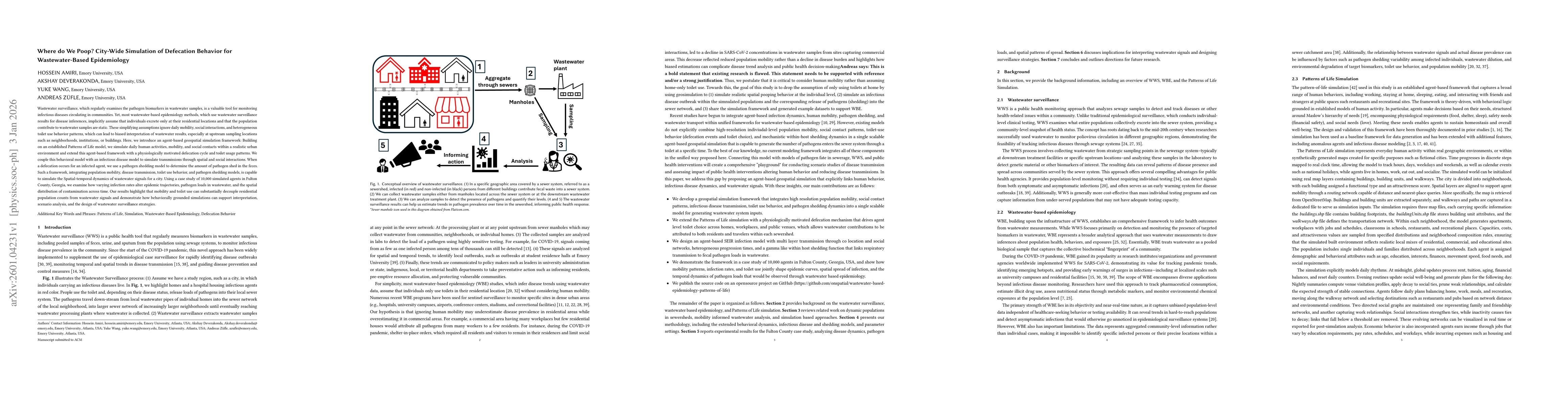
Wastewater surveillance, which regularly examines the pathogen biomarkers in wastewater samples, is a valuable tool for monitoring infectious diseases circulating in communities. Yet, most wastewater-...

Designing equitable and effective public transit fare policies is challenging due to complex interactions among traveler behavior, multimodal networks, and socioeconomic heterogeneity. This paper pres...