Hwasoo Yeo
10 papers on arXiv
Academic Profile
Statistics
Similar Authors
Papers on arXiv
A Real-time Evaluation Framework for Pedestrian's Potential Risk at Non-Signalized Intersections Based on Predicted Post-Encroachment Time
Addressing pedestrian safety at intersections is one of the paramount concerns in the field of transportation research, driven by the urgency of reducing traffic-related injuries and fatalities. Wit...
A Framework for Pedestrian Sub-classification and Arrival Time Prediction at Signalized Intersection Using Preprocessed Lidar Data
The mortality rate for pedestrians using wheelchairs was 36% higher than the overall population pedestrian mortality rate. However, there is no data to clarify the pedestrians' categories in both fa...
Transformer-based Map Matching Model with Limited Ground-Truth Data using Transfer-Learning Approach
In many spatial trajectory-based applications, it is necessary to map raw trajectory data points onto road networks in digital maps, which is commonly referred to as a map-matching process. While mo...
Analyzing vehicle pedestrian interactions combining data cube structure and predictive collision risk estimation model
Traffic accidents are a threat to human lives, particularly pedestrians causing premature deaths. Therefore, it is necessary to devise systems to prevent accidents in advance and respond proactively...
Automated Object Behavioral Feature Extraction for Potential Risk Analysis based on Video Sensor
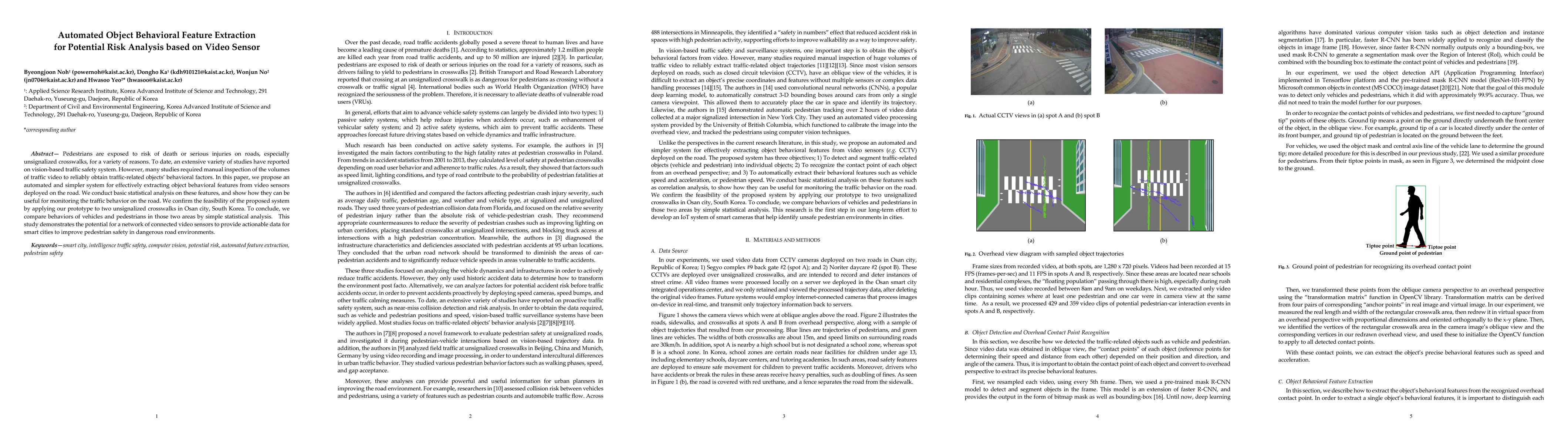
Pedestrians are exposed to risk of death or serious injuries on roads, especially unsignalized crosswalks, for a variety of reasons. To date, an extensive variety of studies have reported on vision ...
A novel method of predictive collision risk area estimation for proactive pedestrian accident prevention system in urban surveillance infrastructure
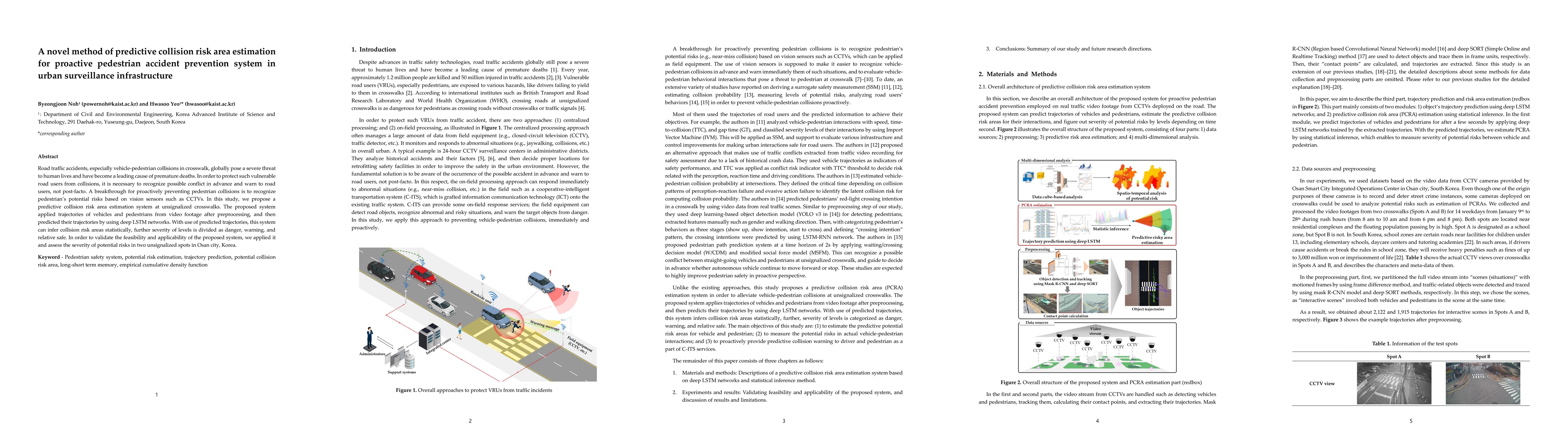
Road traffic accidents, especially vehicle pedestrian collisions in crosswalk, globally pose a severe threat to human lives and have become a leading cause of premature deaths. In order to protect s...
A Real-Time Predictive Pedestrian Collision Warning Service for Cooperative Intelligent Transportation Systems Using 3D Pose Estimation
Minimizing traffic accidents between vehicles and pedestrians is one of the primary research goals in intelligent transportation systems. To achieve the goal, pedestrian orientation recognition and ...
Traffic Data Imputation using Deep Convolutional Neural Networks
We propose a statistical learning-based traffic speed estimation method that uses sparse vehicle trajectory information. Using a convolutional encoder-decoder based architecture, we show that a well...
Advanced computer vision for extracting georeferenced vehicle trajectories from drone imagery
This paper presents a framework for extracting georeferenced vehicle trajectories from high-altitude drone footage, addressing key challenges in urban traffic monitoring and limitations of traditional...

DRIFT open dataset: A drone-derived intelligence for traffic analysis in urban environment
Reliable traffic data are essential for understanding urban mobility and developing effective traffic management strategies. This study introduces the DRone-derived Intelligence For Traffic analysis (...