Academic Profile
Statistics
Similar Authors
Papers on arXiv
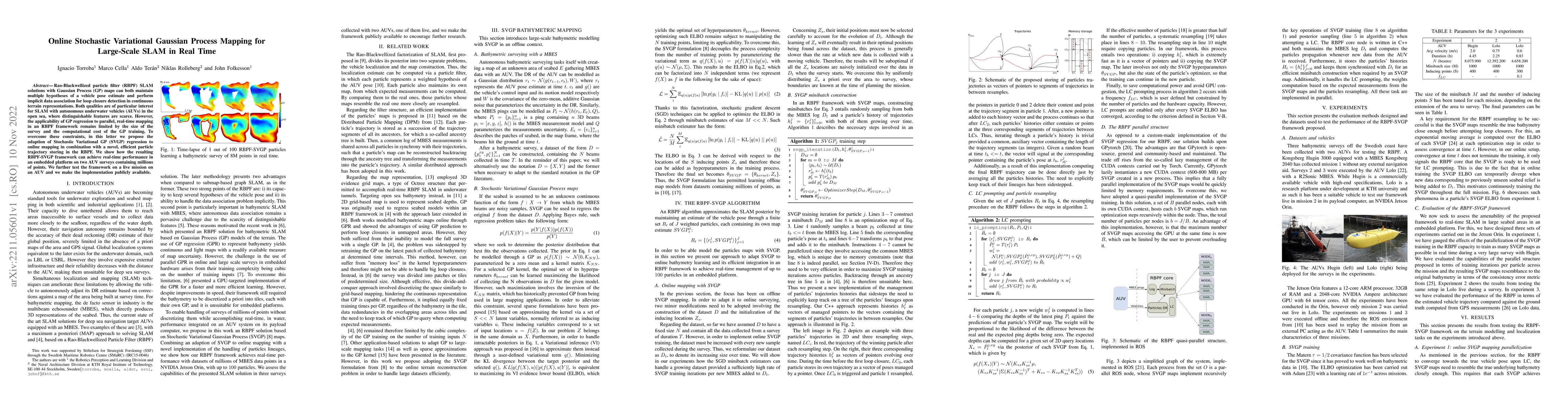
Autonomous underwater vehicles (AUVs) are becoming standard tools for underwater exploration and seabed mapping in both scientific and industrial applications \cite{graham2022rapid, stenius2022syste...
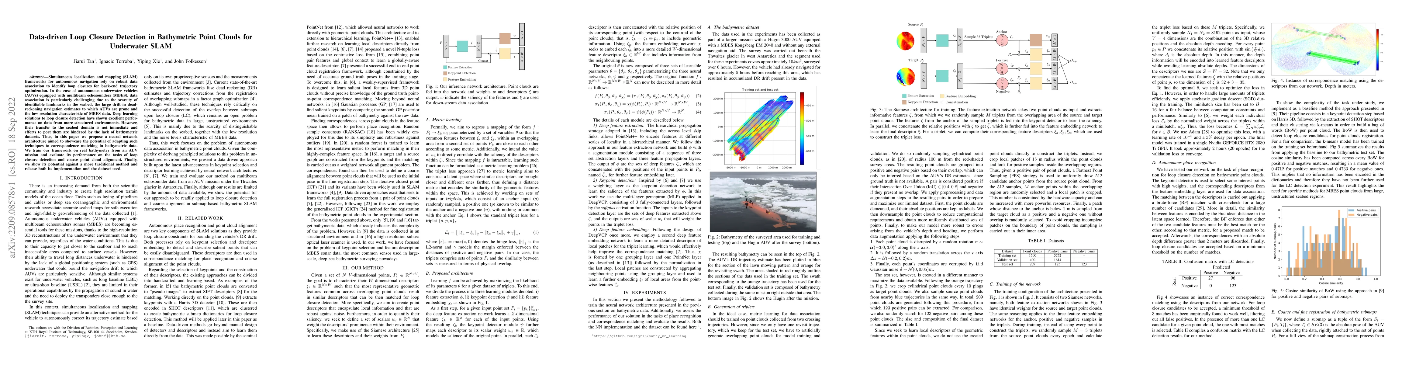
Simultaneous localization and mapping (SLAM) frameworks for autonomous navigation rely on robust data association to identify loop closures for back-end trajectory optimization. In the case of auton...

Gaussian processes (GPs) are becoming a standard tool to build terrain representations thanks to their capacity to model map uncertainty. This effectively yields a reliability measure of the areas o...
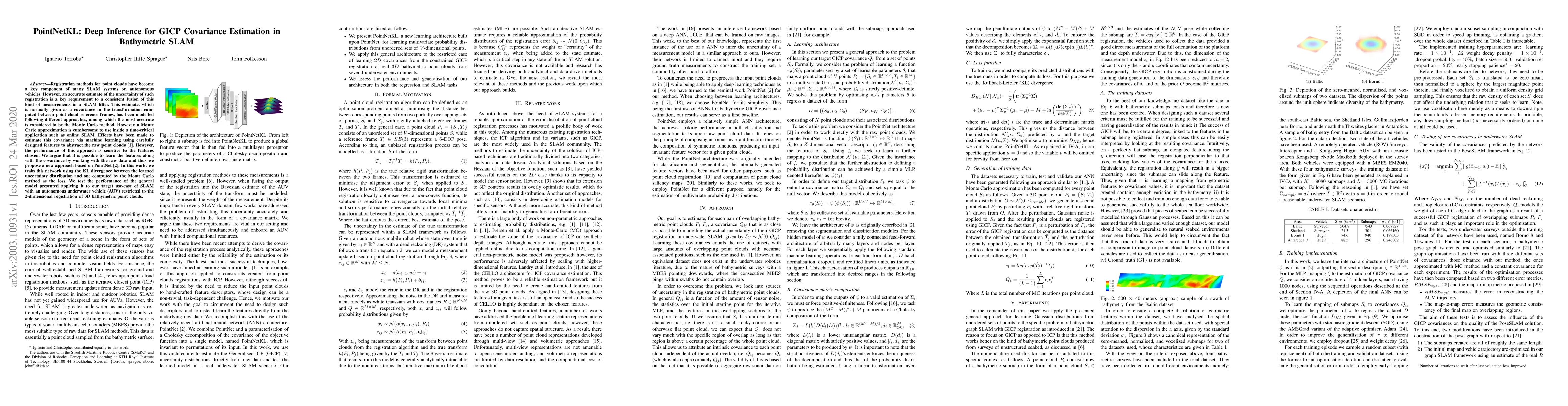
Registration methods for point clouds have become a key component of many SLAM systems on autonomous vehicles. However, an accurate estimate of the uncertainty of such registration is a key requirem...
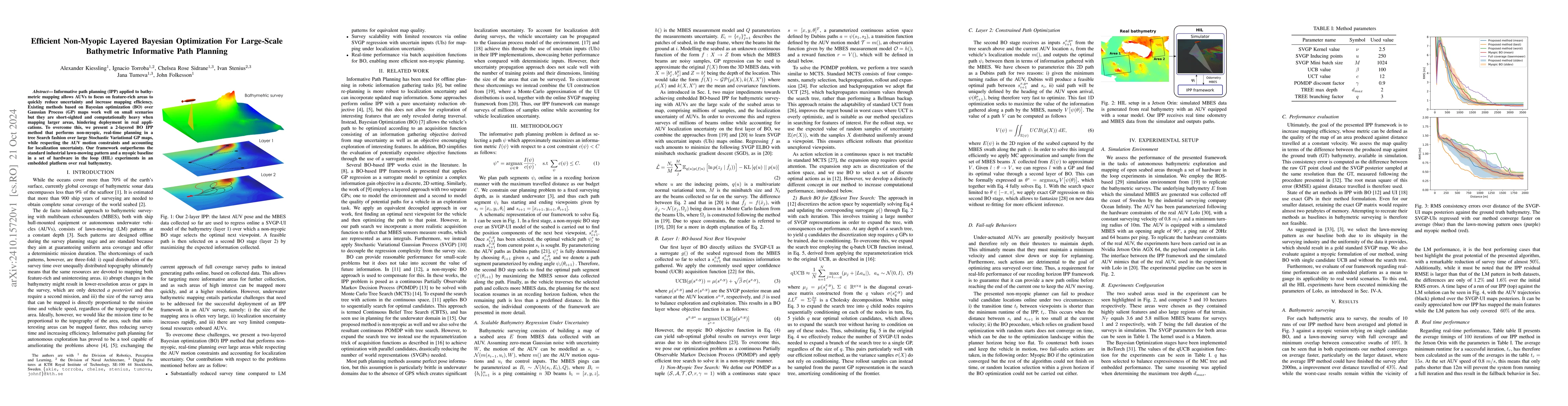
Informative path planning (IPP) applied to bathymetric mapping allows AUVs to focus on feature-rich areas to quickly reduce uncertainty and increase mapping efficiency. Existing methods based on Bayes...
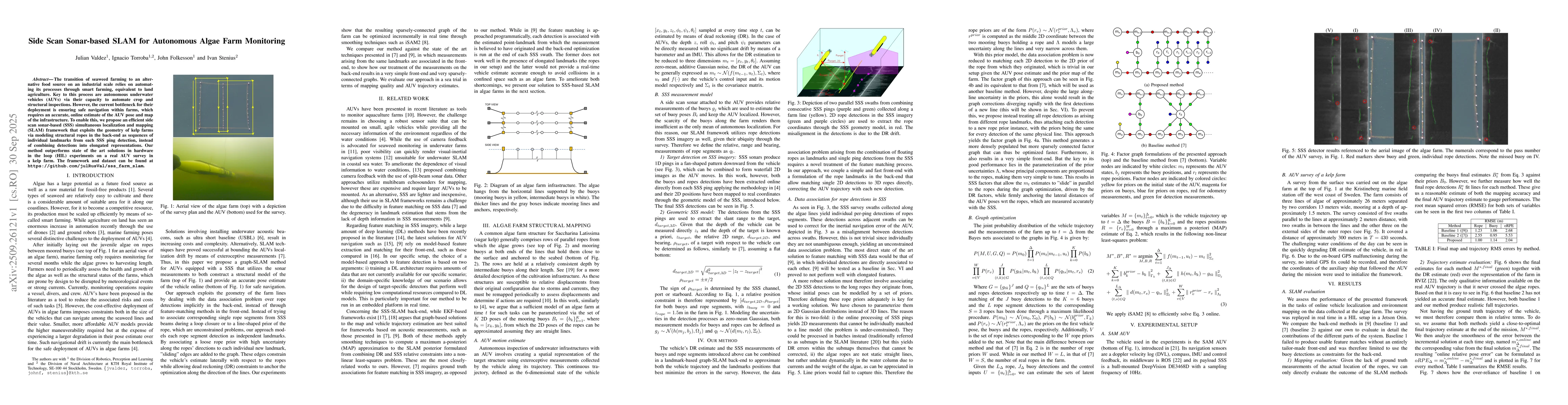
The transition of seaweed farming to an alternative food source on an industrial scale relies on automating its processes through smart farming, equivalent to land agriculture. Key to this process are...
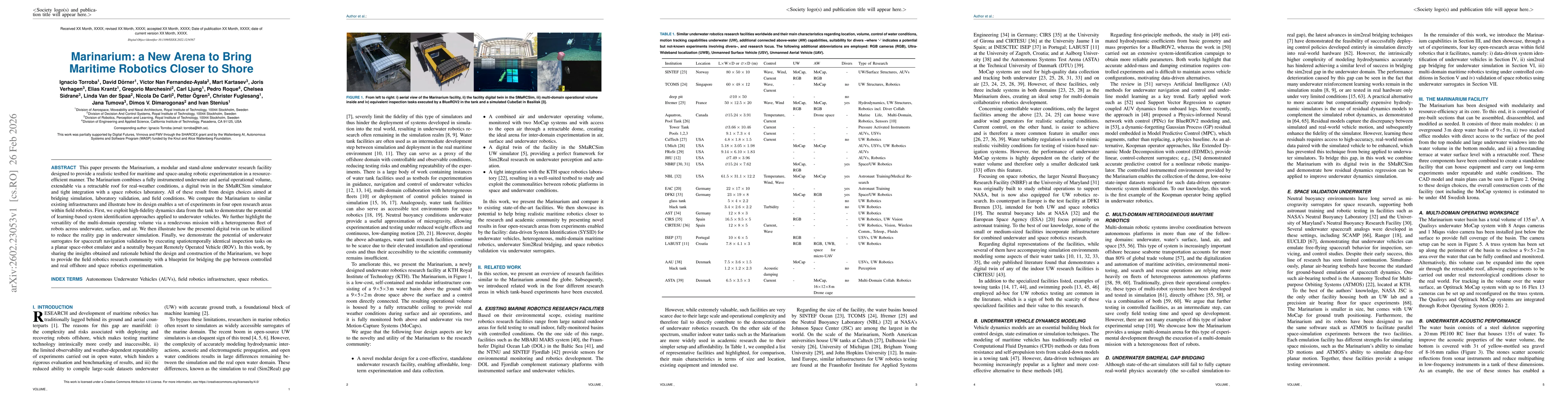
This paper presents the Marinarium, a modular and stand-alone underwater research facility designed to provide a realistic testbed for maritime and space-analog robotic experimentation in a resource-e...
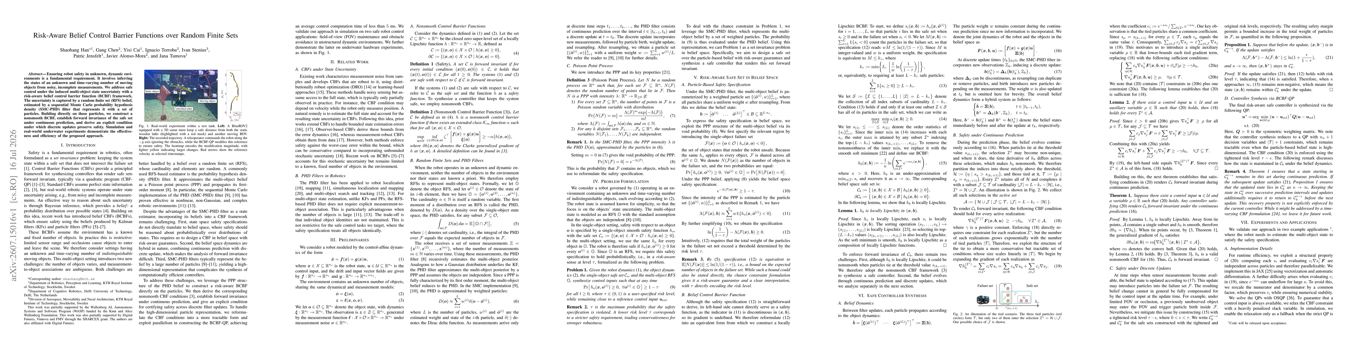
Ensuring robot safety in unknown, dynamic environments is a fundamental requirement. It involves inferring the states of an unknown and time-varying number of moving objects from noisy, incomplete mea...