Academic Profile
Statistics
Similar Authors
Papers on arXiv
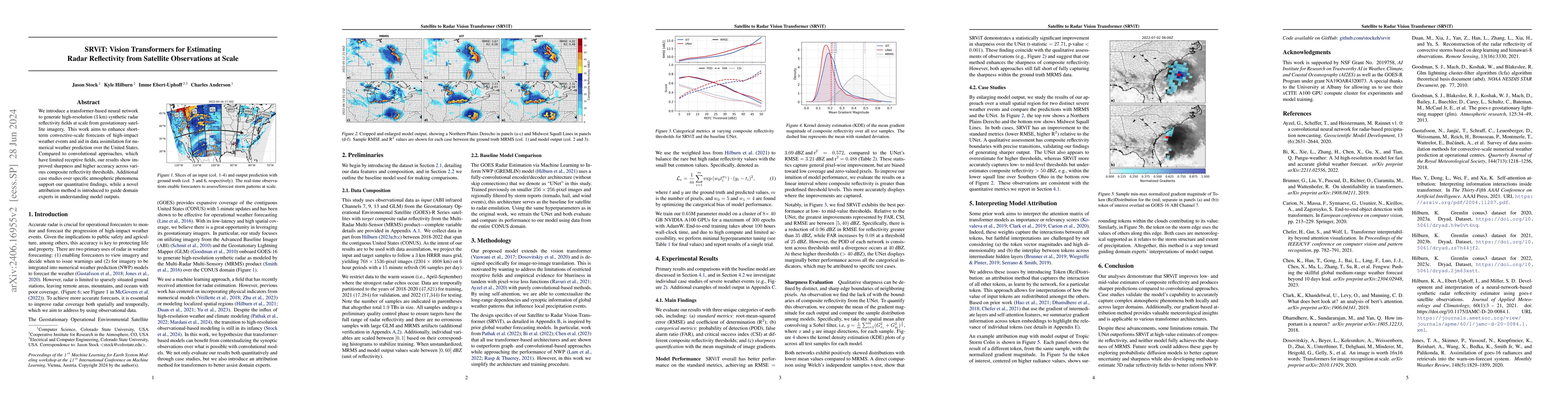
We introduce a transformer-based neural network to generate high-resolution (3km) synthetic radar reflectivity fields at scale from geostationary satellite imagery. This work aims to enhance short-ter...
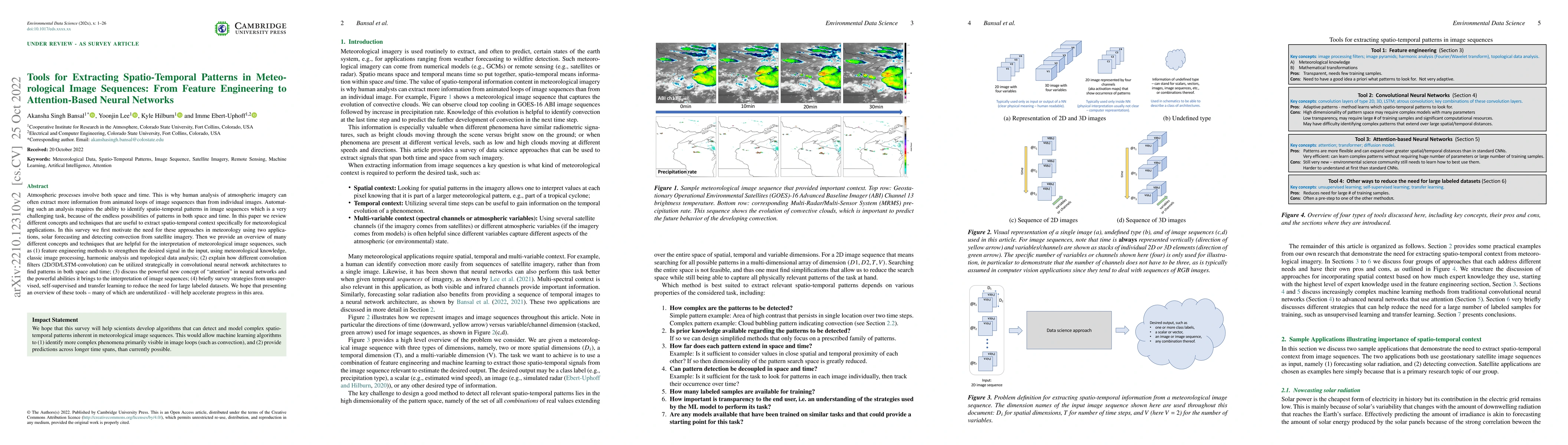
Atmospheric processes involve both space and time. This is why human analysis of atmospheric imagery can often extract more information from animated loops of image sequences than from individual im...
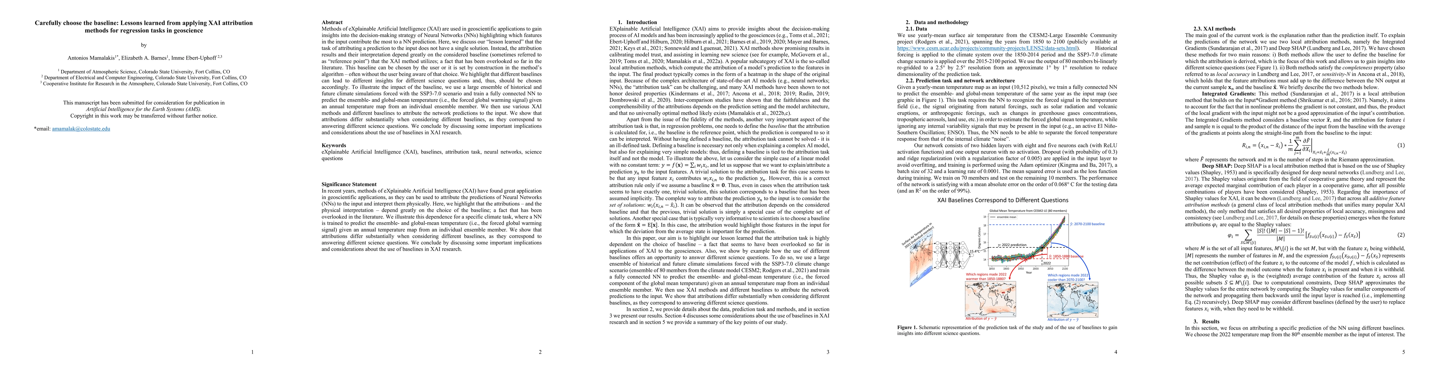
Methods of eXplainable Artificial Intelligence (XAI) are used in geoscientific applications to gain insights into the decision-making strategy of Neural Networks (NNs) highlighting which features in...
Topological data analysis (TDA) is a tool from data science and mathematics that is beginning to make waves in environmental science. In this work, we seek to provide an intuitive and understandable...
In the last decade, much work in atmospheric science has focused on spatial verification (SV) methods for gridded prediction, which overcome serious disadvantages of pixelwise verification. However,...
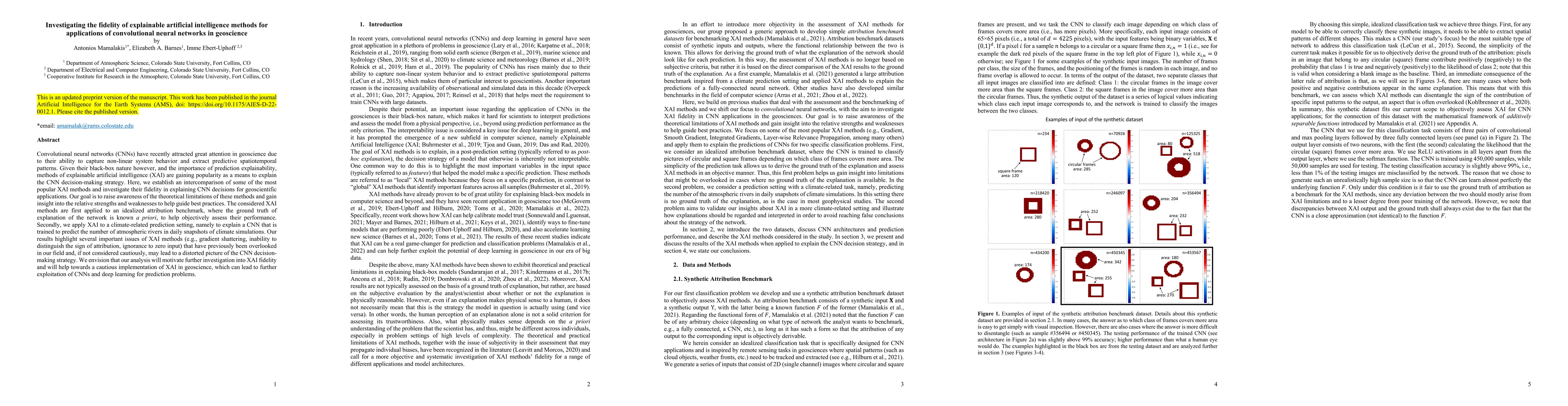
Convolutional neural networks (CNNs) have recently attracted great attention in geoscience due to their ability to capture non-linear system behavior and extract predictive spatiotemporal patterns. ...
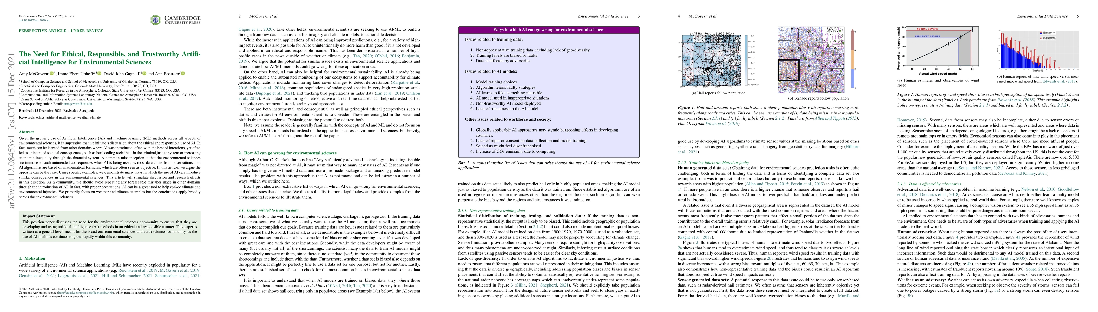
Given the growing use of Artificial Intelligence (AI) and machine learning (ML) methods across all aspects of environmental sciences, it is imperative that we initiate a discussion about the ethical...
Neural networks are increasingly used in environmental science applications. Furthermore, neural network models are trained by minimizing a loss function, and it is crucial to choose the loss functi...
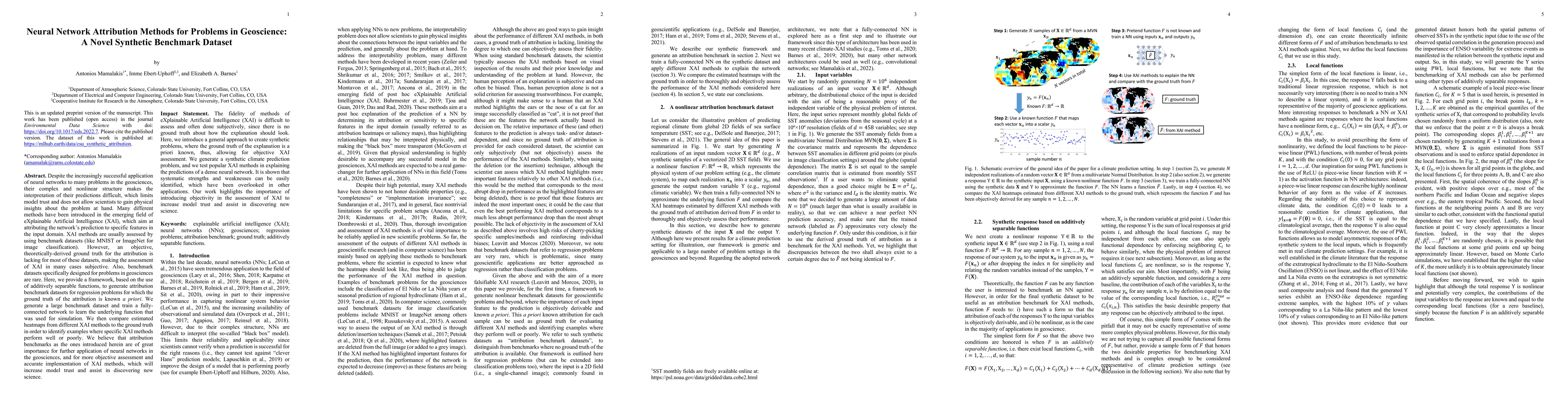
Despite the increasingly successful application of neural networks to many problems in the geosciences, their complex and nonlinear structure makes the interpretation of their predictions difficult,...
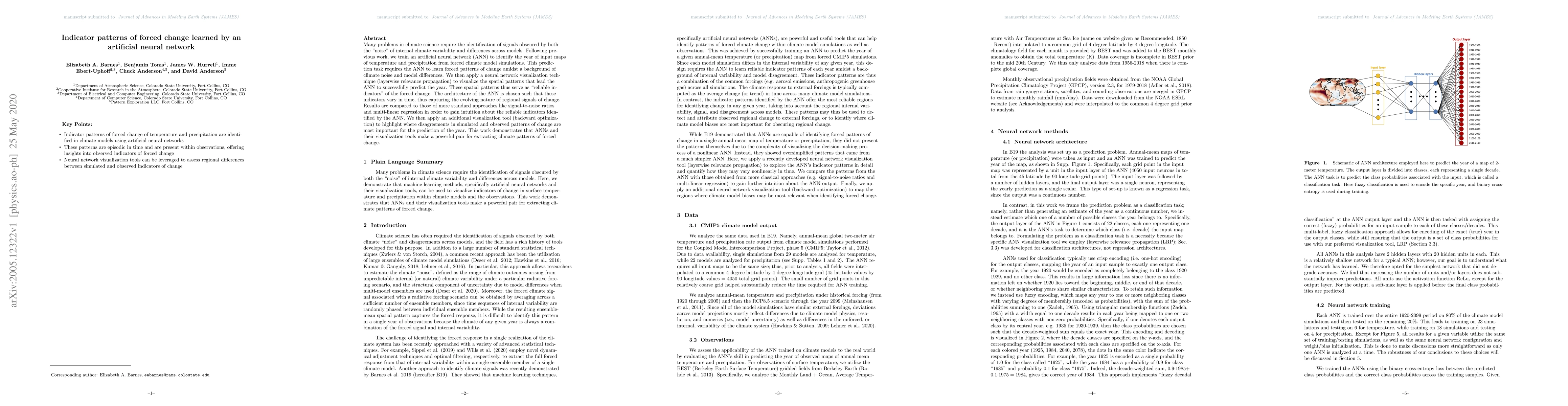
Many problems in climate science require the identification of signals obscured by both the "noise" of internal climate variability and differences across models. Following previous work, we train a...
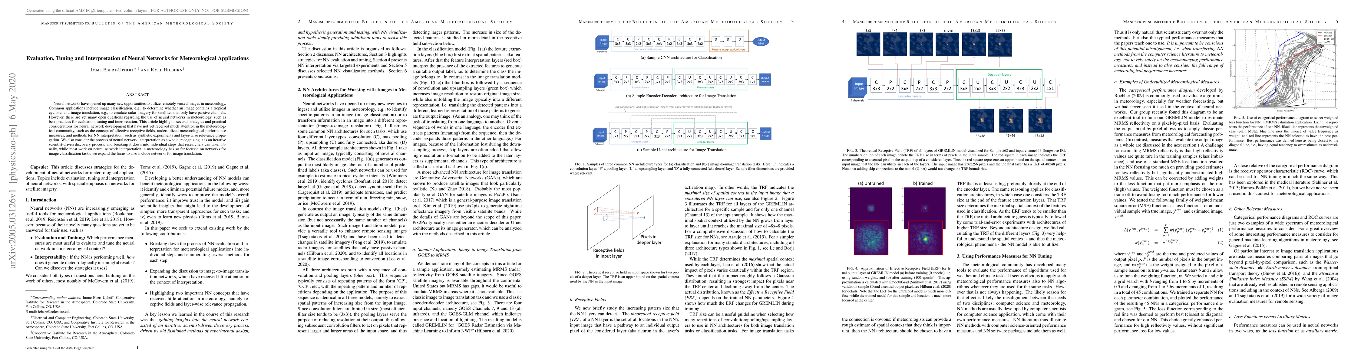
Neural networks have opened up many new opportunities to utilize remotely sensed images in meteorology. Common applications include image classification, e.g., to determine whether an image contains...
The objective of this research is to develop techniques for assimilating GOES-R Series observations in precipitating scenes for the purpose of improving short-term convective-scale forecasts of high...
In just the past few years multiple data-driven Artificial Intelligence Weather Prediction (AIWP) models have been developed, with new versions appearing almost monthly. Given this rapid development, ...
Determining the location of a tropical cyclone's (TC) surface circulation center -- "center-fixing" -- is a critical first step in the TC-forecasting process, affecting current and future estimates of...
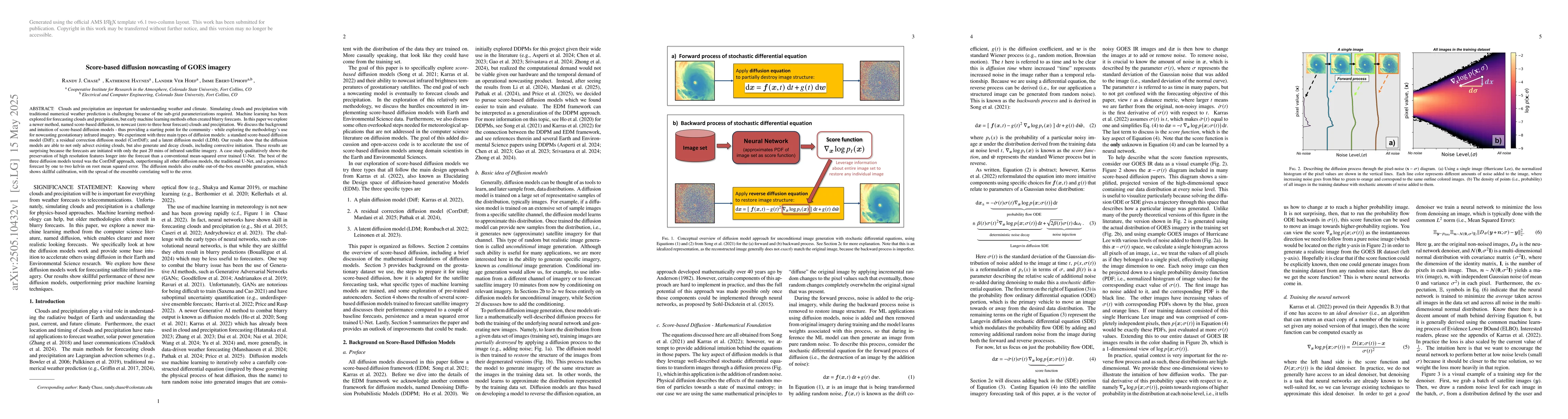
Clouds and precipitation are important for understanding weather and climate. Simulating clouds and precipitation with traditional numerical weather prediction is challenging because of the sub-grid p...
An Explainable Boosting Machine (EBM) is an interpretable machine learning (ML) algorithm that has benefits in high risk applications but has not yet found much use in atmospheric science. The overall...
Global climate models (GCMs), typically run at ~100-km resolution, capture large-scale environmental conditions but cannot resolve convection and cloud processes at kilometer scales. Convection-permit...