1
arXiv Papers
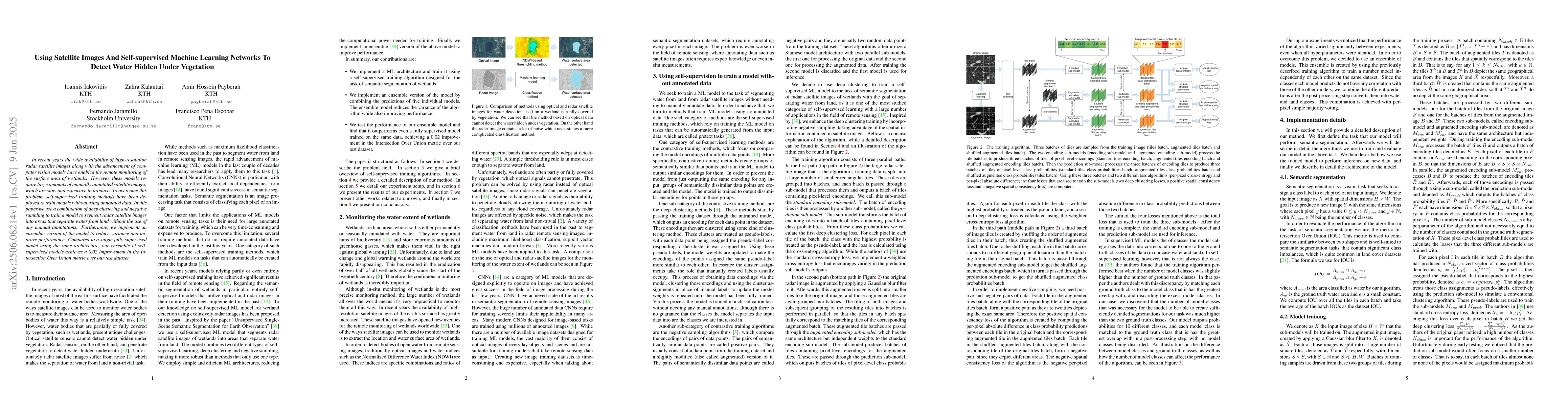
1
Total Publications
Profile
Academic Profile
Metrics
Statistics
1
arXiv Papers
1
Total Publications
Network
Similar Authors
Publications
Papers on arXiv
arXiv
Using Satellite Images And Self-supervised Machine Learning Networks To
Detect Water Hidden Under Vegetation
In recent years the wide availability of high-resolution radar satellite images along with the advancement of computer vision models have enabled the remote monitoring of the surface area of wetlands....