Academic Profile
Statistics
Similar Authors
Papers on arXiv
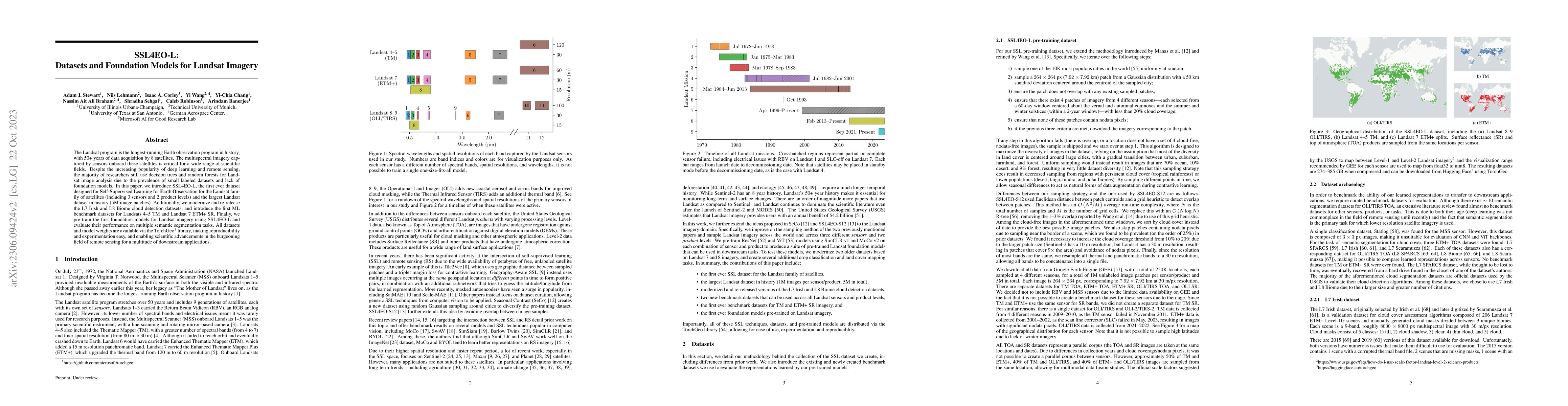
The Landsat program is the longest-running Earth observation program in history, with 50+ years of data acquisition by 8 satellites. The multispectral imagery captured by sensors onboard these satel...
Remotely sensed geospatial data are critical for applications including precision agriculture, urban planning, disaster monitoring and response, and climate change research, among others. Deep learn...
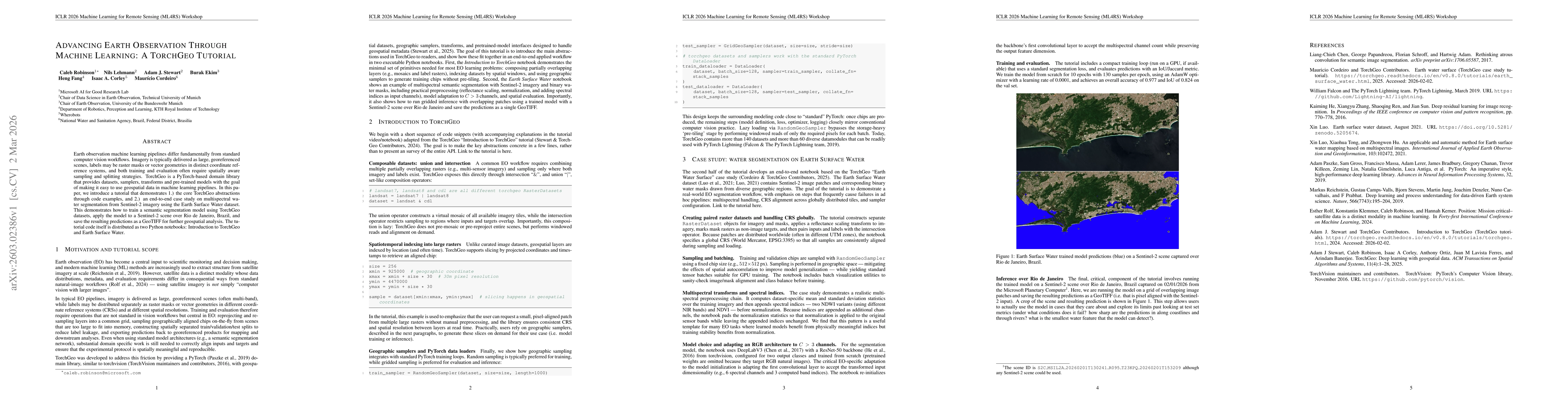
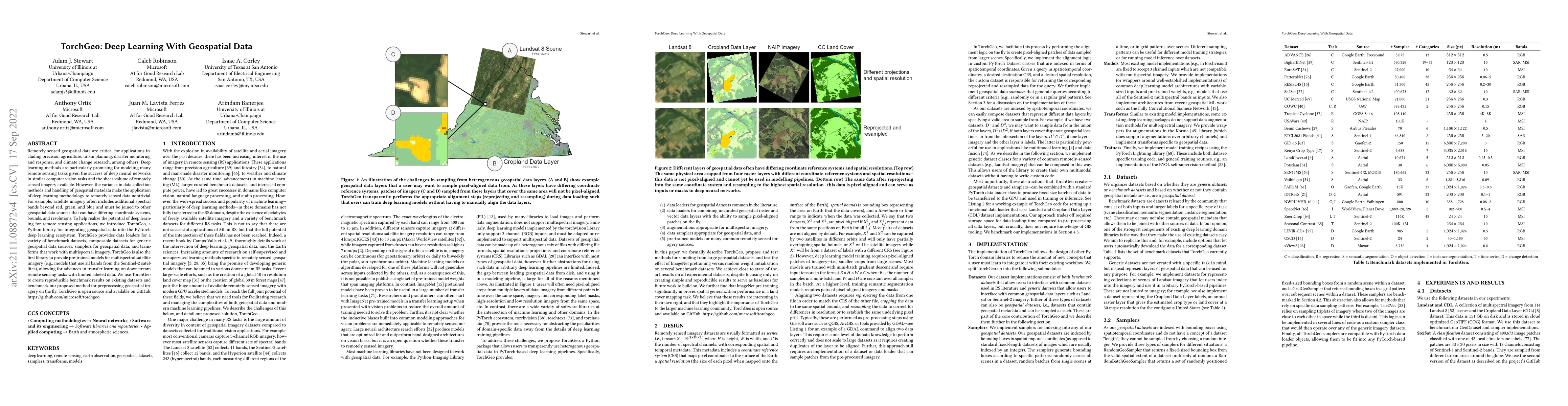
Earth observation machine learning pipelines differ fundamentally from standard computer vision workflows. Imagery is typically delivered as large, georeferenced scenes, labels may be raster masks or ...