Academic Profile
Statistics
Similar Authors
Papers on arXiv
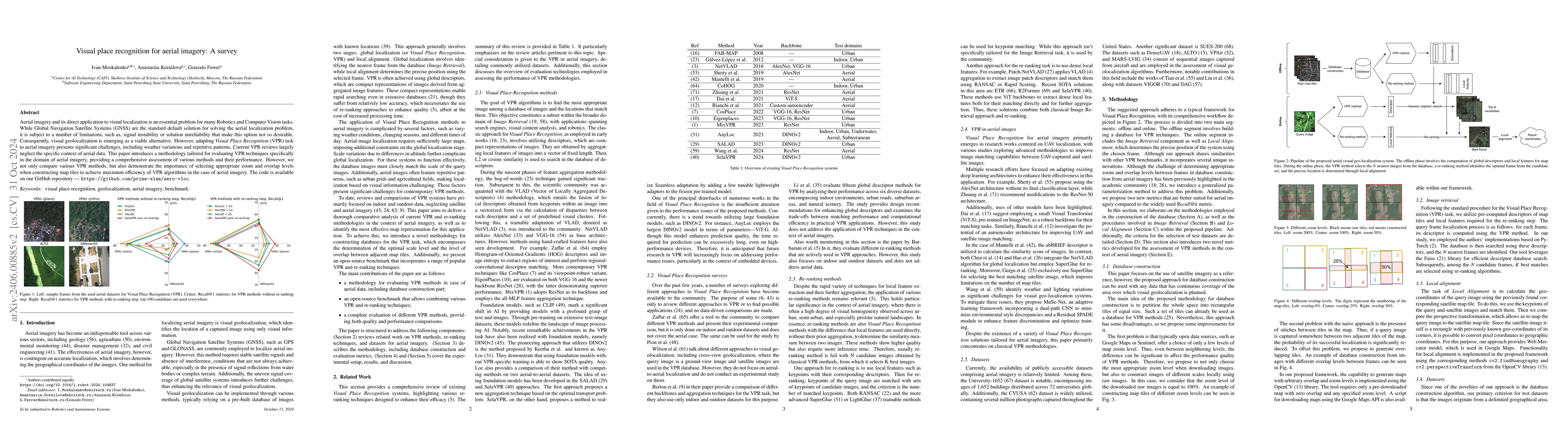
Aerial imagery and its direct application to visual localization is an essential problem for many Robotics and Computer Vision tasks. While Global Navigation Satellite Systems (GNSS) are the standar...
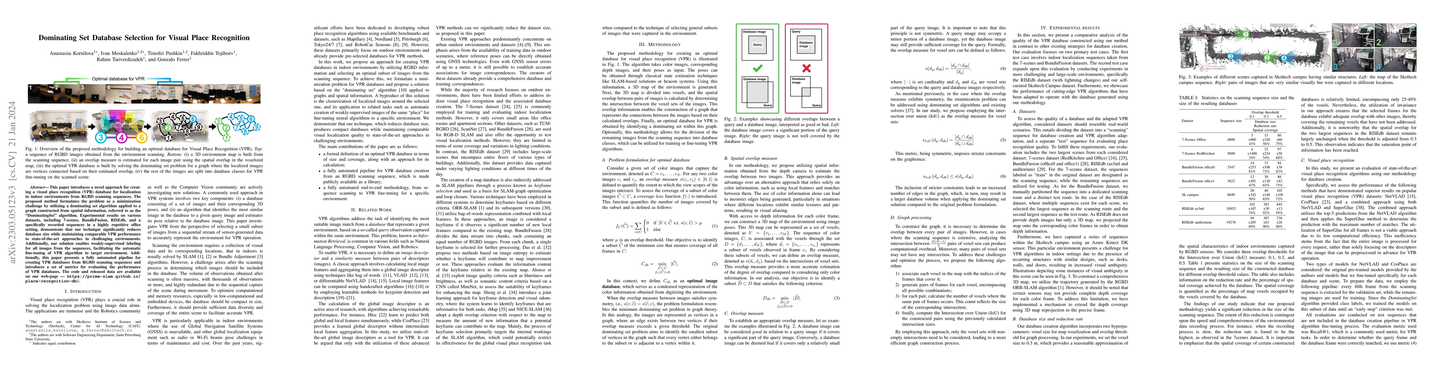
This paper presents an approach for creating a visual place recognition (VPR) database for localization in indoor environments from RGBD scanning sequences. The proposed approach is formulated as a ...
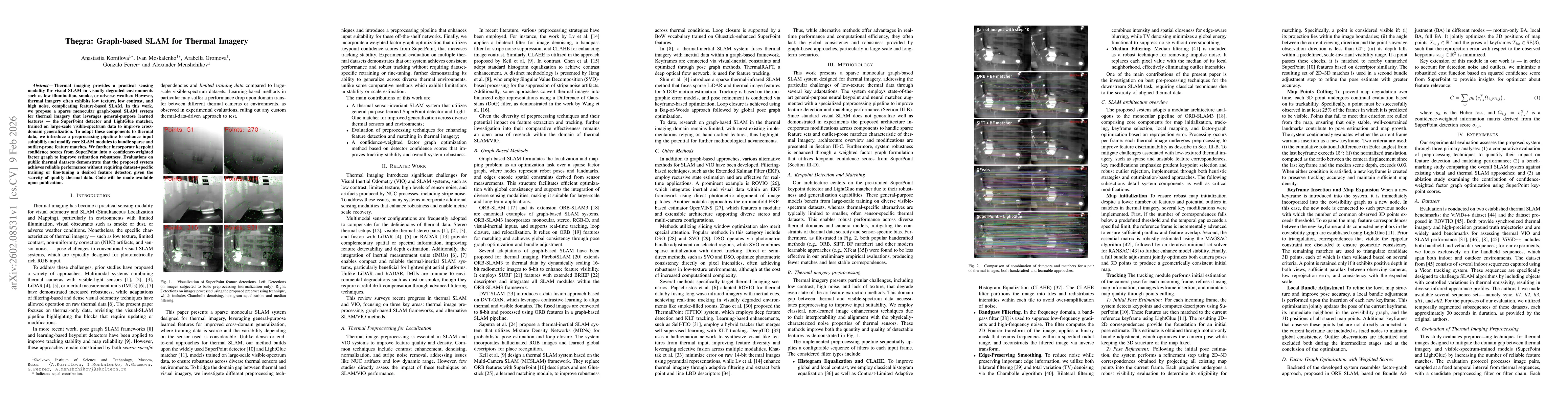
Thermal imaging provides a practical sensing modality for visual SLAM in visually degraded environments such as low illumination, smoke, or adverse weather. However, thermal imagery often exhibits low...