Academic Profile
Statistics
Similar Authors
Papers on arXiv
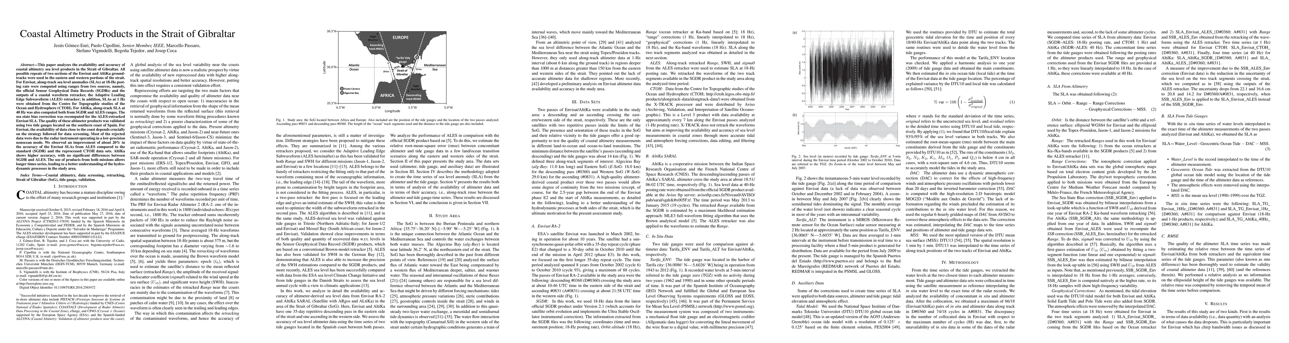
This paper analyzes the availability and accuracy of coastal altimetry sea level products in the Strait of Gibraltar. All possible repeats of two sections of the Envisat and AltiKa ground-tracks wer...
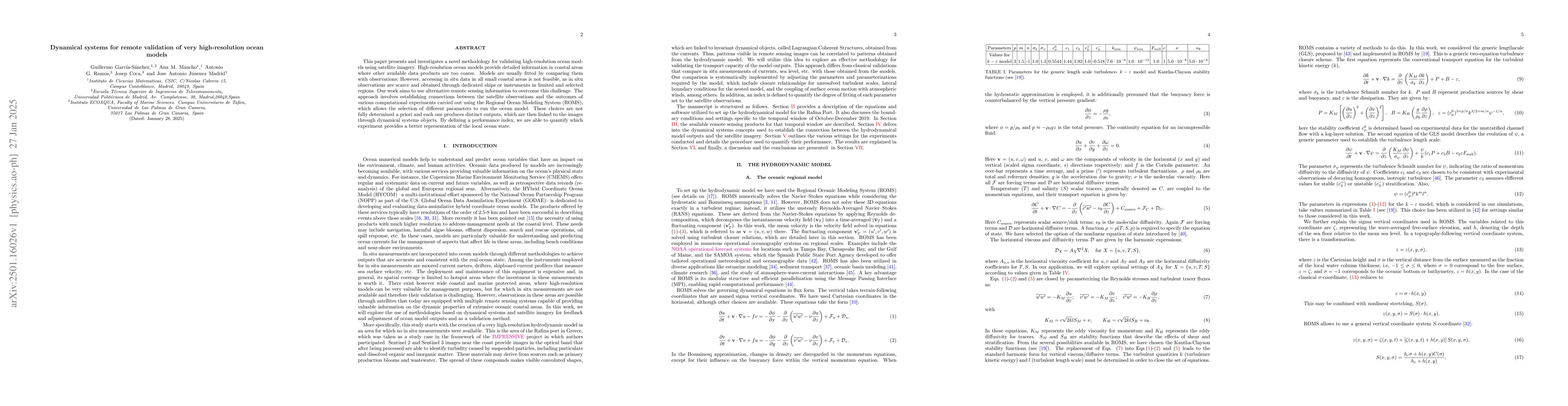
This paper presents and investigates a novel methodology for validating high-resolution ocean models using satellite imagery. High-resolution ocean models provide detailed information in coastal areas...
This paper discusses the combined use of tools from dynamical systems theory and remote sensing techniques and shows how they are effective instruments which may greatly contribute to the decision mak...