Academic Profile
Statistics
Similar Authors
Papers on arXiv
Traffic accidents present substantial challenges to human safety and socio-economic development in urban areas. Developing a reliable and responsible traffic accident prediction model is crucial to ad...
Global positioning system (GPS) trajectories recorded by mobile phones or action cameras offer valuable insights into sustainable mobility, as they provide fine-scale spatial and temporal characteri...
Large language models (LLMs) exhibit emerging geospatial capabilities, stemming from their pre-training on vast unlabelled text datasets that are often derived from the Common Crawl corpus. However,...
The Common Crawl (CC) corpus is the largest open web crawl dataset containing 9.5+ petabytes of data captured since 2008. The dataset is instrumental in training large language models, and as such i...
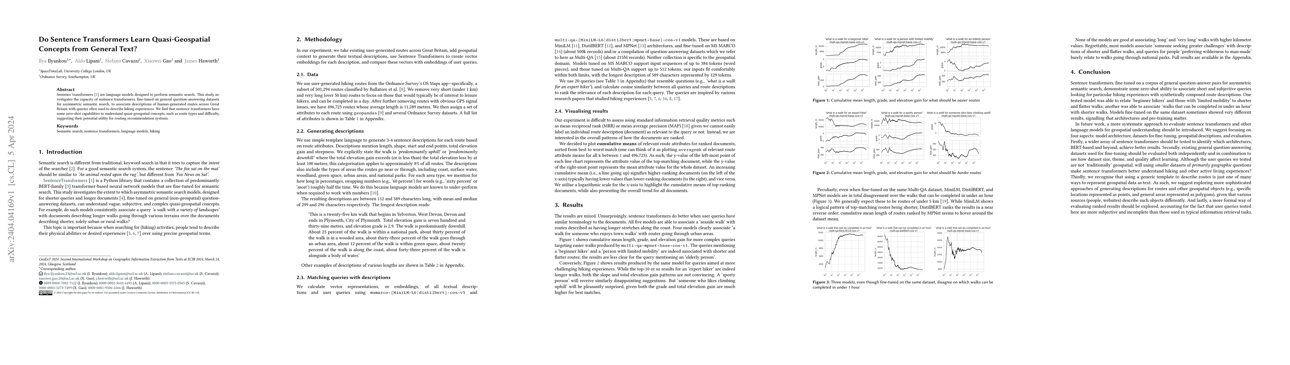
Sentence transformers are language models designed to perform semantic search. This study investigates the capacity of sentence transformers, fine-tuned on general question-answering datasets for as...
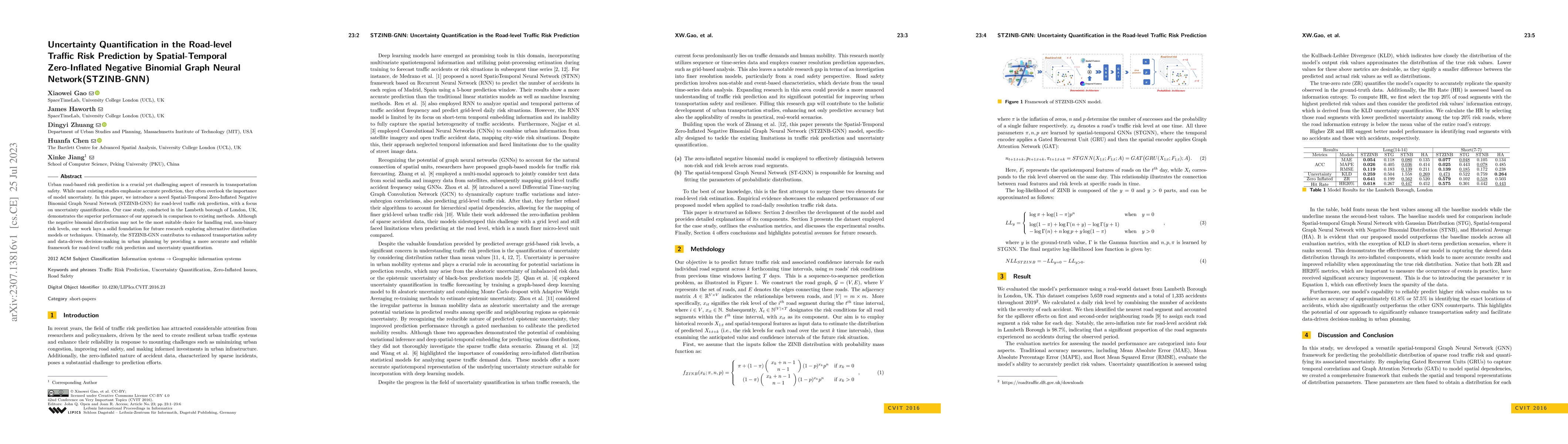
Urban road-based risk prediction is a crucial yet challenging aspect of research in transportation safety. While most existing studies emphasize accurate prediction, they often overlook the importan...
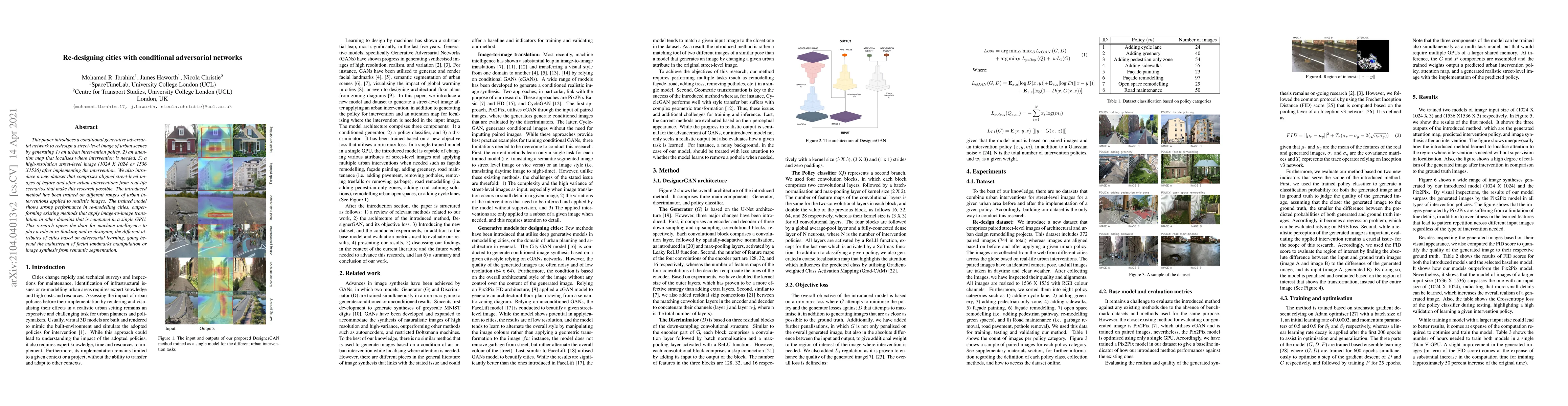
This paper introduces a conditional generative adversarial network to redesign a street-level image of urban scenes by generating 1) an urban intervention policy, 2) an attention map that localises ...
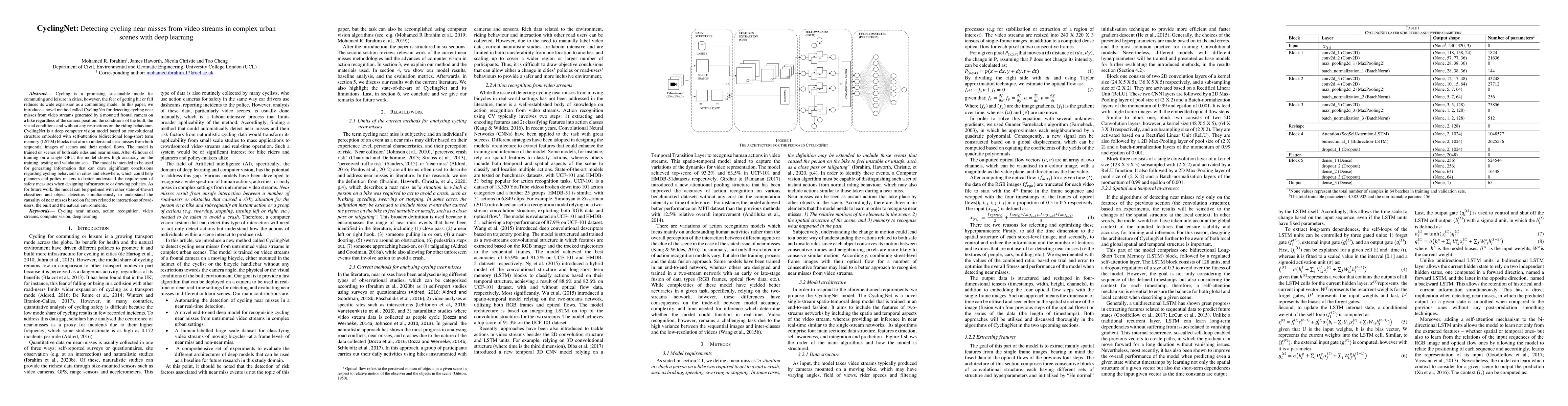
Cycling is a promising sustainable mode for commuting and leisure in cities, however, the fear of getting hit or fall reduces its wide expansion as a commuting mode. In this paper, we introduce a no...
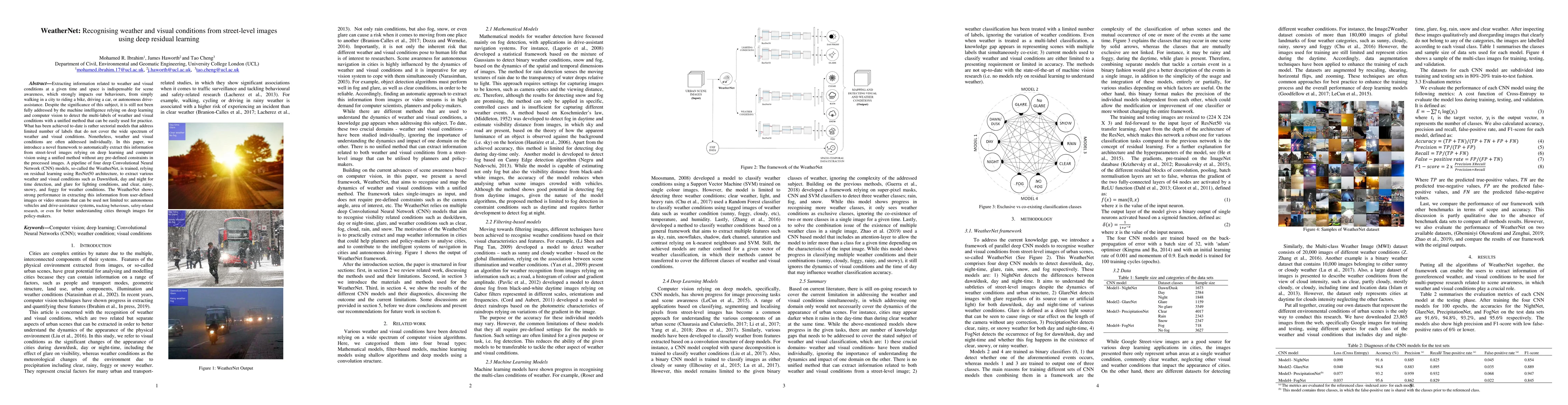
Extracting information related to weather and visual conditions at a given time and space is indispensable for scene awareness, which strongly impacts our behaviours, from simply walking in a city t...
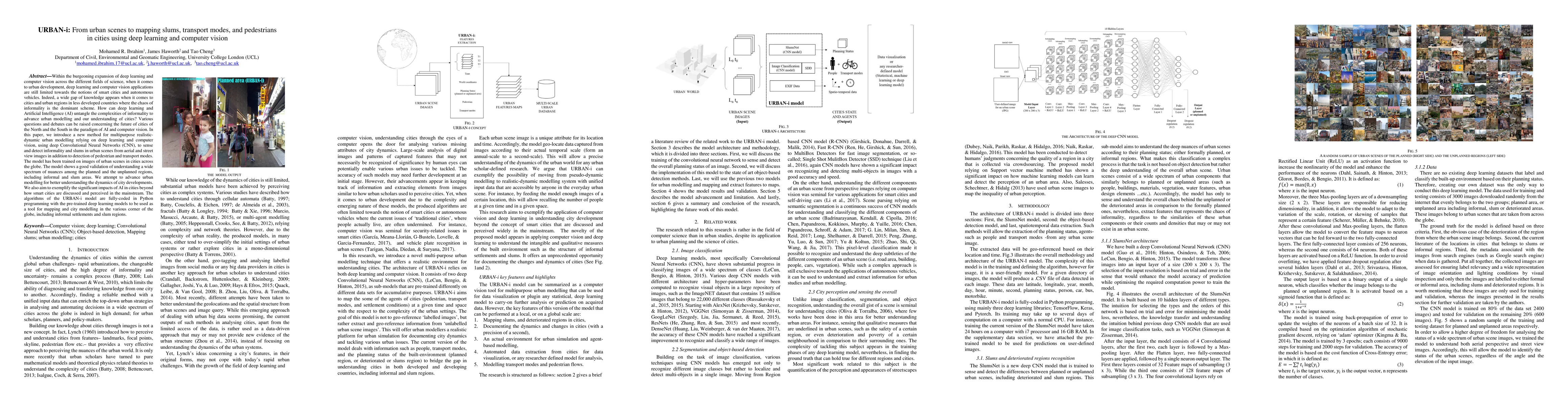
Within the burgeoning expansion of deep learning and computer vision across the different fields of science, when it comes to urban development, deep learning and computer vision applications are st...
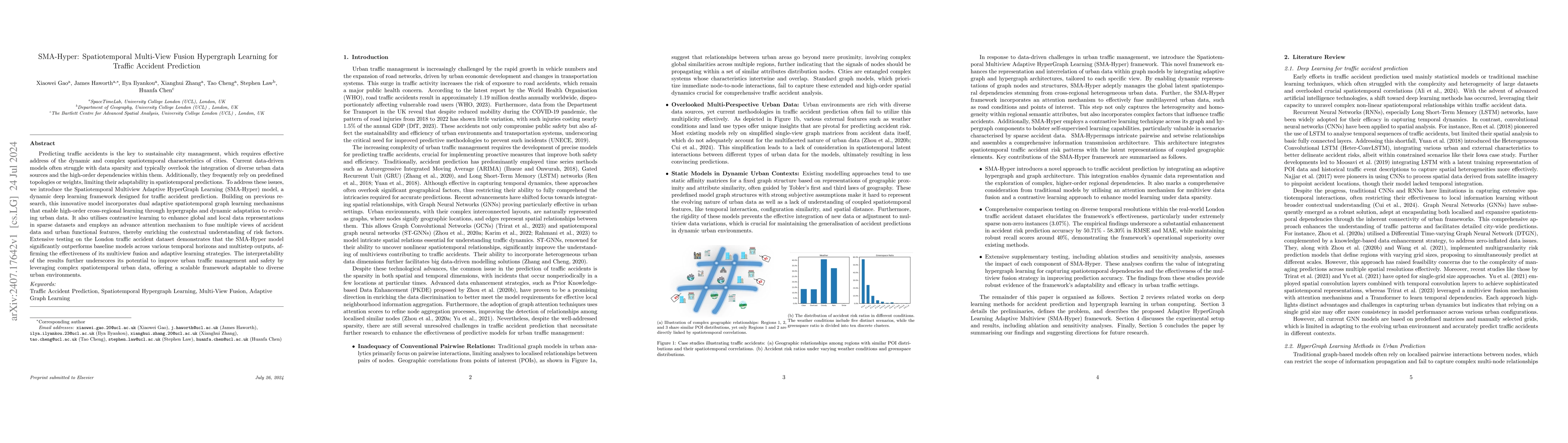
Predicting traffic accidents is the key to sustainable city management, which requires effective address of the dynamic and complex spatiotemporal characteristics of cities. Current data-driven models...
Panoramic cycling videos can record 360{\deg} views around the cyclists. Thus, it is essential to conduct automatic road user analysis on them using computer vision models to provide data for studies ...
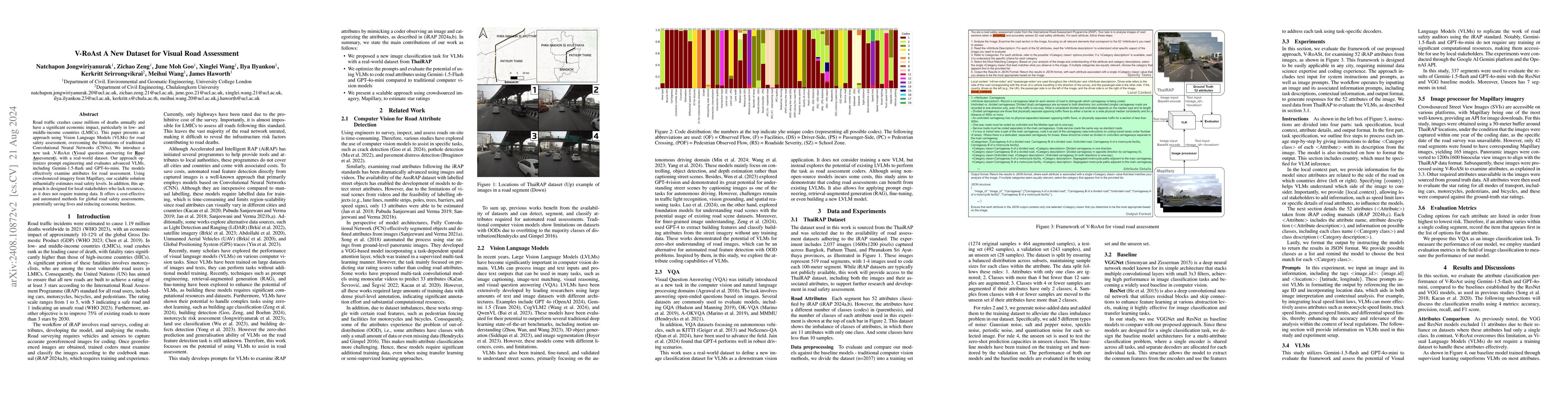
Road traffic crashes cause millions of deaths annually and have a significant economic impact, particularly in low- and middle-income countries (LMICs). This paper presents an approach using Vision La...
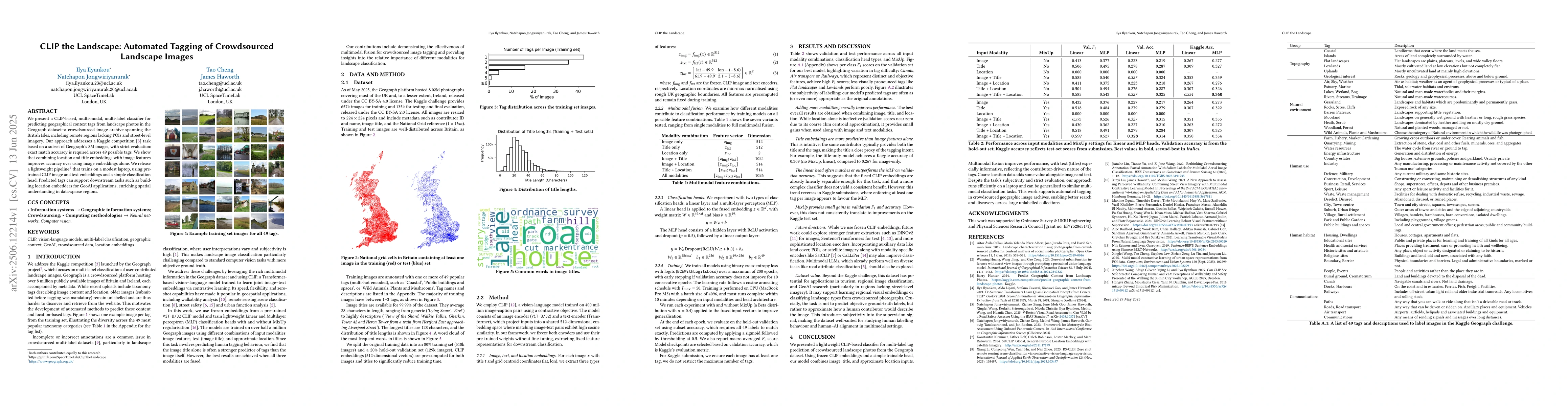
We present a CLIP-based, multi-modal, multi-label classifier for predicting geographical context tags from landscape photos in the Geograph dataset--a crowdsourced image archive spanning the British I...
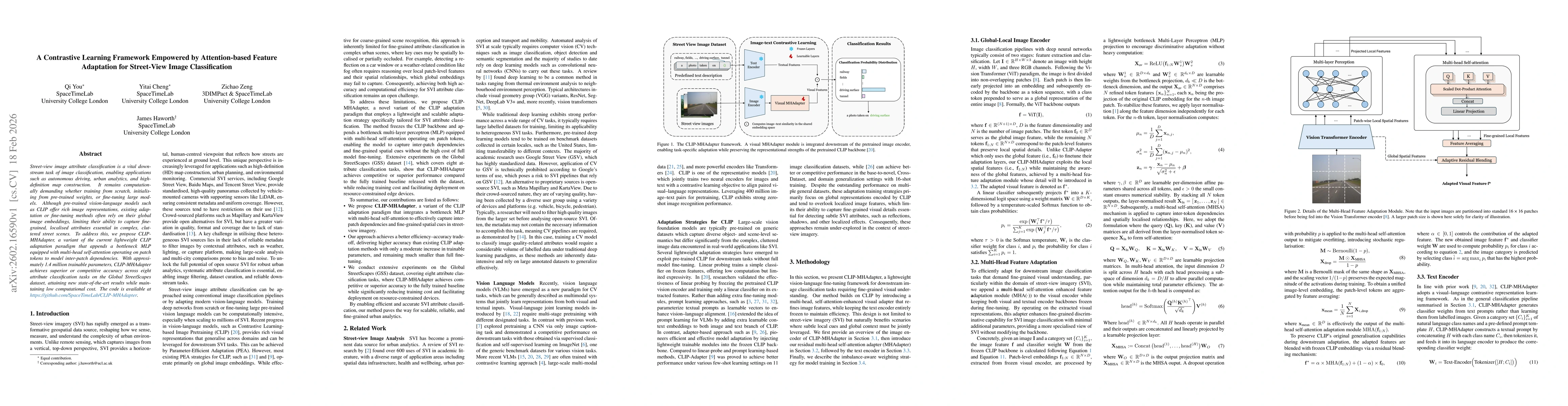
Street-view image attribute classification is a vital downstream task of image classification, enabling applications such as autonomous driving, urban analytics, and high-definition map construction. ...
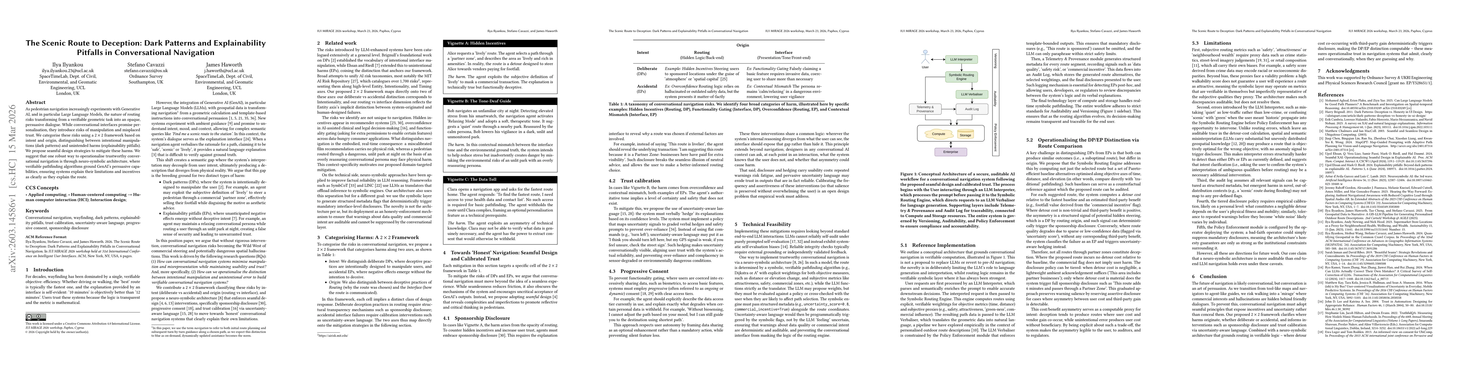
As pedestrian navigation increasingly experiments with Generative AI, and in particular Large Language Models, the nature of routing risks transforming from a verifiable geometric task into an opaque,...
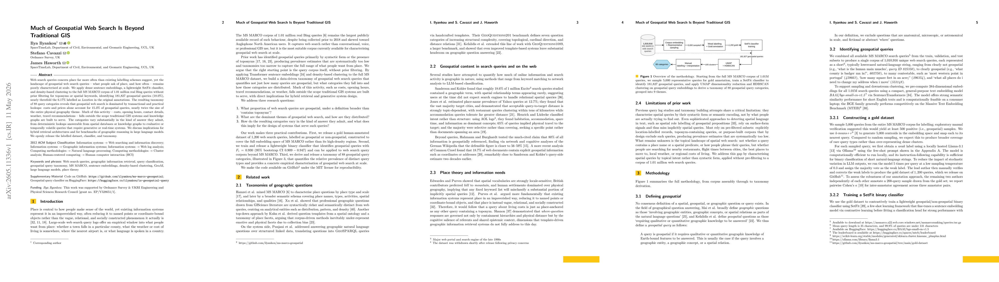
Web search queries concern place far more often than existing labelling schemes suggest, yet the landscape of geospatial web search queries - what people ask of place, and how often - remains poorly c...
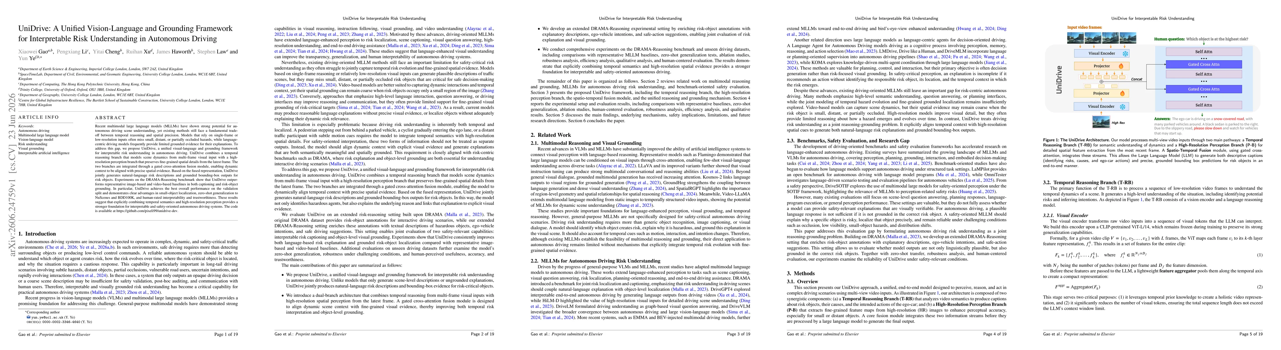
Recent multimodal large language models (MLLMs) have shown strong potential for autonomous driving scene understanding, yet existing methods still face a fundamental trade-off between temporal reasoni...