Academic Profile
Statistics
Similar Authors
Papers on arXiv
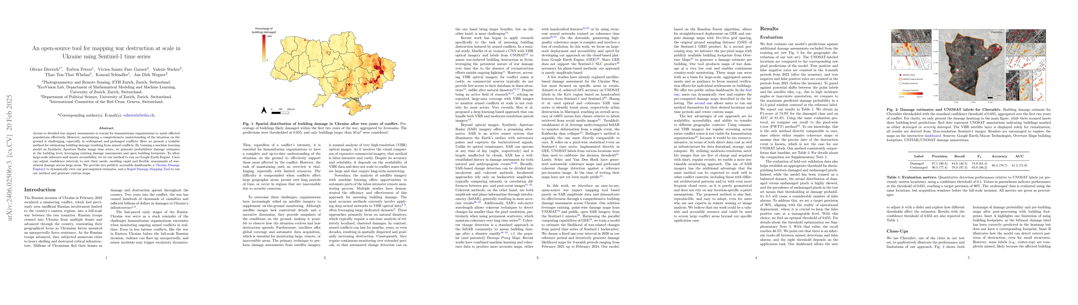
Access to detailed war impact assessments is crucial for humanitarian organizations to effectively assist populations most affected by armed conflicts. However, maintaining a comprehensive understan...
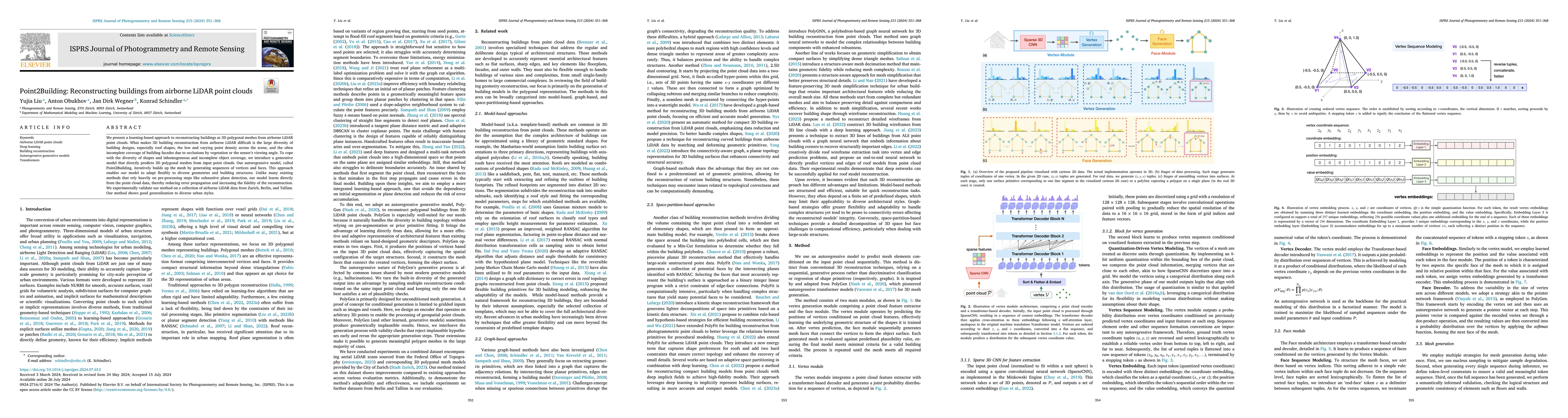
We present a learning-based approach to reconstruct buildings as 3D polygonal meshes from airborne LiDAR point clouds. What makes 3D building reconstruction from airborne LiDAR hard is the large div...
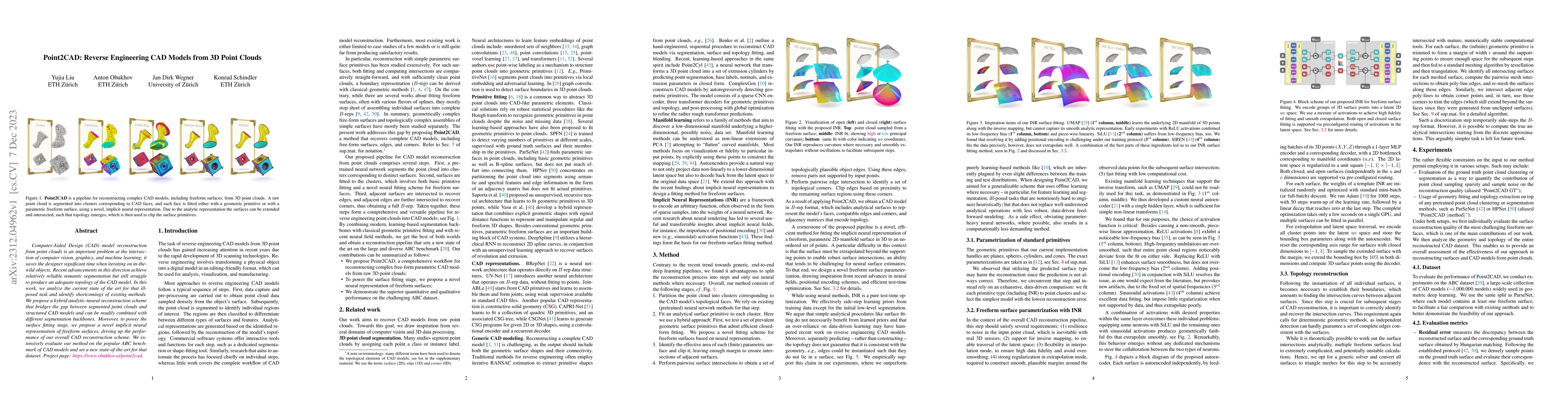
Computer-Aided Design (CAD) model reconstruction from point clouds is an important problem at the intersection of computer vision, graphics, and machine learning; it saves the designer significant t...
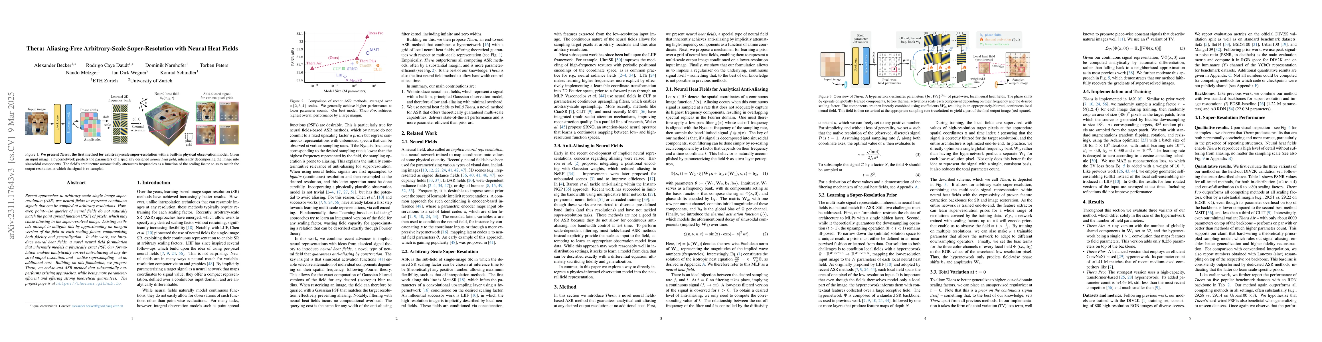
Recent approaches for arbitrary-scale single image super-resolution (ASSR) have used local neural fields to represent continuous signals that can be sampled at arbitrary rates. However, the point-wi...
Data imbalance is ubiquitous when applying machine learning to real-world problems, particularly regression problems. If training data are imbalanced, the learning is dominated by the densely covere...
Clouds and haze often occlude optical satellite images, hindering continuous, dense monitoring of the Earth's surface. Although modern deep learning methods can implicitly learn to ignore such occlu...
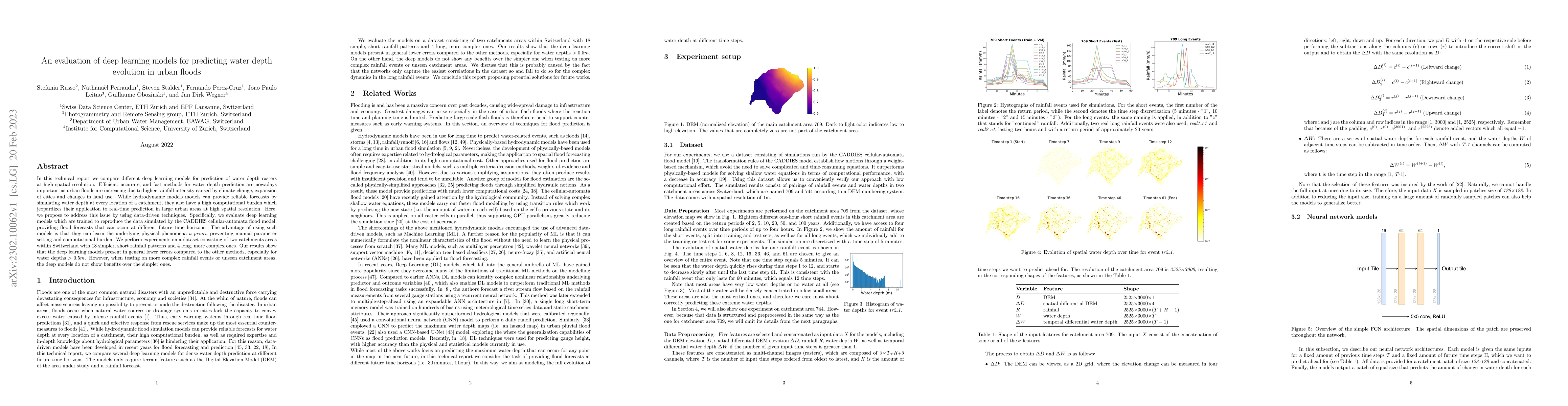
In this technical report we compare different deep learning models for prediction of water depth rasters at high spatial resolution. Efficient, accurate, and fast methods for water depth prediction ...
The ability to estimate epistemic uncertainty is often crucial when deploying machine learning in the real world, but modern methods often produce overconfident, uncalibrated uncertainty predictions...
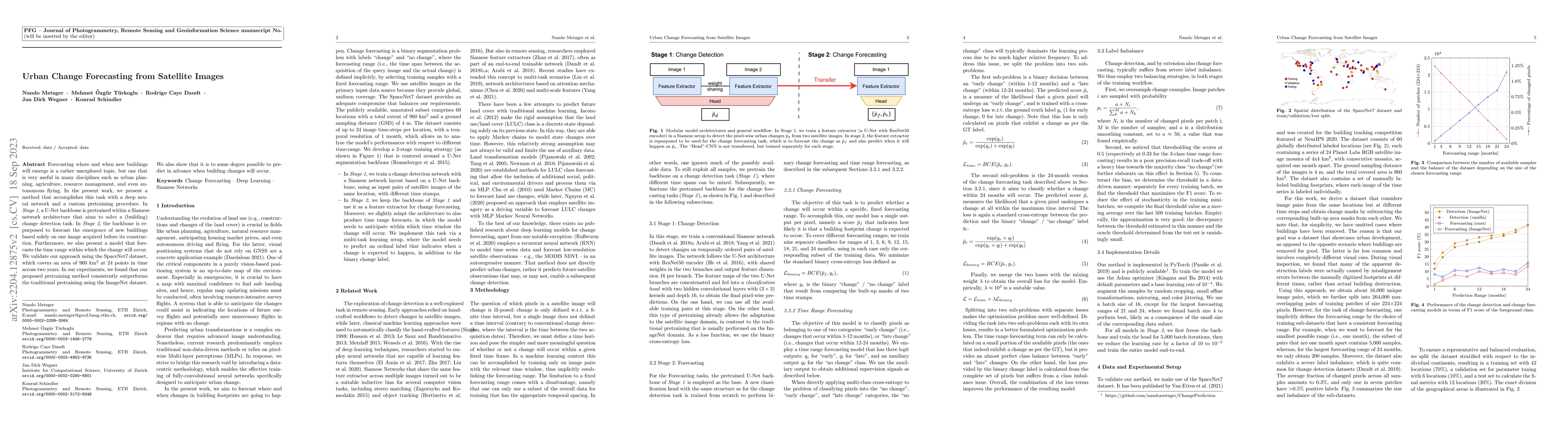
Forecasting where and when new buildings will emerge is a rather unexplored topic, but one that is very useful in many disciplines such as urban planning, agriculture, resource management, and even ...
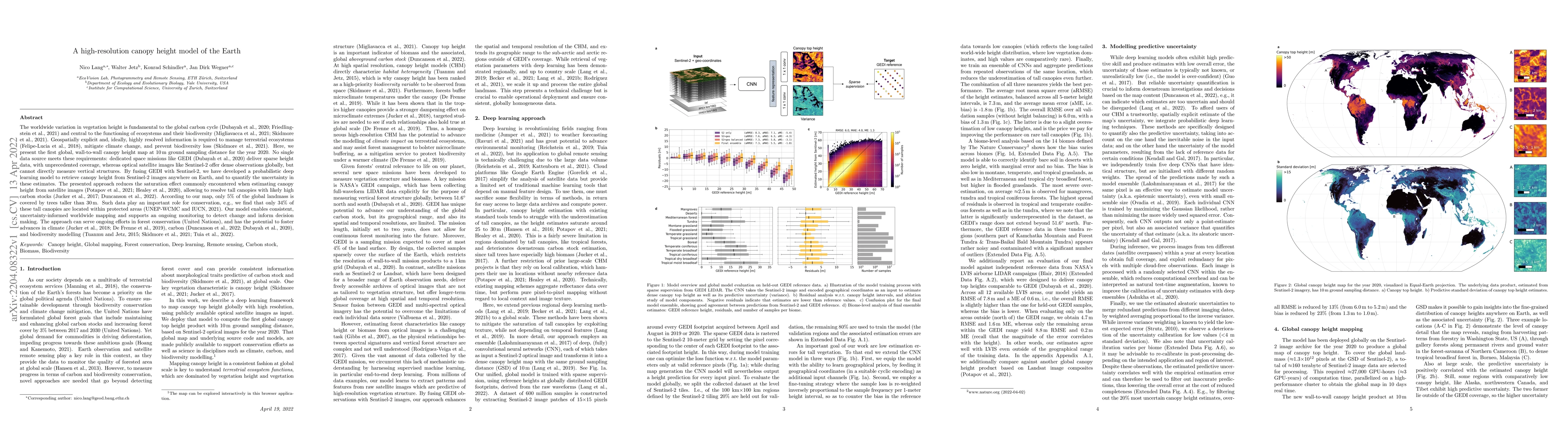
The worldwide variation in vegetation height is fundamental to the global carbon cycle and central to the functioning of ecosystems and their biodiversity. Geospatially explicit and, ideally, highly...
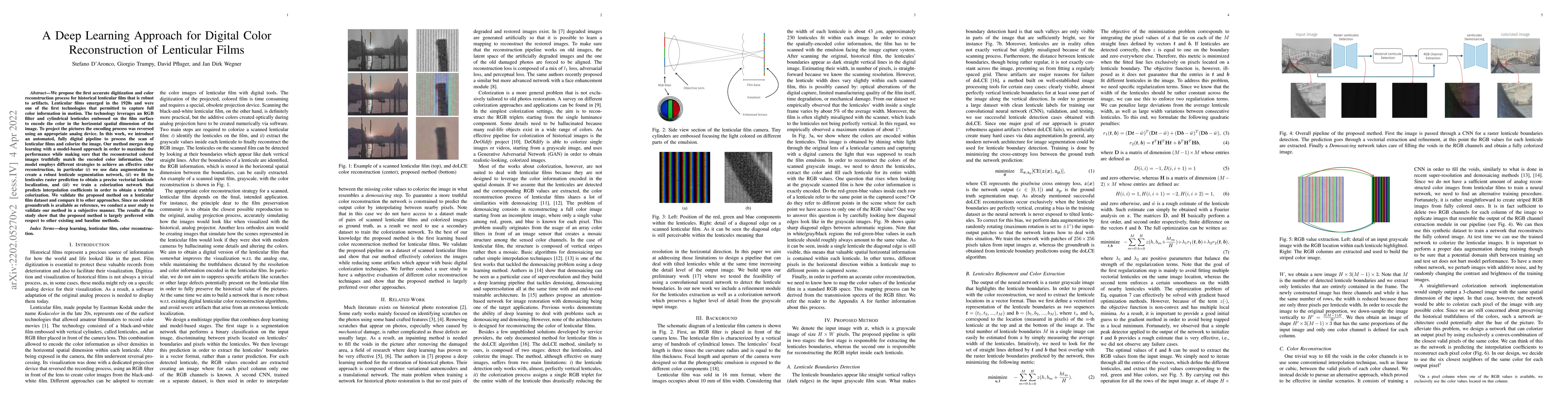
We propose the first accurate digitization and color reconstruction process for historical lenticular film that is robust to artifacts. Lenticular films emerged in the 1920s and were one of the firs...
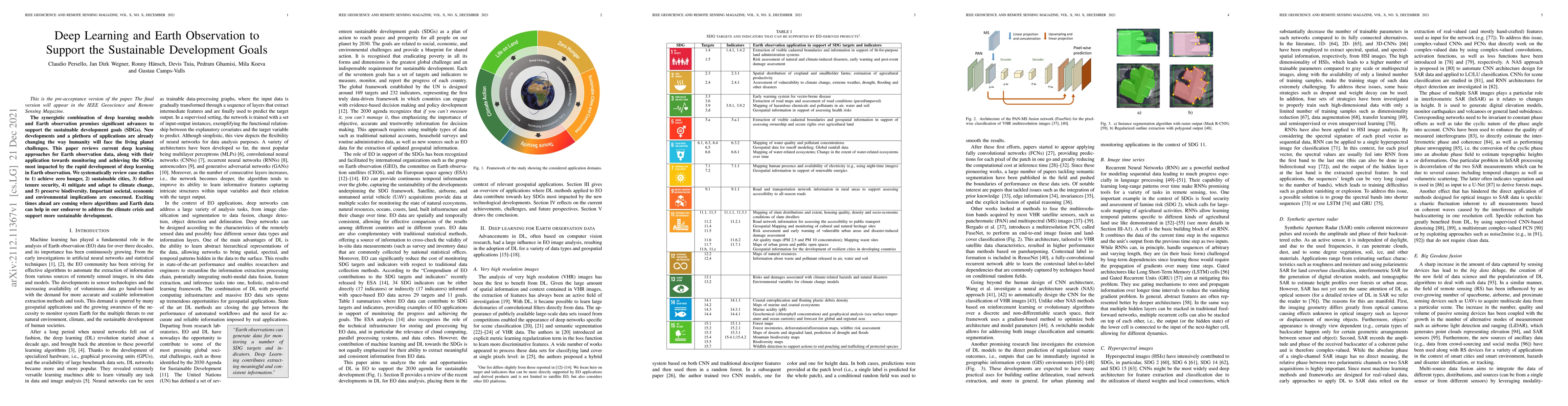
The synergistic combination of deep learning models and Earth observation promises significant advances to support the sustainable development goals (SDGs). New developments and a plethora of applic...
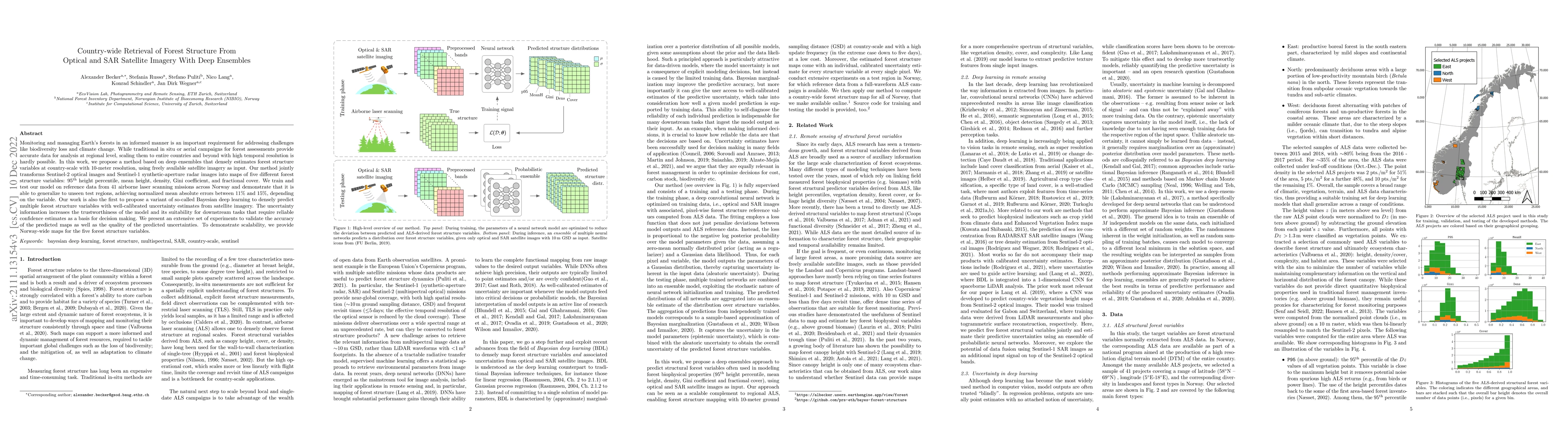
Monitoring and managing Earth's forests in an informed manner is an important requirement for addressing challenges like biodiversity loss and climate change. While traditional in situ or aerial cam...
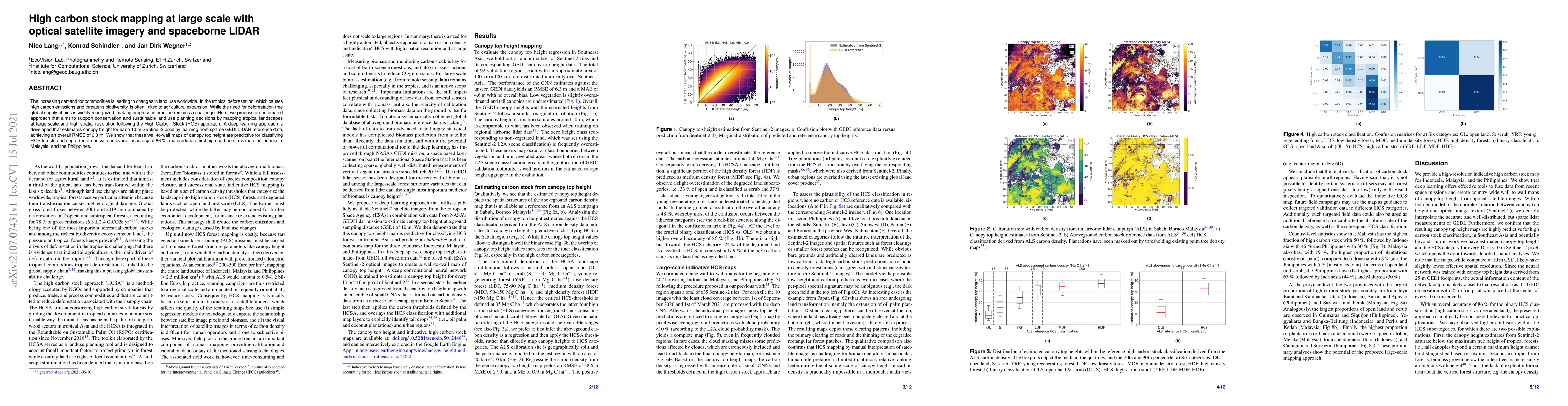
The increasing demand for commodities is leading to changes in land use worldwide. In the tropics, deforestation, which causes high carbon emissions and threatens biodiversity, is often linked to ag...
In the last years we have witnessed the fields of geosciences and remote sensing and artificial intelligence to become closer. Thanks to both the massive availability of observational data, improved...
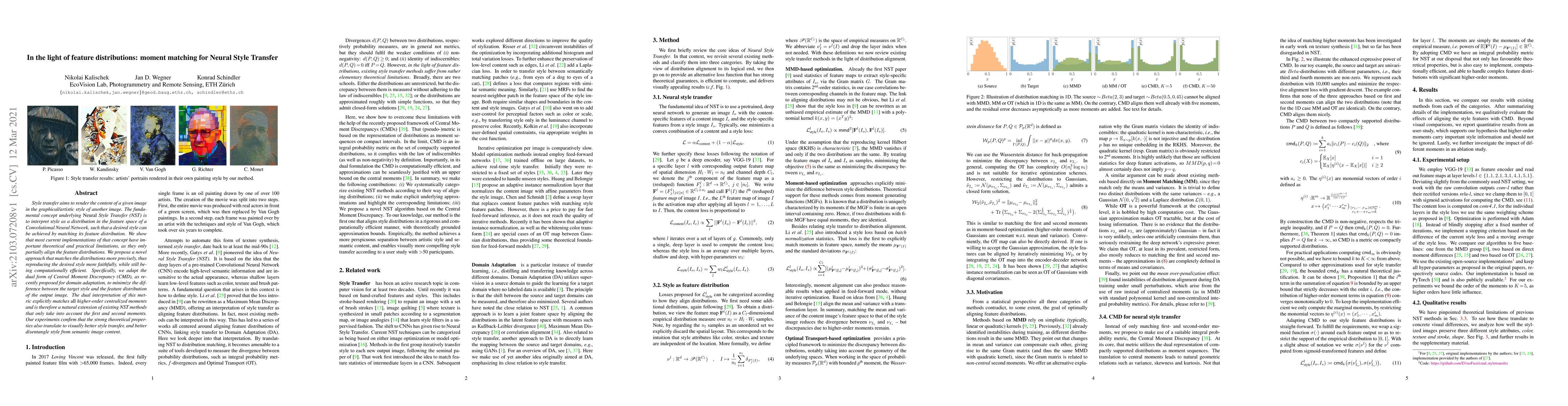
Style transfer aims to render the content of a given image in the graphical/artistic style of another image. The fundamental concept underlying NeuralStyle Transfer (NST) is to interpret style as a ...
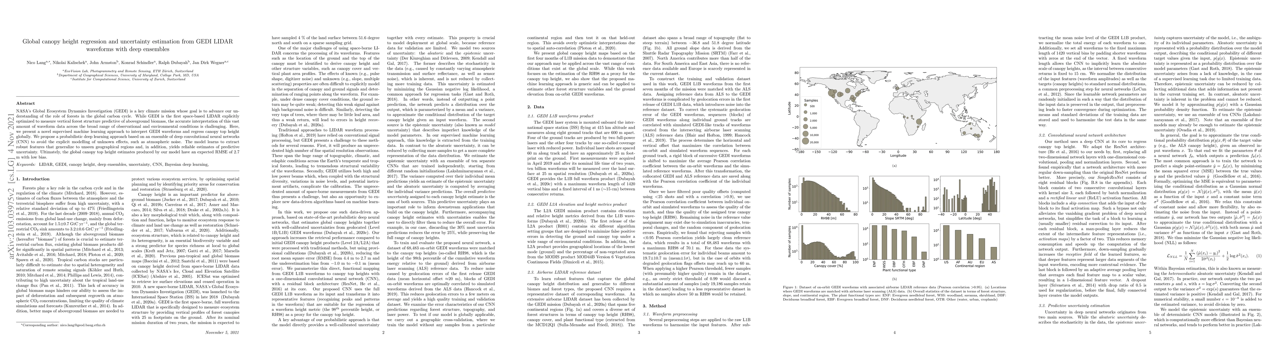
NASA's Global Ecosystem Dynamics Investigation (GEDI) is a key climate mission whose goal is to advance our understanding of the role of forests in the global carbon cycle. While GEDI is the first s...
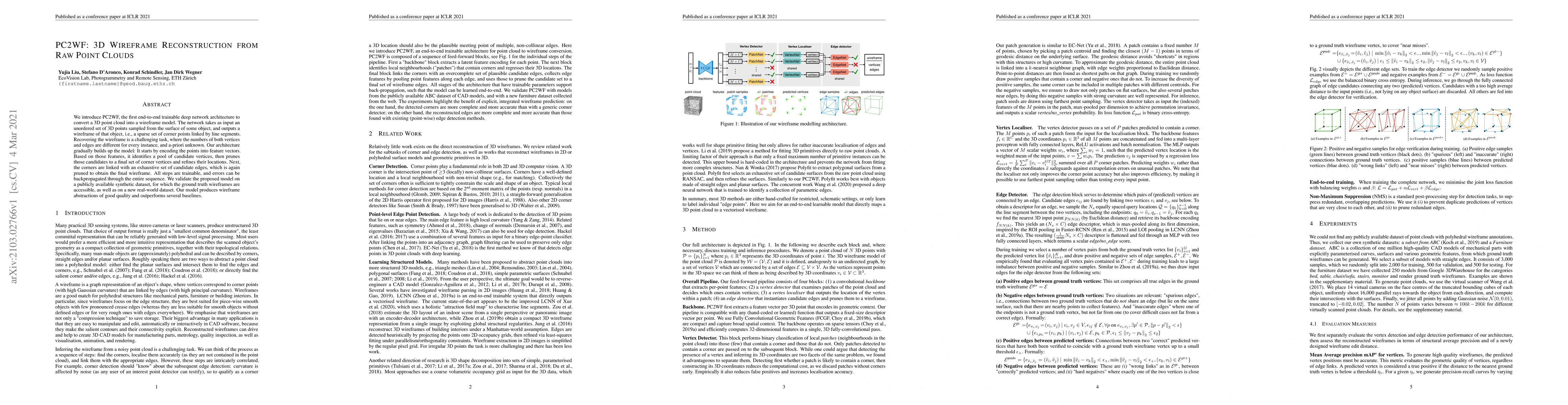
We introduce PC2WF, the first end-to-end trainable deep network architecture to convert a 3D point cloud into a wireframe model. The network takes as input an unordered set of 3D points sampled from...
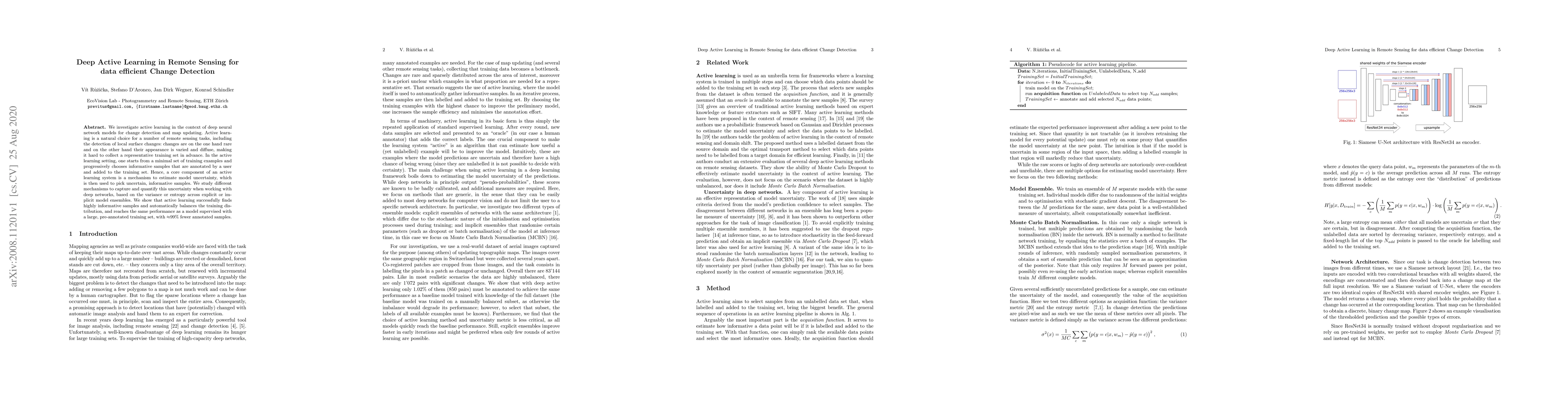
We investigate active learning in the context of deep neural network models for change detection and map updating. Active learning is a natural choice for a number of remote sensing tasks, including...
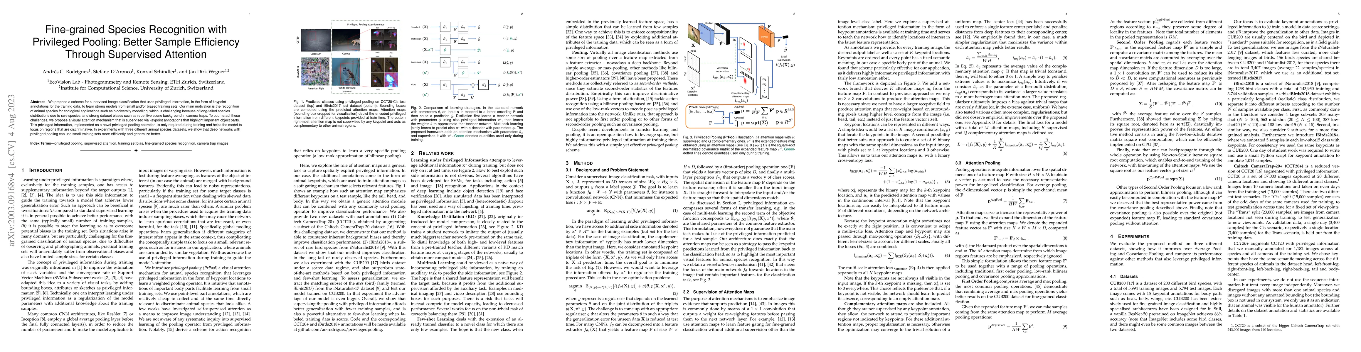
We propose a scheme for supervised image classification that uses privileged information, in the form of keypoint annotations for the training data, to learn strong models from small and/or biased t...
We introduce an approach for updating older tree inventories with geographic coordinates using street-level panorama images and a global optimization framework for tree instance matching. Geolocatio...
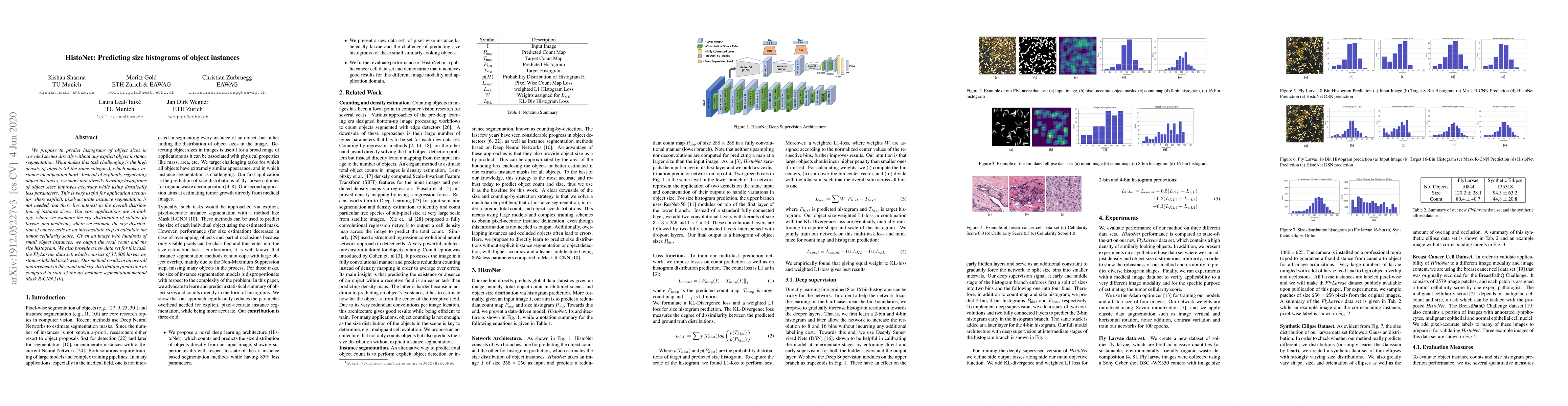
We propose to predict histograms of object sizes in crowded scenes directly without any explicit object instance segmentation. What makes this task challenging is the high density of objects (of the...
We propose a new STAckable Recurrent cell (STAR) for recurrent neural networks (RNNs), which has fewer parameters than widely used LSTM and GRU while being more robust against vanishing or exploding...
Up-to-date catalogs of the urban tree population are important for municipalities to monitor and improve quality of life in cities. Despite much research on automation of tree mapping, mainly relyin...
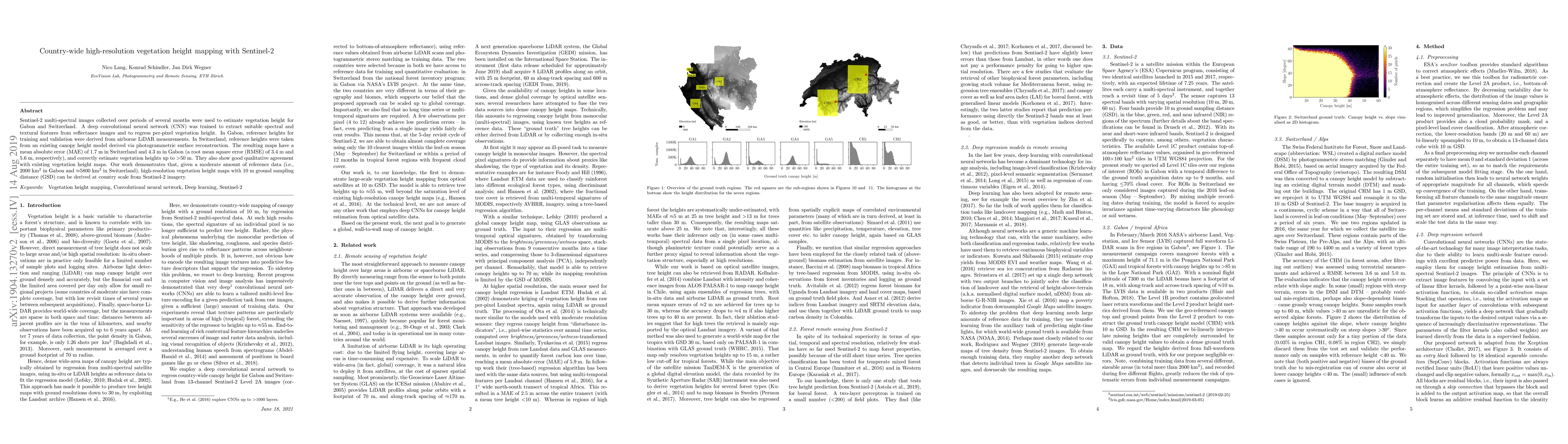
Sentinel-2 multi-spectral images collected over periods of several months were used to estimate vegetation height for Gabon and Switzerland. A deep convolutional neural network (CNN) was trained to ...
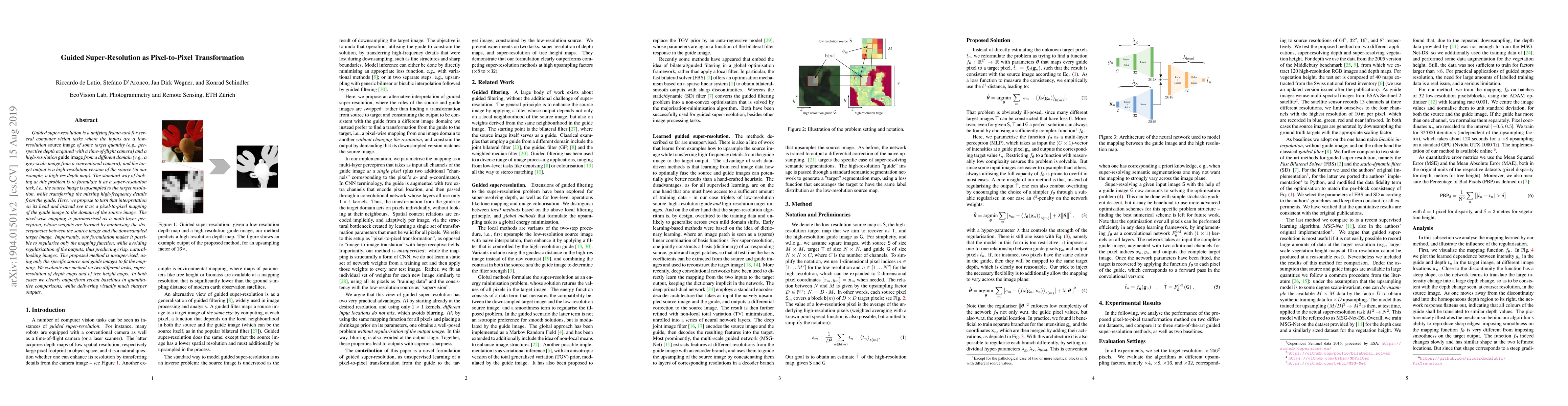
Guided super-resolution is a unifying framework for several computer vision tasks where the inputs are a low-resolution source image of some target quantity (e.g., perspective depth acquired with a ...
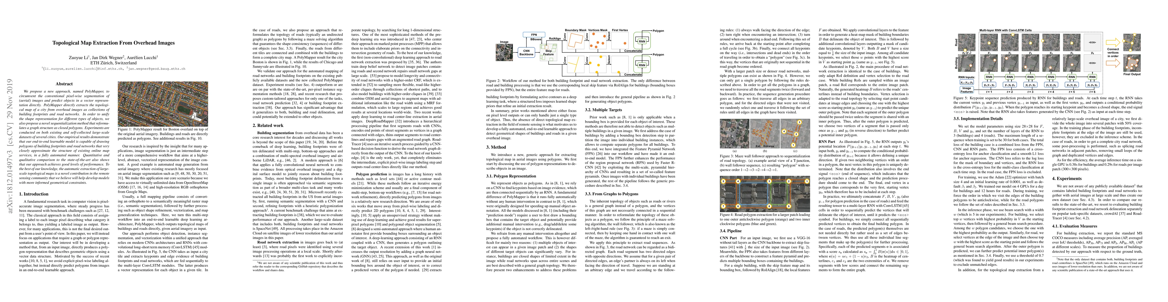
We propose a new approach, named PolyMapper, to circumvent the conventional pixel-wise segmentation of (aerial) images and predict objects in a vector representation directly. PolyMapper directly ex...
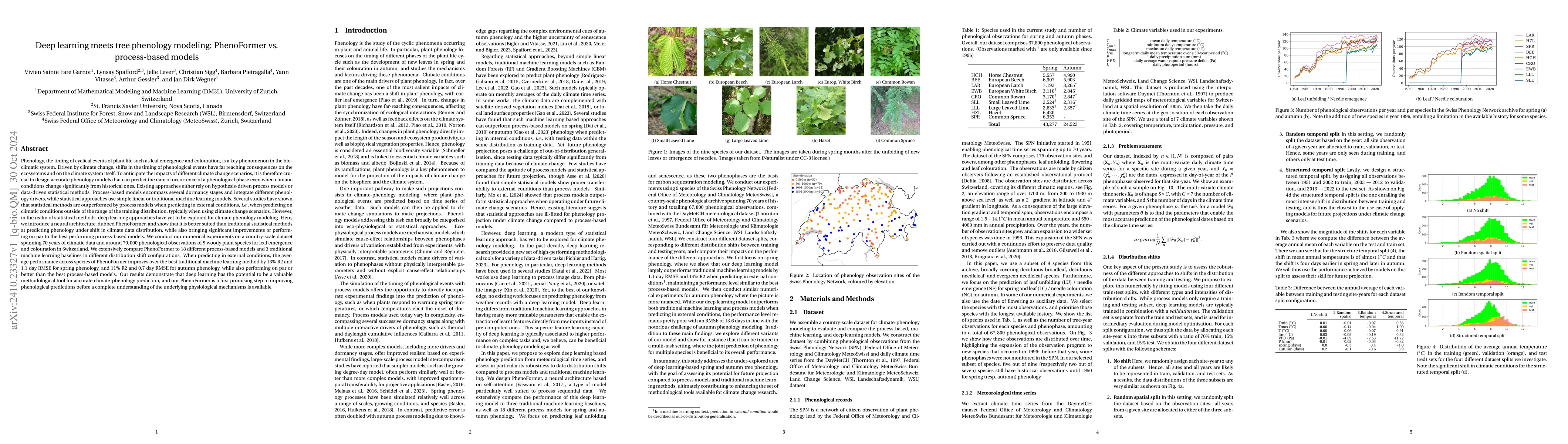
Phenology, the timing of cyclical plant life events such as leaf emergence and coloration, is crucial in the bio-climatic system. Climate change drives shifts in these phenological events, impacting e...
Over the past decades, there has been an explosion in the amount of available Earth Observation (EO) data. The unprecedented coverage of the Earth's surface and atmosphere by satellite imagery has res...
With the exacerbation of the biodiversity and climate crises, macroecological pursuits such as global biodiversity mapping become more urgent. Remote sensing offers a wealth of Earth observation data ...
Deep learning on climatic data holds potential for macroecological applications. However, its adoption remains limited among scientists outside the deep learning community due to storage, compute, and...
Natural disasters demand rapid damage assessment to guide humanitarian response. Here, we investigate whether medium-resolution Earth observation images from the Copernicus program can support buildin...
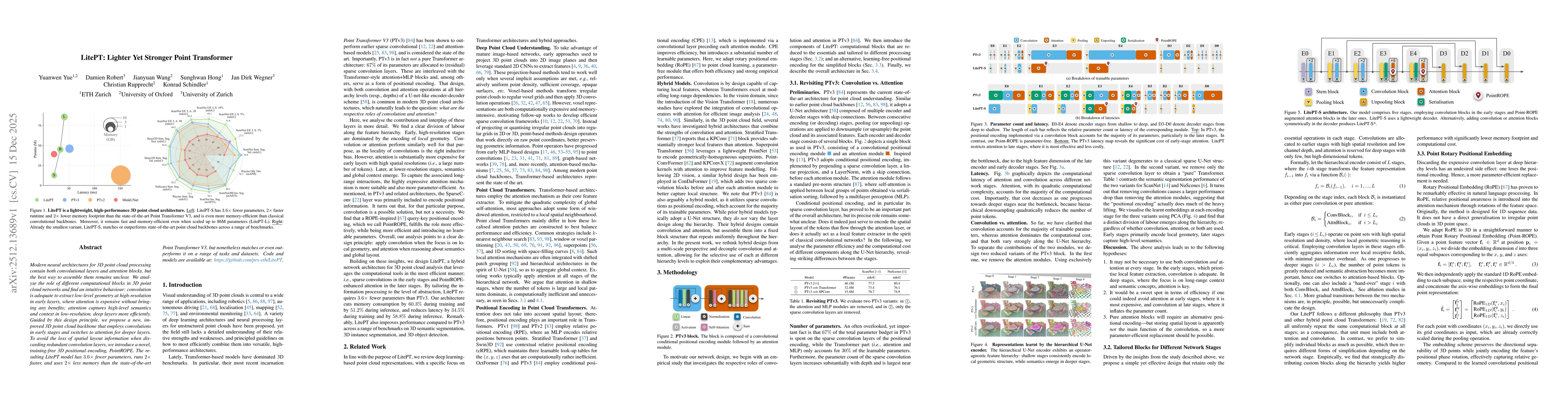
Modern neural architectures for 3D point cloud processing contain both convolutional layers and attention blocks, but the best way to assemble them remains unclear. We analyse the role of different co...
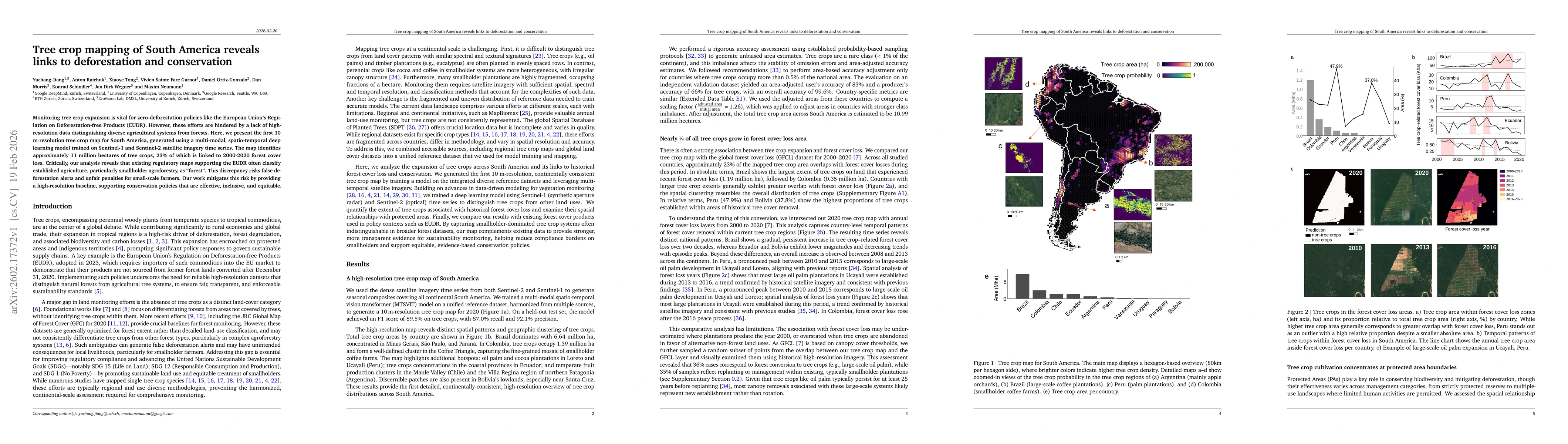
Monitoring tree crop expansion is vital for zero-deforestation policies like the European Union's Regulation on Deforestation-free Products (EUDR). However, these efforts are hindered by a lack of hig...
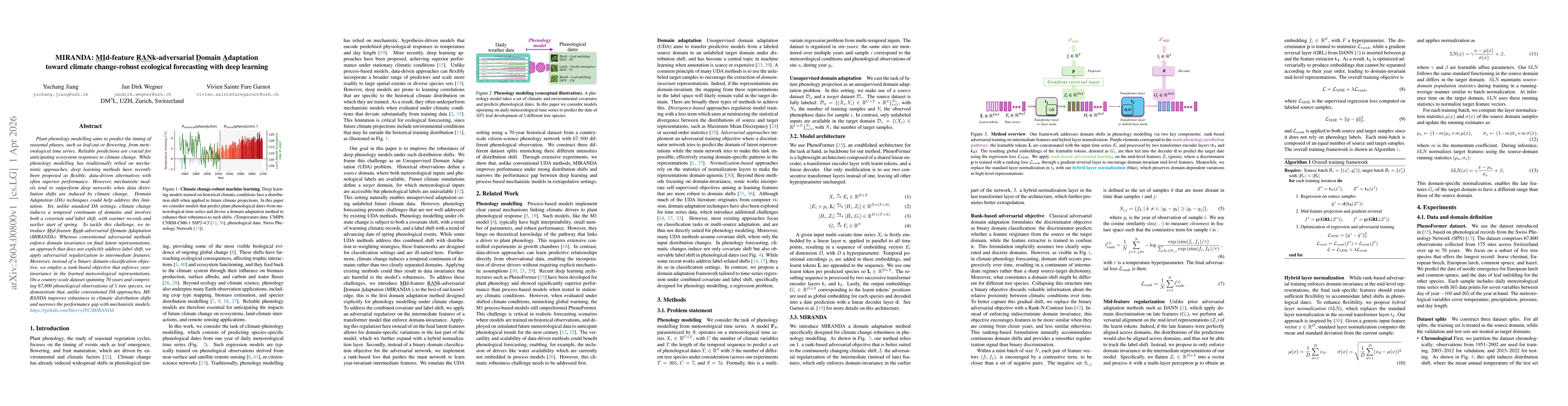
Plant phenology modelling aims to predict the timing of seasonal phases, such as leaf-out or flowering, from meteorological time series. Reliable predictions are crucial for anticipating ecosystem res...
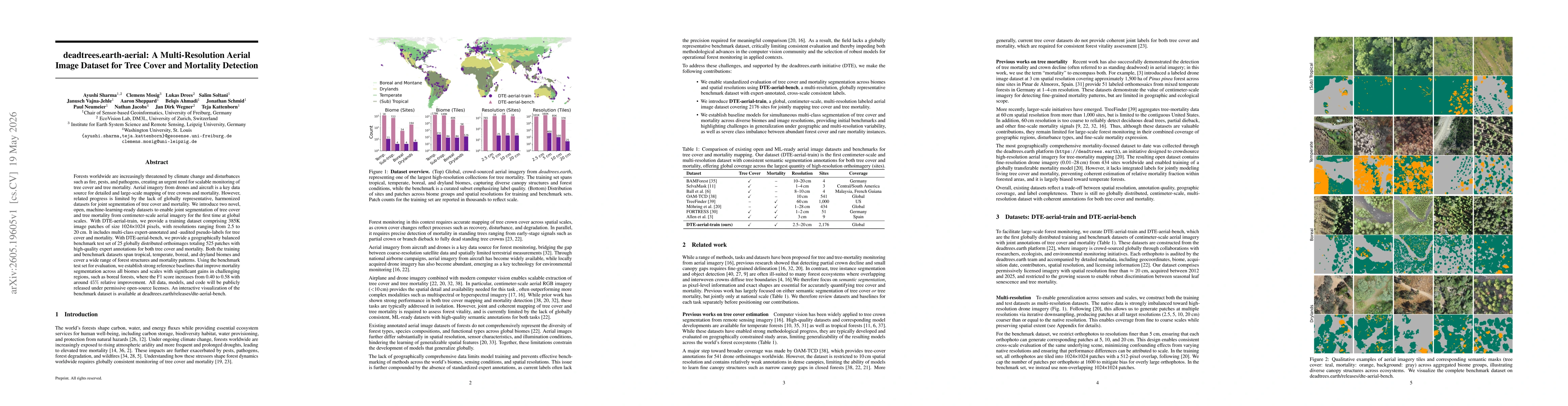
Forests worldwide are increasingly threatened by climate change and disturbances such as fire, pests, and pathogens, creating an urgent need for scalable monitoring of tree cover and tree mortality. A...