Academic Profile
Statistics
Similar Authors
Papers on arXiv
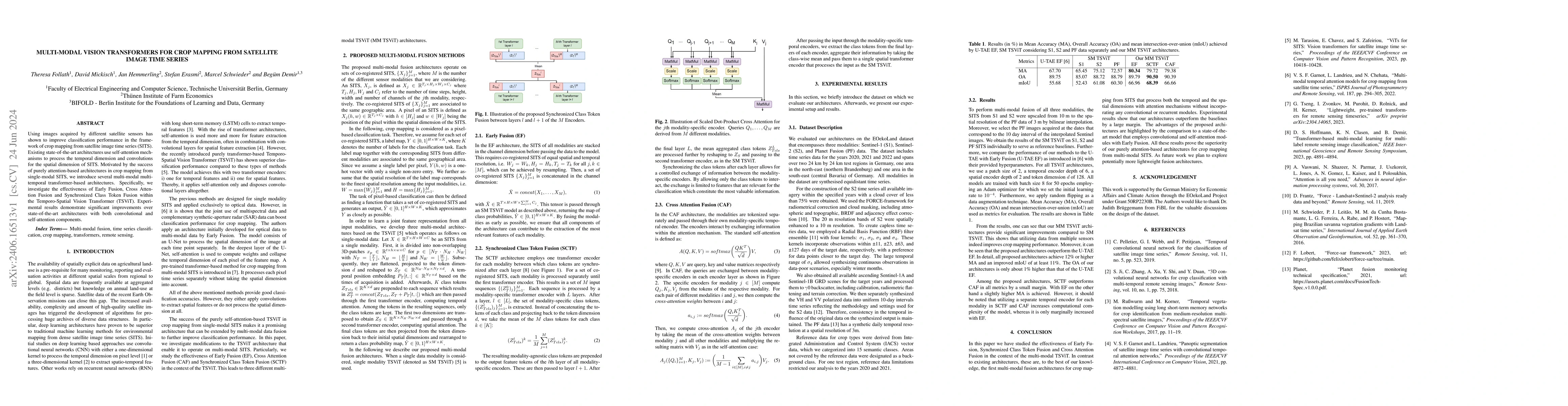
Using images acquired by different satellite sensors has shown to improve classification performance in the framework of crop mapping from satellite image time series (SITS). Existing state-of-the-art...
Transfer learning allows for resource-efficient geographic transfer of pre-trained field delineation models. However, the scarcity of labeled data for complex and dynamic smallholder landscapes, par...
Floods are among the most damaging weather-related hazards, and in 2024, the warmest year on record, extreme flood events affected communities across five continents. Earth observation (EO) satellites...
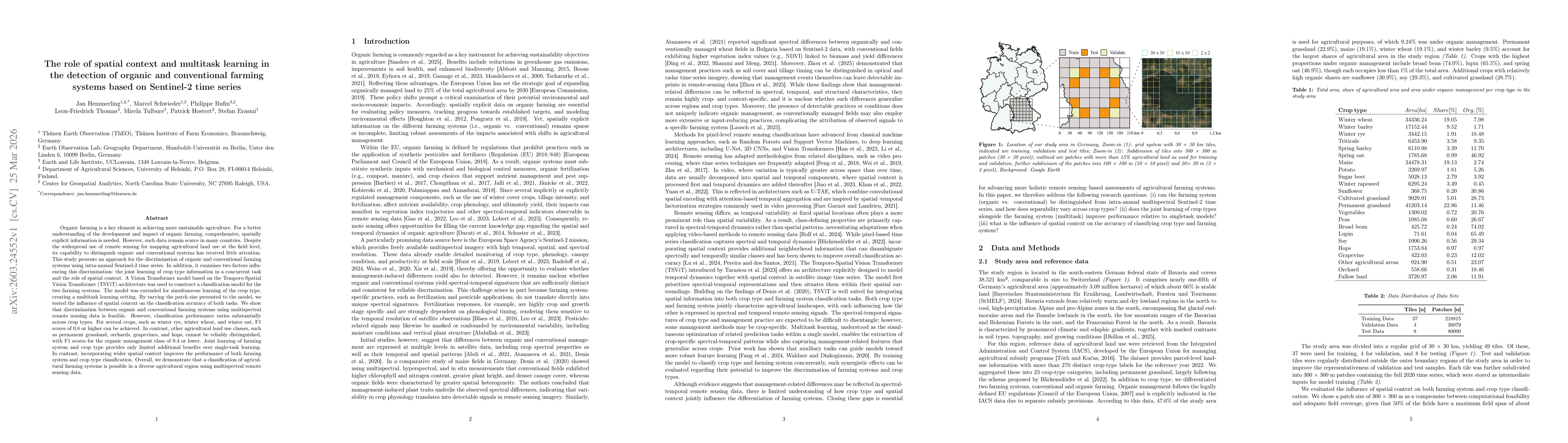
Organic farming is a key element in achieving more sustainable agriculture. For a better understanding of the development and impact of organic farming, comprehensive, spatially explicit information i...